PORTFOLIO
DEANNA M. COWLEY
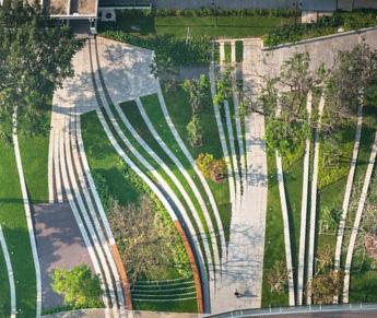
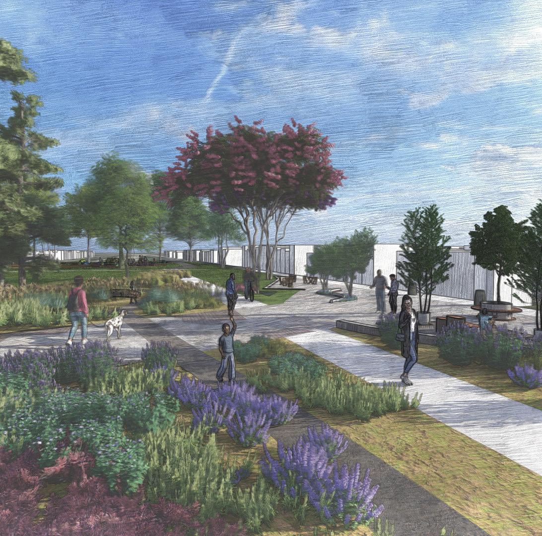
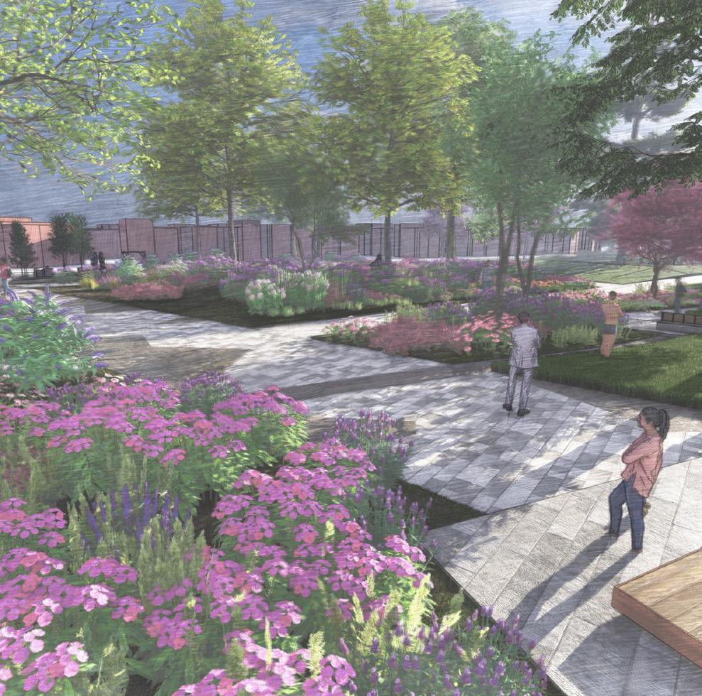
EASTERN MARKET METRO PLAZA - MARKET GARDEN PLAZA 10
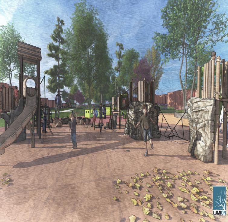
HWY TO NOWHERE - WOODLAND PARK 16
WASTEWATER TREATMENT IN SUBSAHARAN AFRICA 22

EASTERN MARKET METRO PLAZA - MARKET GARDEN PLAZA 10
HWY TO NOWHERE - WOODLAND PARK 16
WASTEWATER TREATMENT IN SUBSAHARAN AFRICA 22
Course: Community Design Studio (Capstone)
Professor: Byoung-Suk Kweon
Year: Spring 2022
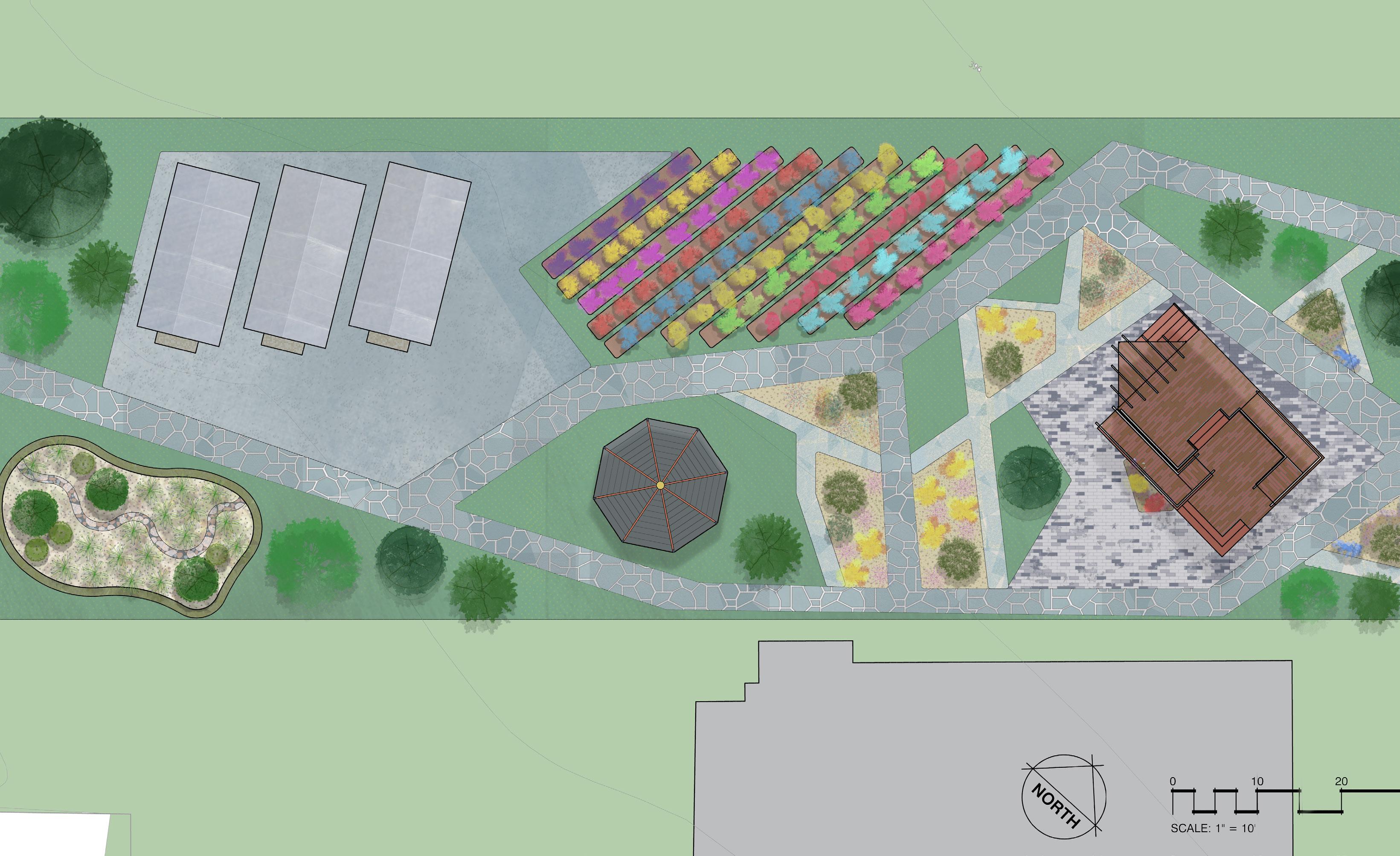
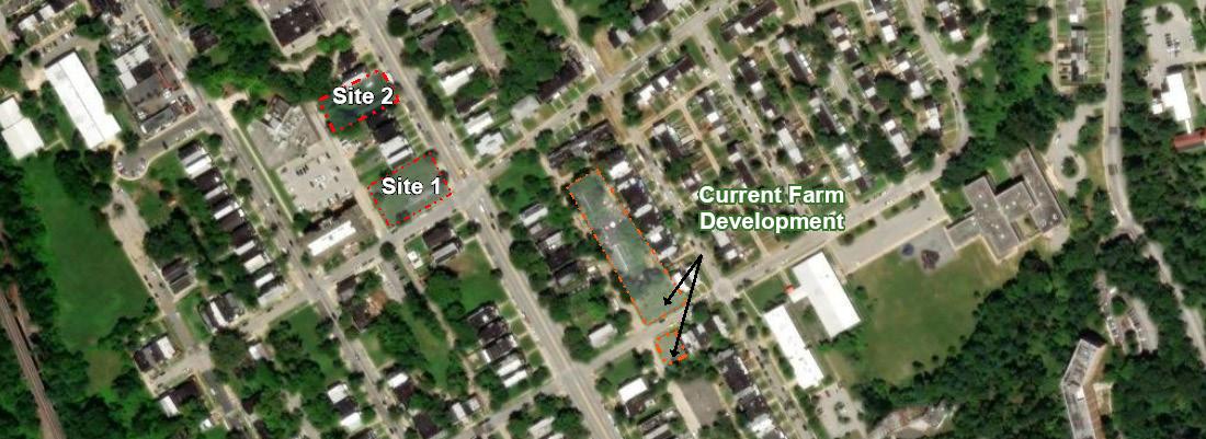
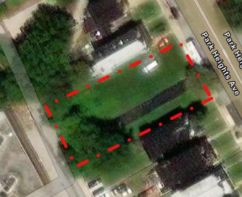
The transformation of two vacant sites into working urban farms.
Location: Central Park Heights, Baltimore, MD
Size:
Project Type: Urban Agriculture, Community Engagement
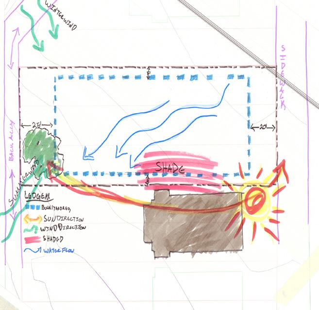
Plantation Park Heights is an inter-generational volunteer work force. They produce foods and help to feed people who live in the food desert areas in Baltimore. They work with youth farmers, community members, artists, developers, academics and other important stakeholders to create the first “Agrihood” in the City of Baltimore.
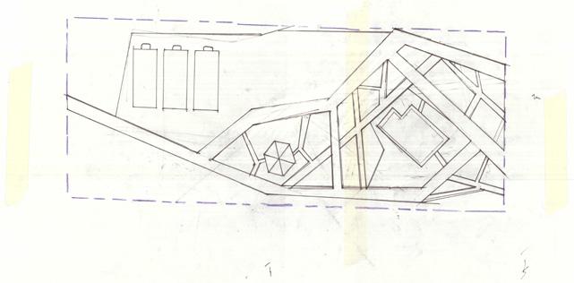
The main intent was to Identify the unmet potential of the undeveloped mid-block (site two) to meet the needs of the community and Plantation Park Heights by implementing a set of goals and requirements given by the client.
Design Process
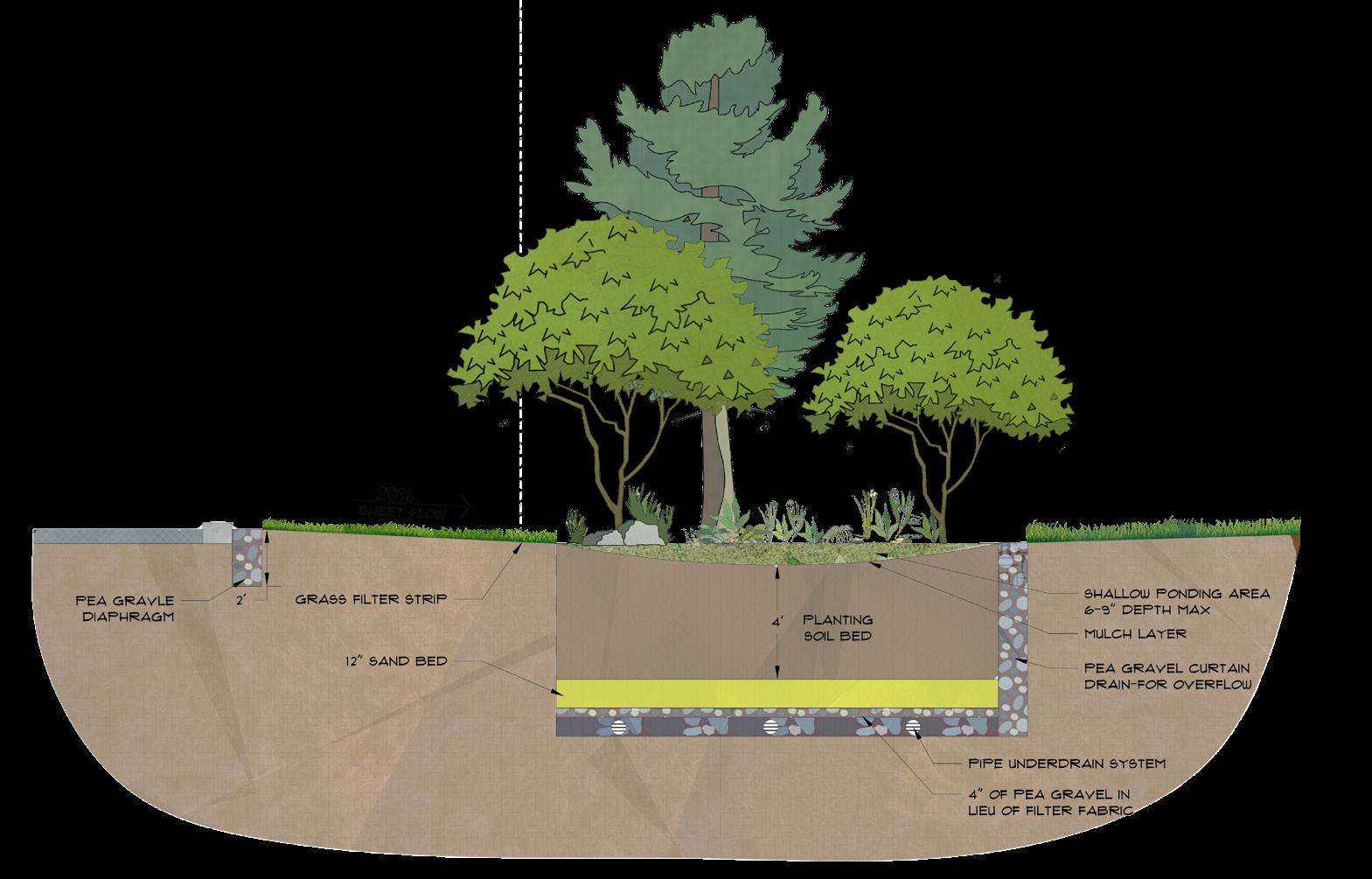
ESD CALCULATION
The Environmental Site Design(ESD) calculations help to determine the total square footage of water to be treated.
I=7,298.84
Rv=0.05+(0.009(7,298.84))=65.73
PE=1
A=(60)(180)=10,800
ESD=(1)(10,800)(65.73)/12 =59,157ft2
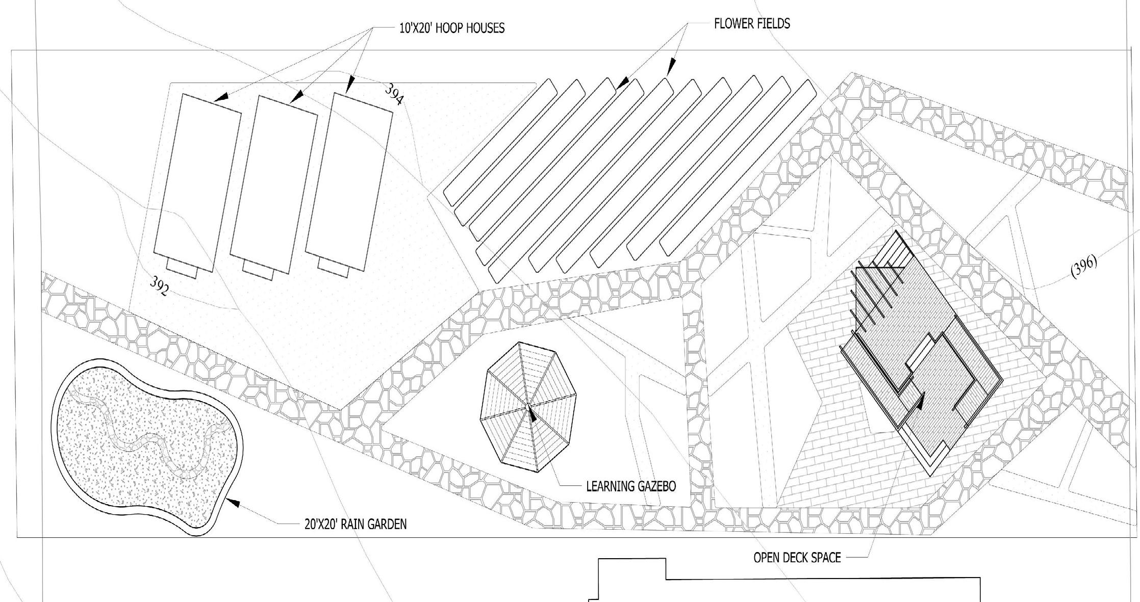
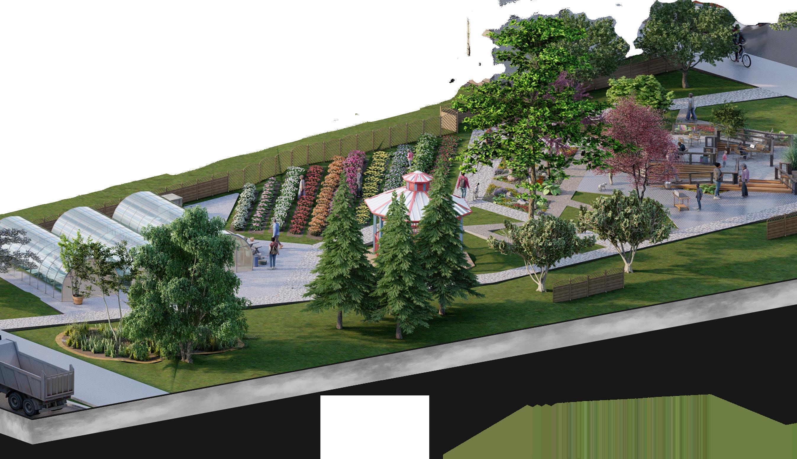
Where the installation of a 20'x20' rain garden will treat 520ft2 of water.
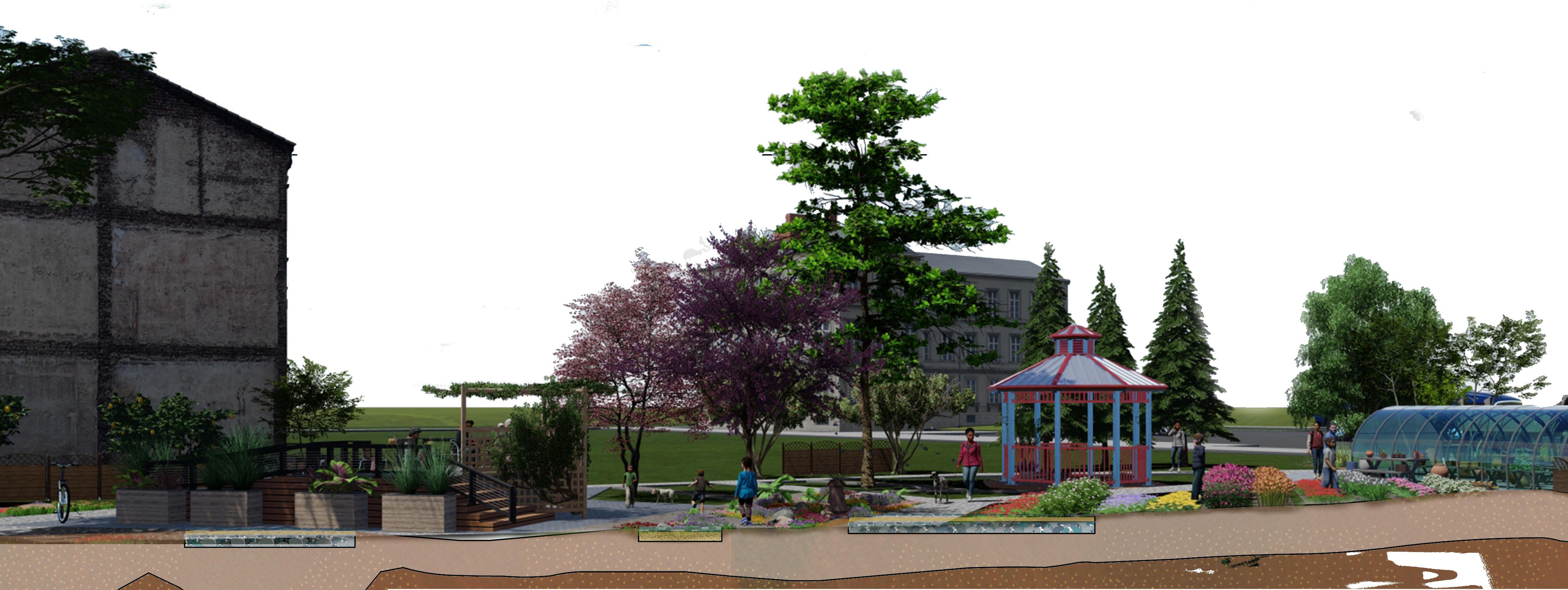
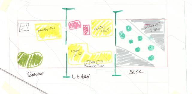
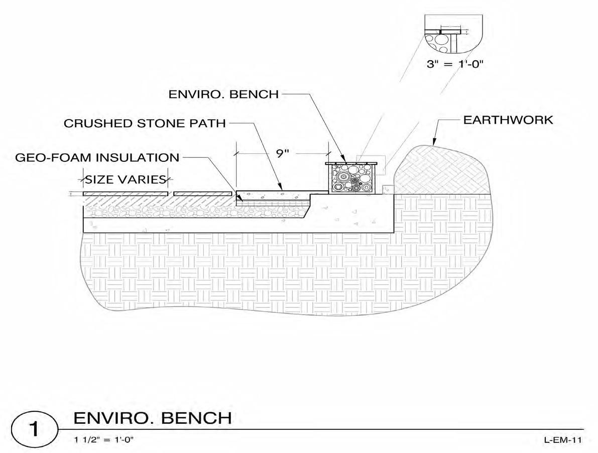
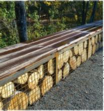
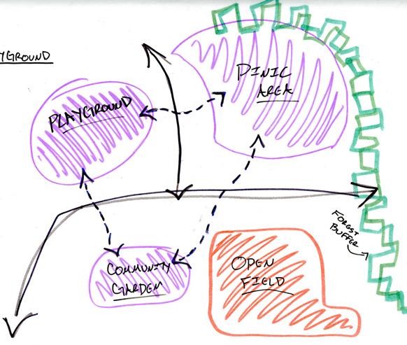
1. Design the mid-block for its intended use as a cut flower farm.
2. Transform empty spaces into active pollinator friendly areas.
3. Safe and quite space to learn, eat, and host small scale events.
4. Implement rain garden to reduce stormwater runoff.
Course: Landscape Structures & Materials
Professor: John Wray
Year: Spring 2020
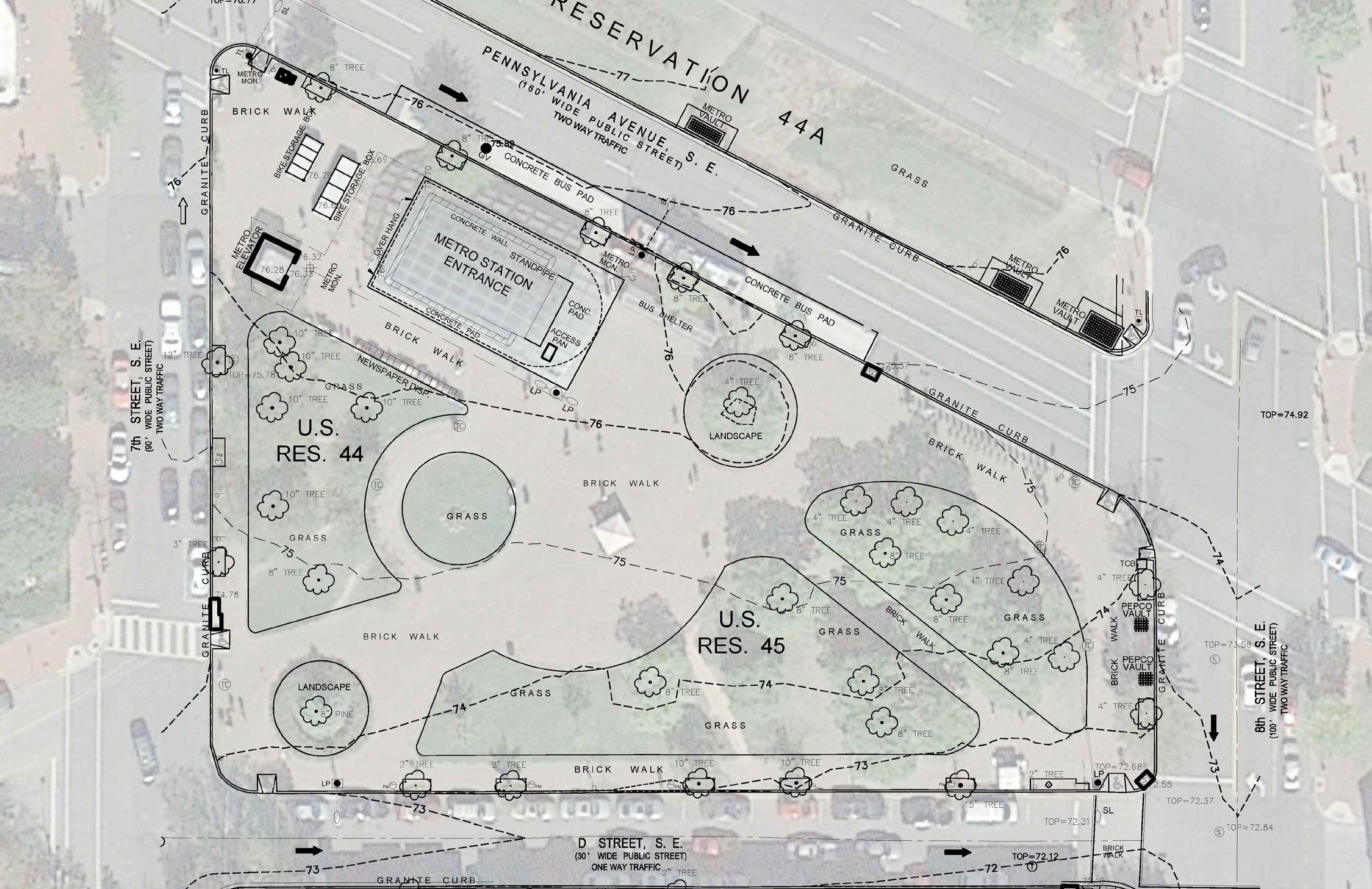
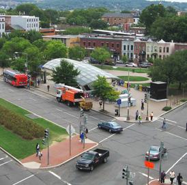
Redesign and rejuvenation of Eastern market Metro Station in D.C. ...
Location: Washington D.C.
Size: 47,242.63 ft 2
Project Type: Plaza
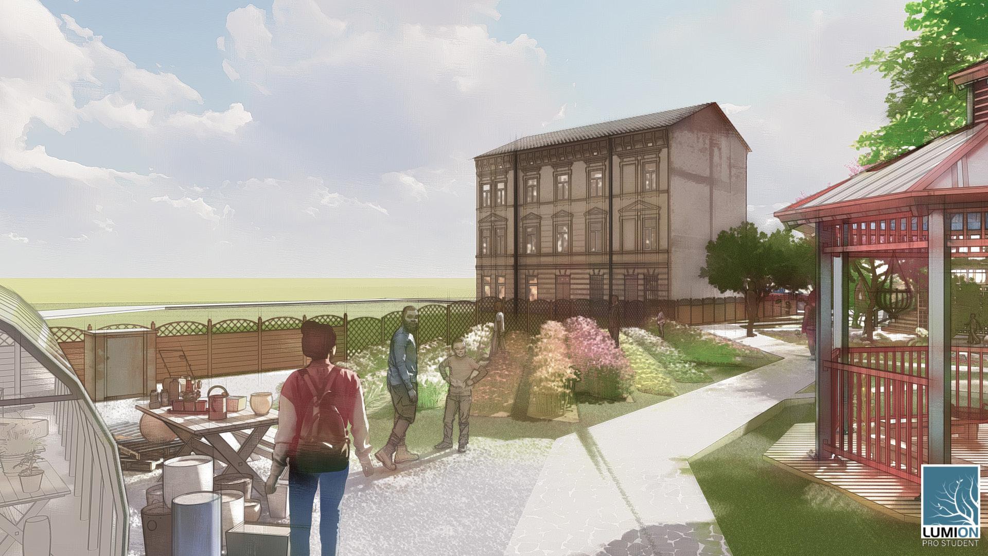
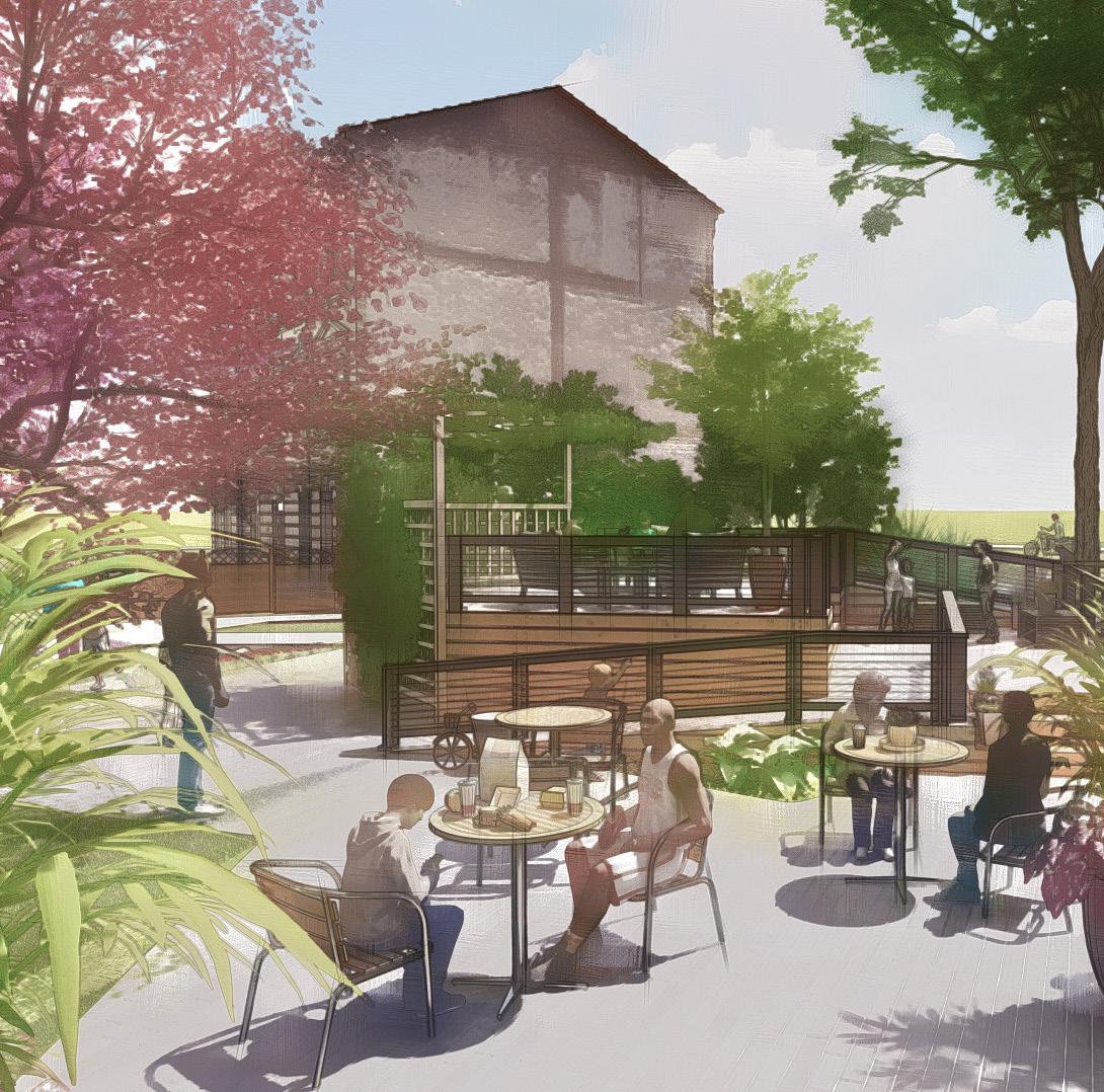
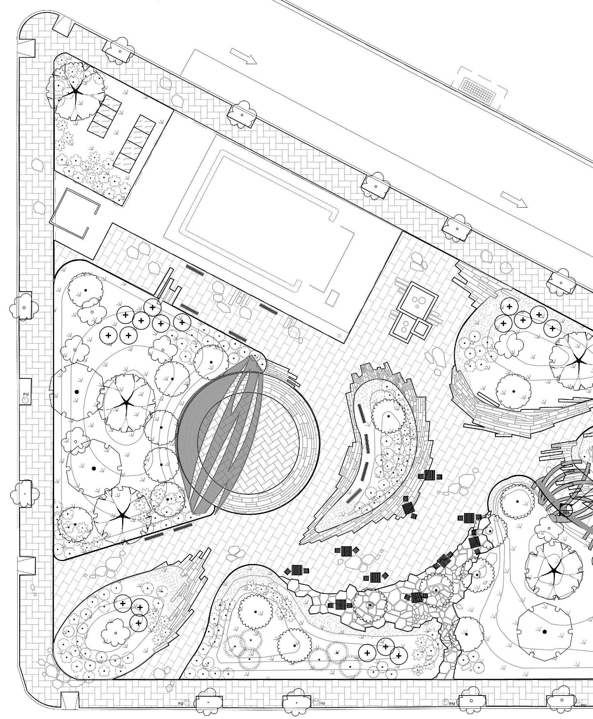
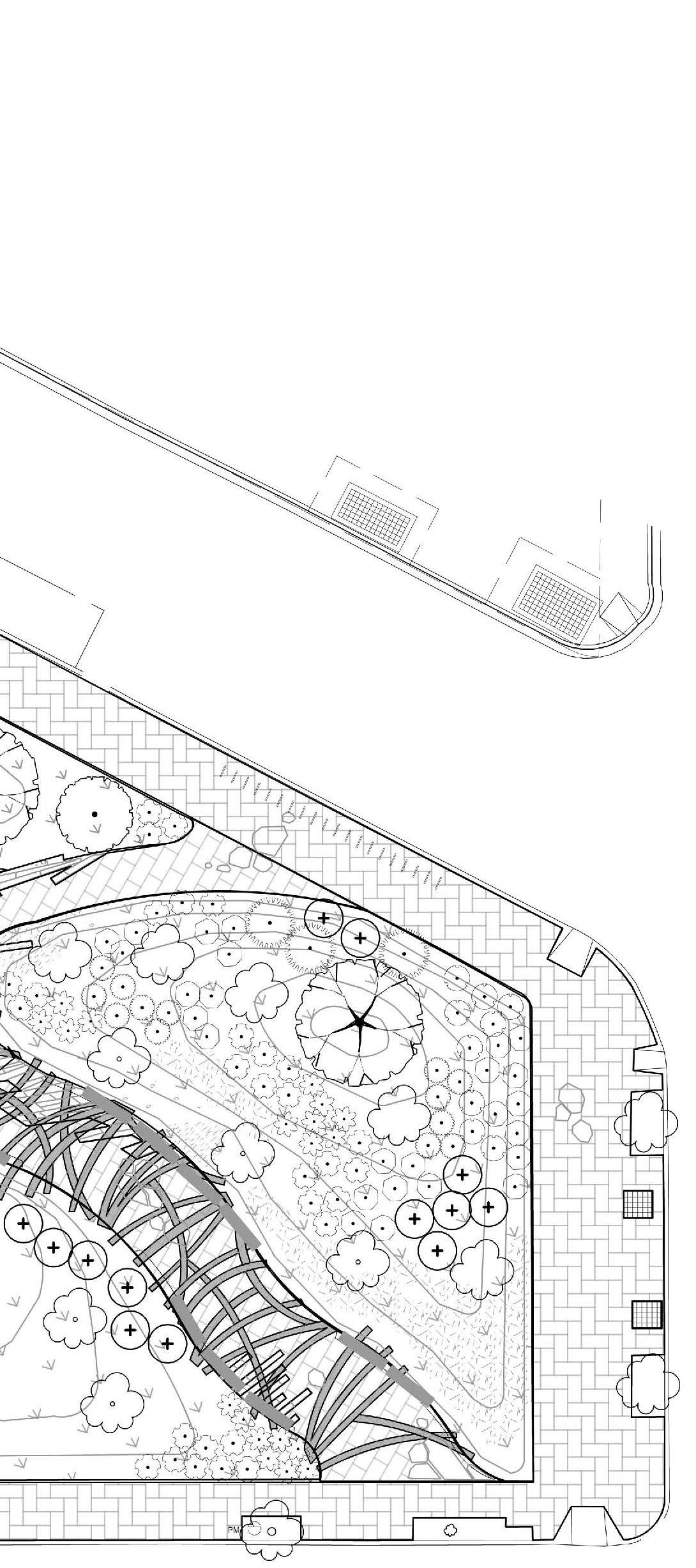
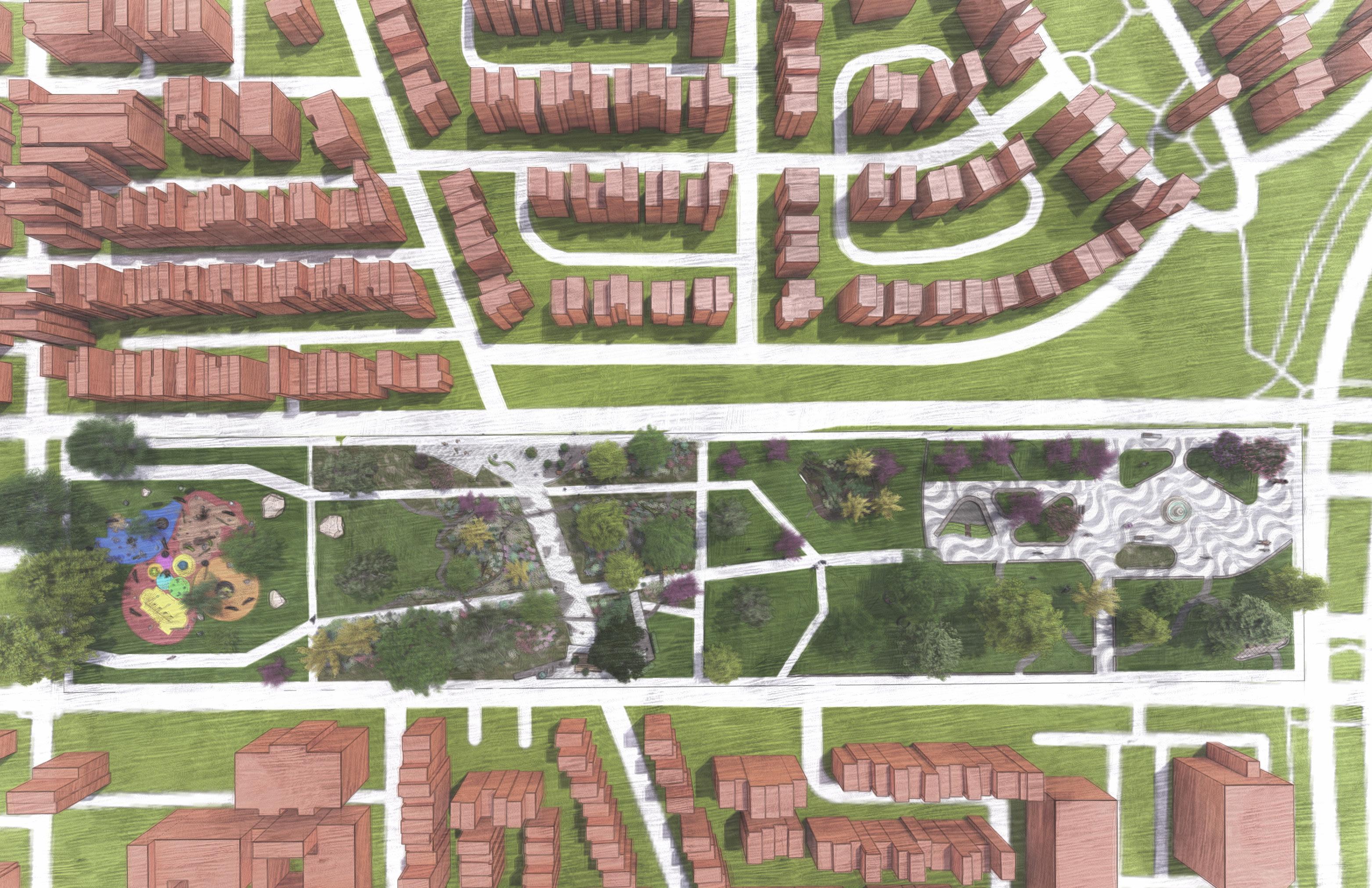
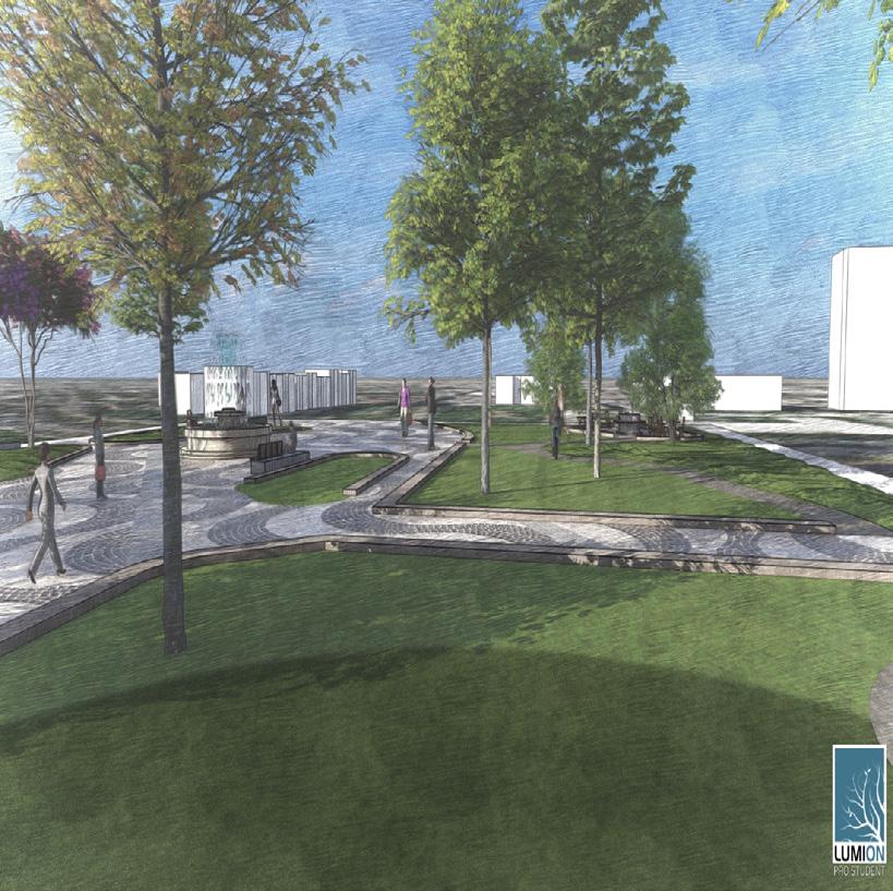
For this project1, the plaza is to be designed to accommodate the flow of both commuters as well as park & plaza visitors. It is imperative to the client that a strong connection be made into the site from the existing road and sidewalk crosswalk network.
The Eastern Market Metro Plaza, which embraces its urban context, is looking for a plaza that will become a place that welcomes a variety of activities and functions from all social and economic backgrounds. It’s important to ensure that the revitalized plaza is capable of hosting a diverse palate of activities.
1 Completed CD was a collaboration w/ others
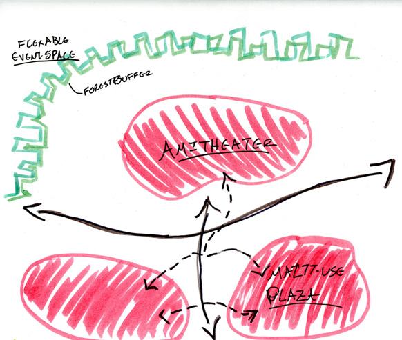
1. Event amphitheater spaces for up to 100 people.
2. Tables & chairs for outdoor dining, min. 8 tables
3. Contemplative/ quiet spaces
4. Spaces designed for public art to be displayed,
5. A direct or semi-direct connection from all sides of the plaza to the entrance of Metro Station and elevator tower
6. Garden planting beds that include a diverse species of native plants that also includes a variety of plant sizes and heights including a tree canopy, under-story planting, ornamental trees, ground-covers, etc.

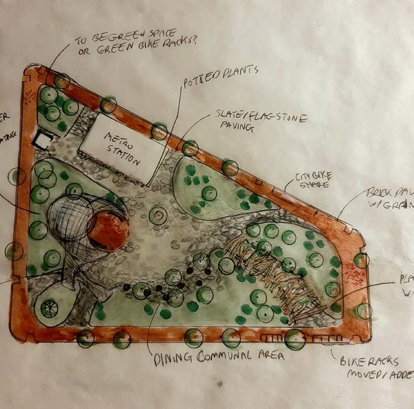

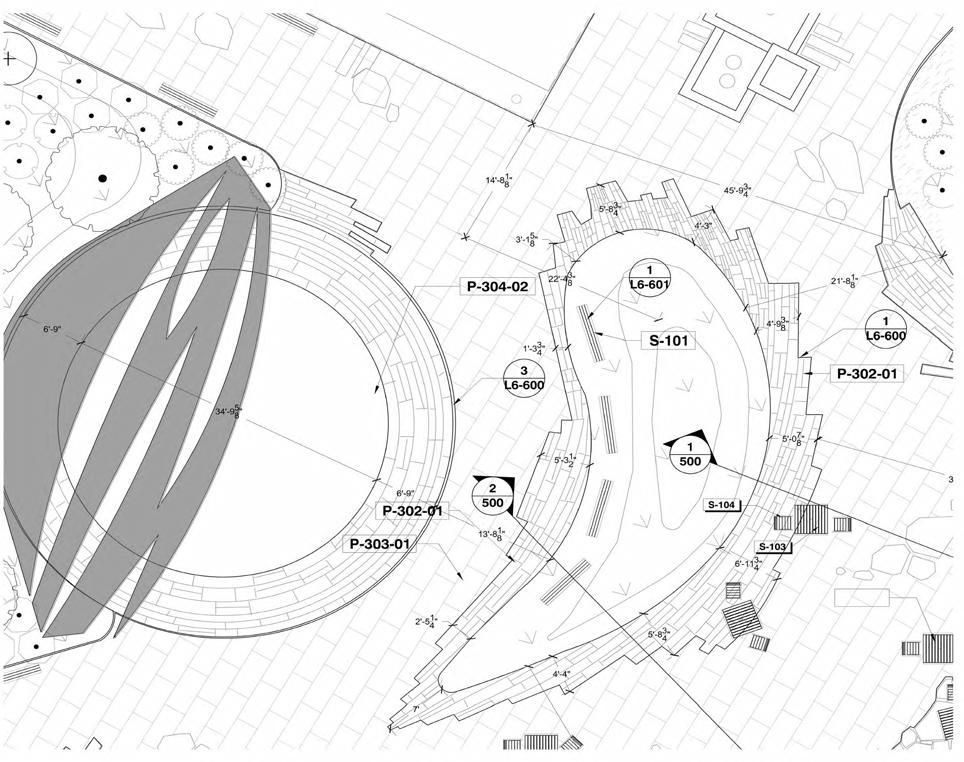
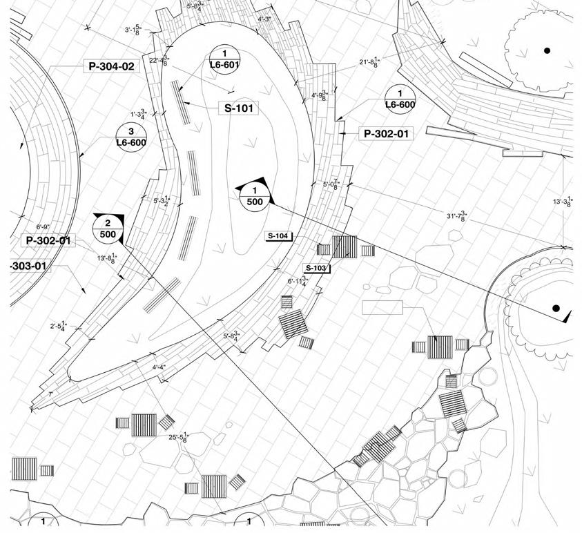
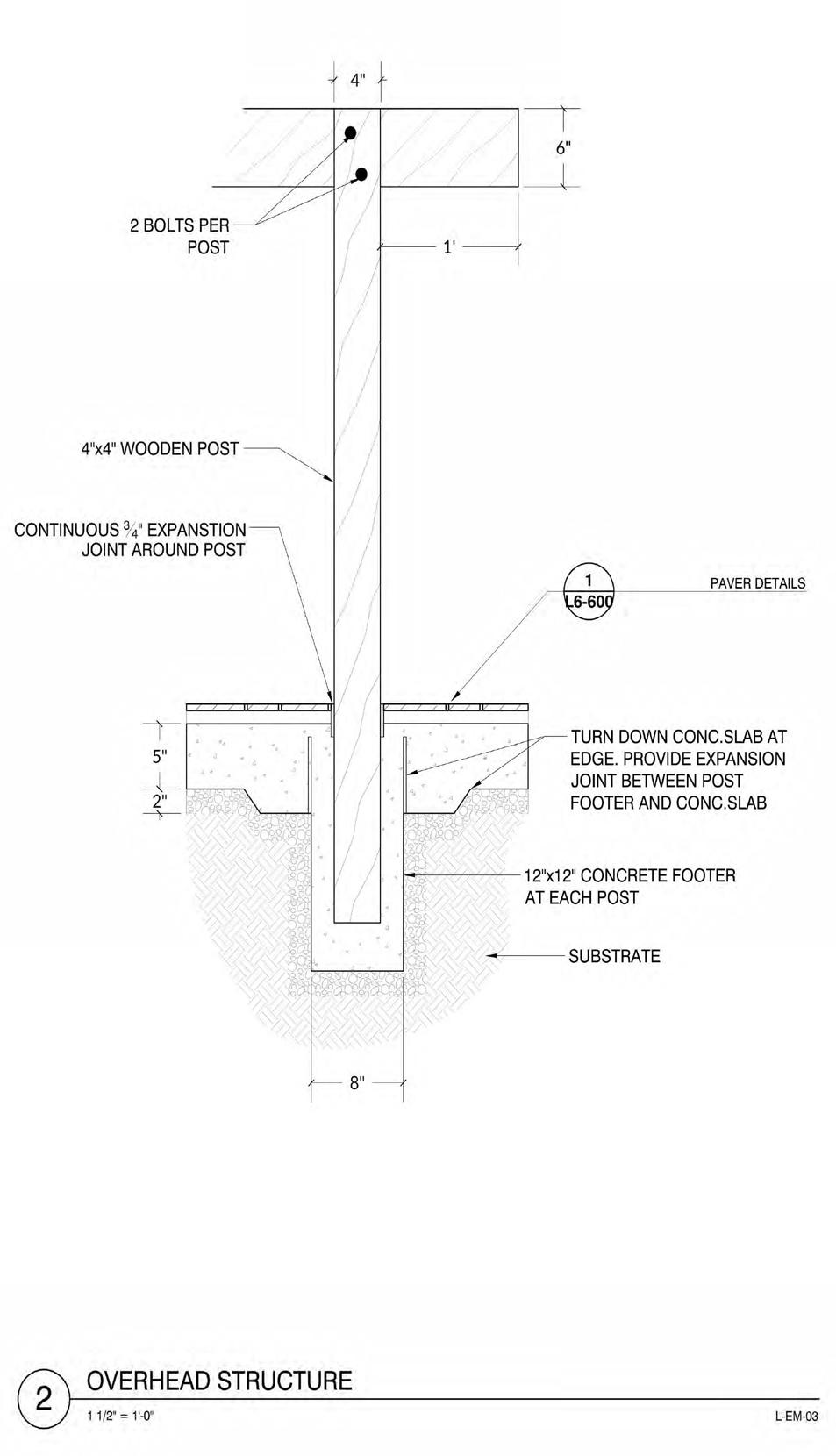
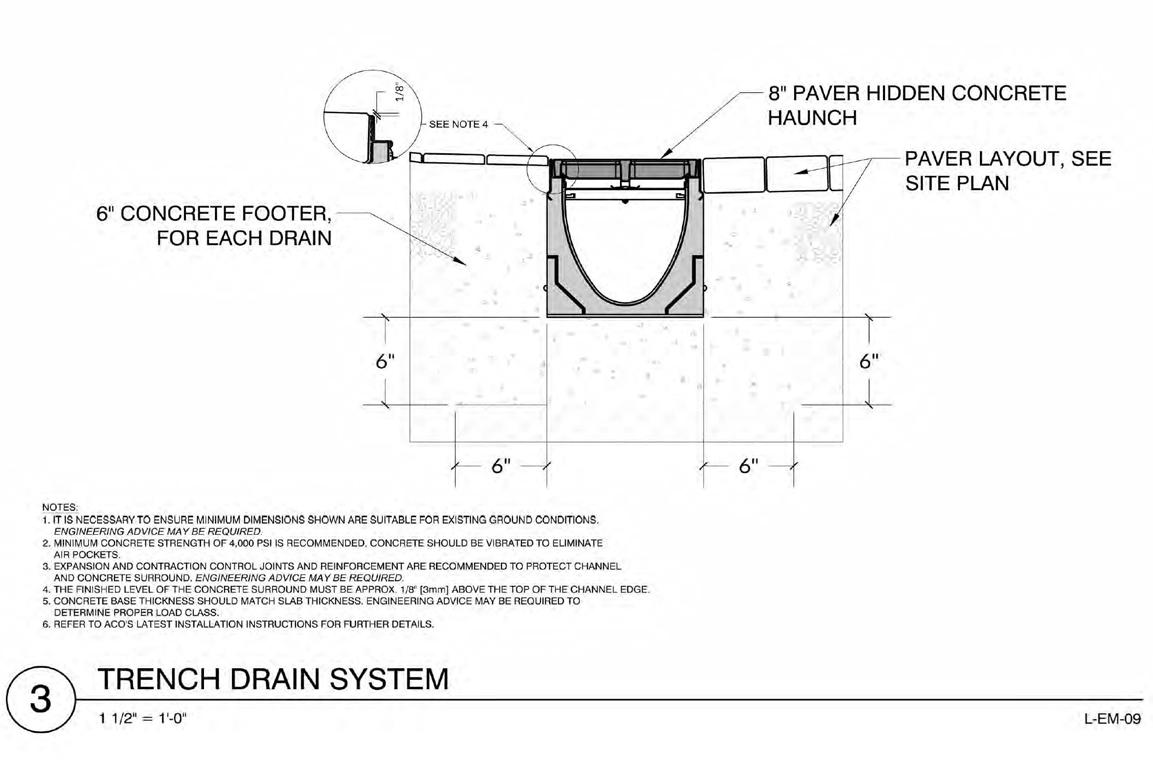
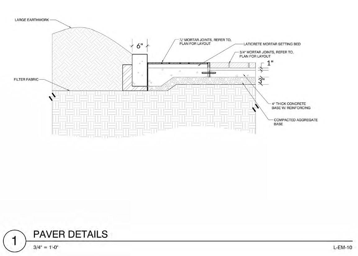
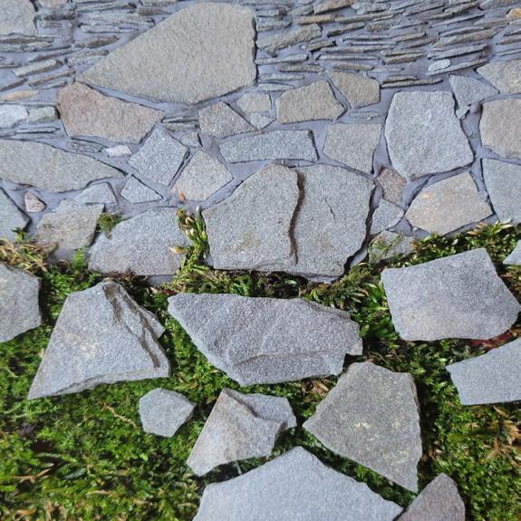
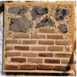
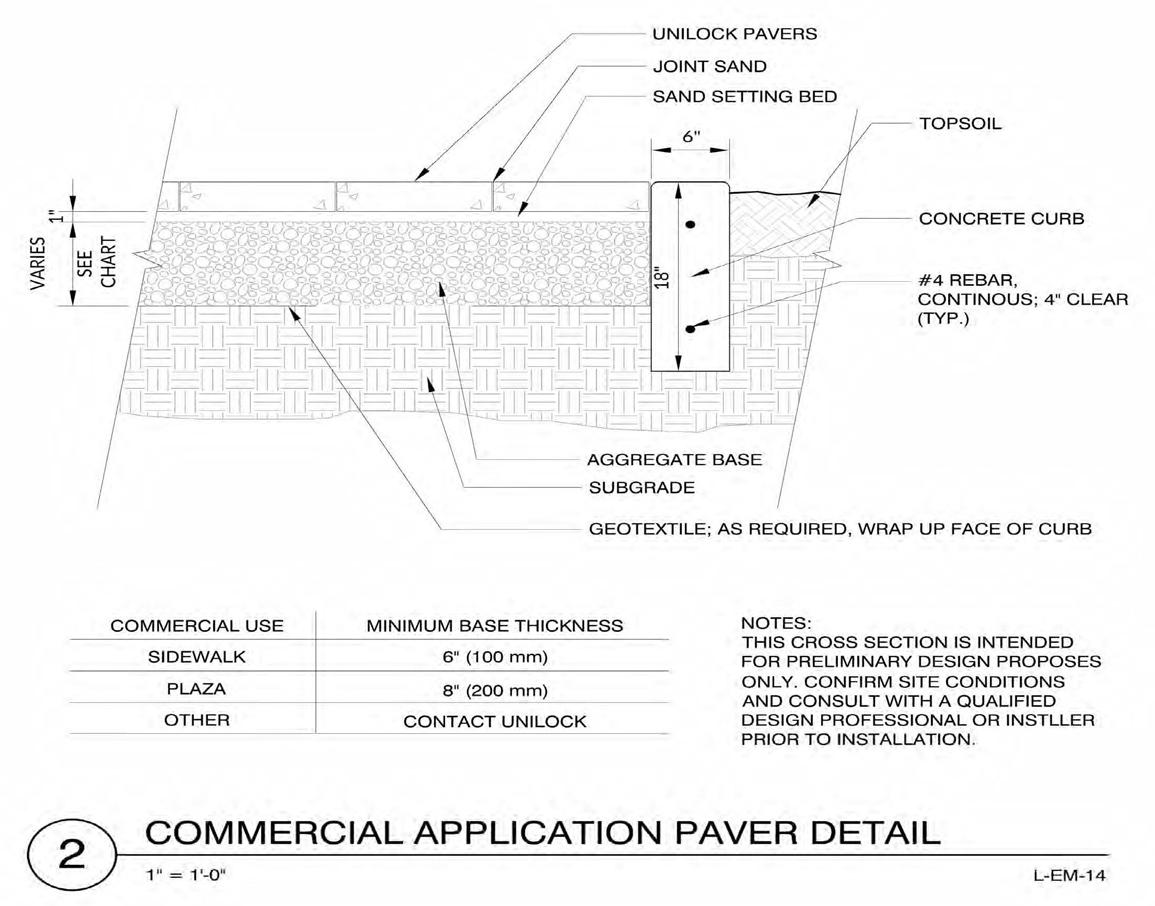
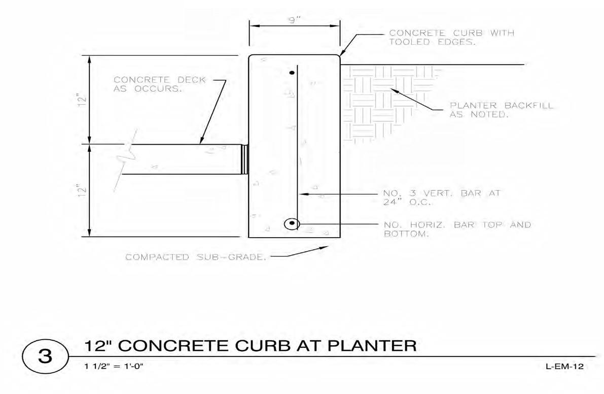
In our materials exploration we decided to explore the uses of slate/flagstone paver's because it was easily available to us and also a highly versatile material to work with. Using samples sourced from local suppliers (Chaney Enterprises, Ernest Meiers Annapolis, etc), and other materials at home; we experimented with different formal arrangements and textures to create detailed patterns in our pavers. The goal was to meld our new slate pavers with the original brick paving of the site cohesively, while also allowing design flexibility by using organic and rigid geometric shapes together in tandem.
For this project, as a team, our design and understanding of space was heavily influenced by our explorations of materiality - practically driven by it. Through our use of materials and the construction documentation process, we:
1. Redefined the existing site with a distinct character of its own, while also re-establishig its connection to its surrounding contexts.
2. Shaped unique spaces within the site that offer multiple points of physical and aesthetic interest, as well as provide flexibility for opportunities for many functions.
3. Promoted sustainability and community beautification by expanding green space and a largely native plant selections.
4.Addressed community and user interests for site through inclusion of new spaces and park facilities.
Course: Urban Design Studio, Theory of Landscape Architecture
Professor: Jack Sullivan, Caren Yglesias
Year: Fall 2021
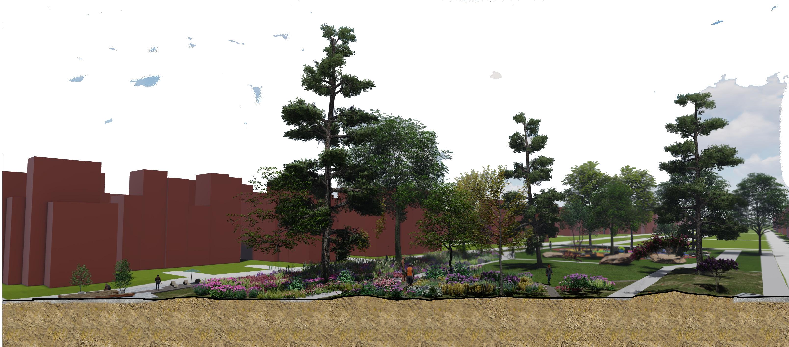
Environmental equity while establishing an ecological sensitive landscape.
Location: Harlem Park, Baltimore, MD
Size: 525,933ft2
Project Type: Urban Design
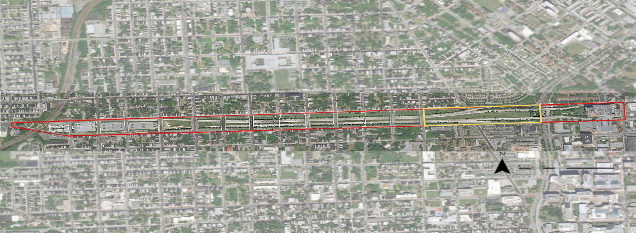
Route 40, better known as the Highway to Nowhere, sits in West Baltimore a community of disrepair. The Highway was built more than five decades ago and destroyed a predominantly African-American neighborhood. This 1- 1/2 mile stretch of road cuts through West Baltimore with its end result of dividing neighborhoods and displacing many residents and businesses, thus causing many economic hardships for the community.
My initial concept asked what if the Highway to Nowhere was transformed from an “open wound” of a six-lane road that was never finished (Collins, 2021), into a natural environment that not only provides a sense of place but is also an ecological presence of West Baltimore?
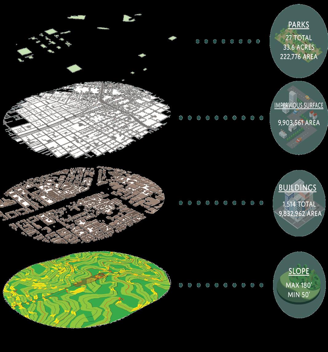
The overall watershed consists of about 75% impervious surfaces. The largest land use areas are Buildings, which are 100% impervious, and Grass, which is entirely previous. Watershed 263 is part of the Baltimore Harbor drainage basin. The watershed drains into a network consisting of 225,543 LF (43 miles) of storm drains, discharging through a single outlet, an 11 ft x 14 ft box culvert to the Middle Branch, part of the Patapsco river.
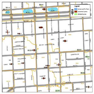
Considering the loss of major rivers and streams within the area many recommendations can be made based on what open space there is. The overall watershed is made up of about 30% open space. Based on the data collected for the Watershed 263 Management Plan
Final Report[1] the implementation of Extended Detention Wet Ponds/wetlands along Rout 40 would provide:
• Temporary and permanent storage
• Improve water quality
Beautification
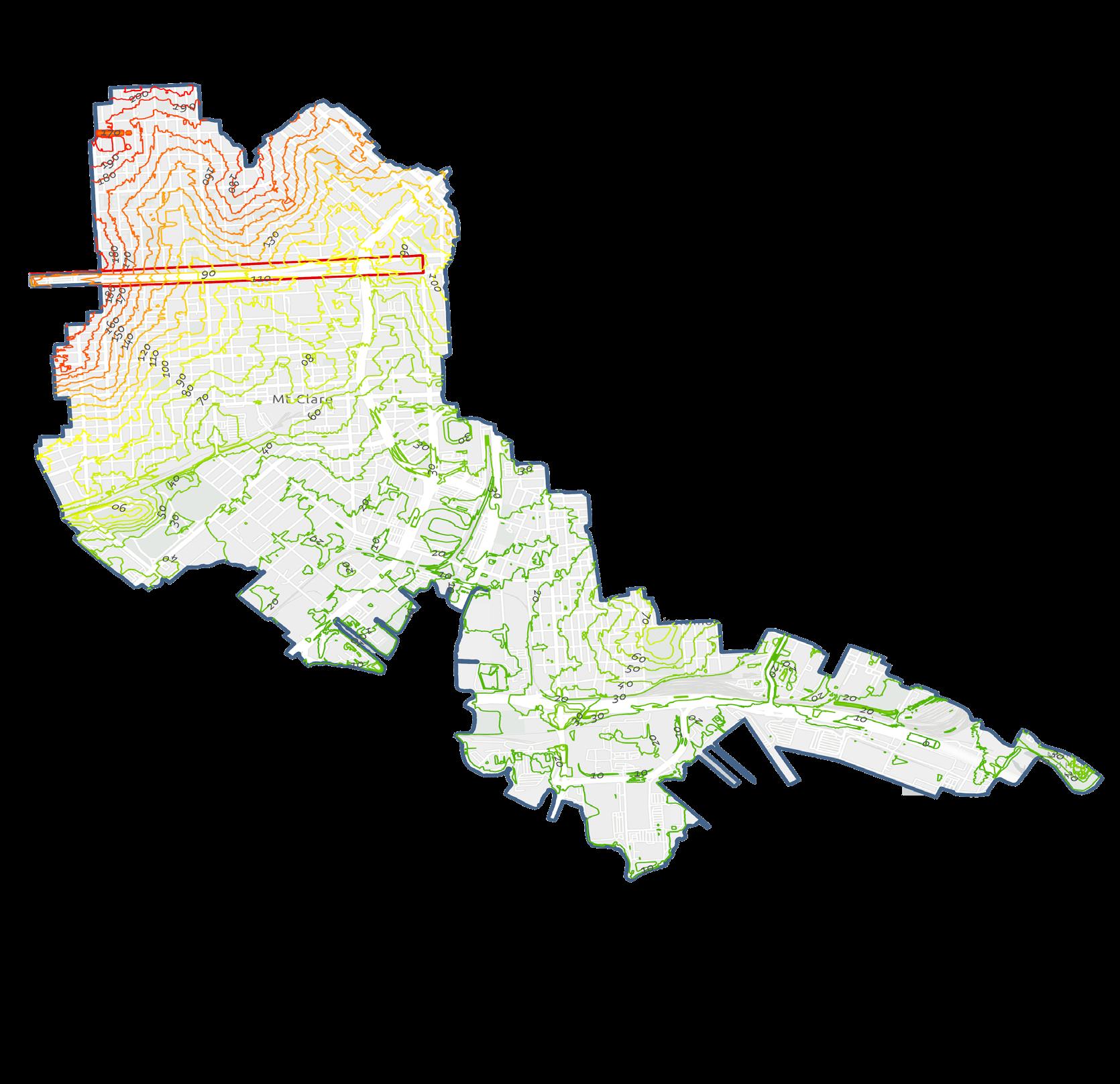
These ponds would be located along Mount Street and Gilmore Street, Strickler Street and Calhoun Street, or Carey Street and Carrollton Avenue.
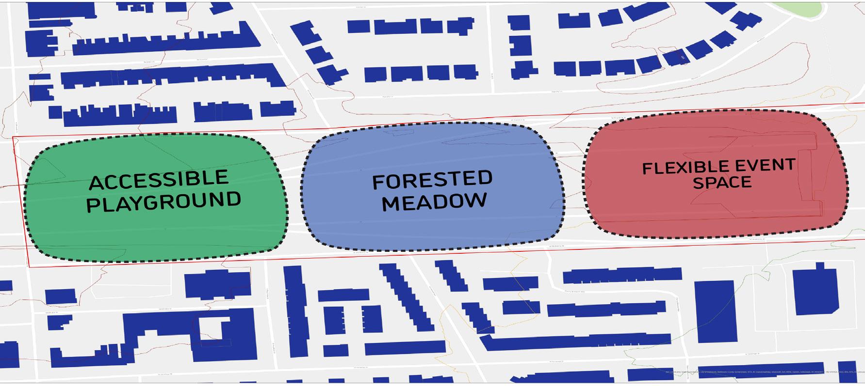
1. Environment
a. Utilized bioswales or rain gardens to improve stormwater infrastructure throughout the site
b. The use of native plant species or other plantings to establish a sustainable climate
2. Community
a. Provide open spaces that can be functional, accessible, and enjoyable for all ranging demographics
b. Establish environmental stewardship through community engagement projects
3. Economics
a. Allow for flexible outdoor space that can host a wide range of events
b. Employ mixed-use development to improve community jobs and education
"In order for Urban Ecology to successfully work both “SOCIAL AND ECOLOGICAL FACTORS must INTERACT IN THE URBAN ECOSYSTEM”[1].
Course: Ecological Design
Professor: Peter May
Year: Spring 2022
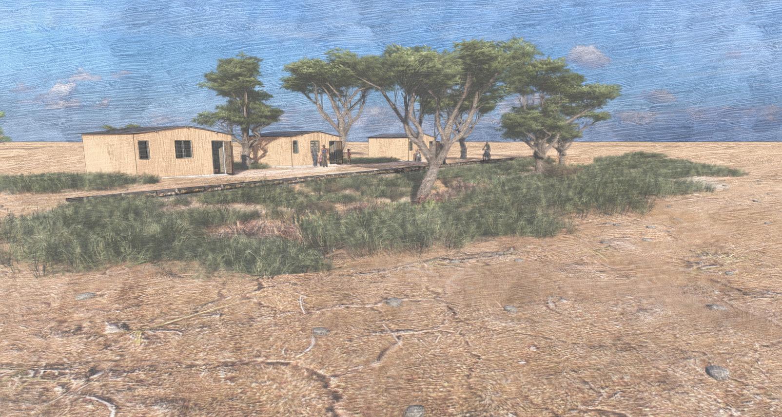
Enhancing availability of clean water in a drought ridden country.
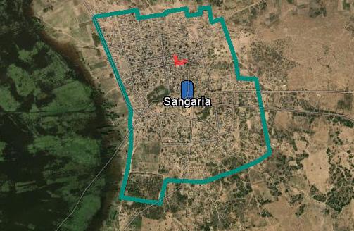
Location: Sangari, Republic of Chad
Size: 1400ft2
Project Type: Green Infrastructure/Theory, Green New Deal
The construction of a series of bio-swales and bioretention wetlands in Sub-Saharan Africa. In a small city located just south of Lake Chad and east of the Chari river called Sangari,Republic of Chad. Despite obstacles in helping the region restore Lake Chad, there are efforts to keep the lake from drying that exist. Climate change and global temperature increase is the main driver of the shrinkage of the lake; however, there are measures to be taken to prolong the existence of Lake Chad.
This design will help in reaching the goals projected by the Green New Deal by diverting water use from a depleting body of water. Climate change has played a key role in the shrinking of Lake Chad. By implementing tools that help communities adapt to the products of climate change, we can focus our resources on combating the global problem.
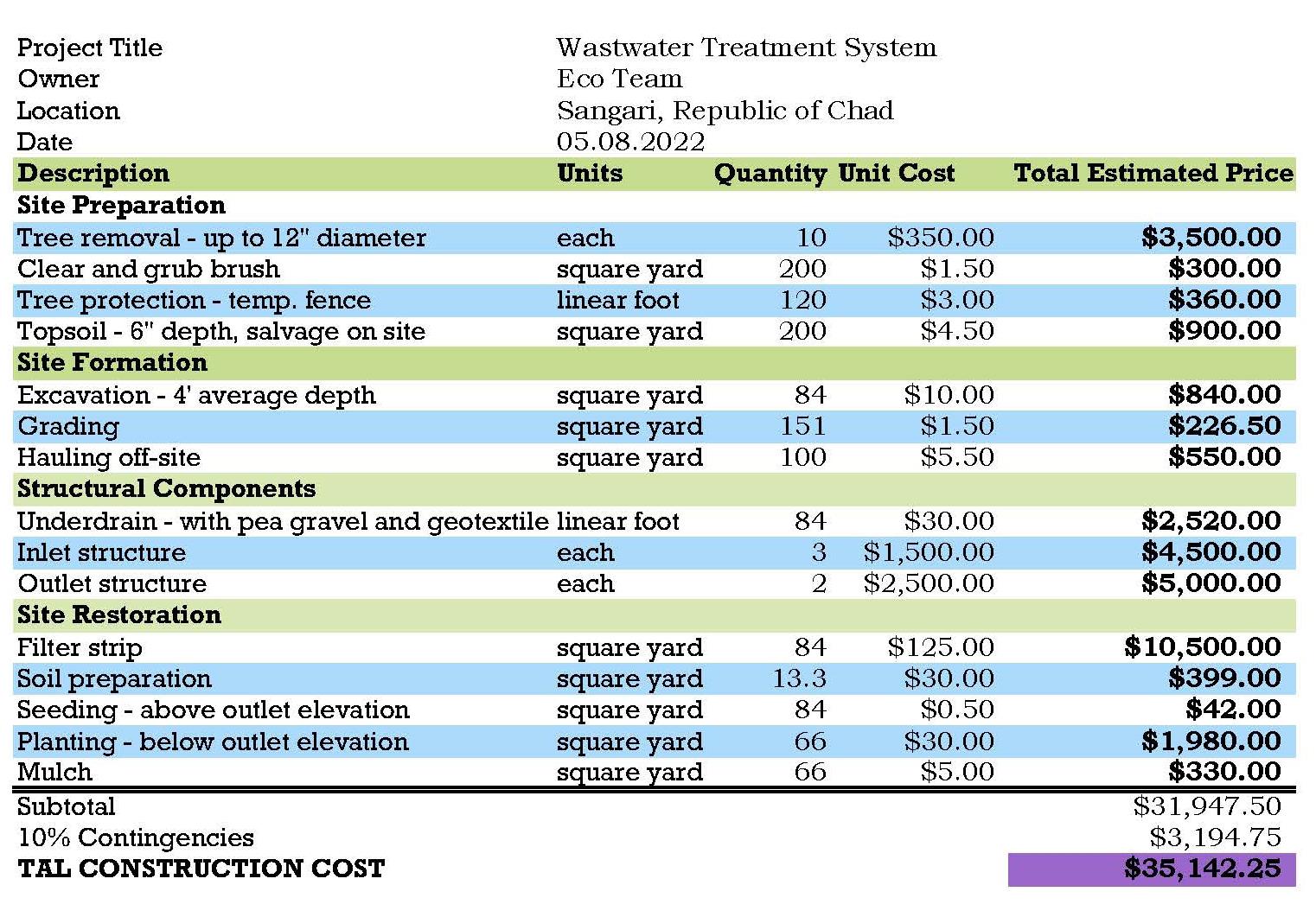
Costs range around $3-5.00 per square foot with a 10% contingency fee to allow for any extra costs that might come.
medium-sized 21m(69 ft)
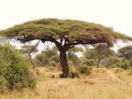
Nitrogen fixing
Area - 1400ft2
Climate - Arid/Dry
Approximately 10% slope
Rainfall - 50-150mm per month
Soil - leptosols, regosols, and arenosols
• Leptosols - very shallow profile depth contain large amounts of gravel.
• Regosols - shallow, medium- to fine-textured
• Arenosols -Sandy soils, lack any significant soil profile development
30 to 150 cm
Fruiting May to July
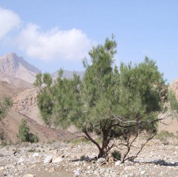
Found on sand dunes 15 ft. (4.6 m)
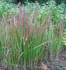
Thrives in lake margins, wetlands, saline environments
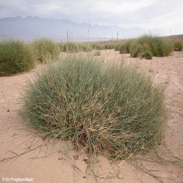
1.5 m (5ft) by 0.2 m (0ft 8in)
Prefers dry or moist soil
Drought tolerant
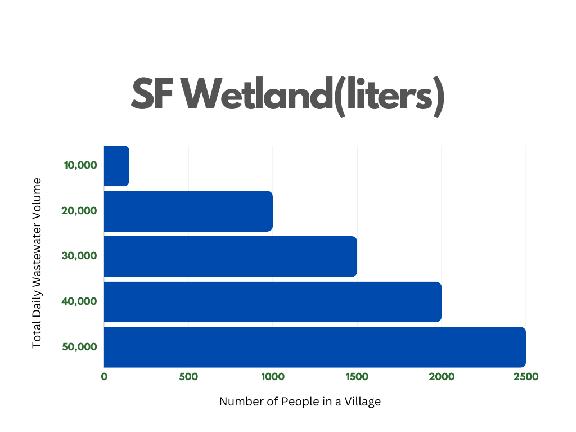
5 hectares, bioretention can hold up to 1,269,997 liters of water. A person (African City) can discard between 20-150 liters of wastewater per day.
• Consists of approximately 2500 people.
• Wastewater 20 liters per person
Total daily wastewater volume = Number of people × Wastewater produced per person
With a 23.1% reduction in total Nitrogen (N) and a 58.1% reduction in total Phosphorus (P).
By implementing this BMP or ecological design, a small village of people are provided with greater food security, a wastewater treatment system thus mitigating disease related issues, and even help reduce pressure for water usage in a drought-stricken region. In order to have a greater impact, this type of thinking would have to be implemented at a legislative level. The human dimensions of climate change are often forgotten when resolving issues related to climate change. This ecological design project in particular was designed to contribute to a better quality of life for the people of Sangari.
Average wastewater inflow load is 50m ^3 per day
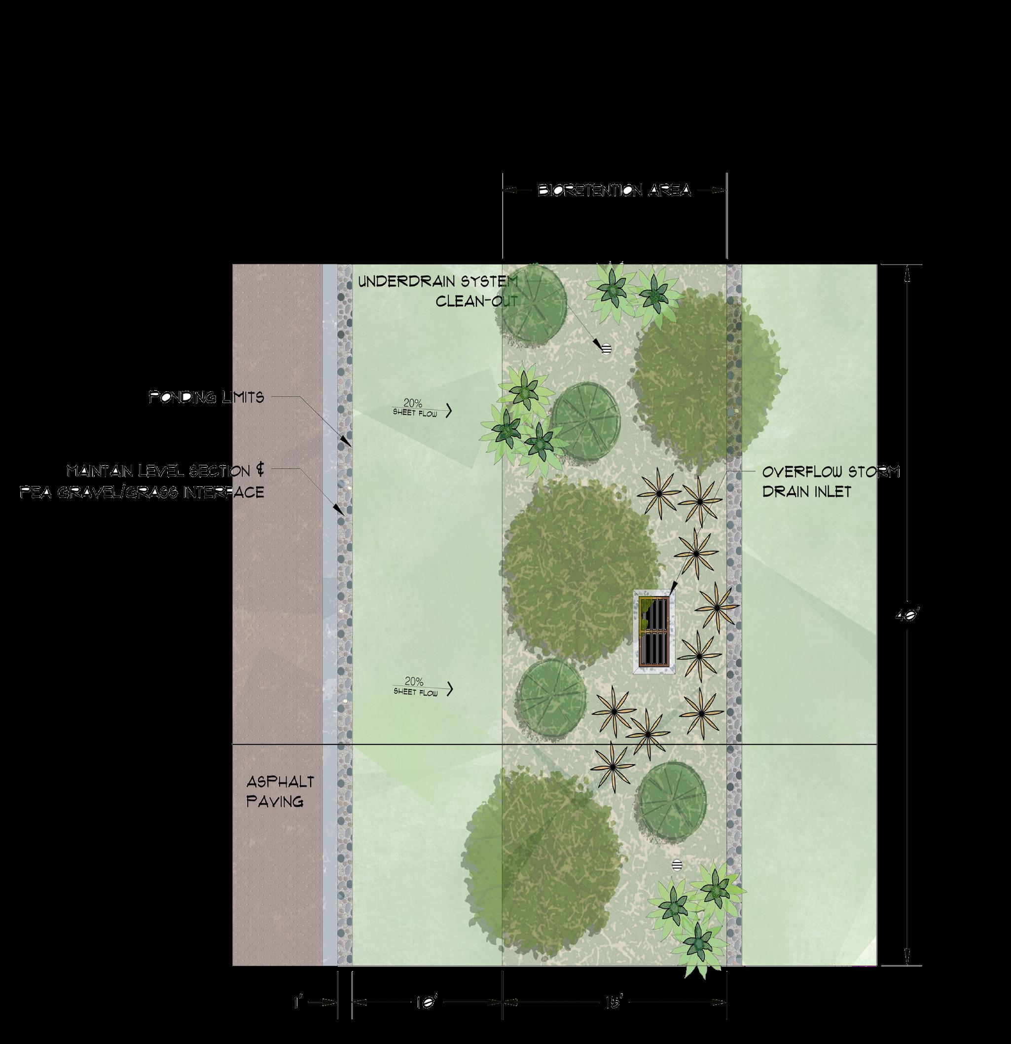
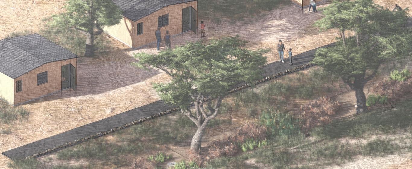
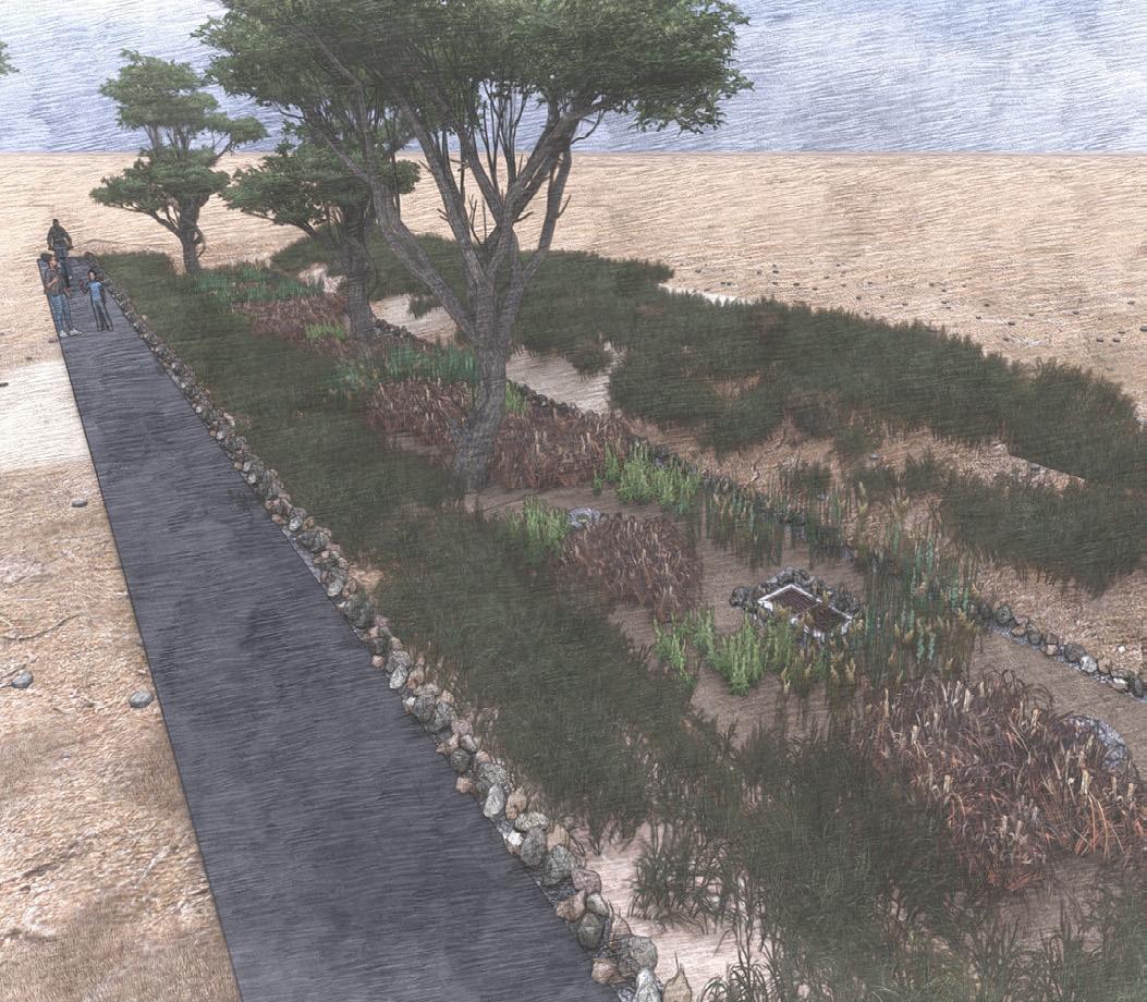
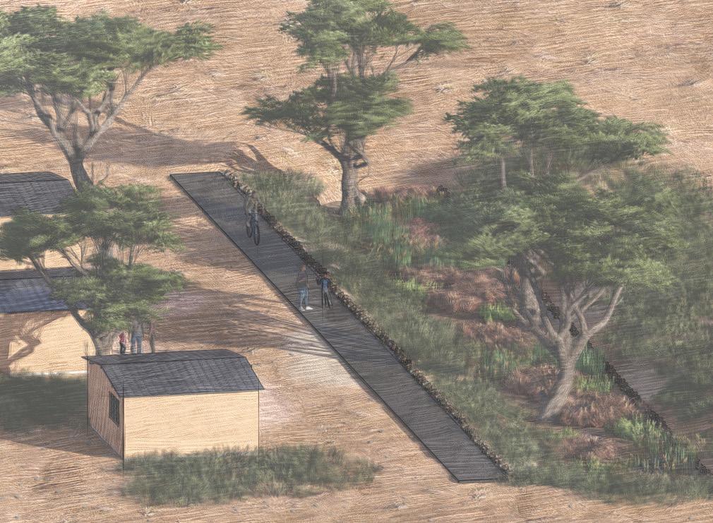
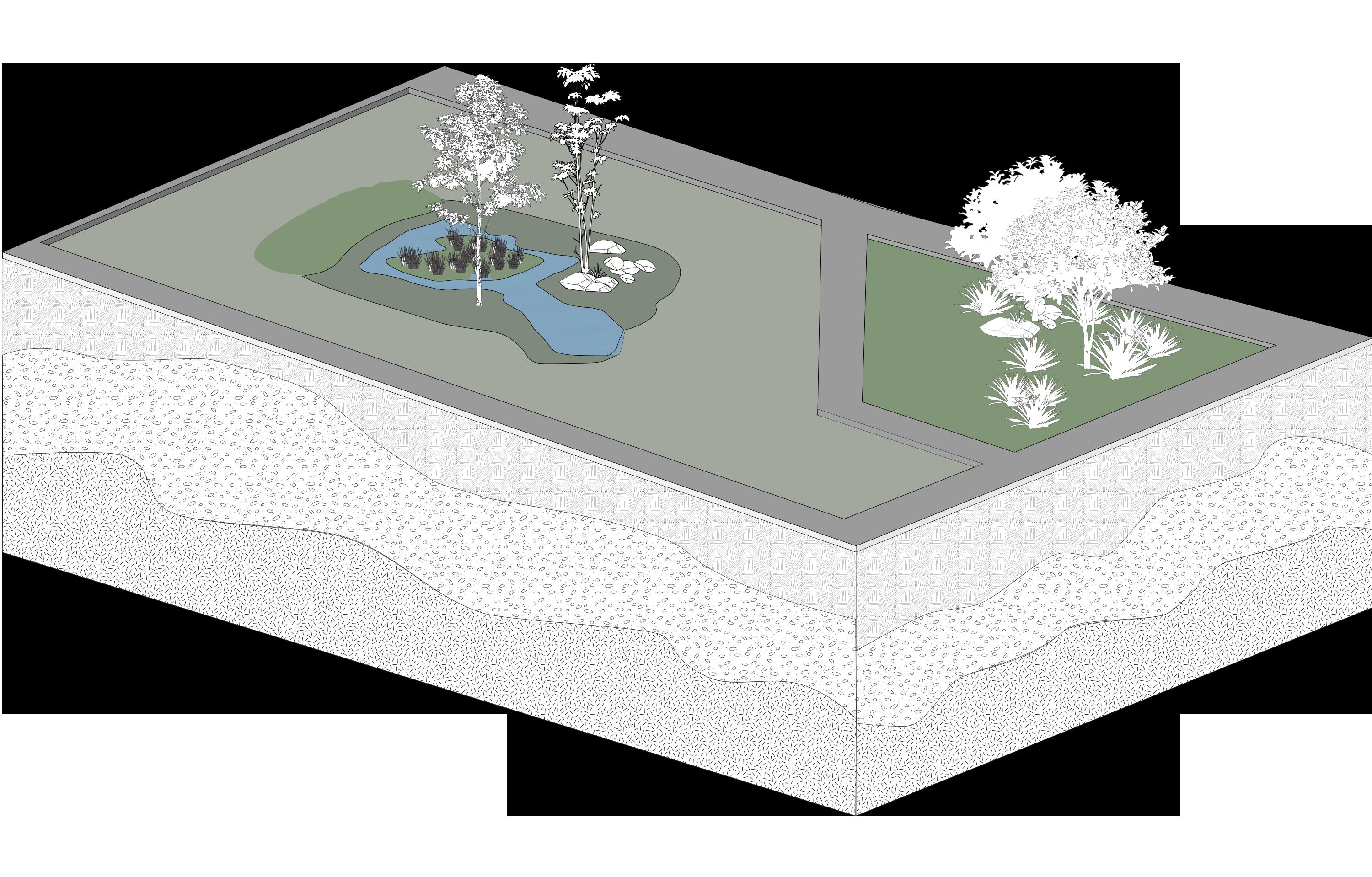
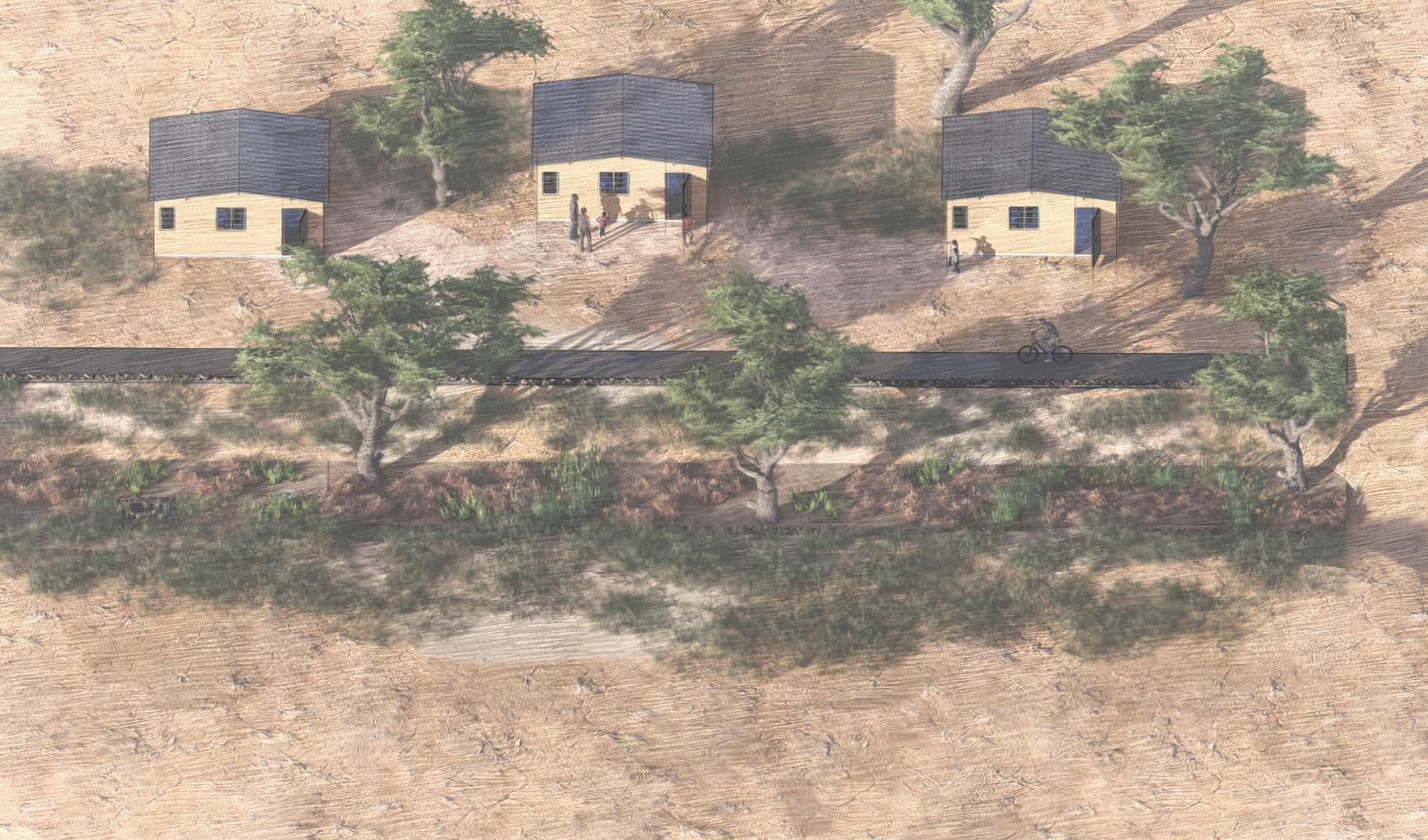
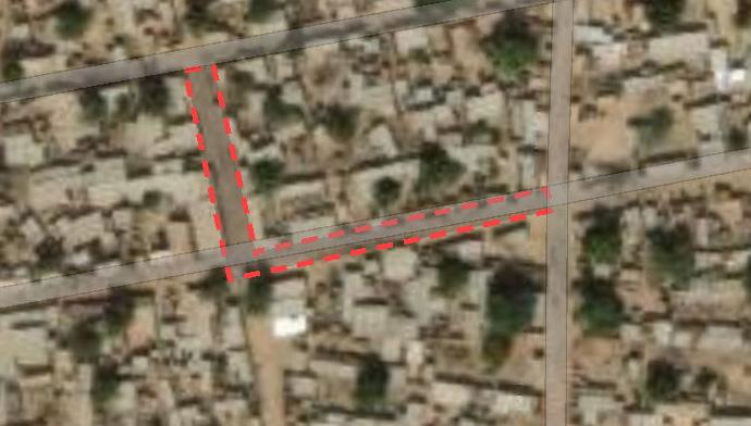
Site Plan for bioretention
Design considerations for Sangarai should consist of the topography, climate, and vegetation.The bioretention makes up 4,200ft2 with a total length of 120ft. In theory the system should be able to treat 1269997.46 liters of water. The use of a subsurface bioswale system allows for the onsite treatment of stormwater that can then be implemented for the use of irrigation.
Section Cut showing bioretention materials