
2025 - First Edition
2025 - First Edition
INDUSTRY DIRECTORY & PARTNER GUIDE

In-depth
In-depth
Updates
Updates


Welcome to this very first edition of The Geospatial Ecosystem, powered by Geomares. This is a truly valuable ‘industry directory and partner guide’ to keep close to hand on your desk, on a shelf or in your bag. Whenever you are searching for a manufacturer or service provider to help with your next project, grab The Geospatial Ecosystem and have a quick flick through it – especially if you are looking for a bit more information about the inner workings of these companies that are active in the broad field of photogrammetry and remote sensing, aerial imagery, land surveying, GNSS or laser scanning. What really drives them, what do they regard as the key highlights, and which success stories have they worked on? Of course, there’s some practical information as well: contact details and a handy QR code to take you directly to the supplier’s profile on Geomatching or GIM International
We believe that the companies included in this guide really do form the backbone of the geospatial ecosystem. It’s no coincidence that all the companies are members of
GIM International, meaning they support and help to sustain in-depth and high-quality information for geoprofessionals through our platform. The featured companies are open to networking, collaborating and doing business. The people who own, lead and operate within these organizations are truly dedicated to furthering the geospatial field.
At Geomares, we aim to support their efforts through all of our information channels – and, particularly tangibly, through this new guide –to strengthen the geomatics industry’s role and reputation as the fundamental layer of so many important developments shaping the world of tomorrow. Whether speeding up the energy transition, tackling climate change, increasing security, guaranteeing land rights or decreasing poverty, deployment of the right equipment, software, imagery and data –and therefore the knowledge, expertise and solutions from these suppliers – will be vital to future success.
Durk Haarsma director of strategy & business development
Director Strategy & Business Development
Durk Haarsma
Financial Director
Meine van der Bijl
Project Managers
Sandro Steunebrink, Linda van der Lans
Copy Editor Lynn Radford
Marketing Advisors
Myrthe van der Schuit, Sandro Steunebrink, Peter Tapken
Design
Persmanager, The Hague
Image courtesy
State Government of Victoria, Australia
P.O. Box 112, 8530 AC Lemmer, The Netherlands
T:+31 (0) 514-56 18 54
F: +31 (0) 514-56 38 98 gim-international@geomares.nl www.gim-international.com
No material may be reproduced in whole or in part without written permission of Geomares. Copyright © 2025, Geomares, The Netherlands All rights reserved.ISSN 1566-9076
Land surveying equipment

3D TARGET was founded to provide assistance, products, rentals and training courses on mapping to every company, professional and public administration. We anticipate and solve challenges related to the development of solutions that make mapping easier through innovative and flexible approaches.
✓ Multi-platform capability: Scanfly is a versatile Lidar solution deployable on cars, backpacks and UAVs for different mapping needs
✓ User-friendly design: its compact, cable-free design with tool-less mounting ensures easy setup and operation
✓ Accurate data processing: our SmartProcessing Lidar software generates precise point clouds from synchronized sensor data
✓ Wide market application: serving sectors such as topography, digital mapping, road cadastre, monitoring and asset management
Scanfly’s versatility makes it a truly unique solution. Its multi-platform design allows a single user to quickly switch the compact, cable-free sensor between a car, backpack or UAV. This adaptability ensures that our accurate Lidar solution meets the specific mapping needs with unmatched ease.
Our driving force is our mission to enable people to measure, understand and interpret the world around them. We are inspired by our vision to create innovative sensing solutions that are both high-performance and incredibly easy to use. Every aspect of Scanfly, from design to software, is a reflection of this philosophy.

Key highlights
3DT Scanfly | The world digitally twinned. With over a decade of experience, we provide easy-to-use Lidar solutions. Our clients worldwide use our technology for a wide range of applications, from digital mapping to asset management and monitoring.
Success story
Autostrade per l’Italia (www.autostrade.it/), the largest operator of Italy’s highway network, needed a solution to digitalize its 3,000km road network and map its infrastructure. It chose 3DT’s Scanfly DUO, with dual multi-channel Lidar heads and a 72MP panoramic camera. A single operator could travel at 100km/h, avoiding disruption to traffic. The resulting point cloud had an accuracy of 3cm, allowing Autostrade to analyse elements such as road signs and barriers virtually. This project demonstrated that Scanfly DUO is a fast, accurate and safe solution for large-scale mapping.
Company type
Equipment supplier
Laser scanners

Company details
Via Preferita, Traversa 1, 21 25014 Castenedolo, Brescia
Italy
info@scanfly.it
+39 030 535 7677
Scan the QR code to access 3D TARGET’s Geo-matching profile with complete product specifications.


Airbus Geospatial operates a commercial constellation of optical and radar Earth observation satellites, delivering highly accurate data and a wide range of products. With over 40 years of industry experience, we help customers tackle challenges with greater speed and precision.
✓ Earth observation (EO) satellite constellation: we operate a fleet of advanced optical and radar satellites, delivering high-resolution, near real-time imagery for global monitoring, mapping and analytics
✓ Cutting-edge technology and expertise: we leverage 40+ years of geospatial experience with proprietary processing tools, AI-driven analytics and cloud-based platforms to ensure accuracy, scalability and speed
✓ Comprehensive services and solutions: we offer data delivery, intelligence services and tasking
Airbus offers a unique blend of world-class EO satellite capabilities, 40+ years of expertise and end-to-end geospatial solutions. We deliver unmatched accuracy, revisit rates and global coverage across diverse data needs.
At Airbus, we’re driven by a commitment to delivering trusted insights that help shape a safer, more sustainable world. We believe in the power of satellite data to inform critical decisions, protect lives, manage natural resources and support global resilience.

Key highlights
• Delivering trusted geospatial intelligence in 100+ countries
• Backed by 40+ years of experience
• Our 30cm-resolution satellites set new standards in image quality and responsiveness
Success story
An environmental agency used 30cm-resolution and radar satellites to monitor illegal logging in the Amazon. The all-weather imagery enabled rapid detection of deforestation, supported enforcement actions and improved forest management, helping safeguard critical ecosystems. “Airbus’s imagery and analytics have transformed how we monitor and protect the rainforest. The detail and frequency of data empower us to act decisively,” says the head of environmental monitoring, Partner Agency.
Company type Service provider Geospatial imaging solutions
Company details
5 Rue des Satellites 31030 Toulouse France
rebecca.bauley@airbus.com +33 5 6219 4040
Scan the QR code to visit Airbus Geospatial’s profile on GIM International and learn more.


Founded in 2008, ALPHA GEO is a global market-leading high-tech company focusing on high-precision GNSS technology. ALPHA GEO is engaged in R&D, manufacturing, sales and services to develop and manufacture precise satellite and optical positioning products and software solutions for the geographic positioning, construction and agricultural industries.
✓ Non-contact measurement: this system utilizes active laser scanning technology integrated with simultaneous localization and mapping (SLAM) algorithms to achieve highprecision spatial data acquisition in complex and dynamic environments
✓ HDR true-colour point clouds meet AR navigation: the Falcon X integrates dual 1,200MP panoramic lenses and advanced binocular synchronous acquisition technology, enabling 360° omnidirectional high dynamic range (HDR) true-colour imaging. It produces highly detailed and accurate point clouds with realistic colour information, making it ideal for augmented reality (AR) navigation and immersive 3D mapping applications
✓ Super lMU: say goodbye to repeated initialization. The system incorporates a high-performance IMU sensor that supports fast initialization, requires no calibration and remains immune to magnetic interference. This ensures consistent and reliable operation even in challenging environmental conditions
ALPHA GEO proudly introduces the Falcon X, a revolutionary surveying mobile terminal integrating GNSS, high-precision vision modules and Lidar to redefine traditional RTK workflows. By combining SLAM technology with high-accuracy RTK and a powerful core processor, it enables real-time point cloud coordinate calculation and establishes a unified coordinate system for both indoor and outdoor environments. Data can be directly used in engineering design without post-processing, greatly improving operational efficiency and accuracy.

We are driven by our mission: ‘Where precision meets innovation’.
Key highlights
• 98% customer satisfaction
• 30,000+ users in the industry
• Products sold in 50+ countries around the world
Success story
ALPHA GEO instruments are powering the Chilean high-speed rail project. Chile’s long, narrow terrain, characterized by complex topography including deserts, mountains, canyons and coastlines, presents significant engineering and surveying challenges for the construction of the high-speed rail link. ALPHA GEO technology is playing a key role in this critical phase of the project.

Company type
Equipment supplier
Land surveying equipment
Company details
Building C, Runhui Science and Technology Park
Shenzhou Road, Huangpu District, Guangzhou 510663 Guangdong, China sales@alphageo-info.com +8618565149475
Scan the QR code to visit ALPHA GEO’s profile on GIM International and learn more.

Founded in November 2011, we create prototypes of ideas that we think are ‘fun’, ‘wow’ or ‘useful’. We listen to client needs and ideas to create innovative products. Our staff is multi-talented and capable of both designing software and fabricating hardware. We collaborate with and have alliance partners who are aligned with our philosophies.
✓ UAS Lidar manufacture and sale of lightweight, high-performance green Lidar systems for UAS
✓ Survey equipment products that enable highprecision measurements in ICT construction
✓ End-to-end UAS survey solution services preview while scanning, complete analysis upon upload and optimized results
✓ We provide a complete UAS surveying solution service
The ‘TDOT 7 GREEN’ amphibious Lidar with a wide field of view of 120 degrees sets up apart. We also offer the ‘TDOT 7 GREEN LITE’, which maintains high performance while reducing the weight to 2.7kg.
Since successfully commercializing the world’s first Lidar scanner system optimized for drones in 2013, we have been researching, developing and delivering the products, services and solutions that make it possible to enhance the precision of ICT-enabled construction and to boost work efficiency at surveying sites using industrial drones.
Key highlights
In 2022, we conducted operations in 14 countries worldwide and continued our activities on a global scale. Starting with the ‘TDOT GREEN’ series, which enables diverse surveying from land to underwater, we develop and sell various Lidar systems tailored to our customers’ needs.
Success story
We started developing drones in 2006. In 2017, at the request of Japan’s Ministry of Land, Infrastructure, Transport and Tourism (MLIT), we developed the TDOT GREEN series, capable of both terrestrial and underwater surveying. We also developed drones that maintain stable flight even in strong winds. These systems have been adopted by regional development bureaus nationwide.
Company type Equipment supplier Laser scanners

Company details
No. 2401, Shin-Daibiru. 24F, 1-2-1 Dojimahama 530-0004 Kita-ku, Osaka Japan info@amuse-oneself.com +81 6 6341 0207
Scan the QR code to access amuse oneself’s Geo-matching profile with complete product specifications.


BDStar Navigation Co, Ltd offers a comprehensive portfolio of GNSS products and services, such as GNSS chips, modules, antennas and data services, with a strategic focus on the intelligent Location Digital Base (iLDB).
✓ Our core businesses include GNSS chips, modules, antennas and data services
✓ We deliver high-quality products, solutions and services to customers worldwide
BDStar is establishing a globally comprehensive intelligent Location Digital Base based on the ‘cloud + chip’ strategy, delivering highly reliable and precise GNSS products and services for various applications, including industrial, automotive and consumer markets.
We are driven by the desire to provide customers with satisfactory location-based solutions to contribute to society and create better lives for customers, partners, employees and investors.

Key highlights
• One of the top 10 global GNSS core component and receiver manufacturers
• Comprehensive portfolio of core products and services across all series and applications
Success story
BDStar provides global customers with GNSS chips, modules, antennas and data services, offering positioning accuracy that ranges from metres to sub-metres, centimetres and even millimetres. These solutions are designed to meet the requirements for applications in the industrial, automotive, consumer and Internet of Things (IoT) sectors.

Company type
Equipment supplier
GNSS receivers, components and correction services
Company details
No. 7, Fengxian East Road, Yongfeng industrial base, Haidian district 100089 Beijing China
BDStar@BDStar.com +86 10 6993 9966
Scan the QR code to visit BDStar’s profile on GIM International and learn more.


Blue Marble Geographics delivers powerful, affordable and user-friendly geospatial software solutions: Global Mapper Pro, Global Mapper Mobile and Geographic Calculator. For over 30 years, Blue Marble’s products have been trusted by companies worldwide to streamline their geospatial workflows.
✓ Geospatial analysis: tools including contour creation, watershed modelling, DTM generation and spatial data processing
✓ Lidar classification: automatically classify features such as ground, buildings, vegetation and powerlines, and explore custom classification models
✓ Photogrammetric processing: quickly turn drone-captured imagery into 3D models, point clouds or orthoimages
✓ 3D visualization: view and analyse your data in a 3D environment, complete with tools to create fly-through animations
Global Mapper is the fast, powerful and affordable solution for GIS professionals. Developed with direct input from users, the all-in-one software continually evolves to meet real-world needs with unmatched file format support and an extensive suite of analysis and processing tools.
We believe that powerful geospatial tools should be a helping hand, not a headache. Our software is developed with fast and intuitive tools, along with extensive file format and coordinate conversion support. We’re committed to providing all the tools geospatial professionals need to complete their workflows – affordably and efficiently.
Key highlights
Global Mapper Pro and its award-winning Lidar Classification toolset is available around the globe, in 11 languages. The Global Mapper Insight and Learning Engine integrates deeplearning models, including building and vehicle identification.
Success story
For years, Blue Marble Geographics has partnered with the Office of Surface Mining Reclamation and Enforcement (OSMRE) to support their vital mission: turning former mine sites into safe, usable land for humans and wildlife. OSMRE relies on Global Mapper to carry out tasks such as Lidar classification, terrain modelling and volume calculations for spoil pile removal. These tools are essential for minimizing environmental impact and restoring natural landscapes. Thanks to Global Mapper, OSMRE has successfully reclaimed towns, stabilized critical infrastructure such as roads and reestablished habitats for wildlife.

Company type
Software supplier
Photogrammetry & remote sensing software
Company details
22 Carriage Lane 04347 Hallowell, Maine USA
sales@bluemarblegeo.com
+1 207 622 4656
Scan the QR code to visit Blue Marble Geographics profile on GIM International and learn more.

Bluesky International, a Woolpert company, is a leading aerial survey and geographic data company, producing and maintaining high-quality, accurate digital aerial photography and height data on a national scale in both Great Britain and the Republic of Ireland.
✓ Expertise: delivering high-quality geospatial solutions including orthophotography, Lidar, vegetation mapping, 3D modelling and renewables mapping
✓ Driving innovation: creator of the only National Tree Map and National Hedgerow Map for Great Britain and the Republic of Ireland. Bluesky also has an active innovation and R&D team
✓ Government partner: Bluesky is the sole contractor supplying current aerial photography and height data to all public sector organizations under the APGB contract
Bluesky continues to develop innovative tools and unique products, including National Tree Map, National Hedgerow Map 3+30+300 Rule Analysis and the newly launched Change Detection Service, in response to customer needs, empowering them with cost-effective data that drives informed decision-making.
The Bluesky team is passionate, highly experienced and motivated to deliver the best products and services for our customers. We are driven by the knowledge that there is always more we can do and strive to embrace technologies and provide new products and services that help our customers meet their challenges.
Key highlights
Founded in 2003, Bluesky has 20+ years of experience and 100+ staff across the UK, Ireland, the US and India. In 2025, Bluesky was acquired by Woolpert, a global AEG and consulting firm, extending our reach and capabilities far beyond the UK and Europe.
Success story
We were proud to support the creation of MetaCity: Liverpool. This pioneering digital twin of the Liverpool City Region captures 210km2 of the city and was developed by the University of Liverpool’s Virtual Engineering Centre. Built on our MetroVista dataset created with Skyline software, utilizing a combination of vertical and oblique aerial photography, and Lidar, the immersive tool integrates a wide range of geospatial data to support city management, planning, emergency response, environmental monitoring and more.
Company type
Service provider
Aerial & satellite imagery

Company details
The Station, Station Road Ashby-de-la-Zouch LE65 2AS UK
info@bluesky-world.com +44 1530 518518
Scan the QR code to visit Bluesky’s profile on GIM International and learn more.


CHC Navigation (CHCNAV) is a global leader in high-precision positioning and mapping technologies. We empower professionals in geospatial, construction, agriculture and autonomous industries with accessible, reliable and innovative solutions to build a smarter world.
✓ Geospatial: we develop cutting-edge GNSS, Lidar, UAV and monitoring systems that transform mapping and surveying
✓ Machine control: our advanced positioning technologies optimize construction equipment performance, enhancing productivity and precision
✓ Precision agriculture: we enable farmers to maximize yields with accuracy guidance and autosteering technologies
✓ Navigation: we pioneer positioning technologies for vehicles across land, sea and air environments
At CHCNAV, we democratize high-precision geospatial technology. We bridge the gap between high-end performance and affordability, designing powerful yet user-friendly solutions that deliver an exceptional return on investment and make advanced capabilities accessible to businesses of all sizes.
We believe in building a smarter world with precise geospatial information. Guided by passion, integrity, innovation and entrepreneurship, we strive to democratize highprecision technology, helping every customer turn challenges into success.

Key highlights
• Global reach in over 140 countries
• Delivered 100,000+ GNSS smart antennas in 2024 alone
• Holder of 450+ patents in GNSS and related technologies
• Fourth-largest geospatial solutions provider
Success story
Our 16-year partnership with CPE in Brazil exemplifies our ‘partnering for success’ philosophy. By providing CPE with robust, user-friendly and affordable GNSS solutions, we empowered it to capture a market share of over 50%. Today, CPE is the #1 geospatial technology provider in Brazil. Their win is our win. We are committed to equipping our partners worldwide with a decisive competitive edge, turning a shared strategy into market leadership.
Company type
Equipment supplier
GNSS receivers, components and correction services
Company details
Smart Navigation & Geo-Spatial Technology Park 577 Songying Road Shanghai 201703 China
marketing@chcnav.com +86215426273
Scan the QR code to access CHCNAV’s Geo-matching profile with complete product specifications.

As a listed company, ComNav Technology is a leading hi-tech company focused on high-precision GNSS technologies and applications with 20+ years’ experience. We develop and manufacture GNSS chips, modules, terminals and solutions, Our 26,000m2 Shanghai GNSS Industrial Park hosts 600 employees daily.
✓ Key technologies: fast fix technology, full-constellation technology, RTK-KEEP technology, PDP technology, dual RTK engine technology
✓ INS technology services: R&D, manufacturing, sales, services. OEM offered
✓ Markets: Up to 2024, we sold to 140+ countries worldwide with 1 million+ units/ modules
✓ Sectors: land survey, machine control, UAV, USV, UGV, deformation monitoring, personnel positioning, precision agriculture, marine
ComNav Technology is the only company developing and manufacturing GNSS chip, boards, and solutions in China. We continue to invest over 20% of our annual revenue in R&D yearly. We master high-precision core technology and deliver innovative, premier positioning solutions for various applications.
Driven by the mission to transform working and living conditions with high-precision positioning technology, ComNav Technology innovates as a leader in BDS/GNSS technologies. Guided by professionalism, innovation and cooperation, we develop high-performance, self-developed solutions to empower a digital era with highprecision positioning.
Key highlights
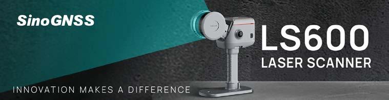
Key technologies meet advanced international standards. We pioneered the world’s first laser RTK, enabling rodless surveying and stakeout. The newly launched LS600 laser scanner integrates GNSS, SLAM and cameras into a lightweight, portable 3D scanner.
Success story
Jupiter Laser RTK has made its mark in Saudi Arabia, earning widespread acclaim for revolutionizing surveying workflows. In the dessert, the shifting sand dunes and rocky gullies made pole-based surveys hazardous. Jupiter’s 50m green laser solved this: surveyors marked targets from safe distances. In addition, its vision functions make laser pots readable even under sunlight. In dense construction zones, blocking GNSS signals disrupt traditional stakeout, but Jupiter’s dual cameras and 3D visuals in Survey Master software guide teams by means of directional arrows, making the stakeout much easier.

Company type
Equipment supplier
Land surveying equipment
Company details
No. 618 Chengliu Middle Rd., Building 2, Malu Town 201801 Shanghai China sales@comnavtech.com +86 21 6405 6796
Scan the QR code to access ComNav Technology’s Geomatching profile with complete product specifications

Emesent is a leading provider of autonomous Lidar mapping and data analytics solutions, empowering AEC professionals to capture and visualize built environments with high precision. Our flagship product, Hovermap, enables fast, safe and detailed 3D data capture.
✓ Advanced SLAM-based mapping: Hovermap provides accurate and detailed 3D Lidar data capture – ideal for planning, progress monitoring and verification across complex environments
✓ AI-powered autonomy: equipped with intelligent autonomous navigation, Hovermap enables safe and efficient data capture in inaccessible areas
✓ Rapid data capture: continuous scanning and real-time SLAM processing dramatically reduce data acquisition time, enabling faster decision-making
Emesent uniquely combines high-accuracy 3D Lidar scanning with fast, flexible data capture –indoors or outdoors, from intricate structural details to large-scale environments. Emesent Hovermap’s unmatched versatility allows it to be deployed handheld or on a backpack, drone or vehicle.
Our mission is to enhance organizations with the ability to map challenging environments while keeping people safe, providing actionable data that helps with faster decision-making.
Key highlights
Since 2018, we’ve been pushing the envelope for fast and accurate autonomous mapping –outdoors and underground. From the first Hovermap until today, we’ve provided the survey tools that keep people out of harm’s way.
Success story
Emesent has been helping AEC surveyors and reality capture professionals inspect bridges, monitor assets and conduct rapid field surveys (among many other applications) for years. By allowing output of Hovermap data for commonly used industry applications, we support the quick and accurate building of detailed 3D models.

Company type Equipment supplier Laser scanners
Company details
40-52 McDougall Street, Kings Row Office Park Level G, Building 4, Milton 4064 Brisbane, Queensland Australia hello@emesent.com +61 7 3548 9494
Scan the QR code to access Emesent’s Geo-matching profile with complete product specifications.


EvoLogics is a Berlin-based marine technology company specializing in underwater communication, positioning and robotics. With solutions like the Sonobot 5 USV and Quadroin AUV, we extend geospatial data collection into the underwater domain – rivers, lakes, coasts and subsea environments.
✓ Hydrographic survey USVs: the Sonobot 5 delivers professional-grade bathymetry and sonar mapping in a compact, portable platform
✓ Autonomous underwater vehicles: the Quadroin AUV combines advanced sensors with agile, penguin-inspired propulsion for efficient subsea surveys
✓ Underwater communication & positioning: patented S2C technology enables real-time tracking, networking and data exchange for vehicles, divers and other mobile assets
✓ Integrated systems: our platforms interconnect, creating cooperative workflows for mapping, monitoring and inspection missions
EvoLogics’ subsea communication technology is the backbone of our systems, enabling reliable networking between platforms. This allows the Sonobot and Quadroin to operate independently or as coordinated swarms for advanced geospatial data collection.
We believe reliable data is essential for informed decisions on global challenges such as climate change, infrastructure safety and resource management. EvoLogics is driven by a passion for advancing marine robotics and subsea networks that help researchers and industries better understand and protect aquatic environments.

Key highlights
• Founded in Berlin in 2000
• 25 years of subsea technology development
• Sonobot 5 USV launched in 2011, now in its 5th generation
• Quadroin AUV brings penguin-inspired efficient propulsion to subsea mapping
• Expanded Berlin production hub opened in 2025
Success story
In 2024, EvoLogics introduced the Sonobot 5 with integrated USBL, expanding the platform from a hydrographic survey tool to a multifunctional node in subsea operations. The new configuration enables the Sonobot to act as a mobile surface relay for diver navigation systems or as a communication bridge for AUVs. This development extends the platform’s use cases and demonstrates how EvoLogics advances cooperative geospatial workflows across surface, subsea and human operators.
Company type
Equipment supplier
Uncrewed systems and platforms
Company details
Wagner-Régeny-Straße 4 12489 Berlin Germany info@evologics.de +49 30 4679 862 - 0
Scan the QR code to access EvoLogics’ Geo-matching profile with complete product specifications.

Shenzhen Feima Robotics Co, Ltd (Feima Robotics) is a world-leading solution provide for drone systems, dynamic 3D mobile surveying platforms including SLAM handheld laser scanners, and geospatial applications with integrated software and hardware and one-stop spatial data system services.
✓ Drone systems: more than 20 types of intelligent drone systems have been released for aerial survey, remote sensing, patrol and emergency applications
✓ Dynamic scanning systems: innovator and gamechanger for dynamic scanning systems. In total, we have developed four generations of 3D SLAM Lidar scanners together with data processing software
✓ Geospatial services: we provide one-stop professional services to global clients based on our industrial solutions for geospatial applications
Headquartered in Shenzhen City, the innovation hub in China, Feima Robotics benefits from direct access to the suppliers, raw materials and a pool of young creative talent necessary for sustained development and success. We continuously invest in R&D to keep our leading position in the geospatial industry.
We adhere to the core culture of innovation, value and integrity, and aim to be a leader in the global geospatial industry. We are driven to develop and manufacture excellent systems and solutions for global clients, supported by fabulous service.


Key highlights
Since being founded in 2015, we have accumulated rich experience to provide worldleading geospatial solutions. We are the most popular brand in the survey and mapping industry in China. We are also a gamechanger in the development and manufacture of 3D SLAM scanners.
Success story
We have participated in many scientific research programmes in harsh natural environments, including in the Arctic and Antarctic regions. Our drones and 3D SLAM scanners have withstood the severe cold and low temperatures there, successfully assisting scientific researchers in obtaining relevant data. Our SLAM100 handheld Lidar scanner is the first SLAM scanner in the world to be used in Antarctica.
Company type Equipment supplier Laser scanners
Company details
13th Floor, Building A4, Nanshan Zhiyuan, No. 1001 Xueyuan Avenue, Nanshan District 518055 Shenzhen, Guangdong China overseas@feimarobotics.com +86 139 1010 6639
Scan the QR code to access Feima Robotics’ Geo-matching profile with complete product specifications.


Geo-ICT Training Center is a leading education provider in GIS, offering certified courses such as ArcGIS, AutoCAD and FME Desktop, alongside traineeships and study programmes for starters. In the Netherlands, we also support organizations through specialized staffing of geoinformation professionals.
✓ Courses: full classical courses with certified instructors
✓ Blended learning: learn at your own pace through self-guided online modules, combined with live sessions led by experienced instructors
✓ Online support: get three hours of one-onone online support with an expert
✓ Traineeship: a programme for starters to launch their career in the geospatial field
Unlike general training providers, Geo-ICT Training Center focuses exclusively on the geospatial sector. We combine certified courses with practical traineeships, ensuring participants gain not only technical expertise but also real career opportunities in the (Dutch) geoinformation market.
We believe geoinformation is vital for tackling major challenges such as sustainable housing and the energy transition. At Geo-ICT Training Center, we are driven by preparing professionals to make an impact, and inspired by seeing young talents grow and succeed in the geospatial field.

Key highlights
Since 2009, Geo-ICT Training Center has been a leading provider of geospatial education with over 200 certified courses.
Success story
In 2024, Geo-ICT Training Center was awarded an exclusive four-year tender by the Municipality of Amsterdam to provide all MicroStation courses. This milestone reflects the confidence placed in our expertise and highlights our ability to deliver large-scale, high-quality training programmes for leading organizations.
Company type Service provider Consultancy
Company details
Wapenrustlaan 11-31, Johan Cruijff Boulevard 83 7321 DL Apeldoorn The Netherlands info@geo-ict.nl +31 6 4346 3838
Scan the QR code to visit Geo-ICT Training Center’s profile on GIM International and learn more.

Geodex Surveying Technology Co, Ltd is a leading global provider of highprecision geodetic surveying instruments and geospatial solutions. We are dedicated to providing high-performance GNSS receivers, total stations and 3D Lidar scanners that drive innovation and empower our customers.
✓ High-precision geodetic instruments: we manufacture and provide a wide range of advanced surveying devices, including GNSS receivers, total stations and terrestrial 3D Lidar scanners, as well as high-precision, high-quality geomonitoring surveying prisms
✓ Professional technical services: our commitment extends to providing efficient technical support and expert solutions that ensure our customers achieve success with our products
What sets us apart is our unwavering commitment to both cutting-edge innovation and proven quality. As a global provider, we stand out by leveraging advanced technologies while maintaining the highest standards, as demonstrated by our SGS EU and ISO 9001:2015 certifications.
Our company is driven by a passion for innovation and accuracy. We are motivated by our mission: ‘Where accuracy drives innovations, elevating customers’ success together’. This core belief inspires our team to be at the forefront of cutting-edge technologies and to deliver highperformance products and efficient technical solutions that empower you.
Key highlights
• Established in 2008: we have been a leading manufacturer and global provider in the geospatial industry for over a decade
• Dual-certified products: our products have passed the stringent SGS EU Standard Test and our company holds the ISO 9001:2015
Success story
An infrastructure company was facing delays on a critical highway expansion project due to the complex, mountainous terrain of the site. Traditional surveying methods were proving to be both inefficient and hazardous for the surveying crew. By deploying a Geodex Visual Survey RTK GNSS receiver and terrestrial 3D Lidar scanners, the team was able to perform a complete survey of the area in a fraction of the time. The RTK system provided centimetre-level accuracy even in challenging conditions, while the Lidar scanner quickly captured a high-density point cloud of the inaccessible slopes.

Company type
Equipment supplier
Land surveying equipment
Company details
No. 422, Building #6, Tianhe District Gao Pu Road No. 85 510000 Guangzhou, Guangdong China info@geodex-tech.com +86 139 2957 9611
Scan the QR code to visit Geodex’s profile on GIM International and learn more.

Gexcel is a global leader in geomatics and 3D geospatial innovation, with nearly 20 years of experience. We design and develop cutting-edge hardware and software solutions for 3D data capture and documentation, visual and Lidar data processing, and large-site automatic monitoring.
✓ Technologies:
• HERON – SLAM-based system with highly flexible configurations
• OPMMS – open-pit mine monitoring system for real-time remote displacement detection
• 3DSMS – automatic stockpile volume calculation
• Reconstructor – advanced point cloud and imaging software for static/UAV/mobile scanner data
✓ Markets: mining, AEC, construction, digital twin, cultural heritage
✓ Worldwide services: custom solutions, OEM partnerships, and comprehensive client support for data processing, training and tech assistance
Gexcel stands out for its ‘Made in Italy’ solutions, developed entirely in-house and designed with a strong focus on flexibility and integration. Our technologies adapt to complex environments and connect seamlessly with third-party sensors and software, enabling professionals to build efficient workflows.
We are driven by the belief that 3D geospatial technology should be both innovative and accessible. Our mission is to empower professionals to capture, analyse and visualize with clarity and precision. By improving efficiency and usability of 3D data in surveying, Lidar and monitoring, we push geomatics forward and shape its future.
Key highlights
Gexcel is an independent company with an international presence, collaborating with leading industry players at various levels of integration. We are actively engaged in strong R&D projects that turn innovation into practical 3D solutions.
Success story
“Thanks to the flexibility of HERON technology, we were able to adapt and repurpose existing equipment to meet a very specific challenge. This innovative solution enabled us to safely and efficiently survey historical mine workings that would have been extremely difficult with traditional methods. It’s a clear demonstration of how HERON is designed for real field operations, enabling users to survey a wide range of environments and seamlessly integrate with different technologies,” says Adrian Wilkinson, Land & Minerals Consulting Ltd.

Company type
Equipment supplier
Laser scanners
Company details
Via Branze, n. 45 25123 Brescia , Lombardia
Italy
sales@gexcel.it
+39 030 659 5001
Scan the QR code to access Gexcel’s Geomatching profile with complete product specifications.

Gter srl is an SME founded in 2010 that works in the space tech area. We focus on two technologies: spatial information systems for managing geographic data in web environments, and applications based on precise GNSS positioning. The team has 15 members, with 50% of turnover generated through R&D.
✓ We develop cutting-edge GNSS positioning solutions and downstream services
✓ We specialize in open-source GIS software and custom geospatial solutions
✓ We are among the few European companies creating GNSS downstream software with an open-source approach
✓ We are one of only two Italian companies accredited to issue the international QGIS certification for training courses
Gter’s key strength is its cross-disciplinary expertise in all areas of geospatial data management. Our team combines GIS specialists, surveyors, 3D modelling experts and satellite data analysts, offering clients integrated, end-to-end geomatics solutions with a single point of contact..
At Gter, we believe in bringing space technologies into everyday life. Our mission is to create services and products powered by space data that solve real needs. We’re driven by the impact our solutions have on users and by making innovation truly useful and accessible.
Key highlights
• Gter launched its first custom web geographic platform in 2014 and delivered over 20 in the subsequent decade
• Since 2016, the GIS product ‘GISHOSTING’ has been on the market
• In 2018, Gter introduced its first patented GNSS precise positioning solution
Success story
Since our first ASI-funded project in 2013, Gter has become a leading European innovator in mass-market GNSS positioning. With over 15 R&D projects, two patents and four co-funded industrial PhDs, we have transformed cuttingedge research into scalable solutions. This strong innovation path will lead in a few months’ time to the launch of a new startup focused on a prototype developed in an R&D project. Gter is shaping the future of high-precision positioning –affordable, reliable and ready for the real world.

Company type
Software supplier
General geo-ICT software
Company details
Via Jacopo Ruffini, 9/1A 16128 Genoa
Italy
info@gter.it +39 010 089 9150
Scan the QR code to visit Gter’s profile on GIM International and learn more.


Harxon is a global leader in high-precision GNSS antenna solutions, delivering customizable, cost-effective and seamlessly integrable products for reliable positioning and navigation across the surveying, UAV, agriculture, robotics, automotive and marine industries.
✓ Versatile antenna options: basic GNSS-only models, all-in-one designs that combine GNSS with 4G/5G/Bluetooth/Wi-Fi/radio, smart antennas integrated with RTK modules
✓ Precise positioning levels: single-point metre-level accuracy, DGPS sub-metre-level accuracy, and RTK millimetre/centimetre-level accuracy
✓ Expert antenna solutions: expert antenna tuning to boost signal quality, system integration advice for smooth compatibility, and custom designs to solve specific challenges
Harxon stands out with cutting-edge GNSS antenna technology. Our expert R&D is committed to designing advanced solutions tailored to diverse client needs. With unmatched customization expertise, we deliver durable, high-performance products swiftly at a superior cost-performance ratio.
We are driven by a passion to deliver superior accuracy worldwide. Our innovative R&D team designs robust solutions for diverse applications. Guided by our mission to promote industrial progress with leading technology, we set new standards for precision and reliability in GNSS solutions.

Key highlights
• 17 years of expertise in positioning solution integration
• 300+ patents in antenna technologies
• 4,000+ clients: delivering unmatched precision and reliability in GNSS solutions to a diverse, worldwide clientele
Success story
Harxon partnered with SYSCADRTK – Romania’s leading RTK solutions provider – and GAMA SURVEYING SRL to deploy a nationwide CORS network. Following extensive testing, our HX-CGX611A compact choke ring antenna was selected for its exceptional signal stability and anti-jamming performance. This solution enables high-precision applications, including geodetic surveying, road construction, seismic and landslide monitoring, bridge deformation tracking and autonomous agriculture, ensuring centimetre-level accuracy and enhanced efficiency across Romania.

Company type
Equipment supplier
GNSS receivers, components and correction services
Company details
Han’s Laser Technology Centre, Shennan Ave No. 9988, Room 501 518057 Shenzhen, Guangdong China sales@harxon.com +86 189 0245 0568
Scan the QR code to access Harxon’s Geo-matching profile with complete product specifications.


Hexagon is the global leader in precision technologies, utilizing digital twins, robotics and AI solutions to transform industries. Hexagon’s Geosystems division offers digital solutions to visualize, measure and build the world around us, encompassing brands like Leica Geosystems and AGTEK.
✓ Reality capture and digital twins: from singlepoint measurements to 3D models of cities, infrastructure, utilities, construction sites, industrial facilities and beyond
✓ Robotic and AI-driven automation: transforming workflows with smarter, connected and autonomous technologies
✓ Data-driven solutions: turning captured information into actionable insights for planning across industries
As the global leader in measurement technologies, we listen to our customers and provide confidence by offering innovative end-toend solutions that cover every step of a project, from data capture to actionable insights.
We have a deep appreciation for accuracy and precision, and give our customers the assurance that every measurement and data point provides a reliable foundation for their projects and decisions. This way, our customers get it right, first time.

Key highlights
For over 30 years and across 50 countries, we have advanced precision and reality capture technologies so our customers can take pinpoint measurements and also scan entire cities.
Success story
In Norway, our technology is helping to build the world’s longest and deepest subsea road tunnel. Two drilling teams started digging 26.7km apart, 392m below the sea, and must meet within 5cm accuracy. That is a truly unique engineering challenge. Our surveying expertise and equipment are fundamental to solving it.
Company type
Equipment supplier Land surveying equipment
Company details
Heinrich-Wild-Strasse 201 9435 Heerbrugg Rheintal Switzerland media.geo@leica-geosystems.com +41717273131
Scan the QR code to visit Hexagon’s profile on GIM International and learn more.

Founded in 1999, Hi-Target is a leading publicly listed Chinese provider of high-precision geospatial solutions, offering integrated surveying, GIS, hydrographic, monitoring and precision agriculture systems worldwide.
What we do
✓ Surveying & engineering solutions (GNSS RTK, total stations, Lidar systems)
✓ Hydrographic survey solutions (USVs, echosounders)
✓ Mobile GIS & monitoring & global correction services
✓ Precision agriculture solutions
What sets us apart
Hi-Target stands out due to its continuous innovation and global partner network, ensuring localized support worldwide. By integrating hardware, software and services, it delivers reliable surveying and mapping solutions across land and water.
What drives us
Our mission is to make professional-grade geospatial data simpler, faster and more accessible. We empower surveyors and engineers to make smarter decisions across infrastructure, construction, marine, mining, agriculture and urban development.
Key highlights
• Founded in 1999; publicly listed in China
• 1,700+ staff; 11 international operation centres
• Sales network covering 100+ countries/regions
• 800+ worldwide partners providing localized support
Success story
Hi-Target continues to strengthen its global presence through strategic alliances, such as its partnership with GMV for high-precision positioning solutions. With long-standing participation at Intergeo and educational initiatives such as the ‘Goes to Campus’ series roadshow and the IGSS project, Hi-Target actively contributes to both industry innovation and talent development worldwide.

Company type
Equipment supplier
GNSS receivers, components and correction services
Company details
301, No. 6, Hongchuang 2nd Street, Nancun Town, Panyu District 511442 Guangzhou, Guangdong China sales@hi-target.com.cn +86 20 2868 8296
Scan the QR code to visit Hi-Target’s profile on GIM International and learn more.

Beijing Hydro-Tech Marine specializes in hydrographic surveying and underwater exploration. Using proprietary technology, the company is based in Beijing with R&D focused on multibeam and sidescan sonars. It has a manufacturing and testing facility in Tianjin and a software centre in Qingdao.
✓ Multibeam echosounders: high-resolution systems (up to 700kHz) for detailed 3D mapping. Our range includes the high-end MS8240 and the compact, all-in-one MS400U for USVs
✓ Sidescan sonars: towfish or embedded options for search, rescue and inspection tasks
✓ Shallow-water systems: ultra-compact, highperformance multibeams designed for USVs, offering high speeds and wide coverage in challenging shallow waters
Hydro-Tech leverages years of innovation to deliver a full range of sophisticated multibeam echosounders and custom underwater solutions. Known for reliability, a three-year warranty and collaborative support, we are the preferred partner for industry experts.
Moving forward, we remain committed to advancing core technologies and driving enhancements in automation and intelligence. We work to realize our vision of ‘making underwater exploration easier’.

Key highlights
Founded in 2016, Hydro-Tech has grown from a team of 15 people to over 150. Our products are trusted by clients in more than 30 countries. In 2025, we launched our flagship MS8240 multibeam, delivering HD 3D point clouds with a 0.3° beamwidth.
Success story
After the flagship multibeam MS8240 release, we gave many on-water demonstrations and delivered products to our customers. Many clients were astonished by our performance and praised our fantastic real-time 3D image. Our survey data can support zoom in & out or viewing from different angles, enabling surveyors to identify fine features of the seabed. One of them told us: “MS8240’s surveying result is amazing! My multibeam cannot see such a small target so clearly until after post-processing.”
Company type
Equipment supplier
Uncrewed systems & platforms
Company details
Building 5, No 33, Jingsheng South 2nd Street Tongzhou District 101102 Beijing China info@hydro-techmarine.com +8613371642975
Scan the QR code to access Hydro-Tech’s Geo-matching profile with complete product specifications.

IGI stands for Integrated Geospatial Innovations. For nearly 50 years, we have been at the forefront of the development of aerial and mobile survey equipment. IGI is the inventor of aerial flight management systems, a pioneer of GNSS/INS positioning systems or 3D mapping and hybrid system integrations.
✓ Positioning systems: provision of high-end GNSS/INS solutions for aerial and mobile mapping with unique features, performance and characteristics, such as anti-jamming and anti-spoofing
✓ Flight management systems and mission planning: tandem of IGIplan mission planning software and the CCNS-5 flight management system is a market benchmark with unmatched reliability
✓ State-of-the-art imaging systems: with UrbanMapper-2 EVO and Penta-DigiCAM, we set the standard for aerial survey mapping performance
IGI is always ready to respond to requests from our clients and partners to create highly customized solutions. Our unique modular architecture allows us to create systems made up of IGI’s own building blocks that can be easily integrated with IGI’s own or third-party sensors.
We are inventors by nature, always ready to answer calls from our clients and the market, providing unique, high-performance solutions. We achieve that thanks to the commitment of over 15 active members of our R&D team, comprising a mixture of youth and enthusiasm, long experience and strong scientific and technological backgrounds. We deliver!


Key highlights
Founded in 1978, IGI is a family-owned company with 35 employees. In 1988, we introduced the first ever GPS-based flight management system. Over the years, IGI has pioneered with GNSS/ INS systems, 3D mapping systems and thermal airborne systems.
Success story
We have recently launched the EcoMapper sensor, a state-of-the-art, high-resolution hybrid system with a metric thermal camera and RGB/ NIR sensors. This unique approach is currently utilized for wide range of environmental applications in Europe, Asia and the US.
Company type
Equipment supplier Geospatial imaging solutions
Company details
Langenauer Str. 46 57223 Kreuztal Germany info@igi-systems.com +49273255250
Scan the QR code to access IGI’s Geomatching profile with complete product specifications.


Inertial Labs provides GPS-aided inertial navigation systems (INSs), inertial measurement units (IMUs), MEMS sensors and other technology for aerospace, defence, maritime and industrial applications.
✓ Aerospace solutions: navigation, stabilization and pointing ground vehicle sensors and systems
✓ Commercial and military specialized for:
• GPS-denied navigation
• Railway navigation and inspection
• Counter UAS (mounted and unmounted)
• Precision agriculture
✓ Industrial solutions for small to large-scale operations: common applications include mobile elevated work platforms and direction
As an expert in sensor fusion, Inertial Labs designs and develops high-quality products at the best price-performance ratio.
We are driven to be a leading developer of exciting technologies. Solutions include inertial sensing, assured position navigation and timing (APNT), GNSS tracking, Lidar scanning, alternative navigation (ALTNAV), visual navigation and programmable navigation solutions.


Key highlights
With over 20 years of industry experience, Inertial Labs is a leading designer, integrator and manufacturer of cutting-edge IMUs, GPS-aided INSs and attitude & heading reference systems.
Success story
Since 2001, Inertial Labs has continued to pursue and be selected for government contracts where precision aiming and navigation systems are needed. Over the last 20 years, we have been awarded numerous SBIR and BAA contracts, leading to three programmes of record and twice being labelled an SBIR success story.
Company type
Equipment supplier
Attitude, heading and motion
Company details
Catoctin Ridge Street 39959 20129 Paeonian Springs, Virginia
USA
sales@inertiallabs.com
+1 703 880 4222
Scan the QR code to access Inertial Labs’ Geo-matching profile with complete product specifications.

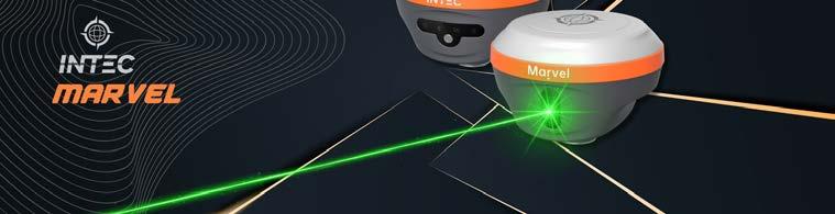
Guangzhou INTEC Surveying Technology Co, Ltd is a professional enterprise that integrates the development, production and sale of high-precision surveying instruments and geospatial solutions.
✓ A professional enterprise that integrates the development, production, sales and service of surveying instruments and provides comprehensive solutions for various surveying applications
✓ We specialize in high-precision measurement technologies, including GNSS systems, total stations and digital surveying equipment for professional surveying applications
INTEC combines research and development with manufacturing excellence to deliver highprecision surveying instruments. Our integrated approach ensures quality control from design to production, providing reliable and accurate solutions for demanding surveying applications.
We are committed to advancing surveying technology through continuous innovation and quality manufacturing. Our mission is to provide surveyors with reliable, precise instruments that enhance productivity and accuracy in geospatial data collection.

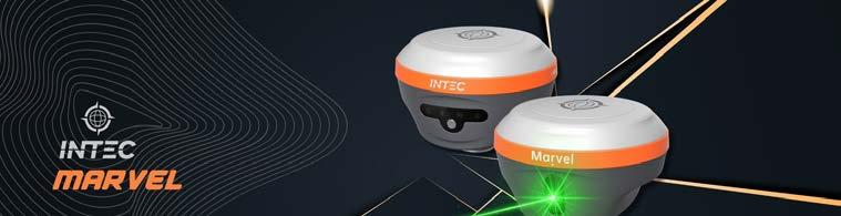
Key highlights
• Integrated R&D, manufacturing and sales operations
• Focus on high-precision surveying instruments
• Comprehensive solutions for various surveying applications
• Strong presence in the Chinese surveying equipment market
Success story
INTEC’s surveying instruments have been successfully deployed in major infrastructure projects across China, including high-speed rail construction and urban development projects. Our precision instruments have contributed to the accurate positioning and measurement requirements of these critical infrastructure developments, supporting China’s rapid modernization efforts.
Company type
Equipment supplier
GNSS receivers, components and correction services
Company details
Room 605,6/F, Building C, No.18 Dong Ming 3rd road, Huangpu district 510700 Guangzhou, Guangdong China
info@intec-surveying.com +86 186 6481 3396
Scan the QR code to access INTEC’s Geomatching profile with complete product specifications.

Lidaretto is an ultra-versatile scanning system for capturing 3D reality. It can be used on multiple platforms on the ground and in the air. Supporting PPK and SLAM scanning methods, Lidaretto presents the ideal scanning solution for many professional applications.
✓ We integrate best-in-class Lidar and GNSS/ IMU technologies into compact, rugged and lightweight devices
✓ We provide survey-grade accurate outputs for professionals requiring high-quality 3D data
✓ The Lidaretto scanning system is an ideal tool for markets including surveying, construction, GIS, forestry, asset management and many more
Our main idea is to bring to the market a solution that increases the productivity of 3D data capture in combination with affordability. We can achieve that thanks to the unique design of our Lidaretto, enabling a single scanning sensor to be used on multiple platforms for countless applications.
Effectiveness and productivity are key to increasing competitiveness. We want to help our customers to become successful in their fields, and we are motivated to keep developing what leads to that success.

Since first starting to develop the Lidaretto system in 2015, we have become an established developer and manufacturer with clients worldwide. We are proud to provide a respected scanning solution made in the EU.
Success story
The Lidaretto scanning system has allowed our clients to expand their service portfolio and do jobs they could not do before with traditional instruments. Our customers have adopted new technologies and workflows quickly within Lidaretto, and for many of them it has become their primarily 3D data capturing tool. By using it to scan roads, streets, buildings (from the outside or inside), terrains and objects of various shapes and sizes, they can now complete their tasks faster and more safely.
Company type Equipment supplier Laser scanners
Company details Cernysevskeho 26 85101 Bratislava Slovakia info@Lidaretto.com +421 903 443 981
Scan the QR code to access Lidaretto’s Geo-matching profile with complete product specifications.


Local Eyes is a HERE Platinum Partner and one-stop shop for global geodata and high-accuracy maps. We support GIS professionals with expert integration, licensing and infrastructure management, helping to turn world-class location data into real-world applications.
✓ Global geodata & maps: access worldwide basemaps, addresses, POIs, boundaries and traffic data with high accuracy
✓ Mapping & APIs: enterprise-grade geocoding, routing, map tiles, SDKs and APIs ready to integrate into GIS platforms
✓ Integration & enablement: from data onboarding to infrastructure management, we streamline deployment and licensing
✓ Analytics & insights: enrich decisions with truck attributes, movement data and QAverified updates
We combine deep HERE expertise with 12+ years of GIS experience. Clients choose us for global coverage, trusted datasets, flexible licensing and co-building of solutions – from prototype to enterprise scale.
We make global geospatial data useful and reliable. By curating trusted maps, datasets and clear documentation, we empower GIS professionals to analyse, model and predict change – guided by accuracy, privacy and a commitment to sustainable impact.

Key highlights
• Active in 95+ countries across four continents
• HERE Platinum Partner
• Best EMEA Reseller award
• 12+ years of GIS expertise
• Serving the public sector, retail, mobility and logistics with global maps and datasets
Success story
With 12+ years of GIS experience, Local Eyes helps enterprises standardize maps and datasets worldwide. Our clients operate in 95 countries, relying on HERE basemaps, addresses, POIs, truck attributes and QA checks with automated updates. The result: consistent analytics, faster rollouts and fewer errors in mission-critical applications. More than 100 organizations trust us as their geospatial backbone.
Company type
Software supplier
General geo-ICT software
Company details
Vijzelgracht 53, c 1017 HP Amsterdam
The Netherlands info@local-eyes.nl
+31 20 707 8677
Scan the QR code to visit Local Eyes’ profile on GIM International and learn more.

NV5 provides end-to-end geospatial solutions, combining advanced remote sensing technologies with analytics and consulting. From data acquisition to AI-powered image processing, we deliver actionable insights to manage resources, mitigate risk and make smarter decisions.
✓ Transform data into decisions: we help organizations unlock the full potential of geospatial data to gain insights
✓ Powerful technology & software: our ENVI Ecosystem and AI-driven tools help turn complex imagery into clear, actionable information
✓ End-to-end solutions: from data collection to analysis and delivery, we provide services to meet client needs
✓ Trusted across industries: serving utilities, infrastructure, energy, environment and governmental agencies worldwide
NV5 is a one-stop shop for all geospatial solutions. From aerial, land and sea data acquisition to groundbreaking enterprise GIS solutions and software development, NV5 provides leading-edge capabilities to cover all your geospatial science needs.
We believe better data leads to better decisions. Our mission is to help organizations see the world more clearly. What inspires us is the opportunity to transform complex geospatial data into insights that solve real-world problems, improve resilience and create a more sustainable and informed future.
Key highlights
NV5 is the world’s leading provider of comprehensive geospatial software and services. With over 1,300 dedicated geospatial professionals, our work spans the globe with projects completed on all seven continents and in over 182 countries.
Success story
NV5 Geospatial’s Double Platinum Partner status with Trimble and Esri reflects the scale and quality of our work. A recent utility project combined high-resolution Lidar with the ENVI Ecosystem and Esri Utility Network, enabling proactive vegetation management to reduce wildfire risk. The result: safer communities, improved grid reliability and a clear example of how NV5 turns data into decisions that matter.
Company type Service provider

Geospatial imaging solutions
Company details
200 South Park Road, Suite 350 33021 Hollywood Florida USA
geospatialinfo@nv5.com
Scan the QR code to visit NV5’s profile on GIM International and learn more.

At OXTS, we combine cutting-edge GNSS and IMU technology with over two decades of sensor fusion and calibration expertise to deliver precision positioning in any environment. With global support teams, our engineers work with you to solve the challenges you face in your industry.
✓ Precision positioning: OXTS devices combine GNSS and IMU data to output precision positioning information for any application, in any environment
✓ Sensor fusion specialists: sophisticated sensor fusion algorithms help our customers augment GNSS/INS data with third-party sensor data, unlocking consistent, reliable precision positioning with and without GNSS
For more than 20 years, OXTS has combined deep expertise in sensor fusion with our customers’ drive to innovate, helping to push the limits of navigation technology. Whether you’re building an autonomous platform or creating a mapping payload, we’re here to support you at every step of your journey.
Simply put, our teams are driven to develop positioning solutions that improve the world we live in. From enhancing automotive vehicle safety to helping protect the environment and everything in between, our teams want to make the world a better place.


Since our inception, OXTS has grown significantly in both reach and capability. Headquartered in the UK, with offices across the world plus a network of local distributors, we offer expertise and support, when and where you need it.
Success story
From helping to protect the Great Barrier Reef in Australia, to improving road safety in Serbia and monitoring infrastructure degradation in Romania, OXTS’s customers use our GNSS/ INS devices to protect the environment, ensure safety and drive innovation across the world. And now, with our latest innovation, WayFinder, we can do all of this without GNSS. Our success comes from our customers’ drive to innovate –and with our solutions, we’re helping them shape a smarter, safer, more sustainable future.
Company type
Equipment supplier
Attitude, heading and motion
Company details
Park Farm Business Centre Middleton Stoney Bicester Oxfordshire OX25 4AL UK info@oxts.com +441869814253
Scan the QR code to access OXTS’s Geomatching profile with complete product specifications.


Photo Mess Systeme AG is the developer of ELCOVISION 10 photogrammetry software, which was the world’s first photogrammetry software for PCs introduced in 1986.
✓ Software development: we develop a suite of surveying programs, mainly our ELCOVISION 10 photogrammetry software and ELTheo, our total station software services
✓ We offer calibration services for metric cameras, Leica Viva and Nova instruments and other cameras for photogrammetric applications
✓ Consulting: we offer consulting for customers conducting in-house special surveying projects
ELCOVISION 10 delivers ultra-robust, fast image orientation with sub-millimetre accuracy and virtually noise-free, detail-rich point clouds. ELTheo enables seamless, high-speed floor plan creation in AutoCAD and BricsCAD, covering several thousand square metres per day.
We are committed to developing surveying software that combines ease of use with advanced functionality, making it accessible to all while giving experts the tools to solve even the most complex surveying tasks.
Key highlights
Visit https://en.elcovision.com/elcovision-10-pmsag-history.html for more information about us, all our milestones and achievements.
Success story
When a major surveying firm was tasked with documenting a huge historic building for renovation, they turned to ELCOVISION 10 and ELTheo. Using ELCOVISION 10 and drones, the firm generated a high-quality point cloud that captured even the finest details of the facades. ELTheo then enabled the team to quickly measure and create precise floor plans directly in BricsCAD. Giving feedback, the client says: “The combination of ELCOVISION 10 and ELTheo has transformed our workflow. We can deliver precise results faster than ever before – without compromising on detail.”

Company type
Software supplier
Photogrammetry & remote sensing software
Company details
Bahnhofstrasse 8 9430 St. Margrethen St. Gallen Switzerland info@elcovision.com +41717447091
Scan the QR code to access Photo Mess
Systeme AG’s Geomatching profile with complete product specifications.

As the leading provider of daily data and insights about Earth, Planet helps organizations harness change for action with a multidimensional view of our changing planet.
✓ Satellite imagery: a high-resolution, continuous and complete view of the world from above, every day
✓ Data tools: to detect and classify objects, identify geographic features and monitor change
✓ Planet Insights platform: a centralized, cloudhosted platform for daily Earth data and analytics
Planet offers a unique combination of daily satellite monitoring, an extensive imagery archive, data and analytics to help identify and track changes including illegal activity, natural disasters and environmental health risks.
We are driven by a mission to image all of Earth’s landmass every day and make global change visible, accessible and actionable. Over the past decade with our customers, Planet has revolutionized the Earth observation industry, democratizing access to satellite data beyond the traditional agriculture and defence sectors.
Key highlights
Planet serves 900 customers in 65+ countries, offering daily geospatial data for approximately 150 million square kilometres of land and 20 million square kilometres of critical ocean territory, in addition to an archive of 3,000+ images of landmass.
Success story
Businesses, governments, researchers and journalists leverage Planet’s data and platform to scale their operations, increase efficiency, mitigate risk and develop novel solutions. Recently, we have expanded into new areas with dedicated satellite capacity, including a landmark €240 million multi-year agreement with the German government to bolster European peace and security. Additionally, we are focused on next-gen AI solutions providing enhanced situational awareness and maritime domain awareness for key customers such as the US Navy.

Company type
Software supplier
Geospatial imaging solutions
Company details
645 Harrison Street, 4th Floor 94107 San Francisco
USA
gis-inquiry@planet.com
Scan the QR code to visit Planet’s profile on GIM International and learn more.

Pointerra3D is a cloud-deployed digital twin platform that transforms the way organizations manage and analyse their geospatial data, enabling efficient visualization, measurement and collaboration for asset constructors, owners and operators.
✓ Centralize 3D and 2D geospatial data in a cloud-native common data environment as a reliable source of truth
✓ Advanced analytics and measurement tools for point cloud analysis and infrastructure management
✓ Collaborative workflows for teams working with large-scale geospatial datasets
✓ Automated insights and reporting using advanced analytics modules tailored for complex industries
Pointerra3D’s cloud-native architecture enables organizations to work with massive geospatial datasets without the hardware limitations of traditional desktop software. Our platform scales automatically and provides real-time collaboration capabilities for distributed teams.
We are driven by the vision of making complex geospatial data simple to access, analyse and act on. Our mission is to empower asset owners and operators to make faster, smarter decisions by turning complex data into actionable insights through the provision of living, functional digital twins.

Key highlights
• Cloud-native digital twin platform
• Effortlessly scale to handle massive datasets
• Real-time collaboration for distributed teams
• Common data environment that provides a single source of truth across the enterprise
Success story
A major utility faced growing challenges in vegetation management across its transmission network. By adopting Pointerra3D’s cloud platform, teams collaborated in real time, identified hazards earlier and cut field visits by 60%. This significantly improved response times in critical situations.
Company type
Software supplier
General geo-ICT software
Company details
27 Railway Road, Level 2 6008 Subiaco, Western Australia Australia info@pointerra.com +61 8 6323 6100
Scan the QR code to access Pointerra3D’s Geo-matching profile with complete product specifications.

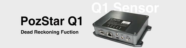
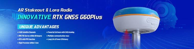
PozStar is the Korean developer and manufacturer of the PozStar P5. This high-precision RTK GNSS receiver is equipped with extraordinary technical specifications. The company is leading innovation in GNSS receivers and plans to expand into global markets.
✓ We develop and produce the PozStar, a 1,408-channel GNSS receiver
✓ Connectivity features include Bluetooth, Wi-Fi, UHF radio and five-pin port
✓ All aspects of the PozStar’s software and hardware have been made in Korea: from initial development to design, moulding and production
We develop all software and hardware ourselves and we are directly involved in production. We immediately integrate the feedback from users and provide clients with good aftersales service.
We are committed to handling all processes for the PozStar – from initial development to design, moulding and production – in Korea. PozStar has its own GNSS main board while having a highprecision board design.
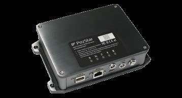
Key highlights
The internal 6,700mAh battery allows for up to 12-18 hours of operation and can be recharged via a USB Type-C connector. The IMU system supports tilted measurement, enabling the users to obtain fast and precise surveys.
Success story
Thanks to developing our own software and hardware and being directly involved in production, we are able to immediately incorporate user feedback and offer good aftersales service. This leads to greater customer satisfaction.
Company type
Equipment supplier
GNSS receivers, components and correction services
Company details
#5-1, Seongnam-daero 772beon-gil Bundang-gu Seongnam-si 13569 Gyeonggi-do Korea
info@pozstar.com +821085598460
Scan the QR code to visit PozStar’s profile on GIM International and learn more.


Pointorama – Mapping made easy. With Pointorama, you can quickly capture interior spaces and generate fast, accurate 2D/3D floor plans. Our web app converts point clouds into ready-to-use vector plans without manual cleanup. No hassle, just results – delivered in minutes instead of hours.
✓ Pointorama turns raw point cloud data into precise 2D and 3D floor plans – automatically, quickly and without manual cleanup
✓ Our smart wall and floor detection ensures centimetre-level accuracy
✓ Seamless exports to CAD, BIM and design tools make the results instantly usable
✓ From property documentation to architectural workflows, we make mapping effortless and reliable
We combine precision with ease of use. Unlike other solutions needing training, Pointorama works out of the box with an intuitive interface. Automated wall and floor detection delivers centimetre accuracy, ready for CAD, BIM and more – delivering faster results, fewer errors and instantly usable plans.
We believe that time and accuracy are key to success in real estate, architecture and construction. Our mission is to make advanced mapping tools accessible to all professionals, without a steep learning curve. By eliminating manual steps and reducing production times, we help our users work smarter, not harder.


Key highlights
• From scan to floor plan in minutes
• Centimetre-level accuracy for walls and floors
• Seamless export to CAD, BIM and floor plan tools
• No training needed – ready to use on day one
• Designed for speed, accuracy and workflow integration
Success story
A busy real estate agency tested Pointorama to escape their time-draining manual workflow. Before, measuring a property meant tape measures, rough sketches and over three hours of work for a single floor plan. After switching, an eight-minute handheld 3D scan and automatic processing delivered a full NEN 2580-compliant plan in under 15 minutes. What once took all morning now fits into a coffee break. The agency doubled its daily output, cut errors to a minimum, and finished the day without the usual stress.
Company type
Software supplier
Geospatial imaging solutions
Company details
Rubensstraat 104/3 2300 Turnhout
Belgium
info@pythagoras.net
+32 14 613 270
Scan the QR code to access Pythagoras
Geo-matching profile with complete product specifications.

RIEGL’s Lidar sensors and systems provide high-precision spatial data that drives innovation across a wide range of geospatial industries. Whether deployed in the air, on the ground or over water, RIEGL is at the forefront of digital transformation – enabling smarter workflows and deeper insights.
✓ Ultimate Lidar technology: development and production of airborne, mobile, terrestrial and UAV-based laser scanners and systems
✓ Software solutions: for an efficient and userfriendly workflow in the field and in the office
✓ Application support: highly efficient solutions for topography, mining, corridor mapping, monitoring, forestry and more
✓ Research & Development: in the field of Lidar technology in close cooperation with universities, research institutions and industry partners
Ongoing innovation and the willingness to work with our customers to solve even tricky tasks are what set us apart. And our high-quality standards do not only apply for RIEGL products; our customers also receive the best possible support in day-to-day operations.
Our goal is to provide highly innovative, state-ofthe-art equipment that enables our customers worldwide to perfectly master the measurement tasks required of them in the constantly evolving geodata industry.
Key highlights
RIEGL’s core smart-waveform technologies provide state-of-the-art, highly accurate and highly informative point cloud data. The seamless integration and calibration of systems is a matter of course.
Success story
RIEGL’s Ultimate LiDAR 3D scanners offer a wide array of performance characteristics and serve as a platform for continuing innovation in 3D for the Lidar industry. Today the RIEGL Group, with its main headquarters in Austria and its North American headquarters in the USA, has a global presence with numerous RIEGL subsidiaries plus a network of representatives to optimally serve the market.

Company type Equipment supplier Laser scanners
Company details
Riedenburgstraße 48 3580 Horn Lower Austria Austria office@riegl.co.at +4329824211
Scan the QR code to access RIEGL’s Geomatching profile with complete product specifications.


SBG Systems provides advanced INS/GNSS solutions for land and air surveying, delivering precise positioning, orientation and motion data. With robust reliability, easy integration and real-time accuracy, they enhance efficiency, safety and survey data quality.
✓ INS/GNSS solutions: high-precision inertial navigation systems ensuring accurate positioning, orientation and trajectory
✓ Motion compensation: reliable data correction for smooth, precise mapping and surveying results
✓ Software tools: post-processing and integration software to streamline survey workflows
✓ Expert services: onboarding, technical support and training to guarantee consistent performance and customer success
SBG Systems stands out with compact, highprecision navigation solutions combining INS and GNSS, delivering unmatched reliability, easy integration and real-time accuracy. Dedicated support, innovative software and robust performance ensure superior value for survey operations.
We are driven by innovation, precision and reliability, delivering cutting-edge navigation solutions that empower marine, land and air industries. Customer focus, continuous improvement and engineering excellence fuel our commitment to performance and trust.

Key highlights
Since 2007:
• Launched innovative IMUs, INS products and software solutions
• Expanded globally into multiple industries
• Introduced advanced calibration processes
• Established a reputation for precision, reliability and customer trust
Success story
GRYFN integrated SBG Systems’ compact
Quanta Micro INS into its GOBI UAV remote sensing platform. With Qinertia software, GRYFN achieved centimetre-level trajectory accuracy, streamlined workflows and a 10% cost reduction over five years, earning top marks across product, software, support and value.
Company type
Equipment supplier
Attitude, heading and motion
Company details
1 avenue Eiffel Campus Eiffel 78420 Carrières-sur-Seine France
sales@sbg-systems.com +33180884500
Scan the QR code to visit SBG Systems profile on GIM International and learn more.

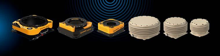
SOMAG AG Jena is an industry-leading developer of high-precision gyro stabilization mounts for data acquisition in the air, on land and at sea. The product portfolio provides automatic real-time compensation for roll, pitch and yaw, ensuring utmost data quality.
✓ Airborne mounts: our three-axis gimbal systems compensate arbitrary vehicle movements in pitch, roll and yaw angles for high-resolution image quality and more flying time at lower costs
✓ Land/marine mounts: our two-axis gimbal systems actively counterbalance vessel movements in pitch and roll, and ensure a drastic motion reduction of the sensor system for high-quality images and data resolution, even in harsh sea states or while driving on road, rail or uneven bumpy offroad terrain
Since we are an independent supplier on the market, our products are unique. They are not limited to a specific set of hardware because we want our clients to be as flexible as possible when choosing a camera or scanner for their projects.
With our stabilization devices and technologies, we help our customers to achieve high-quality data in a sustainable and economical way. The uniqueness of customer projects and the multitude of different applications drives the whole SOMAG team to offer customized solutions and to improve performance with each newly developed device.

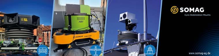
Key highlights
• 2023: awarded as ‘Hidden Champion –Thuringian world market & technology leader’, and awarded with the ‘Großer Preis des Mittelstandes’
• 2024: launch of GSM 5000, the new standard for aerial gyro stabilization mounts
Success story
In May 2025, we supported a challenging thermal imaging mission over Phoenix, Arizona. The mission relied on our latest gyro stabilization platform, the GSM 5000, stabilizing IGI’s EcoMapper-1280 C thermal sensor. Despite difficult flight conditions, the mount delivered precise and stable results, showcasing its unique capabilities in real-world, high-stress environments. “Without a mount, it wouldn’t have been possible to collect meaningful data,” says Kamil Wójcik, business development manager/ technical sales at IGI.
Company type
Equipment supplier
Attitude, heading and motion
Company details
Am Zementwerk 2 07745 Jena, Thuringia Germany
info@somag-ag.de +49 3641 633 680
Scan the QR code to access SOMAG’s Geo-matching profile with complete product specifications.


STEC is dedicated to creating geospatial positioning equipment and solutions which are built on a foundation of advanced technology, meticulously crafted to deliver unparalleled precision, seamless experience and exceptional value. We believe in the philosophy of ‘technology and humanity’.
✓ GNSS positioning systems: merging technologies of IMU tilt measurement, AR stakeout, laser measurement, visual measurement, etc.
✓ Total stations: from conventional total stations, to robotic total stations for highaccuracy monitoring and one-man surveys
✓ Auto steering: 2.5cm accuracy achieved by STEC AgriPilot, consisting of a highperformance GNSS receiver, electrical wheel of rated torque and rugged tablet with powerful software
We excel at seamlessly integrating cutting-edge technologies from diverse fields, combining them with our proprietary algorithms and software to deliver a more efficient, precise and humancentred user experience.
We believe technology should never be a cold, impersonal tool. That’s why we are committed to delivering more human-centred geospatial measurement solutions for users everywhere.


Key highlights
By employing EDM technology from a total station and supreme IMU, the SDi Pro GNSS receiver simply makes the inaccessible accessible. With an accuracy of 3cm within 20m, the points that are difficult to reach can be measured easily and safely using LaserFix.
Company type
Equipment supplier
Land surveying equipment
Company details
C-201, No.11 Guangpu Middle Road, Huangpu District Guangzhou (City) Guangdong (Province) China infor@stecprecision.com
Scan the QR code to visit STEC’s profile on GIM International and learn more.

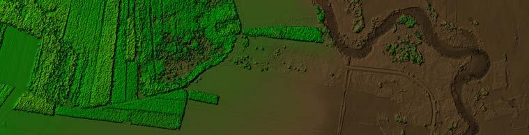
At Trimble Applanix, our systems, software and solutions are designed for pinpoint accuracy, efficiency and ease of use, supporting applications for mobile mapping, surveying and autonomous vehicles.
✓ Mobile position and orientation solutions for sensors and vehicles to enable mobile mapping, aerial surveys and hydrographic surveys
✓ Industry-leading GNSS-aided inertial technology for maximum accuracy
✓ Direct georeferencing solutions for imaging devices
✓ Sensor fusion and complex systems integrations
Trust your position – if it drives, flies or floats, our tailored positioning solutions get you moving in the right direction. We are a global technology company and industry leader with over 30 years of experience dedicated to delivering solutions for a better, safer and more sustainable future.
Like our solutions, we work for you in all environments, applying our deep domain/ technology expertise and passion to customize practical solutions that meet your complex needs on the ground, in the air or on open water.
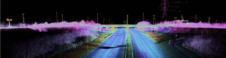
Key highlights
We are a global technology company and industry leader with over 30 years of experience dedicated to delivering solutions for a better, safer and more sustainable future.
Success story
“We love working with Trimble Applanix because they bring us reliable hardware and more importantly a reliable extended team. Trimble Applanix is a pleasure to deal with,” says Al Thead, VP Operations, SmartDrone Corporation.

Company type
Equipment supplier
Attitude, heading and motion
Company details
85 Leek Crescent
Richmond Hill ON L4B 3B3
Canada
info@applanix.com
+1 289 695 6000
Scan the QR code to access Trimble Applanix’s Geo-matching profile with complete product specifications.


Trimble OEM GNSS offers precise positioning solutions with high-accuracy GNSS modules and boards, ensuring reliable location data even in challenging environments. Designed for easy integration, they serve a range of applications including industrial automation, marine, robotics, rail and more.
✓ Precise, consistent performance: a full range of GNSS receiver modules, enclosures, smart antennas and correction services that help you do a job better, faster, cheaper, greener or safer
✓ Centimetre-level accuracy: positioning technology that raises the bar on accuracy, availability and integrity
✓ Easy to integrate: OEMs and system integrators can differentiate their solutions and gain a competitive edge in the marketplace
✓ Peace of mind: extensive domain expertise, global coverage and support
Trimble positioning technology stands at the forefront of accuracy, availability and integrity. We’ll empower you with customized solutions that work whenever you need them, now and into the future. And we make them easy for anyone to use, with global coverage and support no matter where you go.
Solving today’s industry challenges requires more than just accuracy. Trimble GNSS technology provides the position integrity and localization vital for operational safety and precision. With growing demand for reliable positioning, Trimble offers leading high-precision solutions that ensure applications operate successfully in all conditions.

Key highlights
• The Trimble ProPoint engine and Maxwell technology ensure robust performance during signal obstructions or multipath
• Trimble IonoGuard offers ionospheric mitigation
• Our xFill technology supports seamless operation during signal outages
Success story
“Trimble technology delivers the highest accuracy rate in a shielded environment, demonstrates environmental resistance and provides easy access to the GNSS receiver through a web server and configuration settings,” says Mr Rikio Yoshida, president of YBM.
“I would choose Trimble again every time. The product is excellent and the quality of service is superior,” comments Peter Klemp, managing director of SPE GmbH & Co KG.

Company type
Equipment supplier
GNSS receivers, components and correction services
Company details 10368 Westmoor Drive 80021 Westminster Colorado USA sales.oemgnss@trimble.com +17208876100
Scan the QR code to access Trimble’s Geo-matching profile with complete product specifications.


Unicore Communications, Inc is a high-tech company dedicated to highperformance satellite navigation and positioning, multisensor fusion algorithm development, and highly integrated GNSS IC design.
✓ In-house designed proprietary RTK & PPP technology
✓ GNSS chips: ranging all the way from metre and sub-metre level to centimetre and millimetre level
✓ A series of multi-constellation, multifrequency, high-performance GNSS receivers for the industrial and automotive markets
We deliver proven survey-grade technology and safety-certified solutions for driverassistance systems. With end-to-end R&D, QA and support, our trusted team provides the broadest GNSS portfolio and an all-in-one ‘chip + cloud + antenna’ ecosystem, enabling scalable, customized solutions.
At Unicore, we are driven by honesty, integrity, tenacity and innovation. Our mission is to harness satellite positioning and multi-sensor fusion to deliver precise spatiotemporal information. By empowering people with intelligent perception, we aim to enhance everyday life and enable smarter futures.

Key highlights
With 16+ years of mass production and over a dozen high-performance GNSS chipsets enhanced by algorithm expertise, we bring crossindustry experience in the automotive, consumer and industrial sectors, backed by rapid response capability.
Success story
Unicore’s UM960 GNSS module powers the next generation of robotic lawn mowers, delivering stable, real-time centimetre-level accuracy even in challenging garden environments with trees, buildings and signal obstructions. Compact yet powerful, the 12×16mm module provides 20Hz full-constellation, multi-frequency RTK data alongside advanced features like interference detection and environmental awareness. With over one million RTK modules shipped, Unicore has accelerated the transition of robotic mowers from premium products to mainstream adoption. Validated across millions of devices, our technology now drives reliable, intelligent navigation for outdoor robots in industries from gardening to agriculture.
Company type
Equipment supplier
GNSS receivers, components and correction services
Company details
F3, BDStar Navigation Building, No.7, Fengxian East Road, / Haidian 100094 Beijing China info@unicorecomm.com +86 10 6993 9828
Scan the QR code to access Unicore’s Geo-matching profile with complete product specifications.

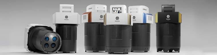
Vexcel is a global leader in aerial imaging, delivering UltraCam cameras and hybrid mapping solutions, UltraMap software and the world’s largest aerial imagery programme. With decades of expertise, we provide innovative tech, continuous upgrades, world-class support and one-stop solutions.
✓ Advanced UltraCam aerial cameras: nadir, oblique and wide-area mapping applications with industry-leading image quality and the highest collection efficiency
✓ All-in-one UltraMap software: complete workflow from UltraCam imagery to DSMs, DTMs, orthophotos and 3D data
✓ Precision hybrid systems: high-resolution nadir and oblique imagery combined with precise Lidar elevation data
✓ World’s largest data programme: highresolution imagery and geospatial data covering 40+ countries
Renowned in the geospatial industry for pioneering expertise, we help customers succeed with innovative, cost-effective photogrammetric technology. The Vexcel ecosystem offers versatile products, integrated workflows and world-class support, scalable to customers’ needs.
We are driven to redefine what’s possible in aerial imaging, empowering professionals with cutting-edge aerial mapping systems and data for smarter, faster decisions. Guided by innovation, quality and collaboration, we inspire our global team to push boundaries and consistently exceed expectations.
Key highlights
With global reach and 30+ years of expertise, Vexcel leads with the largest aerial imagery programme and award-winning innovation. This includes the new Osprey: first on the market with a 247MP Sony CMOS sensor and 27% greater flight line efficiency.
Success story
The Centre for Geographic Information Systems (CGIS) in Qatar used the UltraCam Osprey 4.1 to produce the country’s first advanced vectorized 3D city model of Doha. By capturing high-resolution oblique and nadir imagery, CGIS developed a highly detailed and accurate digital twin of the city. This innovation greatly enhanced urban planning, infrastructure management and smart city initiatives, with the UltraCam’s outstanding image quality and operational efficiency playing a vital role in the project’s success.
Company type
Equipment supplier
Geospatial imaging solutions
Company details
Anzengrubergasse 8, 4 8010 Graz Austria info@vexcel-imaging.com
Scan the QR code to access Vexcel’s Geomatching profile with complete product specifications.

Woolpert is a global leader in architecture, engineering and geospatial (AEG) services, with over a century of experience driving innovation and delivering impact. We fuse deep technical expertise with a forwardthinking mindset to solve complex challenges across the public, private and government sectors.
✓ Surveying: we operate a fleet of high-tech aircraft, vehicles and vessels plus a large inventory of sophisticated GNSS, robotic total station, laser-scanning, electromagnetic and ground-penetrating radar systems
✓ Uncrewed data collection systems: our UASs and robotic survey vessels make detailed spatial data acquisition easier and safer
✓ Lidar: including bathymetry, airborne, mobile and terrestrial scanning for a wide range of mapping and analytical applications
✓ Photogrammetry and remote sensing: our team of operators, technicians and project managers supports our technology and our acquisition and post-processing methods
Woolpert lives where proven methodology and disruptive technology collide. As a leading provider of state-of-the-art geospatial services, we see how the locations of our world relate to each other. For more than five decades, we’ve applied our big-picture view to some of the country’s largest regional and national geospatial projects – and our panorama now includes nations around the globe.
We are committed to a vision to become the premier AEG firm and one of the best companies in the world. Woolpert’s culture is comprised of our values, beliefs, attitudes and mindset. Our culture reflects our core values: supportive, focused, progressive, industry-leading, highperforming and balanced.
Key highlights
• 1,000+ completed international mapping projects
• 1M+ square kilometres of Lidar data collected annually
• 800+ geospatial professionals across the globe
Success story
In October 2024, we supported the mobilization of the NOAA’s Office of Coast Survey, the US Coast Guard and the US Army Corps of Engineers (USACE) to conduct an emergency response survey of a federal navigation channel following Hurricane Milton. Working from Friday evening to Saturday morning, the Woolpert team surveyed and mapped a wide swath of the entrance channel at Port Tampa Bay, Florida. Thanks to the collaboration and quick work to collect, process and deliver bathymetric data, the channel was declared clear and safe to reopen by noon on the Saturday.
Company type Service provider Survey

Company details
4454 Idea Center Blvd Suite 100, Beavercreek, OH 45430
USA
Kim.Hansen@woolpert.com
301.980.7670
Scan the QR code to visit Woolpert’s profile on GIM International and learn more.


YellowScan designs, builds and delivers professional UAV Lidar mapping solutions. With robust hardware, easy workflows and dedicated support, we empower surveyors worldwide to capture accurate data for demanding environments.
✓ Integrated UAV Lidar systems: turnkey hardware and software for accurate, highresolution mapping.
✓ Topographic and topobathymetric Lidar solutions: from land-only mapping to combined land and shallow-water surveys
✓ Global customer support: training, expert guidance and responsive technical assistance
✓ Industry applications: serving surveying, bathymetry, mining, forestry, utilities, environmental monitoring, coastal management and more
YellowScan focuses exclusively on UAV and manned aircraft Lidar systems, developed entirely in-house, including hardware, software and support. This end-to-end approach ensures reliable, easy-to-use solutions. Combined with our customer-centric support, we help professionals in 70+ countries optimize their systems and succeed in the field.
Our mission is to make high-precision Lidar mapping accessible, reliable and field-ready. We are driven by innovation, customer success and a lighter footprint on the planet. We help professionals capture the world with accuracy and confidence.

Key highlights
Trusted by professionals worldwide, YellowScan develops UAV Lidar solutions used across more than 70 countries. In 2024, we launched the Navigator, our first topobathymetric Lidar for seamless land and water surveys.
Success story
In Ystad, Sweden, VisionAir used the YellowScan Navigator to map a coastal zone with both land and underwater features. In a single flight, the team captured accurate data of beaches, shallow seabeds and harbour infrastructure. The seamless workflow, combined with CloudStation processing, allowed fast delivery of precise datasets to local authorities, supporting better coastal management decisions. “The Navigator is a one of a kind when it comes to seamless, highaccuracy Lidar scanning in shallow waters. We can now present data to our clients that was just not possible before,” says Jonathan Rybo.
Company type
Equipment supplier
Laser scanners
Company details
525 Avenue Saint Sauveur du Pin 34980 Saint-Clément-De-Rivière
France
contact@yellowscan.com +33 4 11 93 14 00
Scan the QR code to access YellowScan’s Geo-matching profile with complete product specifications.


As a family-owned company, we are known internationally for our pioneering spirit in the areas of switch cabinets, ferrules, wire processing and laser scanners. For us, the future has a great past, because we have been developing and producing our products at our headquarters for over 60 years.
✓ We construct switch cabinets and control panels in the automotive and processing industries but also in the area of customized applications
✓ The crimp connections created with ferrules and machines from Z+F are UL-certified and every crimp guarantees a perfect connection with a high mechanical load
✓ The Z+F ferrules are available in a wide range of cross-sections and colours
✓ The Z+F PROFILER-series and Z+F IMAGERseries laser scanners have exceptionally high accuracy and speed
Our high-quality ‘Made in Germany’ products are what set us apart. We put a strong focus on maintaining close ties with our partners and customers. Direct communication channels are not only beneficial for our customers in terms of support and consultation, but also for us because feedback helps us to continuously improve.
As a company in the field of electrical engineering, our goal is to promote innovation, develop new products and implement creative solutions. Ambitious goals can only be achieved with a wealth of experience and creative minds. These goals are shared by all of our employees and together they enable the emergence of innovative concepts.


Key highlights
• Founded in 1963, currently more than 300 employees
• Inventor of insulated ferrules
• Long-standing business partners in 40+ countries
• Z+F subsidiary in Pittsburgh (USA)
• Setting new standards in all fields of business for more than 60 years
Success story
Over the years, we have supported many clients in achieving their project objectives. In the course of these projects, multiple new products were developed or ideas for new products were born. Some of our success stories are available as case studies on our website. Besides being in close contact with our customers and partners and supporting them in the best way possible, we also believe it is important to further promote the technology of laser scanning. Our aim is to make the technology accessible, and to assist our partners comprehensively along the way.
Company type
Equipment supplier
Laser scanners
Company details
Simoniusstraße 22 88239 Wangen im Allgäu Germany info@zofre.de +49 (0)7522 9308-0
Scan the QR code to access Zoller + Fröhlich’s Geo-matching profile with complete product specifications.