UNIVERSITY OF CINCINNATI COLLEGE OF DESIGN, ARCHITECTURE, ART & PLANNING
phone:
(248) 376-4160
email: schoenknecht.grace@gmail.com
introduction
I hold a Bachelor’s degree in Urban Planning and a Certificate in Sustainable Landscape Design from the University of Cincinnati. My work is driven by a commitment to building resilient, equitable, and sustainable communities through both regional strategies and site-specific design.
Professionally, I have gained diverse experience across the field: hands-on green roof maintenance, aviation planning consulting with Landrum & Brown, urban planning consulting with OHM Advisors, and nonprofit community development with Beyond Housing. These roles have equipped me with a
well-rounded perspective on how planning impacts people, infrastructure, and the environment.
Since graduating in Spring 2024, I have spent time traveling internationally, learning from new cultures and planning practices. These experiences have broadened my perspective and deepened my appreciation for how local identities and global challenges intersect in shaping urban futures.
This portfolio presents selected works that highlight my skills in urban design, ecological planning, and community engagement, and my vision for creating cities that are adaptable, inclusive, and sustainable.
Eco Ring Cincinnati
senior capstone
UniversityofCincinnati,2024
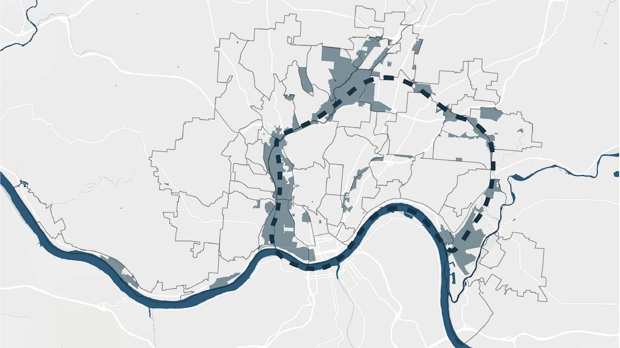
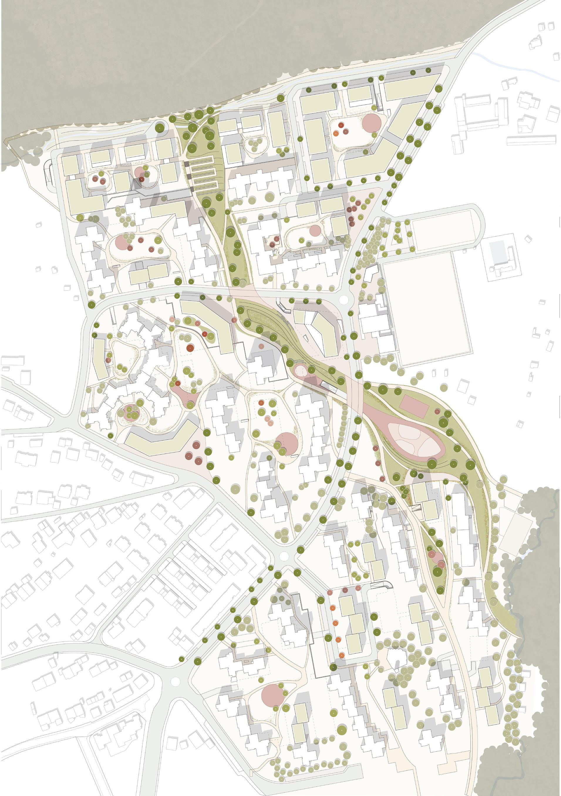
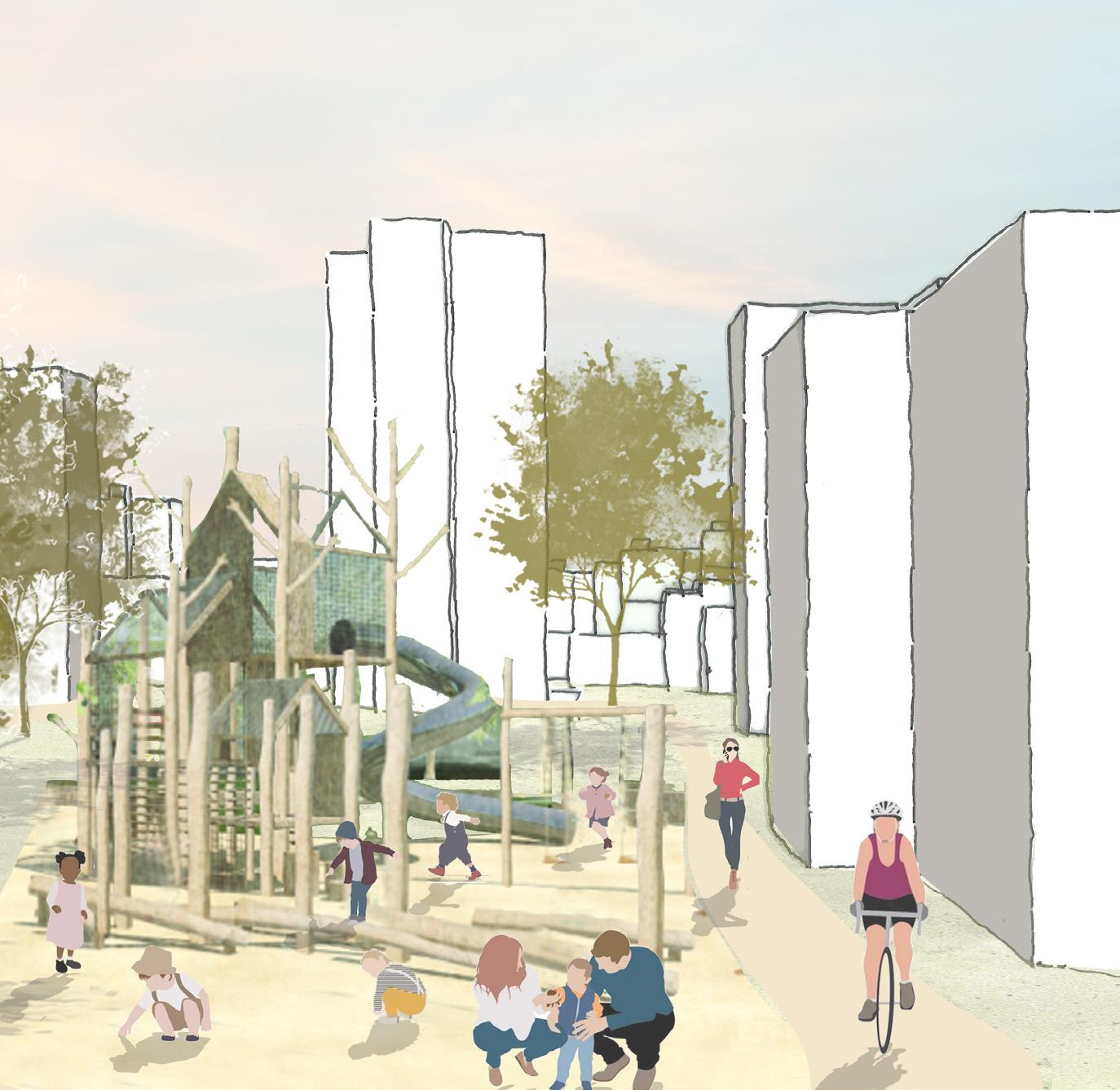
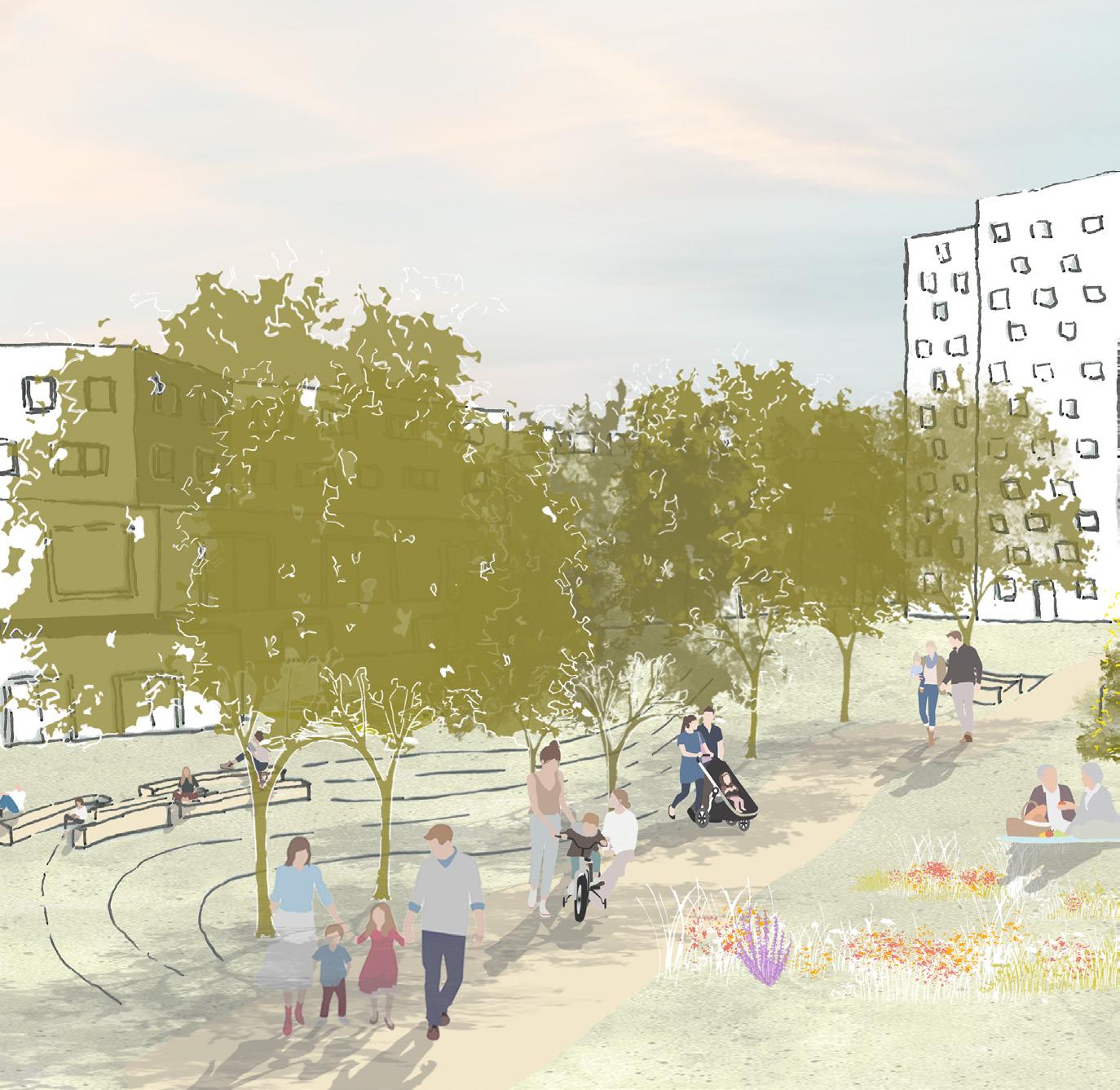
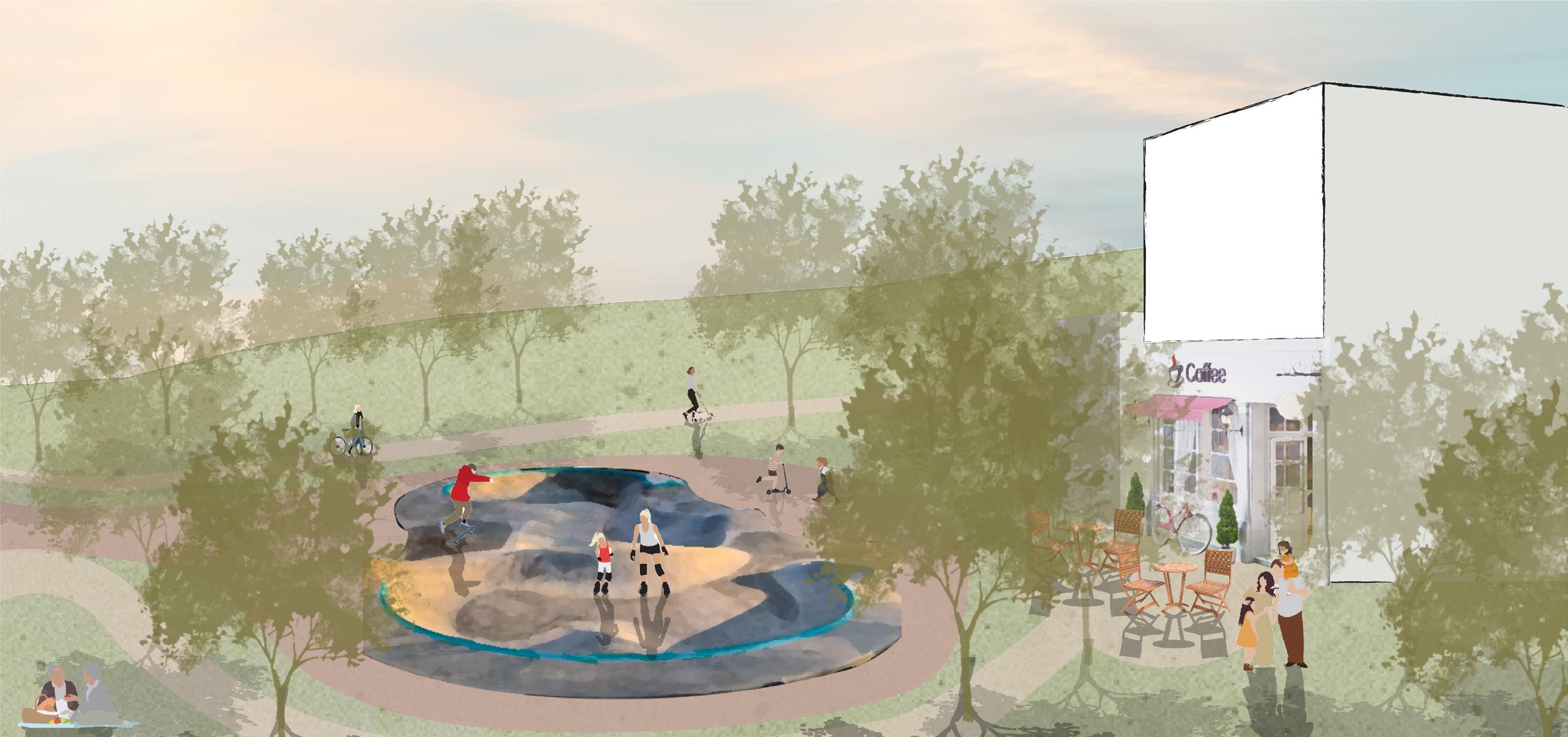
Eco Ring Cincinnati is a transformative proposal to reimagine the city’s historic industrial corridor as a sustainable, equitable, and resilient district. By leveraging the resurgence of U.S. manufacturing and aligning it with green practices, the project envisions converting a carbon-intensive landscape into a protective ecological ring. The framework combines site-scale interventions such as green roofs, stormwater systems, and urban forestry with corridorscale improvements in connectivity and ecological infrastructure. Phased by neighborhood needs and vulnerabilities, Eco Ring Cincinnati demonstrates how industrial land can evolve into a climateconscious, socially inclusive, and economically vibrant urban future.
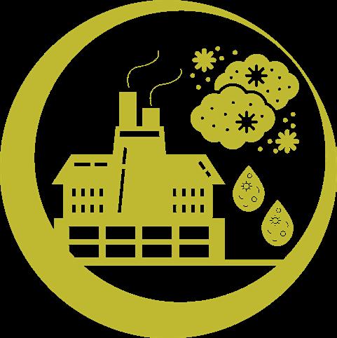
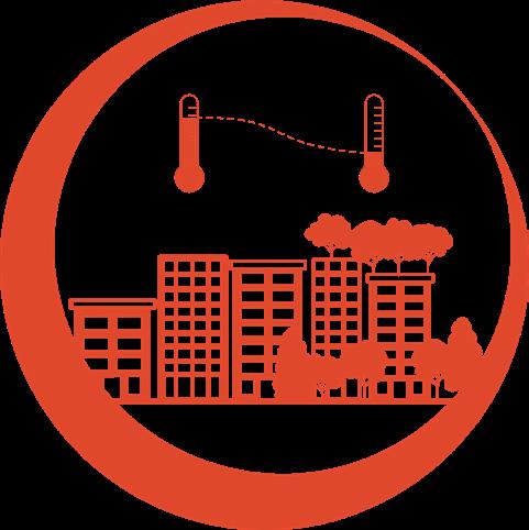
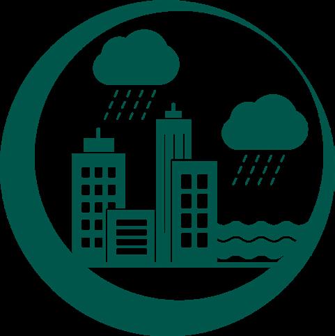
Cincinnati faces pressing climate challenges: rising global temperatures, increasingly severe rainfall and flooding, and declining air quality. The city’s historically industrial zones, with extensive impervious surfaces, are particularly vulnerable to these shifts. If left unaddressed, these conditions will amplify urban heat, strain stormwater systems, and worsen health inequities. Eco Ring Cincinnati directly responds by integrating nature-based strategies—green corridors, bioswales, and tree canopies—to mitigate heat, manage flooding, and improve air quality while preparing the city for the realities of climate change.
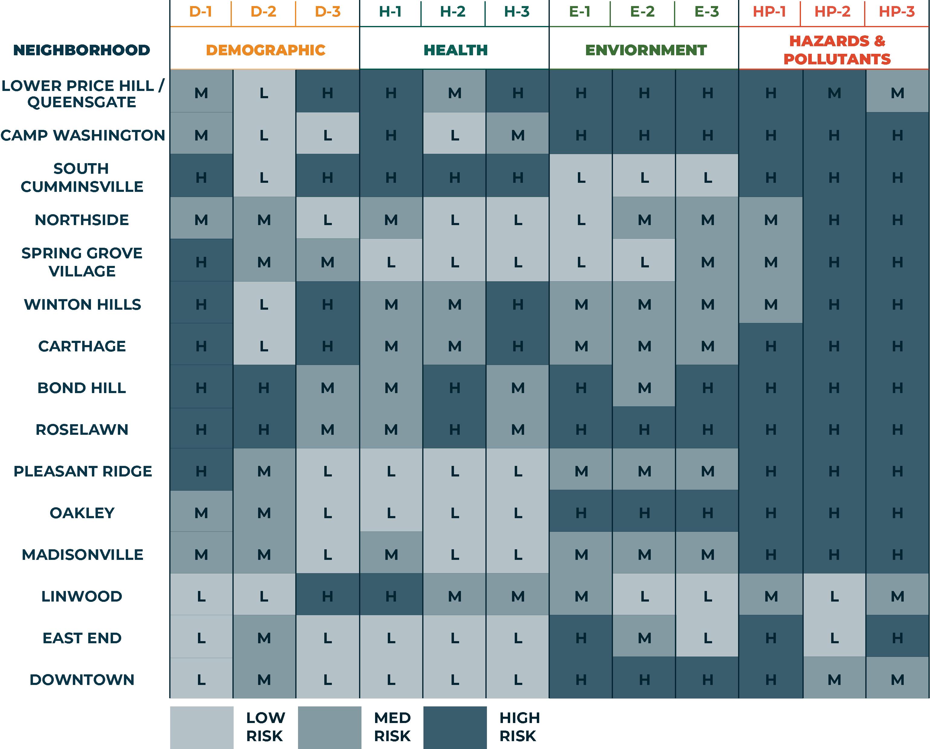
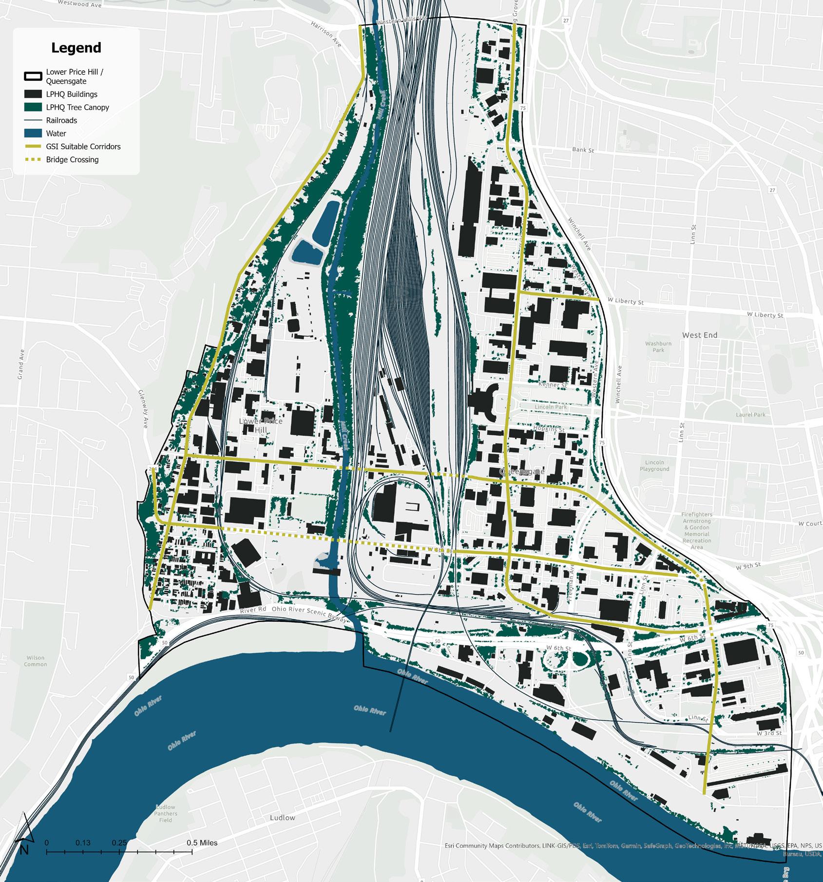
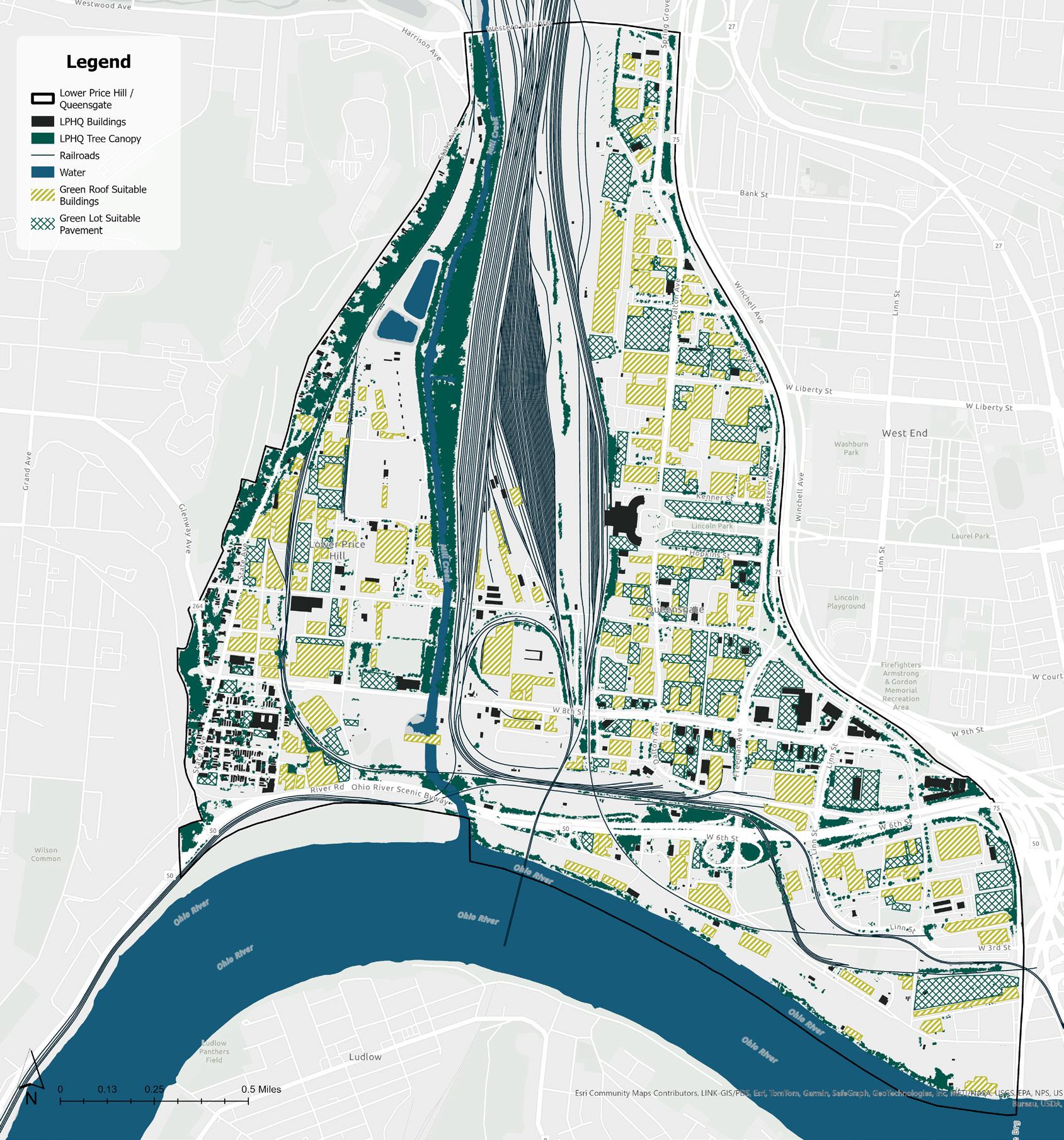
The project uses demographic, health, environmental, and hazard risk indicators to prioritize neighborhoods most in need of intervention. Analysis revealed Lower Price Hill / Queensgate (LPHQ) as the highest priority area due to its large share of impervious surfaces, adjacency to the flood-prone Ohio River, high hazard exposure, and concentration of industrial land. LPHQ also experiences disproportionate impacts from poor air quality and limited green space. For these reasons, it was designated as Phase One, ensuring the Eco Ring’s initial implementation addresses the communities most vulnerable to climate risk and environmental injustice.
Phase Two expands to neighborhoods such as Camp Washington, St. Bernard, Oakley, Madisonville, Bond Hill, Roselawn, and Avondale—areas with significant manufacturing presence but slightly lower immediate risk. Phase Three then addresses Cumminsville, Winton Hills, Sedamsville, and additional central neighborhoods, ensuring that interventions scale outward over time. This phased approach balances urgency with feasibility, starting where vulnerabilities are greatest and systematically extending ecological, social, and infrastructural benefits across the industrial corridor and into the broader region.
Corridor Framework (Left)
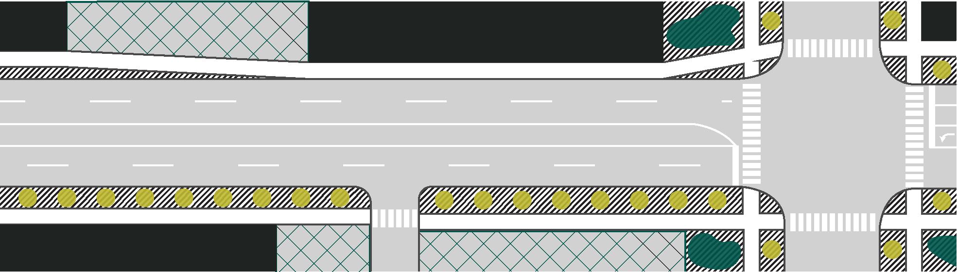
At the regional scale, the Corridor Framework focuses on transforming industrial corridors into ecological spines. These corridors link neighborhoods, parks, and natural systems while improving stormwater management, air quality, and connectivity. Strategies include bioswales, street-level green infrastructure, and stormwater capture zones integrated into transportation and industrial landscapes. The framework positions corridors not just as conduits of commerce, but as multi-functional green networks that mitigate flooding, reduce emissions, and create healthier, more livable environments across the city.
Site Framework (Right)
At the local scale, the Site Framework guides redevelopment with targeted interventions tailored to neighborhood needs. Strategies include green roofs, permeable parking areas, and urban forestry projects that absorb stormwater and filter pollutants. Each site acts as a testing ground for scalable solutions, linking small-scale ecological interventions into the larger Eco Ring system. By combining site-specific resilience measures with corridor-wide infrastructure, the framework ensures climate adaptation is embedded across both neighborhood and regional levels, creating a layered approach to environmental and social resilience.
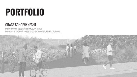
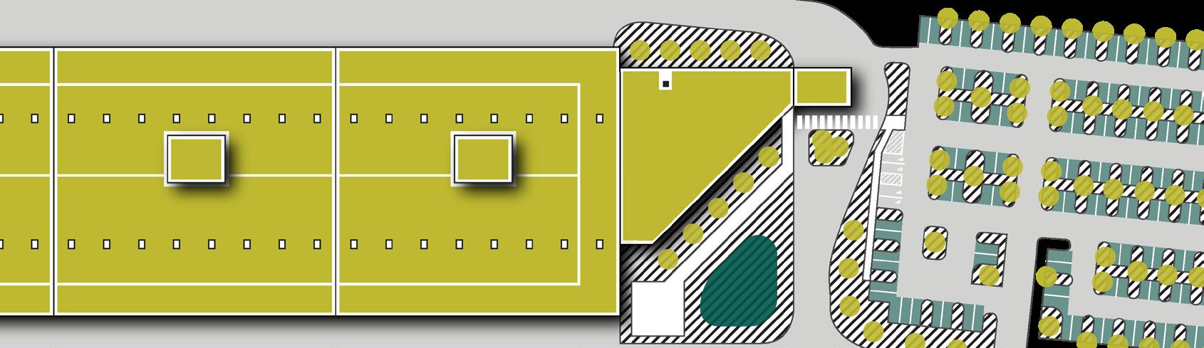
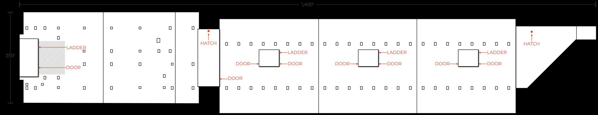
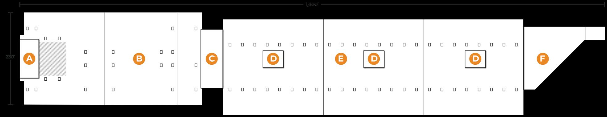
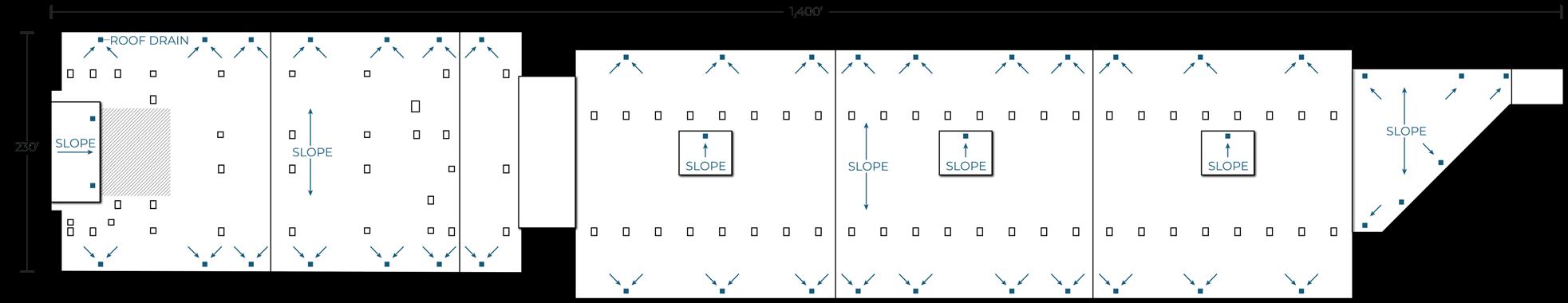
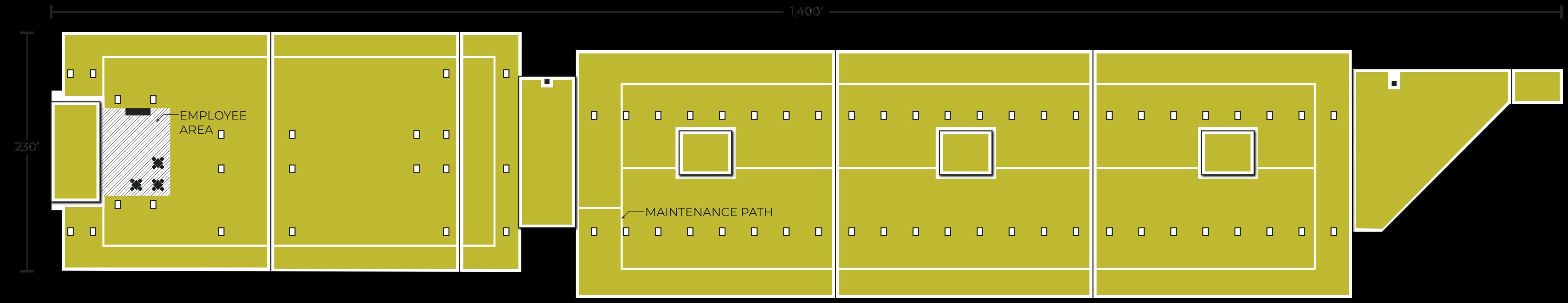
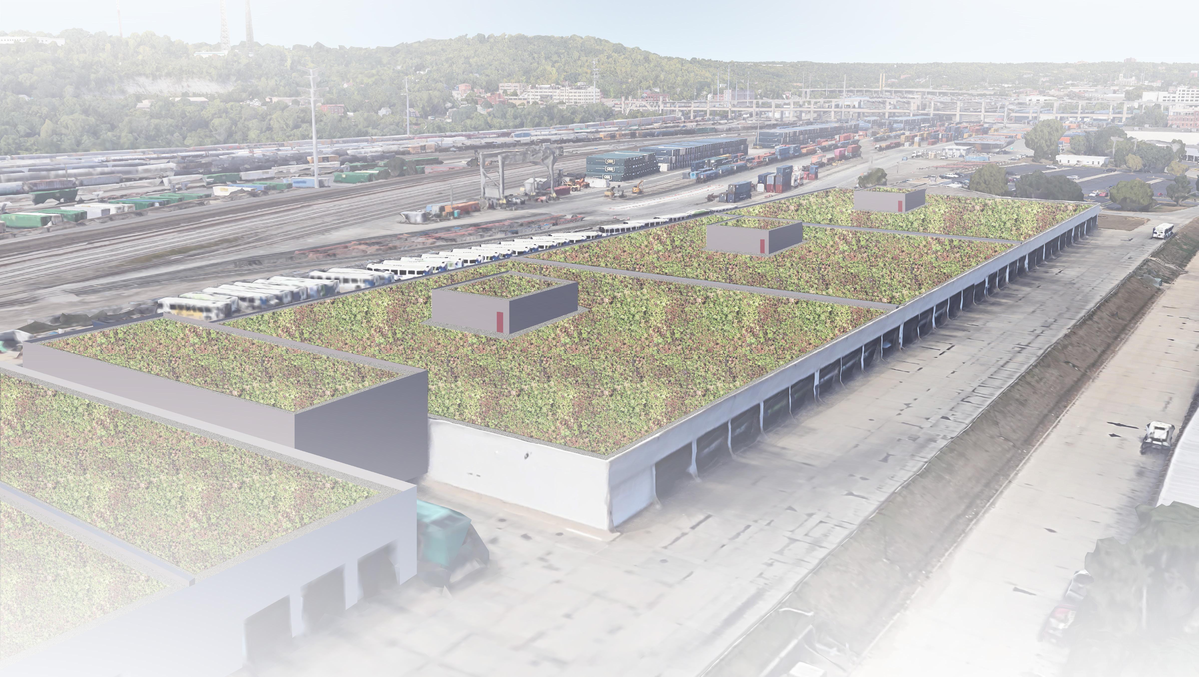
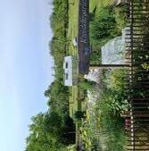
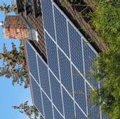
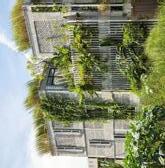
This green roof design is a site-specific intervention within the larger Eco Ring Cincinnati framework. The project proposes an extensive modular green roof system for the SORTA/Metro Queensgate Division building in Lower Price Hill / Queensgate, Cincinnati. The design prioritizes environmental resilience over human use, targeting stormwater management, urban heat island reduction, and air quality improvement in a heavily industrial area adjacent to the Mill Creek and Queensgate Rail Yard.
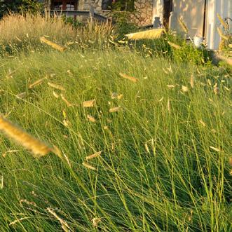
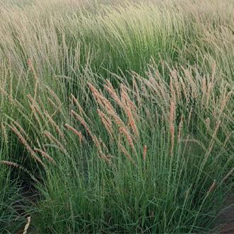
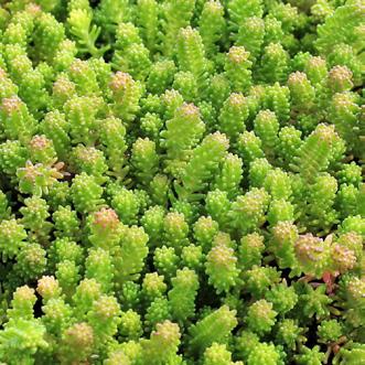
blue grama
sideoats grama,
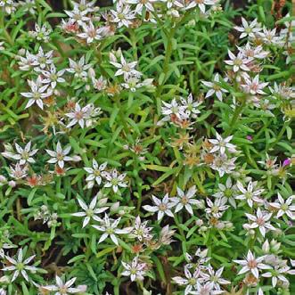
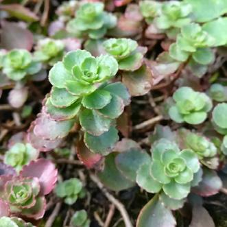
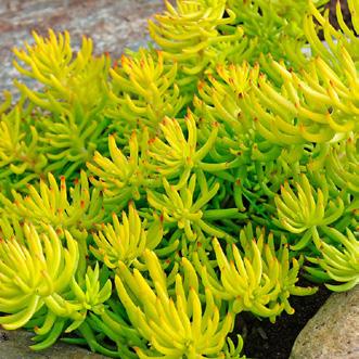
sedum album
sedum spurium
sedum kamtschaticum
sedum rupestre
sedum reflexum
sedum sexangulare
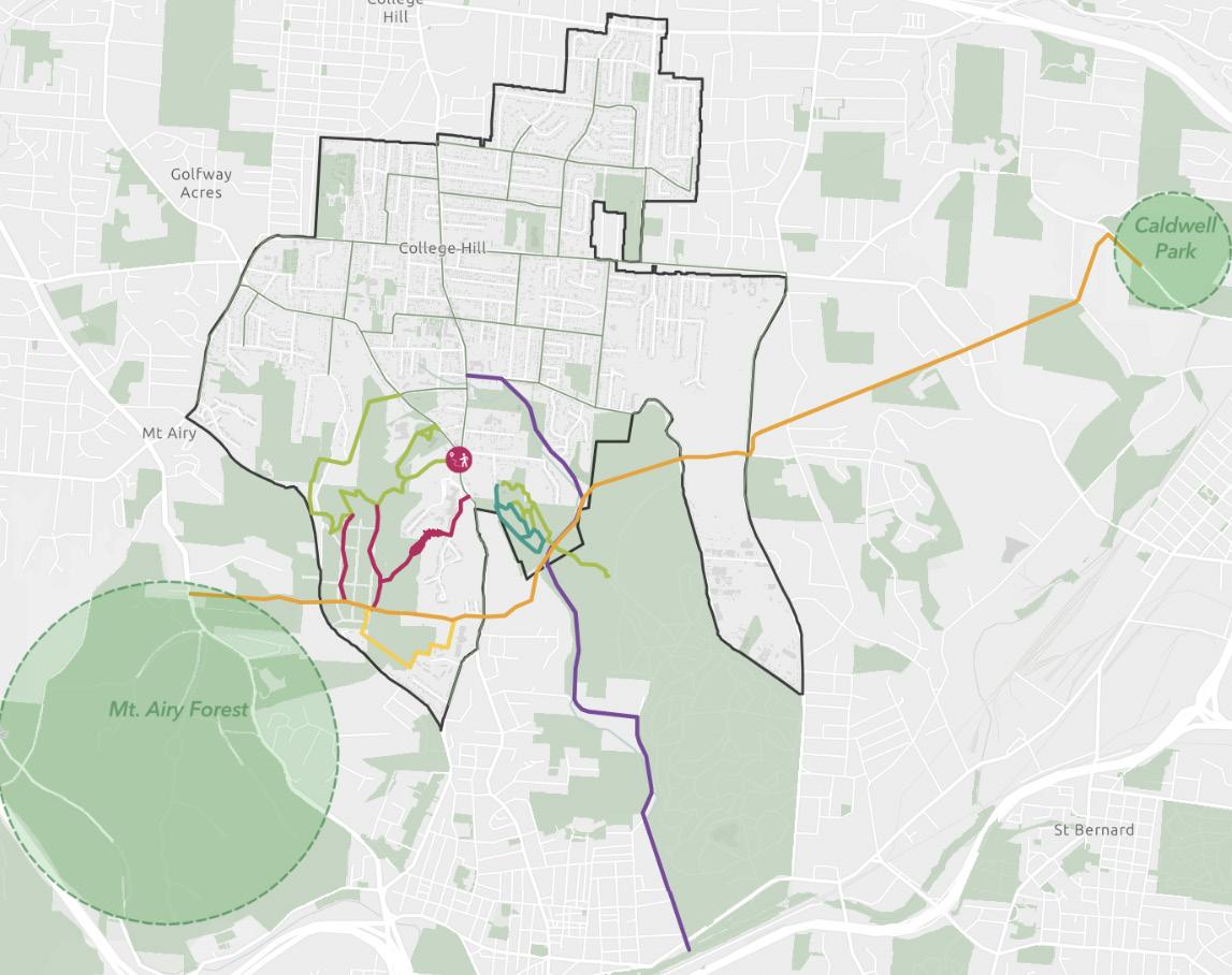
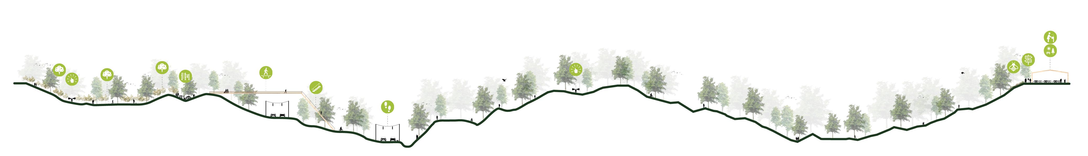
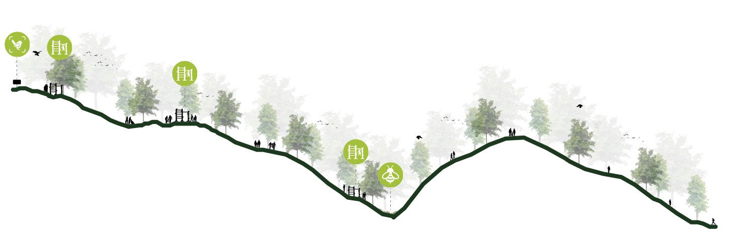
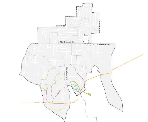
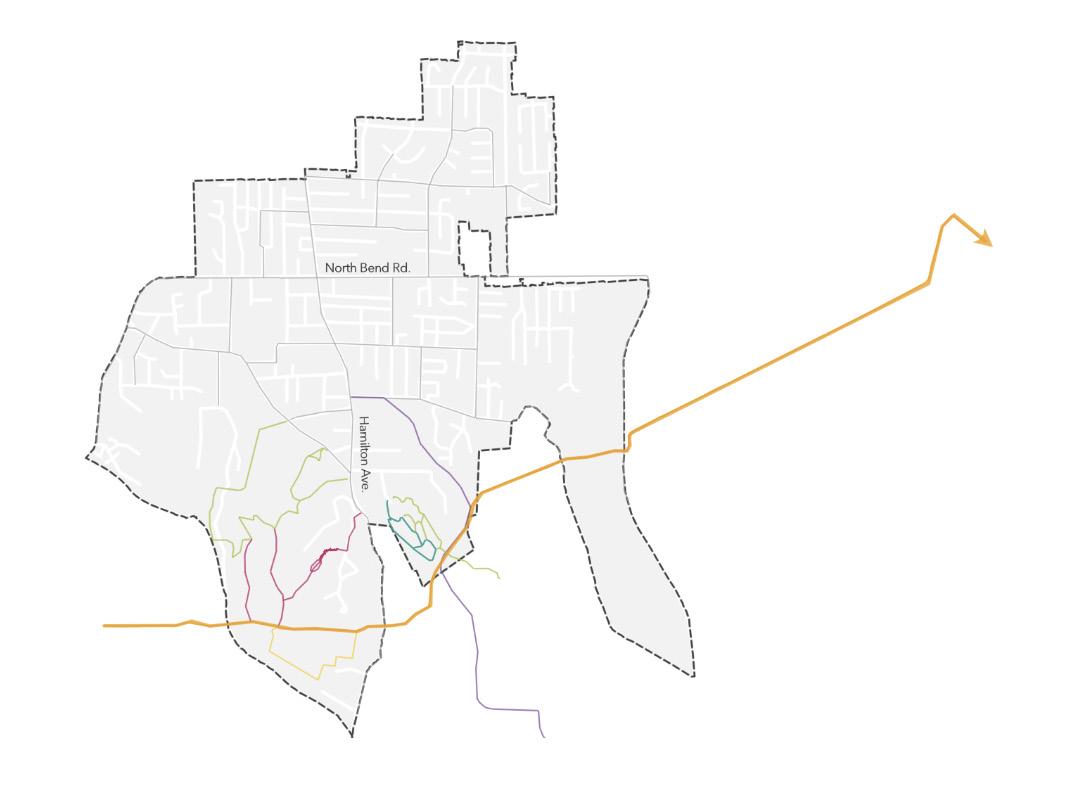
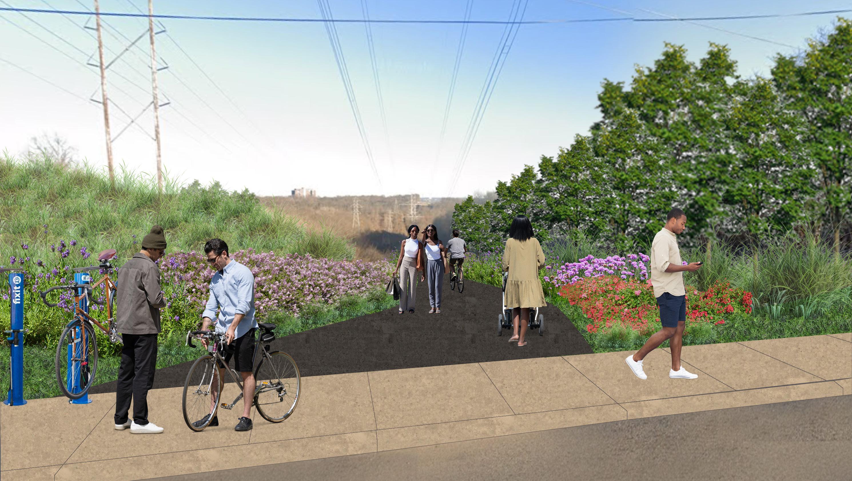
College Hill Trail Network
group studio project
UniversityofCincinnati,2022
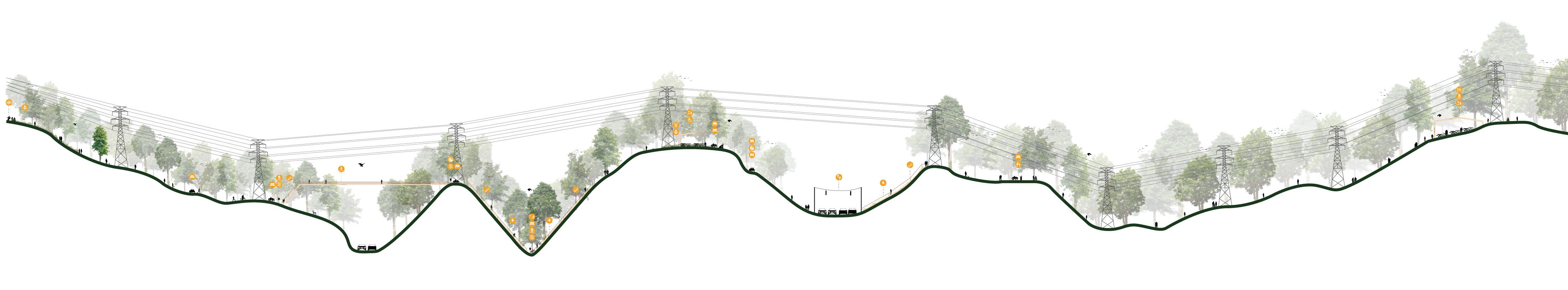
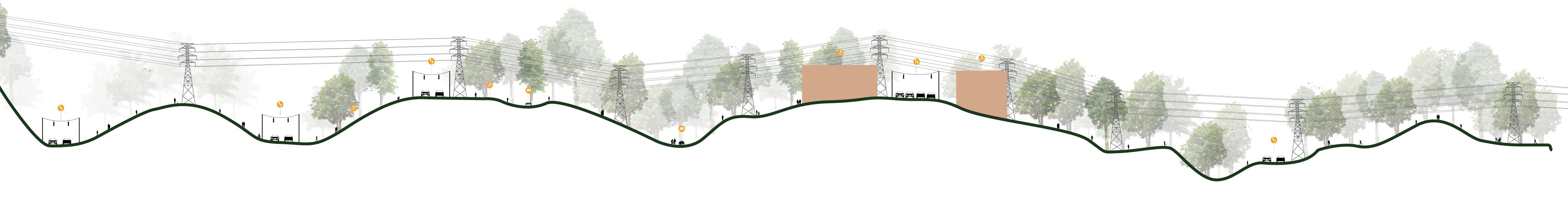
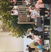
For this studio project, my group and I designed a network of trails in the hillsides of the Cincinnati neighborhood College Hill hillsides. We wanted residents and visitors to have a dynamic experience that fosters a rich sense of history, a connection with the natural environment, and a celebration of the neighborhood’s diverse and inclusive culture. Our five main objectives were to 1. use art as a catalyst to enrich and inspire the community through interactive installations; 2. establish a standard that balances man-made experiences with the natural environment; 3. provide opportunities to engage with nature and promote respect for the environment; 4. cultivate an appreciation of College Hill’s history; and 5. create an exciting and easily navigable experience to connect people to the environment. The map to the right (ArcGIS) shows the route and design of each our six trails. The following two pages show illustrative cross sections for three of our trails, as well as key pieces of information for each. The page following those is an illustrative rendering of a mini-trailhead along the Powerline Connector Trail.
Environmental Stewardship Trail
Plaque Information:
Sustainable life tips
Signage that highlights amazing aspects of nature
Storybook trail
Animal track identification
Trail stats: elevation and terrain
Powerline Connector Trail
total distance: 4.82 mi.
elevation: 893 ft. min elevation: 622 ft. ascent: 1,092 ft. descent: 1,349 ft.
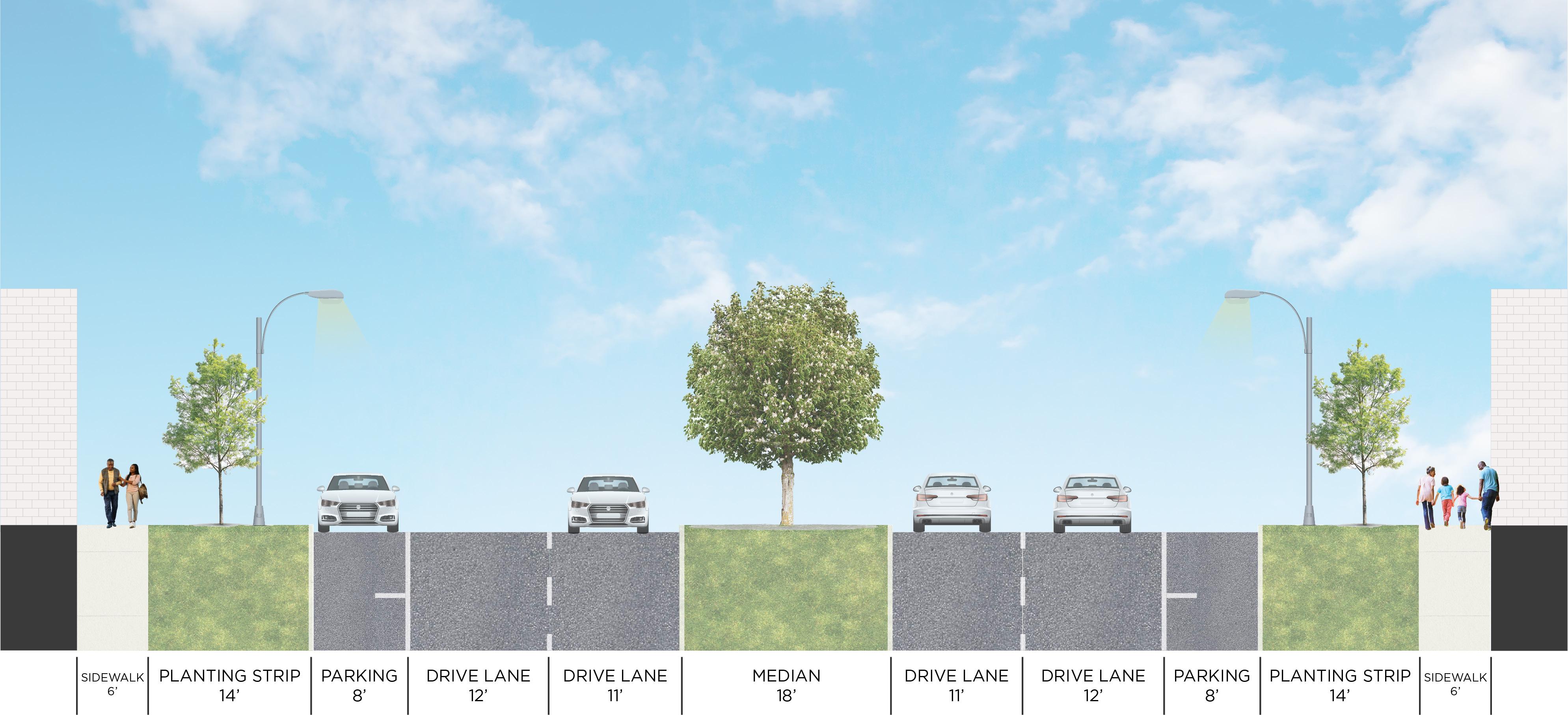
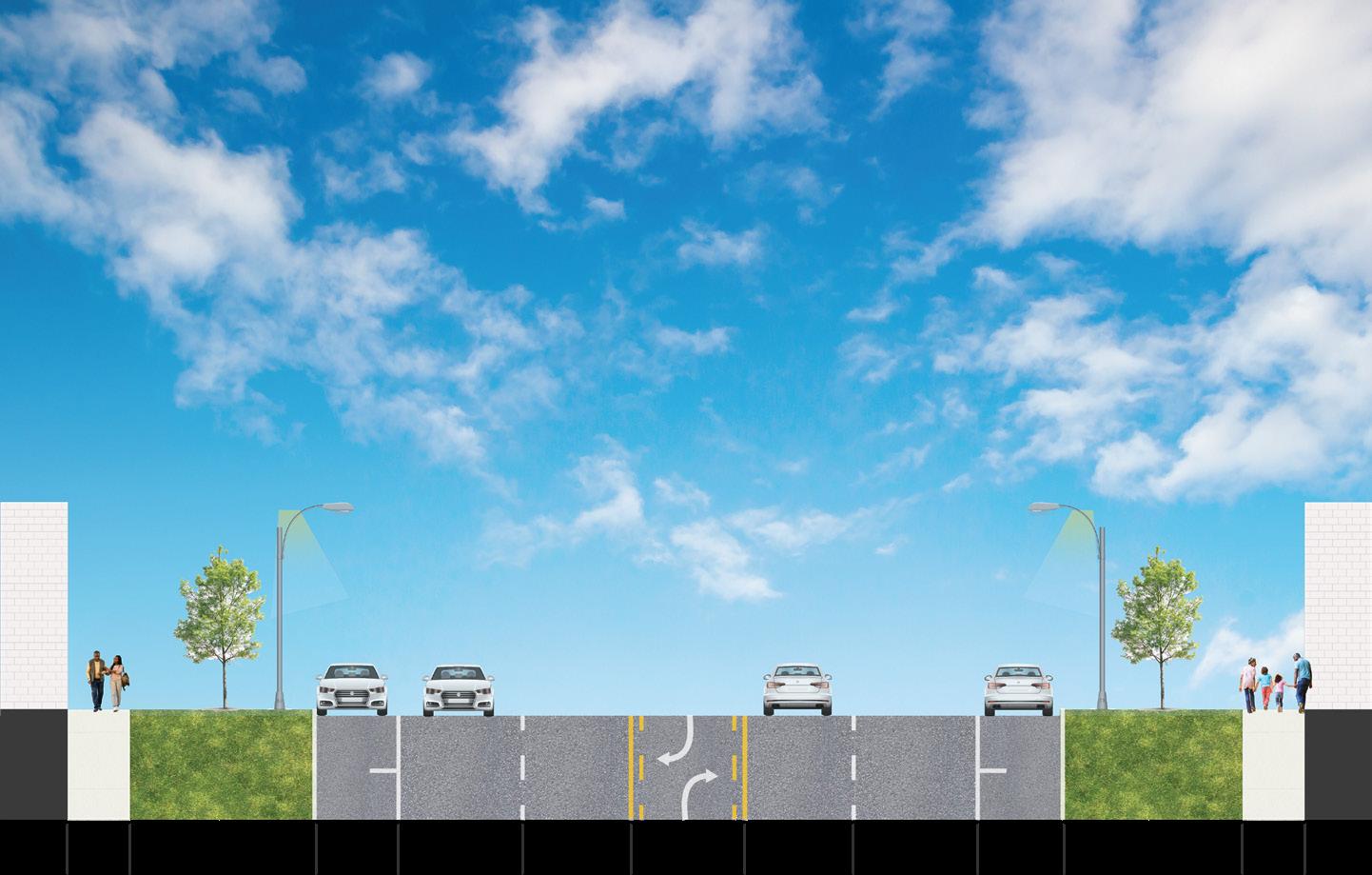
Mack Ave Streetscape Design
East Side Community Network
OHMAdvisors,2023
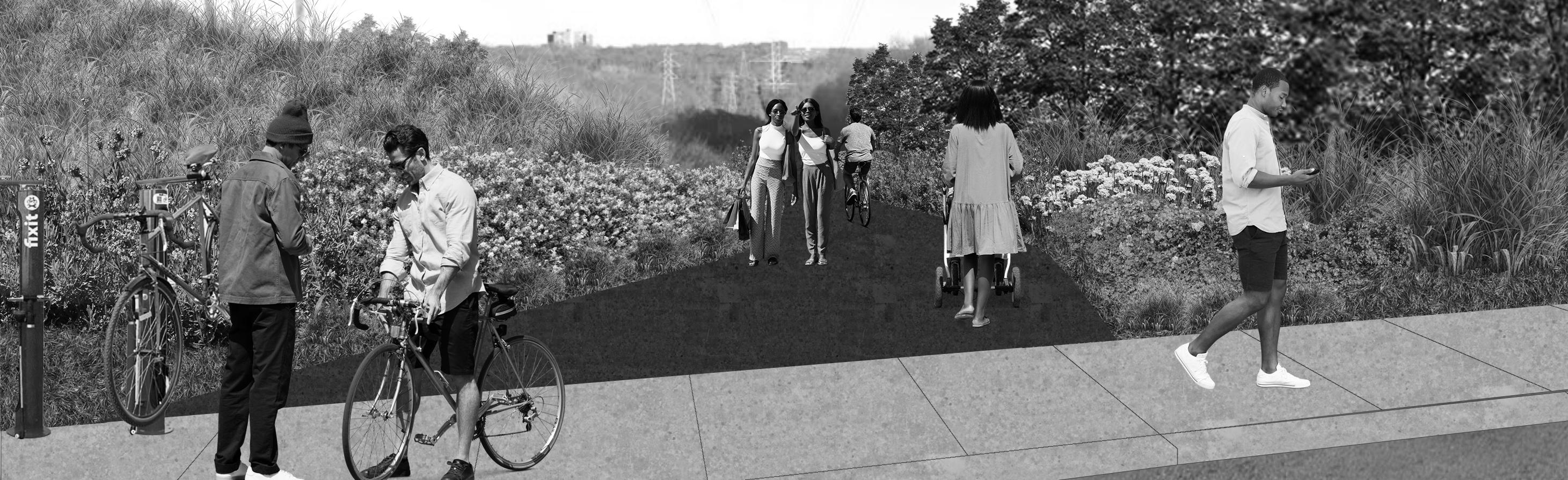
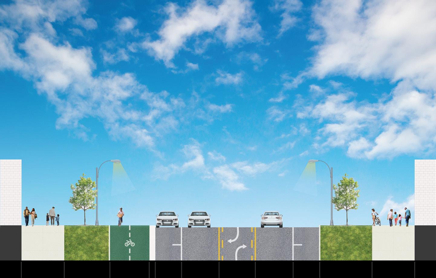
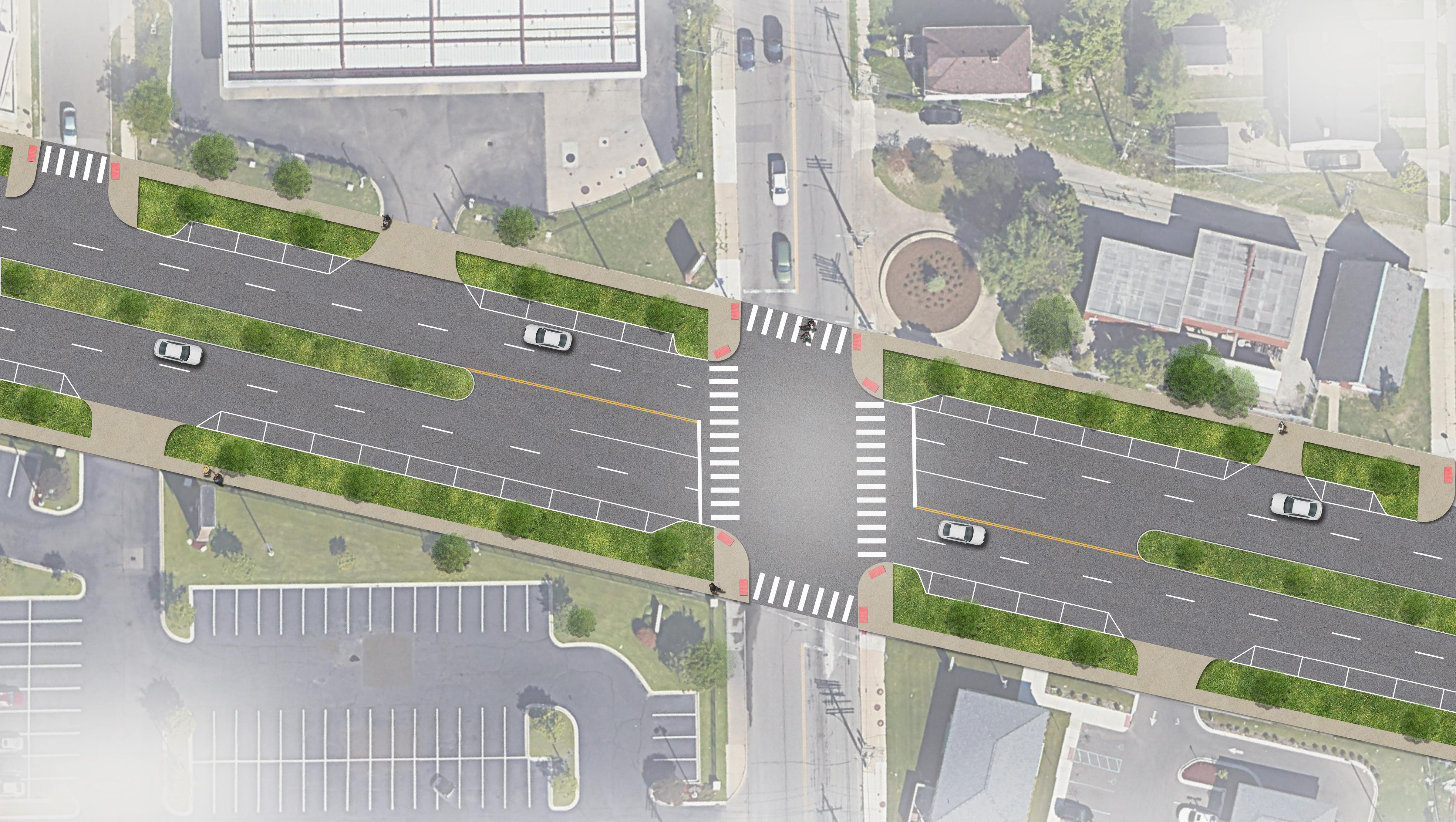
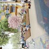
Our team was selected by the Eastside Community Network, an organization that works to “plan for sustainable Growth on Detroit’s Eastside” (Eastside Community Network), to engage the communities, people, and businesses adjacent to the Mack Ave Corridor. Our goal was to create a vision for this corridor that brings a feeling of consistency and cohesiveness. A large part of this effort was to develop alternative street designs for the corridor, which was broken down into three segments. Each segment had 2-3 alternatives for how the road could look in the future. These alternatives were illustrated to bring to the community for residents and business owners to decide on. The cross sections to the right show the three alternatives for one of the segments. On the following page is a large, plan view rendering of how the preferred alternative would look.
ALTERNATIVE 2
Tri-County Trail Study
Tri-County Regional Planning Commission
OHMAdvisors,2023
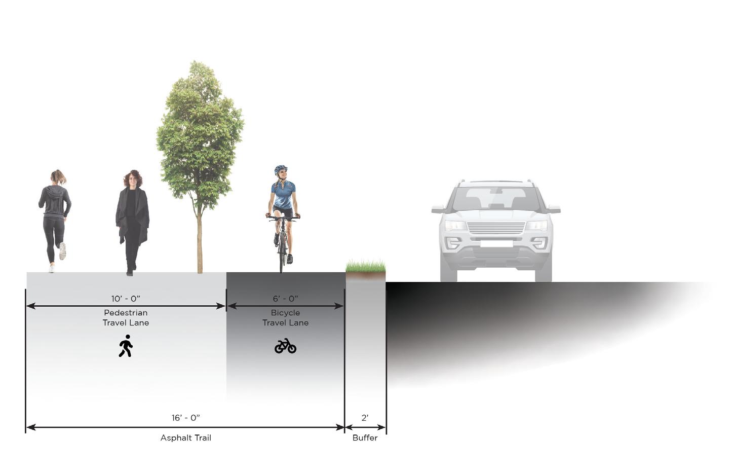
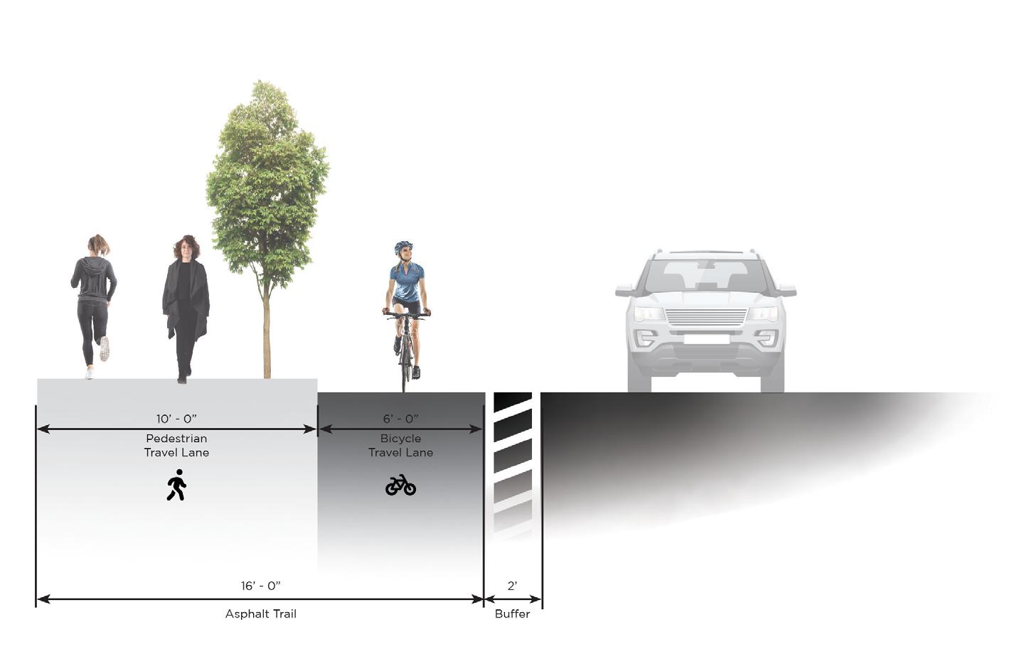
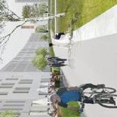
The Tri-County Regional Planning Commission consulted my team to assist in the route planning and conceptualization of trail networks throughout three counties. We developed a series typologies for route segments, taking into consideration various constraints within the network. The following cross sections were supplementary to corridor maps that illustrated which typology was most suitable for each segment of trail. Metrics including cost, comfort, safety, time to implement , and suitability are expressed with each typology to give the community and stakeholders a holistic understanding of the planning study.
Sidewalk Level Protected Bicycle Facility
Typical 6’ Bicycle Facility
Street Level Protected Bicycle Facility
Typical 6’ Bicycle Facility
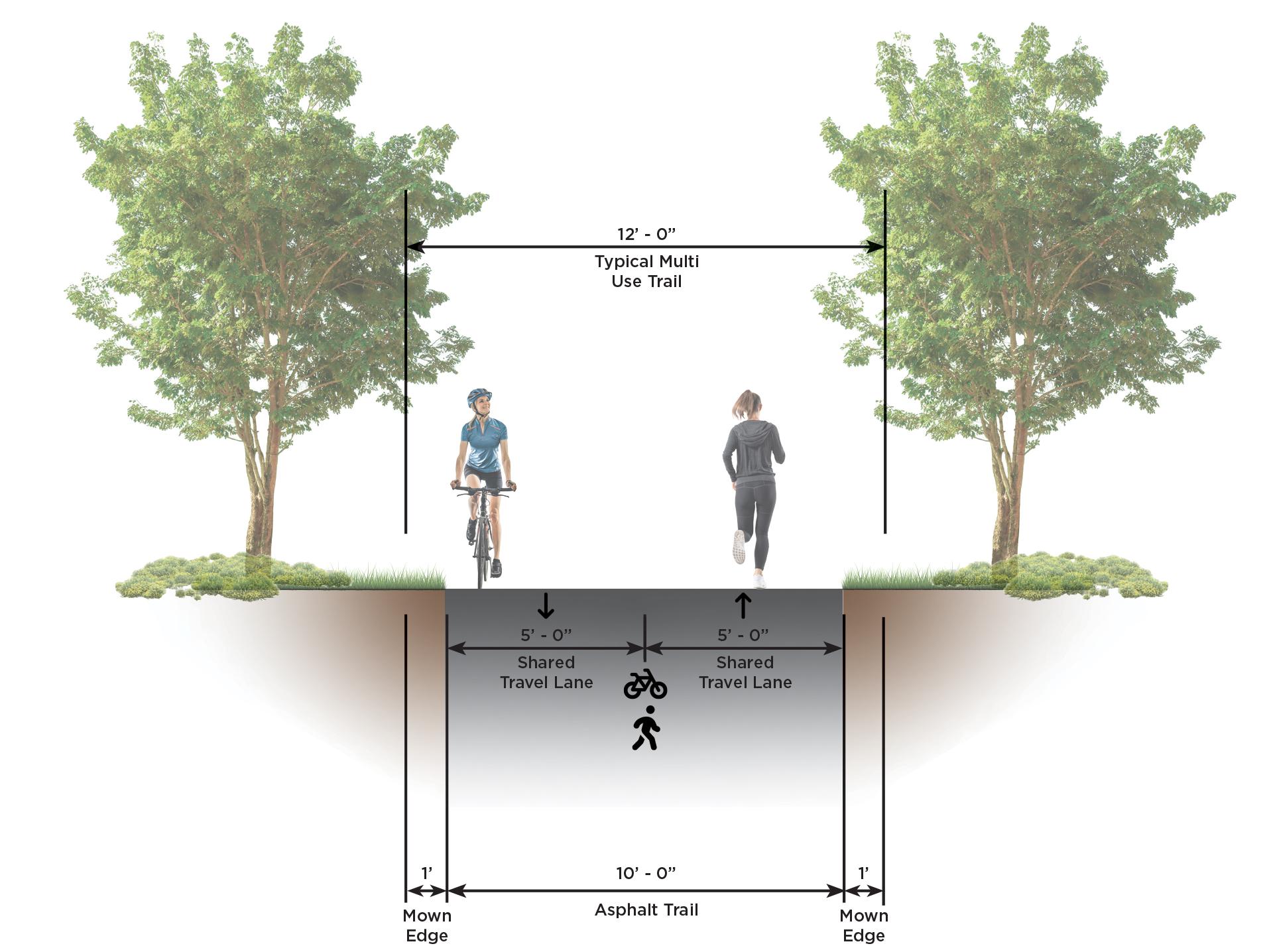
Typical 10’ Multi Use Trail
Paved Shared Use Pathway
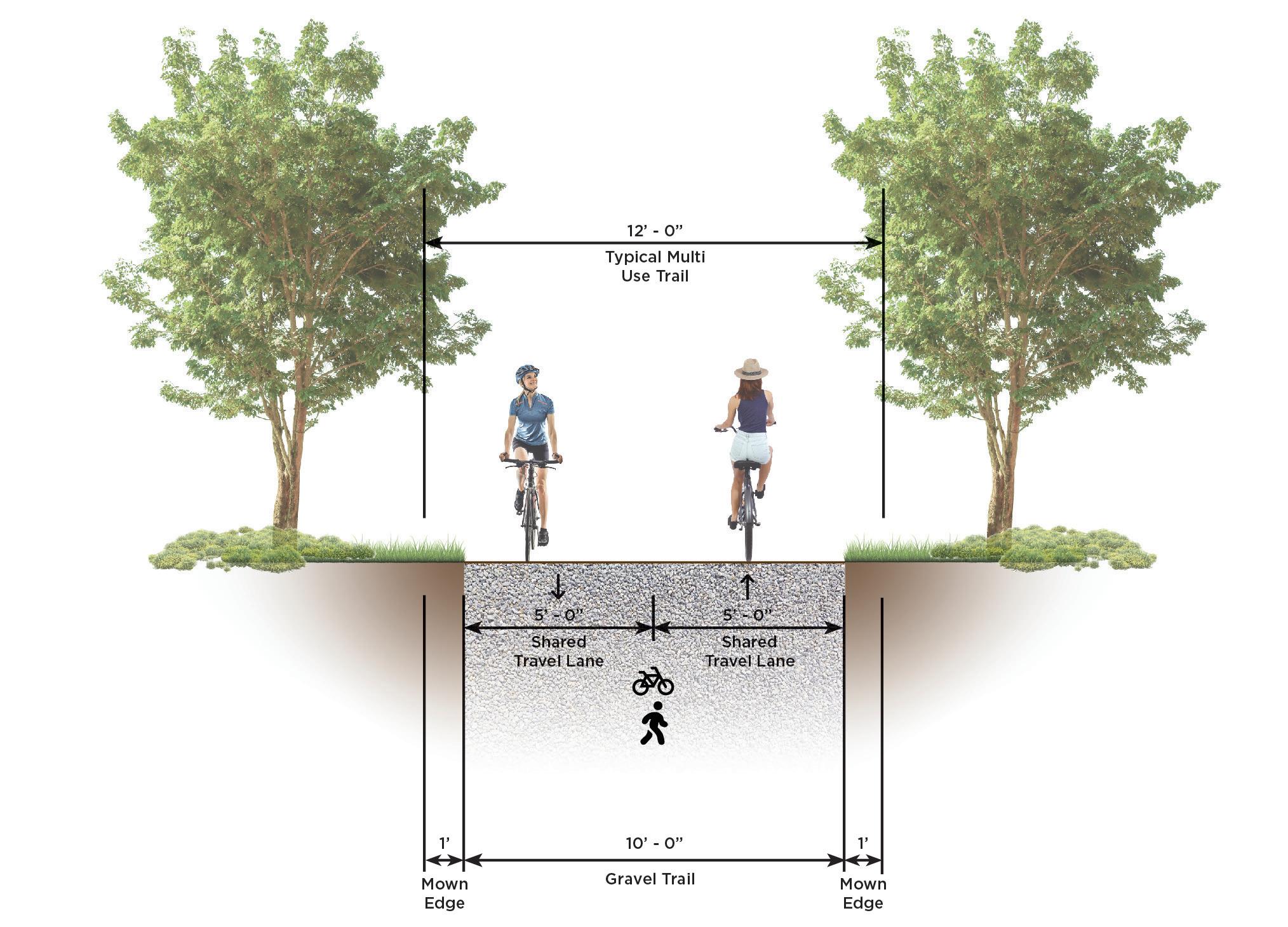
Typical 10’ Multi Use Trail
Gravel Shared Use Pathway
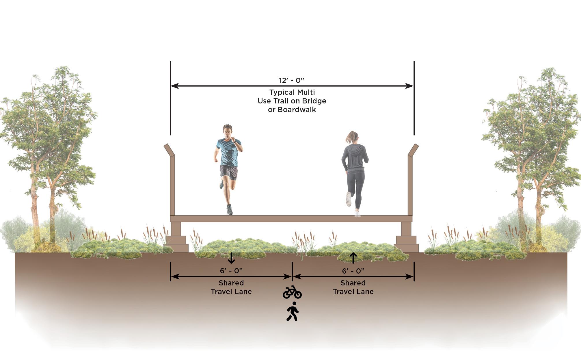
Typical 12’ Multi Use Trail
Bridge or Boardwalk Segment
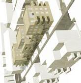
Das Ü3 für Botnang Nord
group studio project
HochschulefürTechnik,2022
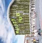
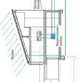
FREIRAUMKONZEPT 2500 Das Quartier in Stuttgart Botnang ist geprägt von hohen Gebäudetypologien, ungenutzten Freiflächen, welchen keine bestimmte Funktion zugeordnet wird, und einer immer wahrnehmbaren Anonymität. Auf Basis diverser Anreize der Anwohner des Quartiers umfasst der Entwurf drei Teilquartiere, welche unterschiedliche Typologien und Konzepte aufweisen. Darüber hinaus wurden vier Thesen aufgestellt, welche mittels eines Werkzeugkasten, bestehend aus verschiedenen Maßnahmen, umgesetzt werden sollen. Der Städtebauliche Entwurf sieht für das erste, nördliche Teilquartier Vierspänner vor, welche sich in unterschiedlichen Anordnungen im gesamten Quartier wieder finden lassen. Das übergeordnete Konzept des ‚Übergangs‘ sieht Punkthäuser vor, welche einen Übergang zum Wald hin ermöglichen. Durch die L-förmige Anordnung der Gebäude, entstehen Innenhöfe. Diese sollen Raum für Begegnungsräume und Nachbarschaften schaffen. Das zweite Teilquartier wird unter dem Motto ‚Umarmen‘ mit Zeilenund Riegelbauten ergänzt. Hierdurch wird die rundliche Gebäudeanordnung der bereits bestehenden Typologien aufgegriffen. Gleichzeitig entstehen Freiräume zwischen den Gebäuden, welche zur Bildung von Nachbarschaften und Zugehörigkeiten beitragen sollen. Das dritte, südlich gelegene Teilquartier weist eine lineare Gebäudeanordnung auf, welche mittels Vierspänner realisiert wird. Zwischen den entstehenden Zeilenbauten, entstehen Durchgangsräume, welche unter dem Motto ‚Unmittelbar‘ gestaltet werden. Durch die klaren Gebäudeanordnungen und den entstehenden Zwischenräumen wird man unmittelbar durch das Quartier geleitet. Die entwickelten Thesen erstrecken sich über alle Teilquartiere. Im Bereich ‚Communication‘ sollen neue Begegnungsund Aufenthaltsräume geschaffen werden. Diese stehen in enger Verbindung zum städtebaulichen bzw. räumlichen Entwurf. Mittels verschiedener Angebote für alle Altersgruppen, wie z.B. Spielplätze, Urban Gardening, Veranstaltungsund Gemeinschaftsräume, soll die Anonymität im Quartier aufgehoben werden. Die These ‚Networking‘ steht für das Mobilitätskonzept. Dieses setzt seinen Fokus auf die direkte Verknüpfung der entstehenden Gebäude und Freiräume. Leitbild ist ein autoarmes Quartier mit kurzen Wegen und alternativen Mobilitätsangeboten. Neue Fußund Radwegeverbindungen sowie ein Mobility Hub entstehen. Dieser umfasst neben einer Tiefgarage, vor allem Radabstellanlagen, Schließfächer, Bikeund Car-Sharing Angebote. An wichtigen Straßenquerungen wird eine Shared Space Lösung realisiert, um zusammenhängende Freiräume gegenüber Straßenachsen zu priorisieren. Die Schaffung einer ‚Identity‘ des Quartiers soll die Attraktivität des Wohnraums erhöhen. Durch eine behutsame Nachverdichtung soll neuer Wohnraum geschaffen werden. Hierbei wird die Formsprache bestehender Bauten aufgegriffen und entsprechend weiterentwickelt. Jedes Teilquartier erhält durch unterschiedliche, städtebauliche Konzepte eine eigene Identität, welche sich optisch voneinander abheben. Dies erleichtert gleichzeitig die Orientierung im Quartier. Unter der These ‚Green Around‘ werden die ökologischen Maßnahmen zusammengefasst. Straßenbegleitgrün sowie eine Flächenentsiegelung und Grünachsen sind grundlegende Maßnahmen der Begrünung des Quartiers. Darüber hinaus werden Retentionsflächen geschaffen und ein Regenwasserbewirtschaftung umgesetzt. In Ergänzung einer generell nachhaltigen Bauweise, einer Kernsanierung der bestehenden Gebäude sowie eine Ergänzung von Photovoltaik Anlagen soll ein klimagerechtes Quartier entstehen.
Veranstaltungssaal
Angebote für Jung & Alt
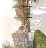
This urban design project responds to the challenges of an existing neighborhood near Stuttgart, Germany, characterized by high-rise typologies, unused open spaces, and a prevailing sense of anonymity. Based on input from residents, the proposal establishes three distinct districts, each with its own spatial strategy and architectural concept, while remaining tied together through overarching design principles.
WERKZEUGKASTEN
Fußwege zur Vernetzung Neue Fahrradwege Mobility Hub Autoarmes Quartier
The northern quarter follows the theme of “Transition”, introducing point houses and L-shaped arrangements that create courtyards, fostering encounters and community. The central quarter, under the motto “Embrace”, features row and block buildings that respond to existing circular typologies, producing shared open spaces that encourage neighborhood identity. The southern quarter, defined by “Directness”, organizes buildings linearly with clear pathways and transitional spaces that guide movement through the district.
AROUND“ Nachhaltigkeit & Klimaanpassung Neue Grünraume und Plätze schaffen mehr Raum für Aufenthalt und reduzieren die Anonymität. Ein sozial durchmischtes Quartier entsteht. Für die direkte Verbindung der Aufenthaltsflächen, der Nahversorgung und Infrastruktur werden kurze Wege geschaffen. Alternative Mobilität verbessert die Erreichbarkeit und sorgt für die CO ² -Senkung. Eine behutsame Nachverdichtung schafft neuen Wohnraum mit großzügigen Freiflächen. Eine angepasster Formsprache der Bebauung schafft neue Identität für die Teilquartiere. Fokus Kinderund Altersgerechtes Wohnen und bezahlbarer Wohnraum.
Eine vernetze Planung von blau-grün-grauen Infrastrukturen sorgt für eine klimagerechte Stadtentwicklung. Der Energieeffizeinte Städtebau schafft neue Möglichkeiten zum Thema energiegerechte Stadtplanung.
„ÜBERGANG“ L-Förmige Anordnung Nachbarschaften | Übergang zum Wald Punkthäuser 4-Spänner
Typologie
Neubau
Besatnd
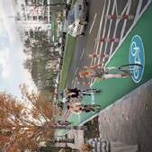
Across all districts, four guiding theses structure the project. “Communication” emphasizes creating diverse public and semi-public spaces—playgrounds, urban gardening, community halls—that strengthen social cohesion. “Networking” introduces a sustainable mobility strategy, with new pedestrian and cycling routes, a mobility hub for bike- and car-sharing, and shared-space concepts to prioritize public life over traffic. “Identity” focuses on sensitive densification, adapting existing architectural language while giving each quarter a distinct character for orientation and belonging. “Green Around” consolidates ecological measures, including street greenery, permeable surfaces, retention areas, and rainwater management, alongside sustainable construction and renewable energy.
TYPOLOGIEN
Modul 5 Integriertes Studienprojekt Städtebau WiSe 22/23 gunther laux _ Asli Akdag Madeleine Bode Linnea Fischer Grace Schoenknecht Dijana Radojevic
Resilient and Flexible Region 2042
group studio project
UniversityofCincinnati,2022
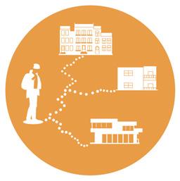
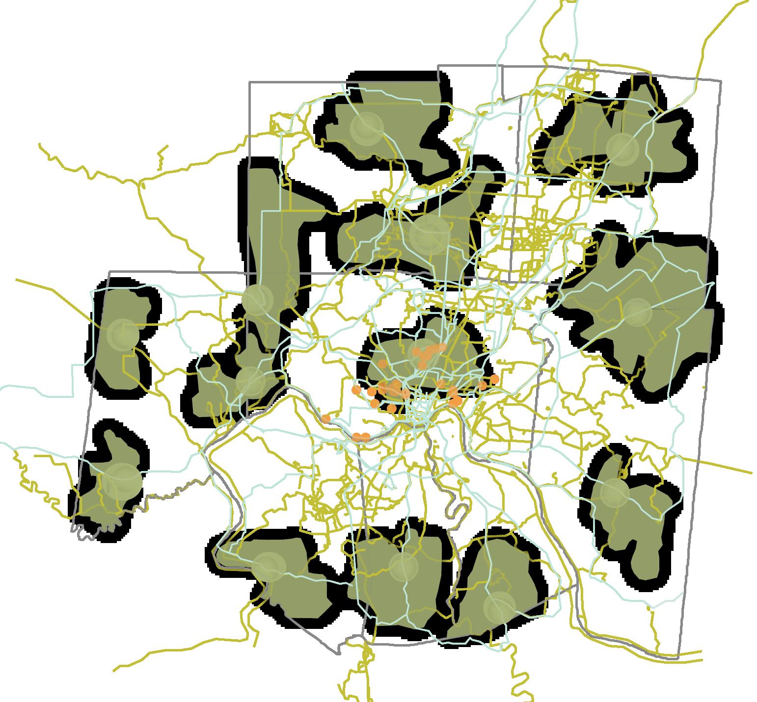
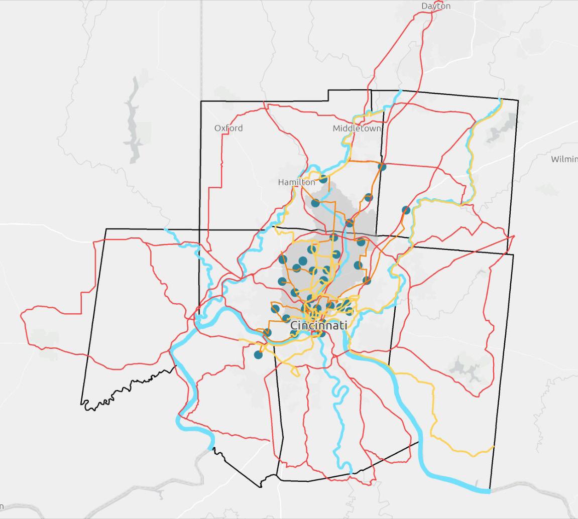
The Resilient and Flexible Region project envisions a future-ready Metro Cincinnati shaped by equity, sustainability, and adaptability. Addressing challenges like climate change, inequitable growth, and car dependency, the design proposes transformative strategies across three themes: Balancing Sustainable Spaces, Shaping Mobility, and The Nomadic Lifestyle. These include green infrastructure to manage stormwater and expand ecological networks, innovative housing models that foster community, and a multi-modal transportation system prioritizing accessibility and reduced carbon emissions. Together, these strategies create a connected, inclusive, and climate-conscious urban region, where mobility, ecology, and equity reinforce one another to support thriving communities in 2042.
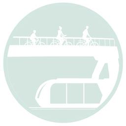
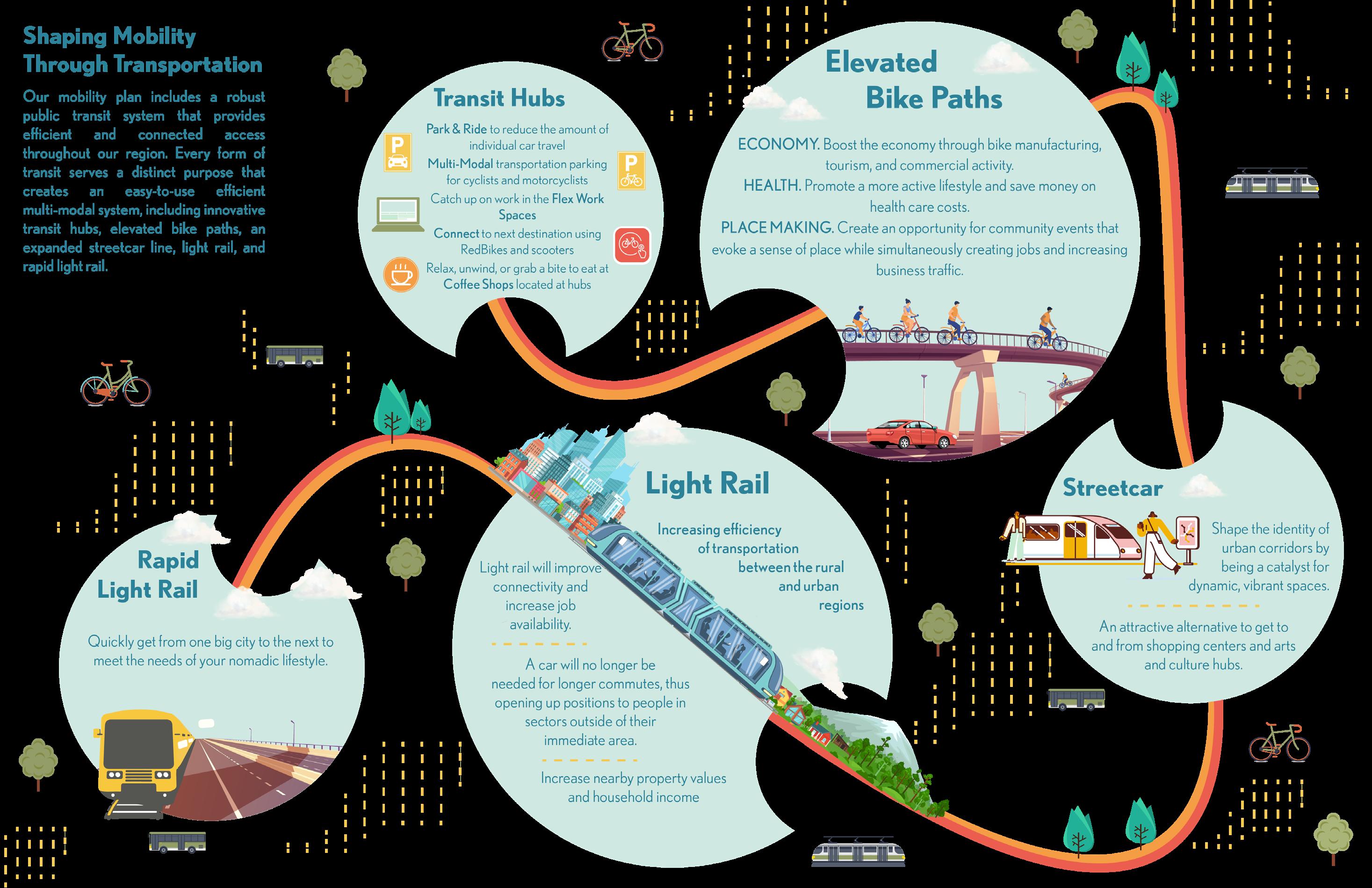
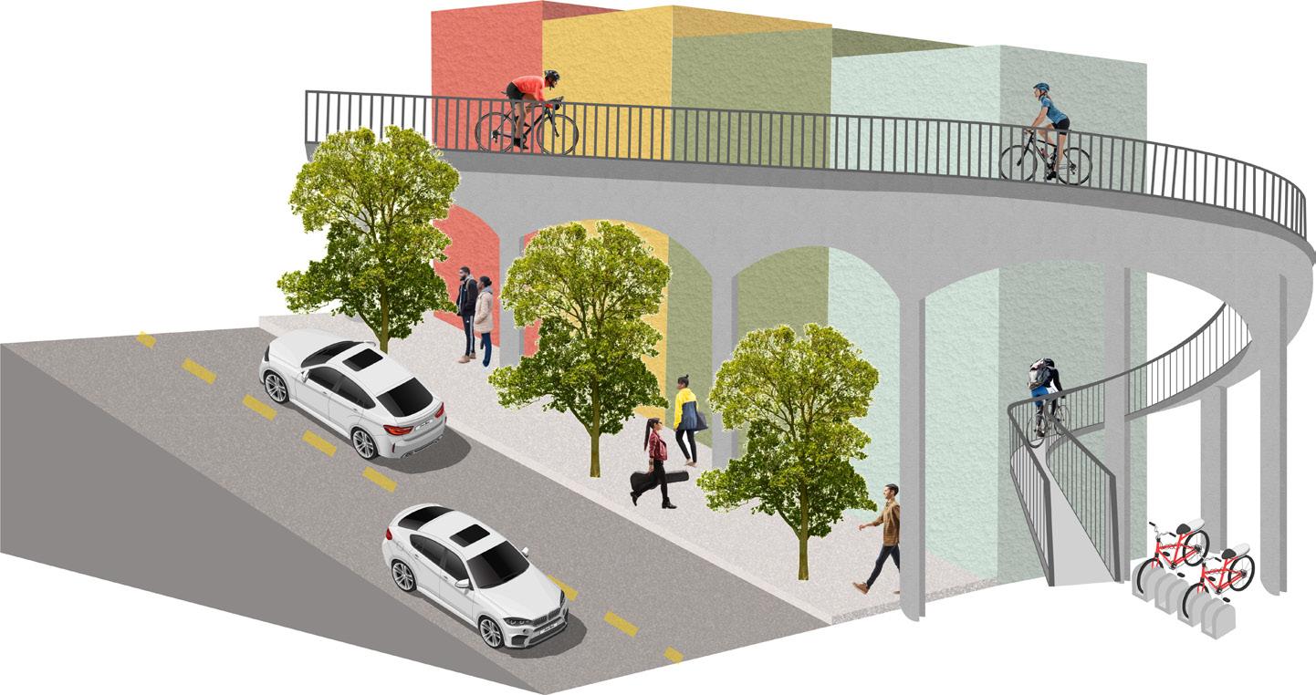
The mobility strategy reimagines transportation as the backbone of regional resilience. A multi-modal system integrates light rail, rapid rail, streetcars, transit hubs, and elevated bike paths, ensuring connections between neighborhoods, job centers, and surrounding cities. Elevated bike paths double as safe commuting routes and recreational attractions, overcoming topographic barriers while linking to existing trail networks. Transit hubs function as adaptable community anchors with amenities for riders, reinforcing equity and accessibility. By reducing car dependence, the plan lowers emissions, boosts economic activity, and makes public transit more attractive than private vehicles, ultimately reshaping mobility into a sustainable and inclusive regional asset