Title: Patterns and Functions in Landscapes: Prototyping Neighbourhood Landscapes in a Densifying Hong Kong
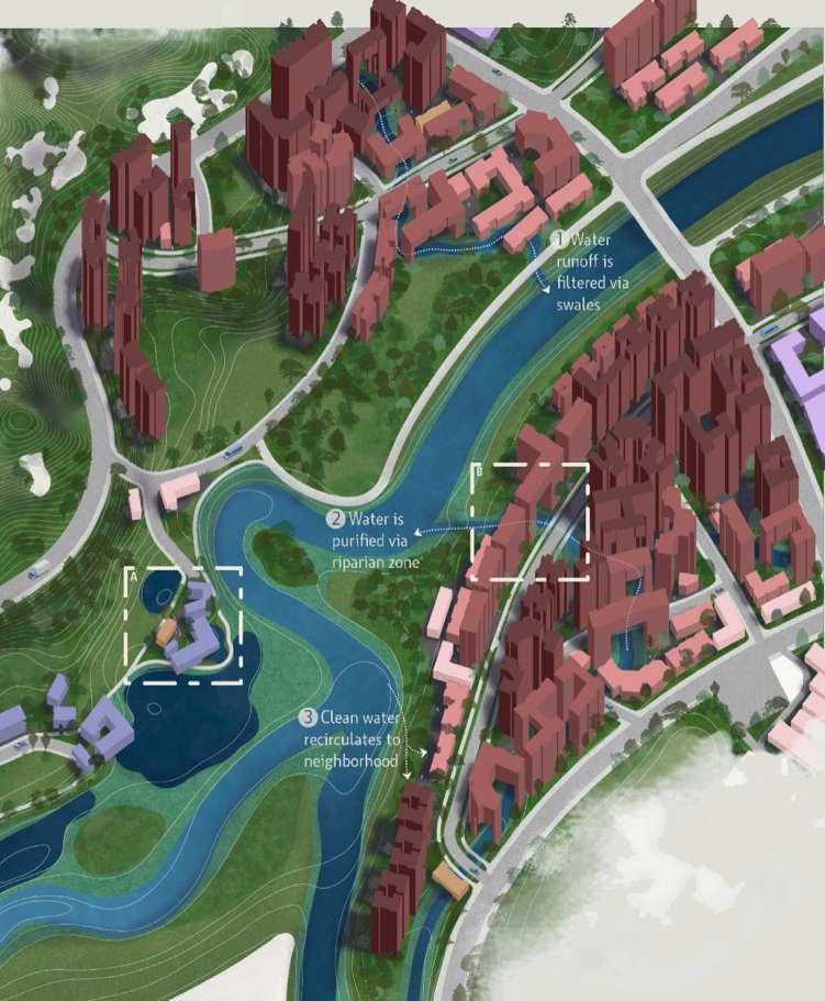
All rights reserved; no part of this publication may be reproduced, stored in a retrieval system, or transmitted in any form or by any means, electronic, mechanical, photocopying, recording, or otherwise without prior written permission of the publisher.
The publisher does not warrant or assume any legal responsibility for the publication’s contents. All opinions expressed in the book are of the authors and do not necessarily reflect those of the National University of Singapore.
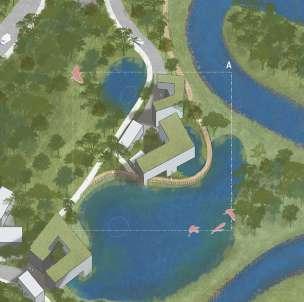
PATTERNS AND FUNCTIONS IN LANDSCAPES
Prototyping Neighbourhood Landscapes in a Densifying Hong Kong
Landscape Architecture, Department of Architecture, College of Design and Engineering
LAD4010 Design 8 & LA4702 MLA Studio: January - April 2025
Li Xiyuan | Sun Peiqiang | Lee Wen Qi Sherly
Zhou Qinying | Zhou Yao | Qi Kexin | Ho Qian Yu
Lina Altoaimi | Mariam Yusuf Rajkotwala | Pan Yuwen
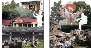
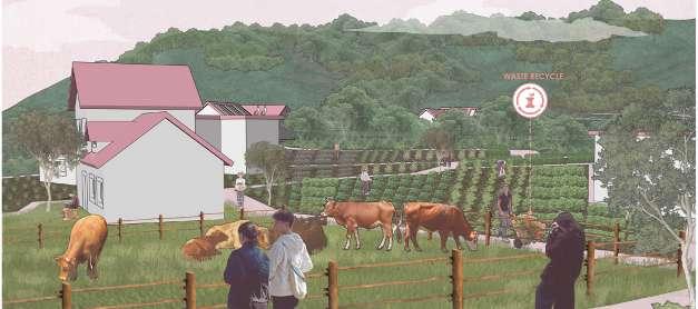
Team A1: Harmonizing Rural Charm with Urban Comforts
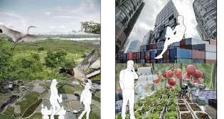
Team A2: Co-Living System of Bird Habitat, Agriculture, & Culture
Team B3: Land Sharing or Land Sparing?
Team B4: Dense + Ecological
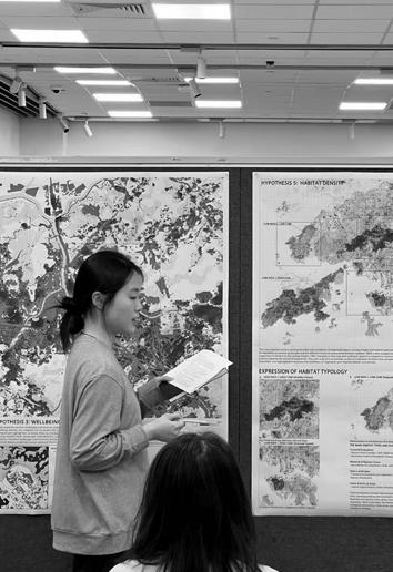
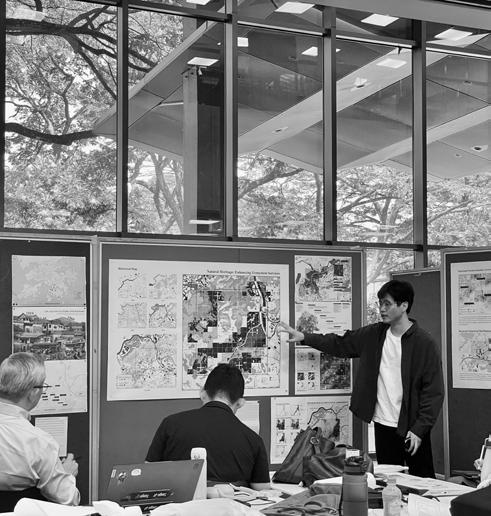
Project 3: Envisioning Landscapes
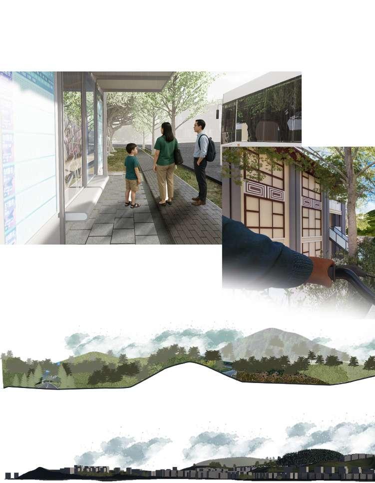
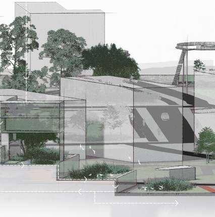
Project 3 Proposals– Team A1 Experience Landscape
Project 3 Proposals– Team A2
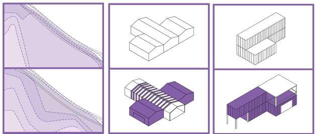
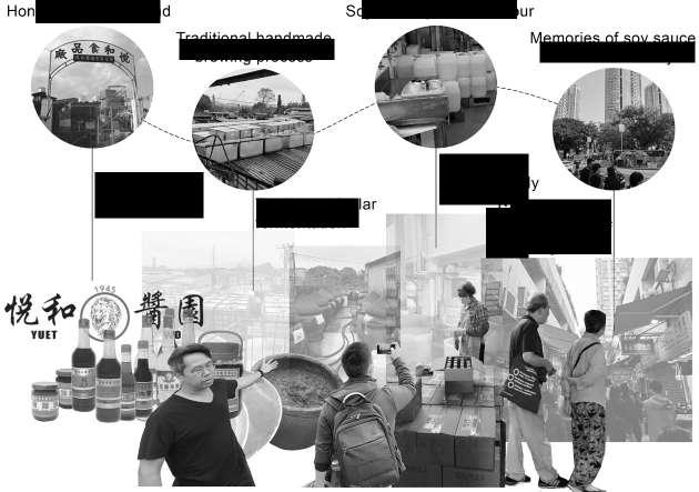
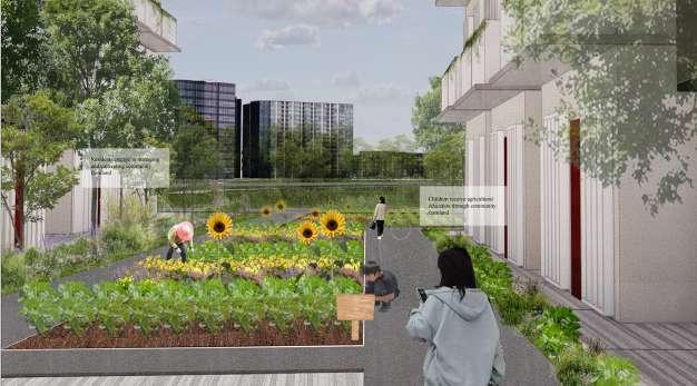
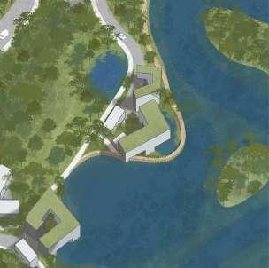
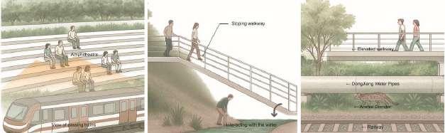
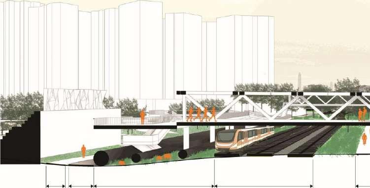
Bridging Traditions By Ho Qian Yu
Reweaving the Urban Fabric By Zhou Qinying & Zhou Yao
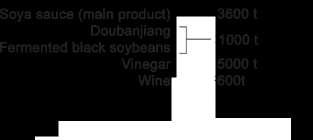
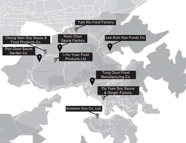
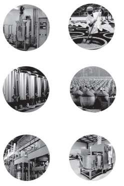
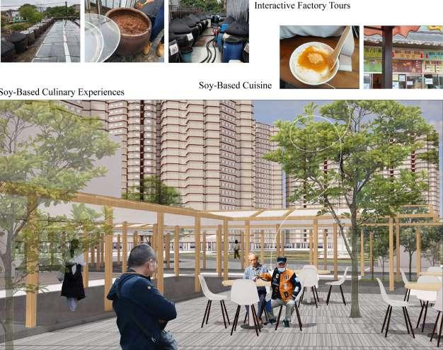
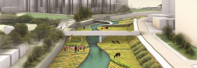
Rooted in Soy By Qi Kexin
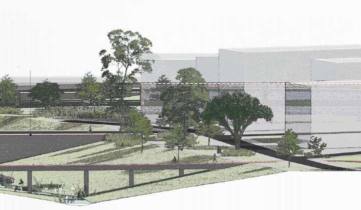
Project 3 Proposals– Team B3
Aggregating Landscape By Lina Altoaimi
Land Re/Coded By Mariam Yusuf Rajkotwala
Adaptive Commoning By Pan Yuwen
Project 3 Proposals– Team B4
Post Infrastructure By Seah Yun Zhang Deston
Temporal Hybridity By Chen Yingzhao
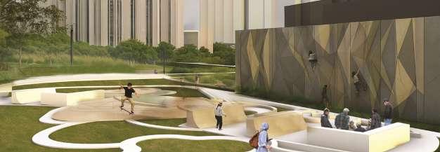
The Everyday Corridor By Choi Yung Zhen Winston
PATTERNS AND FUNCTIONS IN LANDSCAPES
HWANG YUN HYE
Associate Professor, Landscape Architecture, Department of Architecture, College of Design and Engineering, National University of Singapore
Despite advances in urban planning and design, persistent challenges remain due to the limited integration of science-driven and data-based approaches. To address this gap, we conducted a design studio with students from the Bachelor and Master of Landscape Architecture programmes at NUS. This studio focused on suburban areas along the Shenzhen–Hong Kong border—a region where balancing urban expansion with ecological conservation is especially critical in light of Hong Kong’s rising housing demand. Through this studio, students demonstrated how scientific knowledge, particularly insights into pattern–process–function relationships derived from research, can be applied through an iterative science–design loop. In these risk-free, exploratory settings, students utilised pattern-based landscape planning, comparative analysis, and decision-making tools. This approach enabled comprehensive site assessments and facilitated the prediction of functional performance across diverse design proposals. As a result, the studio bridged disciplinary boundaries, deepened understanding of urban multifunctionality, and supported the development of planning goals anchored in measurable landscape values, underscoring the importance of integrating scienceintourbandesignpractice.
The success of this studio was made possible by the generous support and collaborationof many contributors. We extend our sincere gratitude to Ye Zhang (Associate Professor of Architecture, Tsinghua University) for conducting a parallel studio with Tsinghua students, and to Jianxing Huang (Associate Professor of Urban Planning, Hong Kong University) for hosting and assisting with our fieldwork. We are grateful to Wong Shiu Hung Brian and Chow Kin Long Cody (Liber Research Group), Han Hsi Ho (Urban Design Lecturer, Hong Kong University), and Lawrence Liauw (Associate Professor of Urban Planning, Hong Kong University) for their valuable feedback. We also acknowledge Yue Zhu, Jing Wang, and Chen Xinyu from Comparative Ecology of Cities, Future Cities Lab Global, for their technical supports. Special thanks go to Ah Lan from the Union of Kwu Tung North Residents for participating in our field trip presentation.
STUDIO INTRODUCTION PROTOTYPING NEIGHBORHOOD LANDSCAPES
Hwang Yun Hye, Associate Professor, Landscape Architecture, Department of Architecture, College of Design and Engineering, National University of Singapore
Tan Puay Yok, Professor, Landscape Architecture, Department of Architecture, College of Design and Engineering, National University of Singapore
1. Background
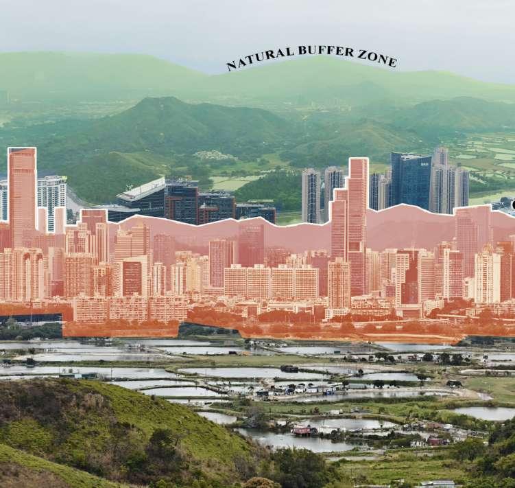
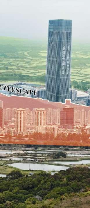
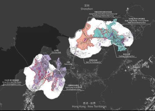
Hong Kong faces a critical need to accommodate its growing housing demands. This demand is driven by a combination of factors including population growth, limited land availability, and economic pressures. In response, New Development Areas (NDAs), which are large-scale extensions of existing new towns, have emerged to help manage urban growth and address housing needs, particularly in the New Territories and northern regions, where the border between Hong Kong and Shenzhen becomes increasingly permeable1
This initiative includes transforming the region into major urban centers with new towns connecting the two cities, thereby boosting economic development and providing new infrastructure, housings, and spurring economic development2. However, these large-scale new town developments in Hong Kong have sparked criticisms due to environmental concerns, socio-economic inequity, and urban planning challenges. For instance, urbanizing greenfield areas may lead to the destruction of natural habitats, disrupting ecosystems, and increase runoff as well as land degradation. There are also job-housing imbalances, inadequate social facilities, displacement of traditional lifestyles, and transportation issue leading to the difficulty of living and limited benefits to the local economy3.
Furthermore, as a general criticism of current design and planning processes, they are often based on outdated norms and do not adequately integrate new scientific knowledge and data, leading to decisions that may be driven more by political or subjective opinions than by empirical evidence4. This can result in biases toward certain designs, materials, or solutions that may not be the most sustainable, nor optimal for the site. The absence of an analytical framework hinders optimal resource allocation, increases the risk of negative impacts on development, and reduces planning efficiency. Additionally, the professional practice and policy making in the realm of planning and design often lag behind advances in science, leading to lost opportunities for developments that are adaptive enough to future challenges of the environment5
2. Questions and Objectives
In the need to accommodate growing housing demands of Hong Kong, expansion of urban areas and densification of existing spaces seem inevitable. This includes the development of greenfield sites, which impacts their natural, social, and cultural values. Hence, this studio aims to answer the following questions:
(1)How can urban development proceed to minimize impacts on existing socioecological systems while creating new urban areas that deliver optimal benefits to humans? (2) How can urban design and planning incorporate new knowledge of pattern-process-function relationships in urban ecosystems science? (3) What are the quantifiable benefits of such an approach? (4) Towards sustainable neighbourhood landscapes, what novel landscape typologies or urban forms that foster synergies across various functions and spatial scales can emerge from this application? (5) Lastly, how design investigations, specifically design conjectures, can inform research, in addition to serving as the testbed for research outcomes?
There are five studio objectives:
─ Use landscape-based interventions as the main driver to derive regional planning strategies
Understand and evaluate applications of pattern-process-function relationships in urban ecosystems as a tool for planning and design
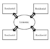
Understand complex forces (social, economic, political, and ecological) that influence planning issues to develop a critical position for landscape interventions
Operate at multiple scales simultaneously through design and research
Develop landscape research skills through data collection and analytical representation
3. Approaches
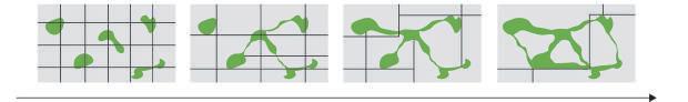
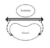
Urban Ecological Principles for Neighbourhood Landscapes: The studio is based on five guiding principles for neighbourhood landscape design6,7. First, emphasizing the interconnectedness of neighbourhoods within larger ecosystems, design should strengthen ecological networks and flows. Second, recognizing that the character of neighbourhood landscapes is shaped not only by natural processes but also by human values, social norms, and institutional policies, design should integratesocial and ecological considerations. Third, design neighbourhood landscapes to adapt to change rather than resist it, acknowledging their dynamic nature. Fourth, design should preserve ecosystem functions at the neighbourhood level is crucial as these landscapes support broader ecological networks. Lastly, design should foster heterogeneity within neighbourhood landscapes which enhances biodiversity and ecosystem functions by incorporating diverse and interconnected habitats.
Science and Design Interface: Theoretical exploration using spatial patterns and ecological principles could be a useful framework to inform the design and management of landscapes. In Joan Nassauer’s paper “Design in Science: Extending the Landscape Ecology Paradigm”8, she highlights the need to blend design concepts with landscape ecology to create landscapes that are both functionally and spatially working. This approach views landscapes as dynamic systems shaped by natural processes and human activities In urban ecosystems as in natural ecosystems, pattern-based planning can enhance green space distributions by strategically placing elements such as green corridors to boost biodiversity, mitigate urban heat and flooding, provide economic benefits, and improve human health.
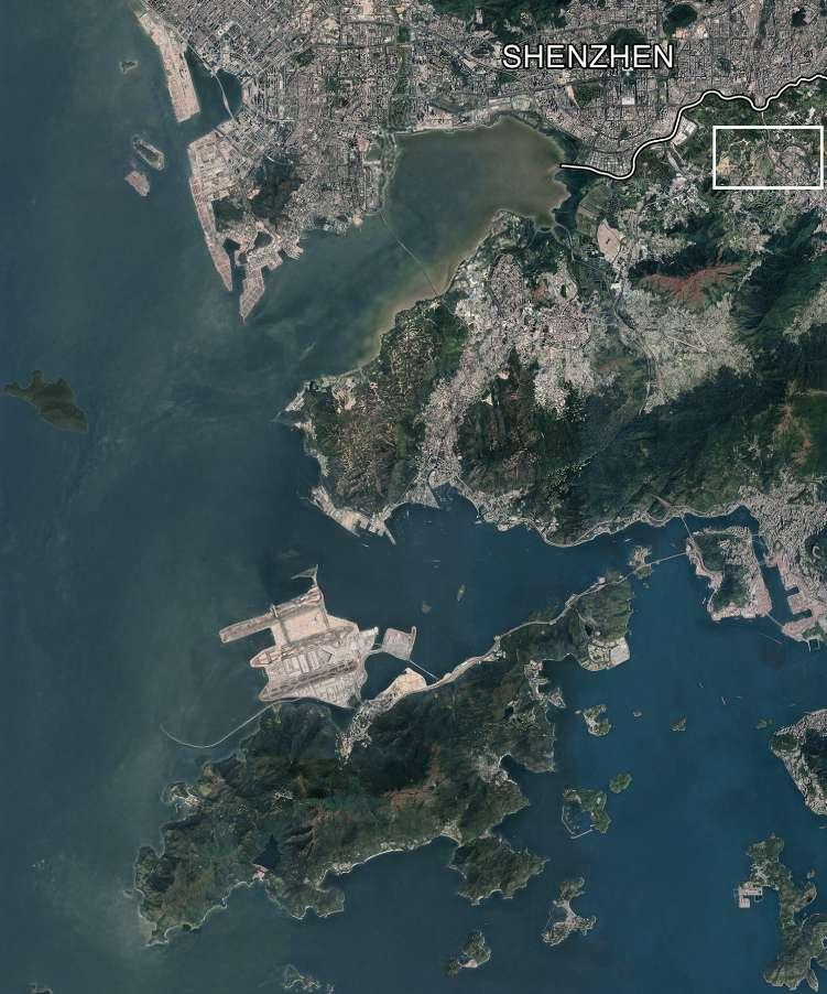
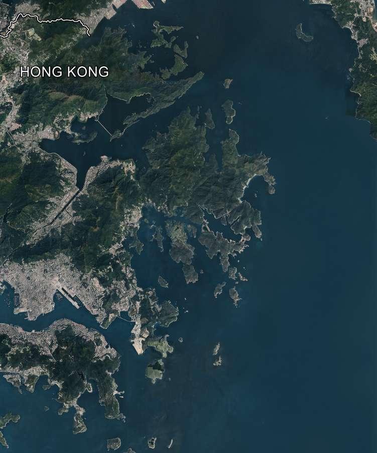
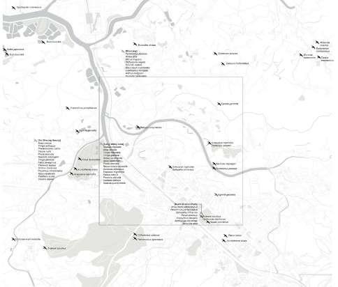
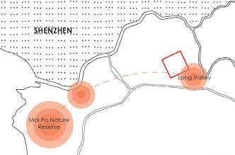
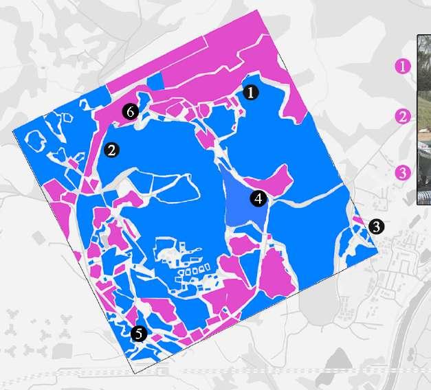
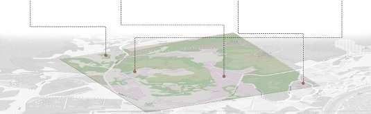
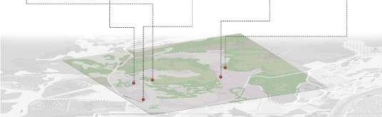
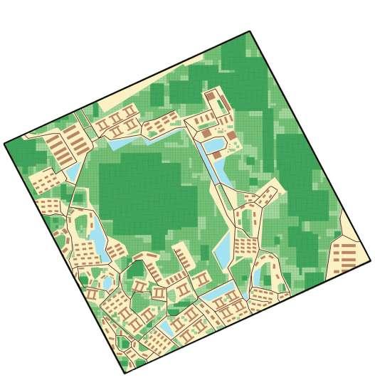
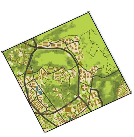
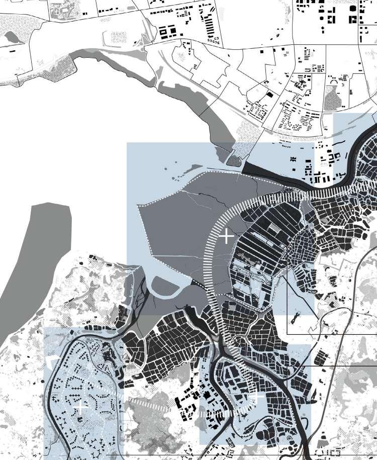
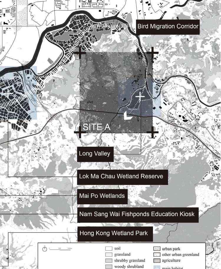
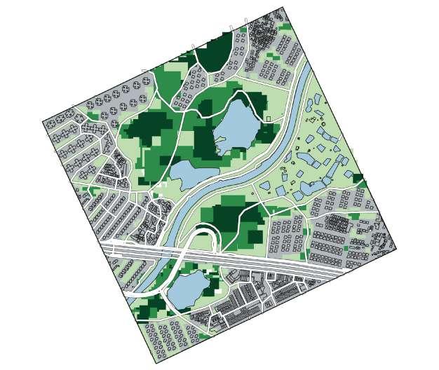
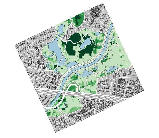
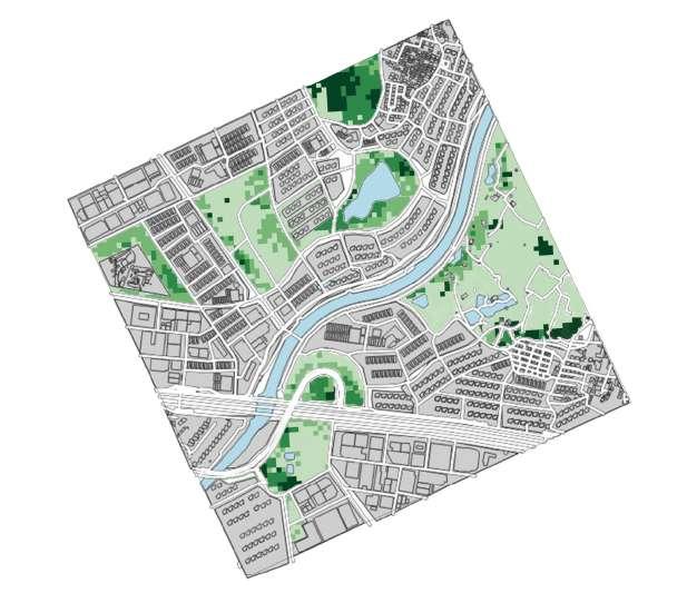
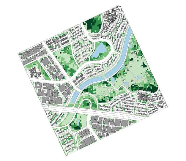
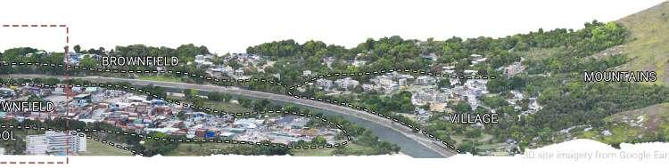
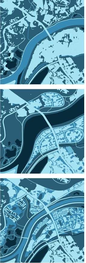
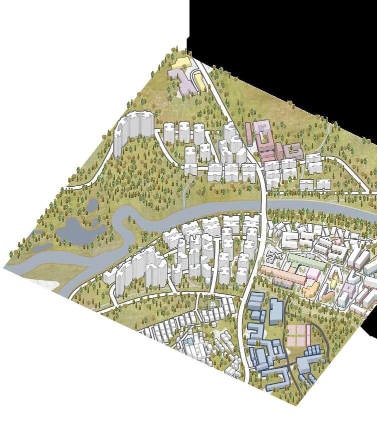
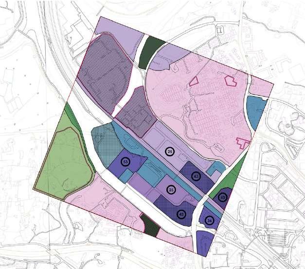
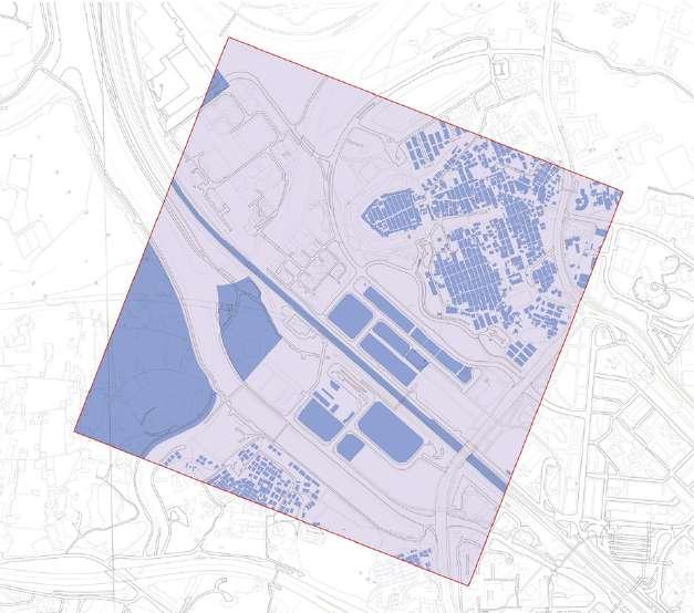
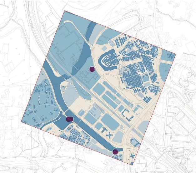
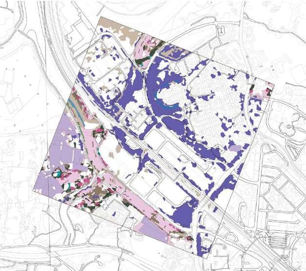
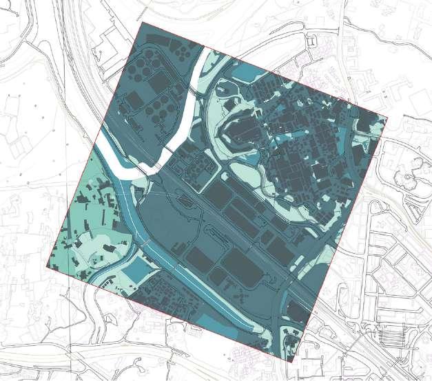
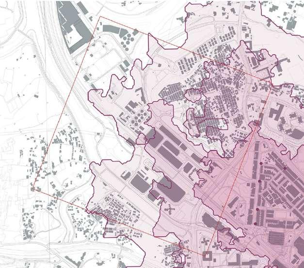
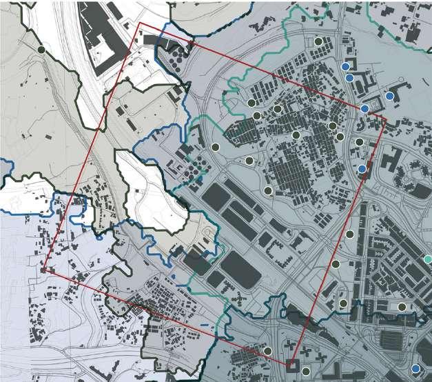
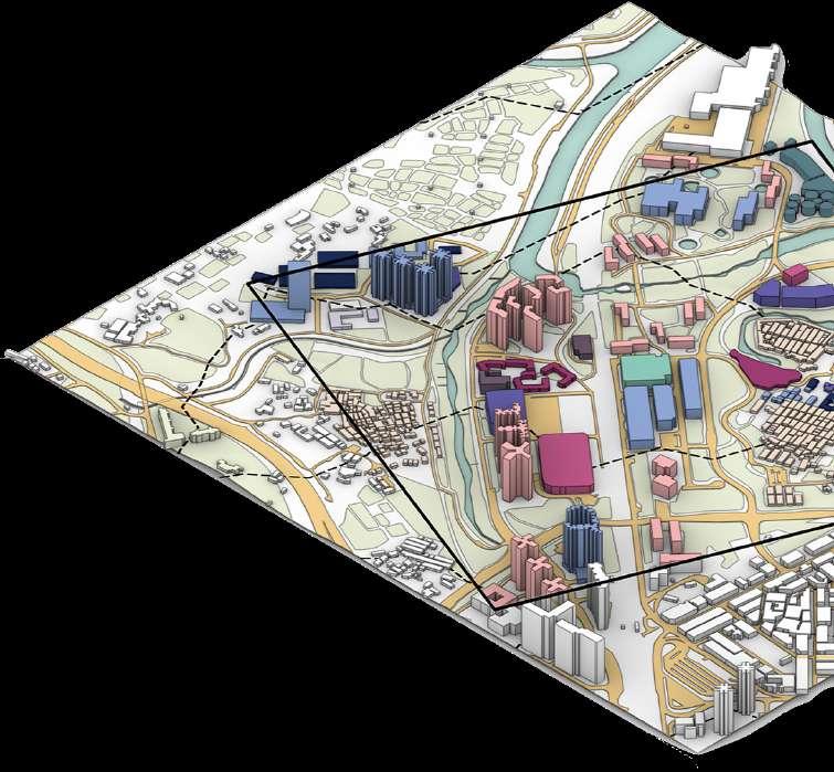
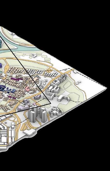
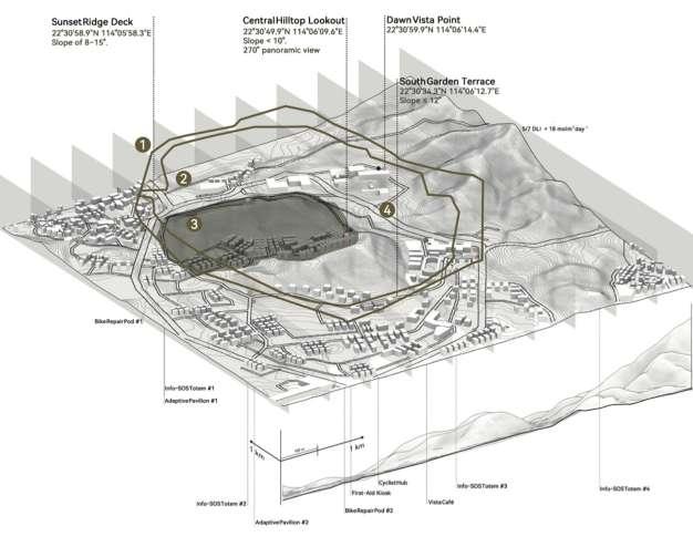
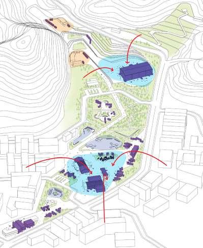
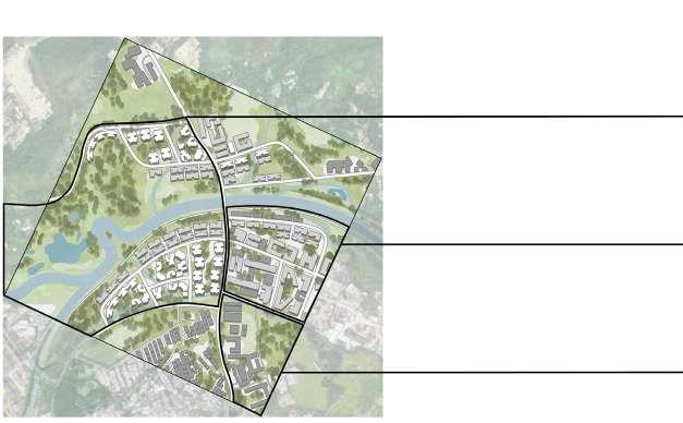
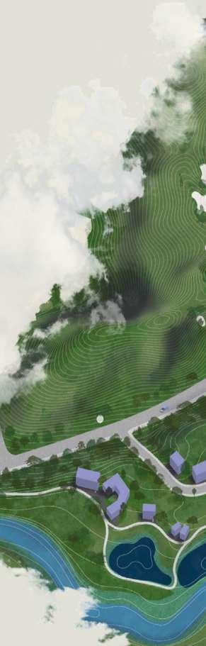
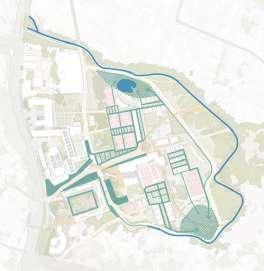
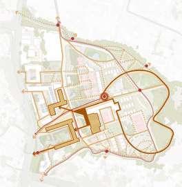
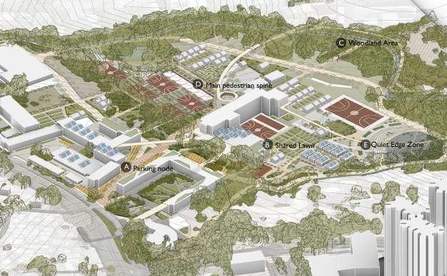
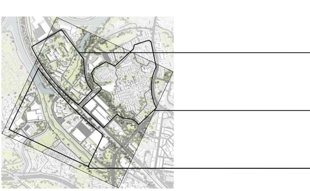
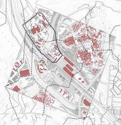
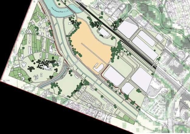
4. Sites
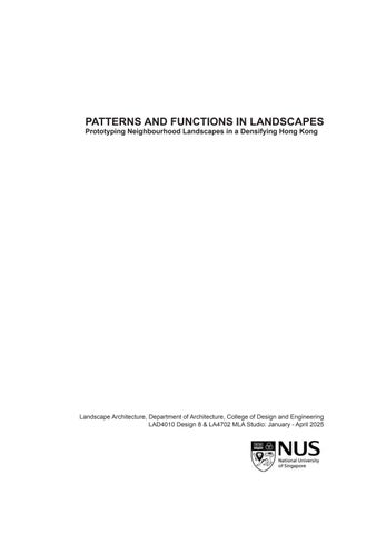
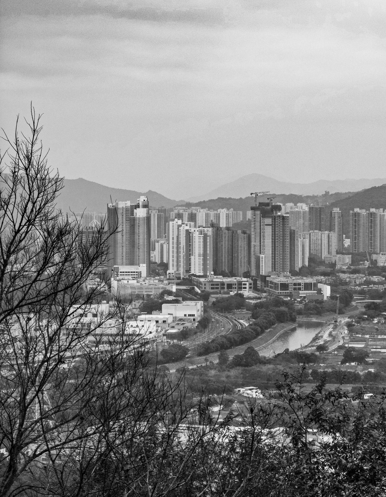
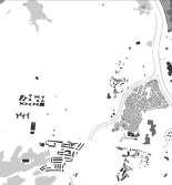
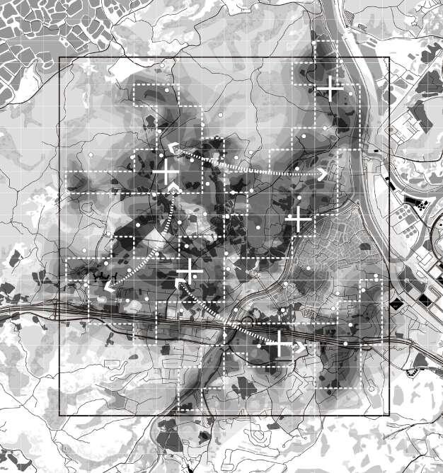
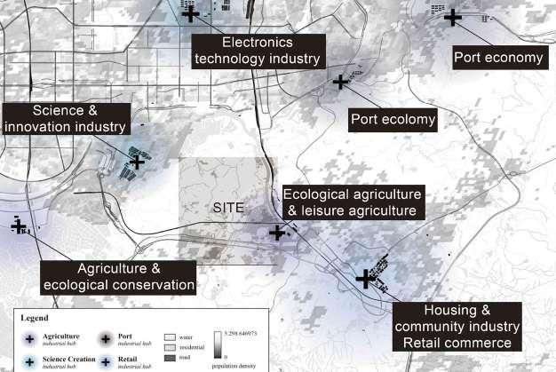
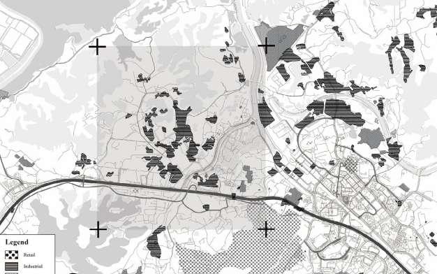
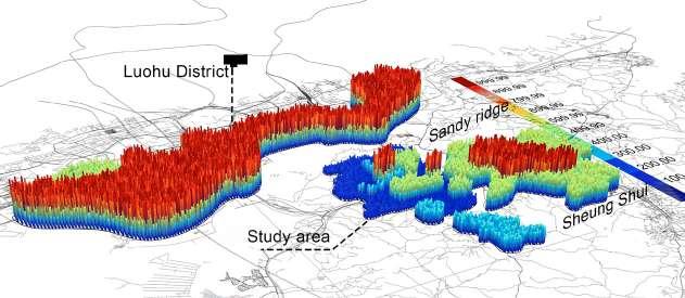
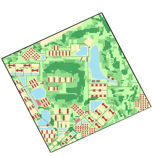
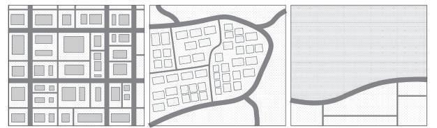
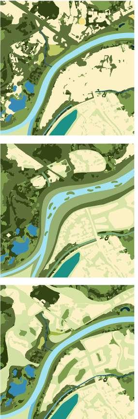
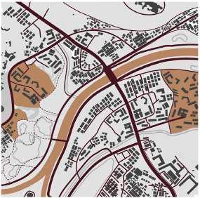
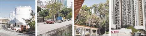
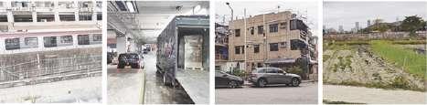
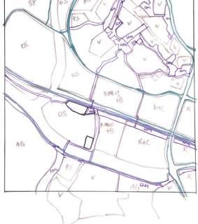
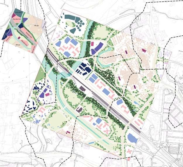
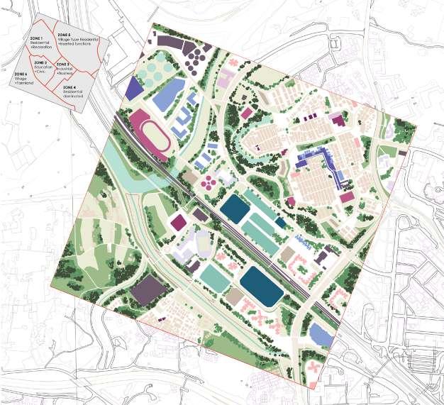
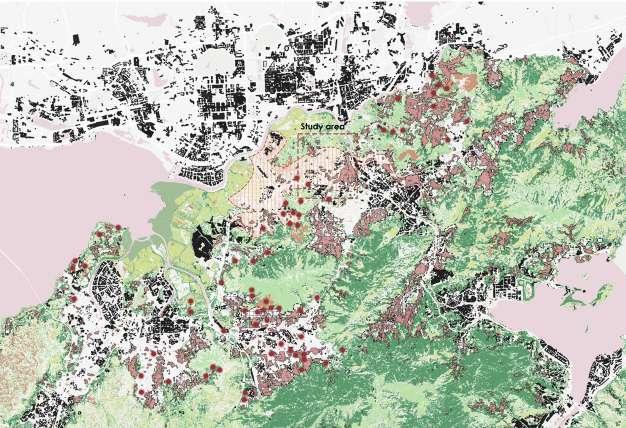
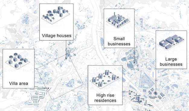
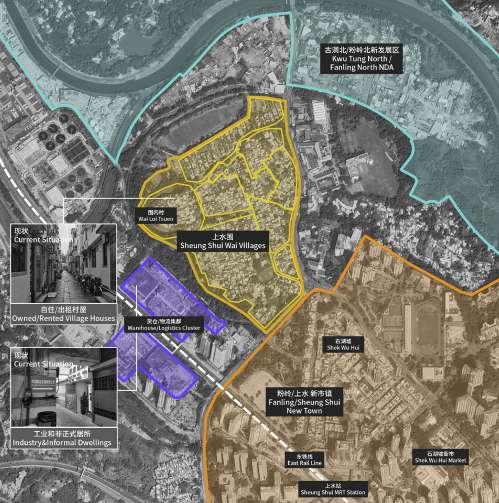
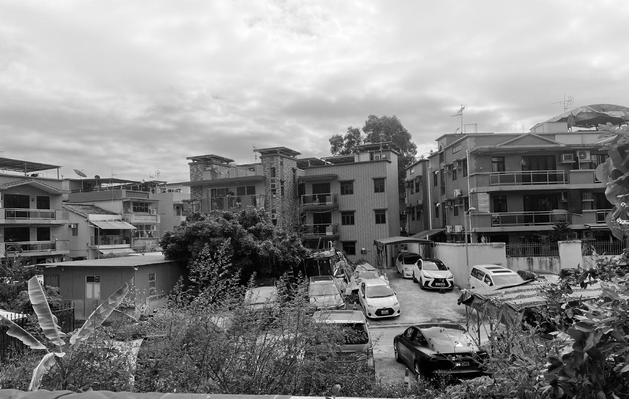
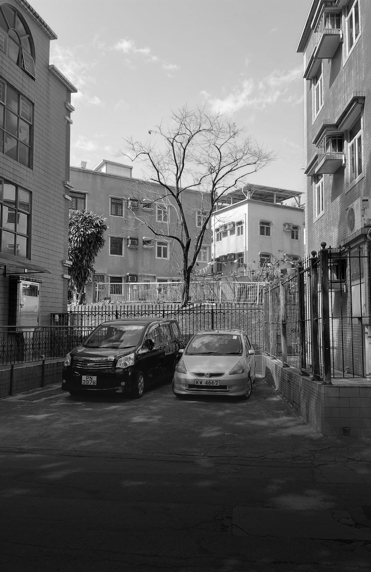
The design site is located intersection between Kwu Tung North (447ha) and Fanling North (165ha) New Development Areas (NDAs) neighbouring in the old new town Fanling / Sheung Shui. Spanning approximately 612 hectares, these new towns are designed to accommodate a population of around 175,000 upon completion9. The areas, currently characterized by scattered brownfields10 and villages, agricultural land, fish ponds, and natural habitats, support diverse flora and fauna. Although the government has committed to developing the Northern Metropolis under the “UrbanRural Integration and Co-existence of Development and Conservation” principle, the landscape of this rural expanse will inevitably undergo substantial changes. While the government’s plans aim to maintain ecological balance through the implementation of green belts, parks, and conservation areas. biodiversity loss, and flood risk, necessitating careful management, the site will feature intensive transportation networks, community facilities, recreational amenities, a mix of public and private housing, with designated zones for commercial with high dense buildings. Overall, these new towns aim to establish self-sustaining, environmentally sustainable communities equipped with all necessary amenities and services.
5. Projects
The semester-long studio comprised of the following projects:
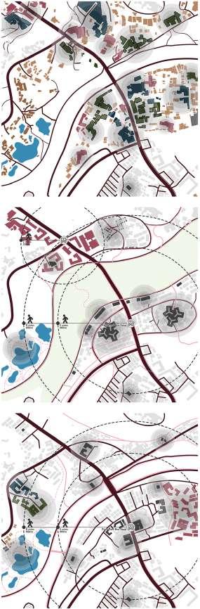
Project 1: Regional analysis
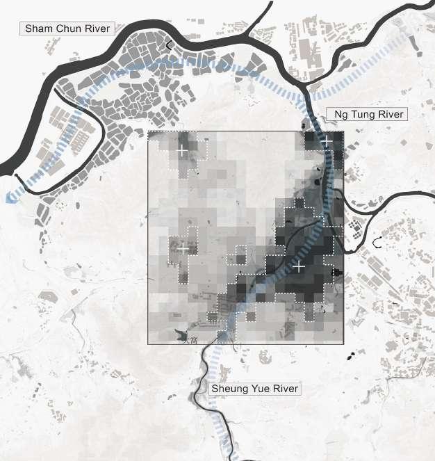
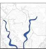
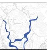
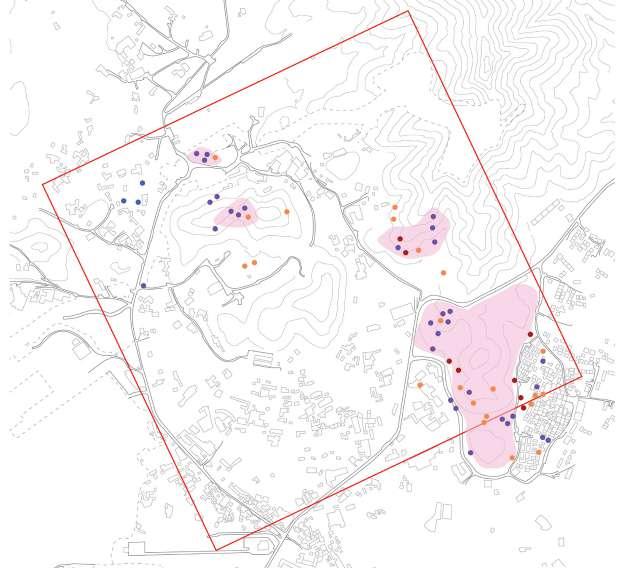
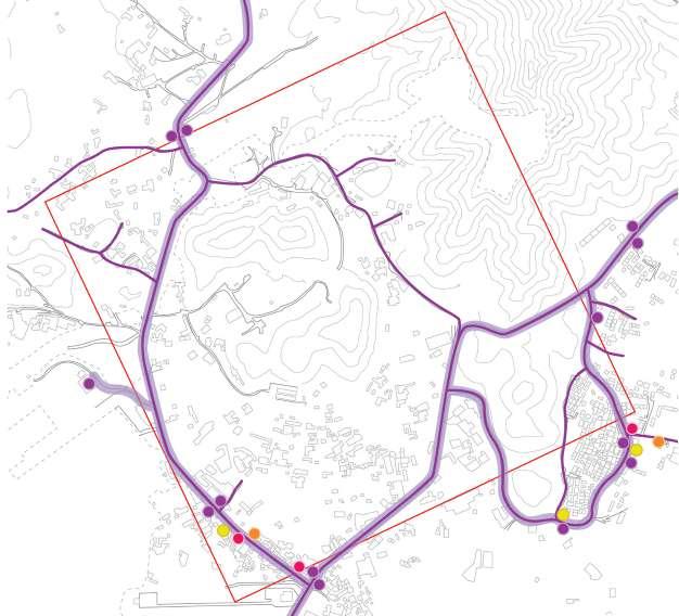
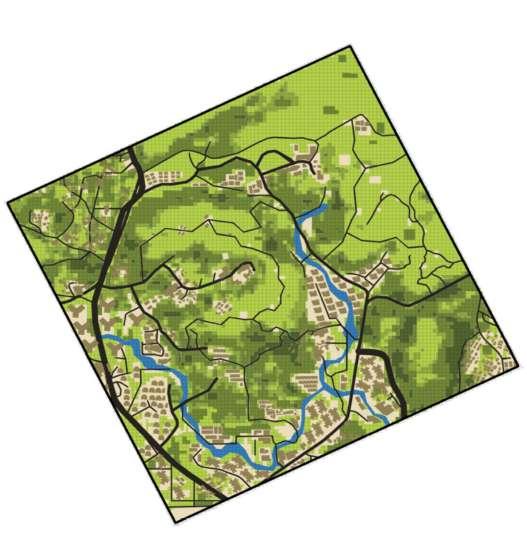
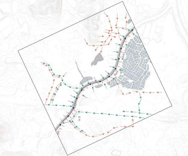
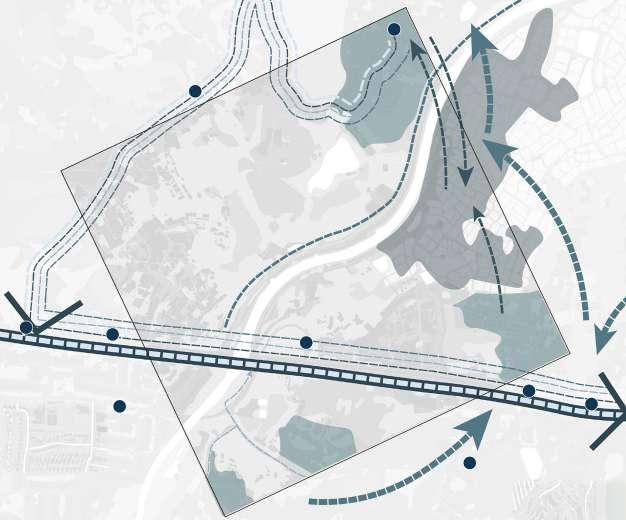
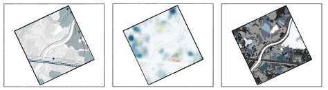
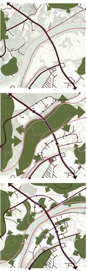
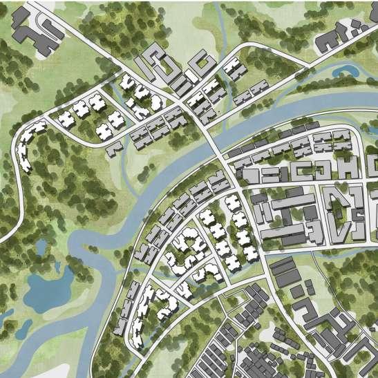
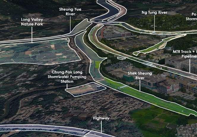
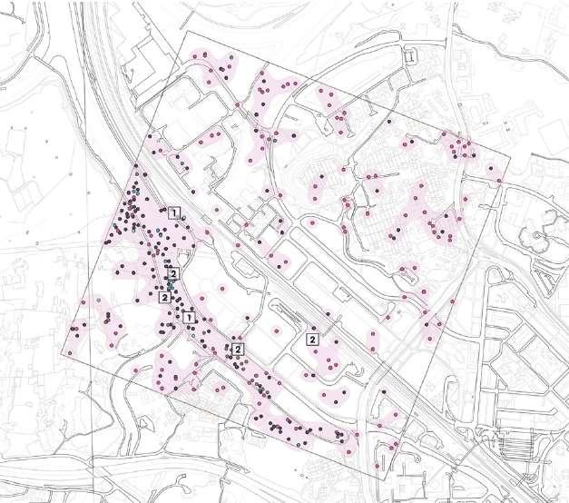
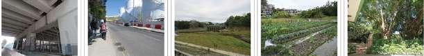
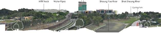
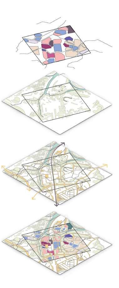
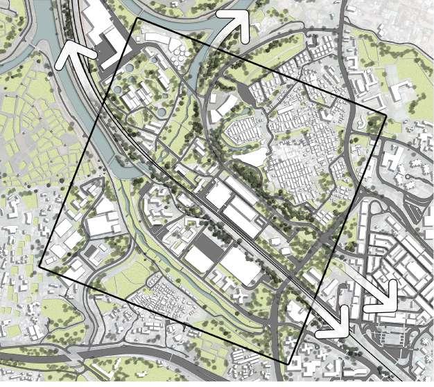
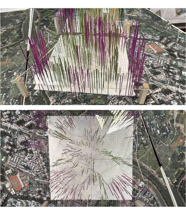
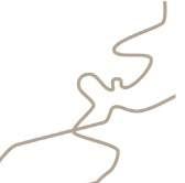
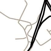
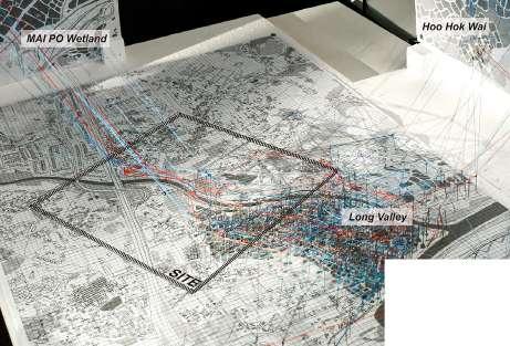
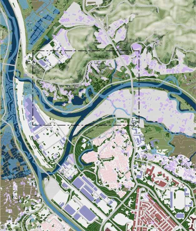
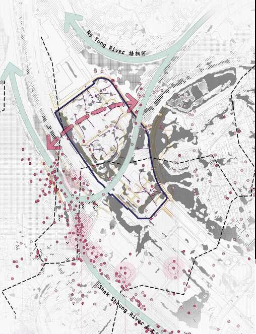
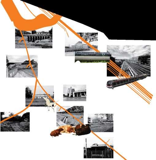
Students conducted a critical mapping of the regional context along the edges of the Sheng Yue and Ng Tung rivers, focusing on the area that connects the border between Hong Kong and Shenzhen. Using both digital and analogue modes of representation, the mapping exercises explored a 2-3 kilometer diameter site, examining the intricate relationships between natural, infrastructural, political, and socio-cultural layers that shape the landscape.
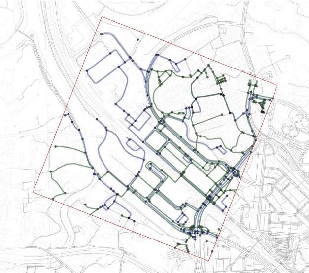
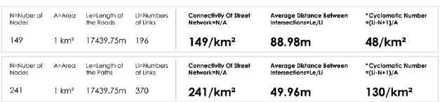
Project 2: Pattern-based planning
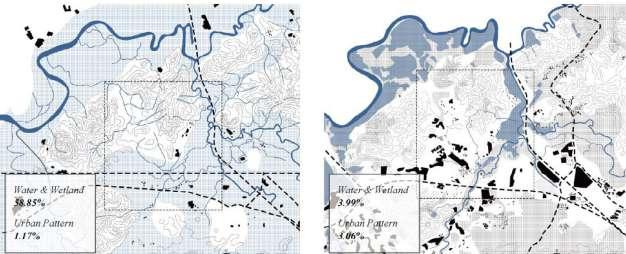
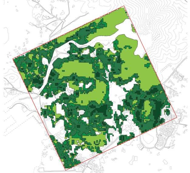
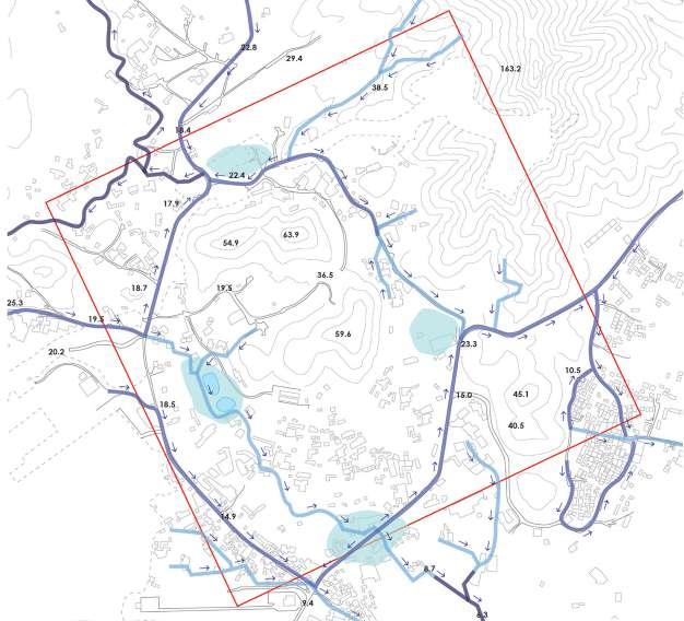
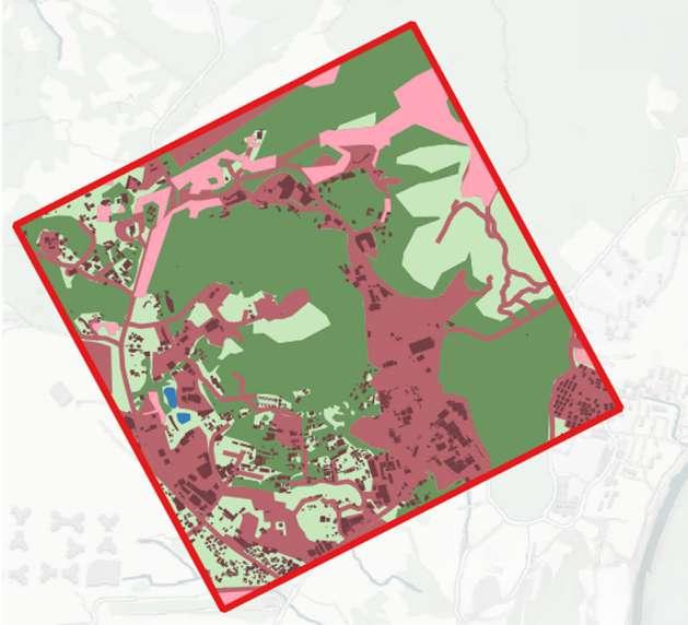
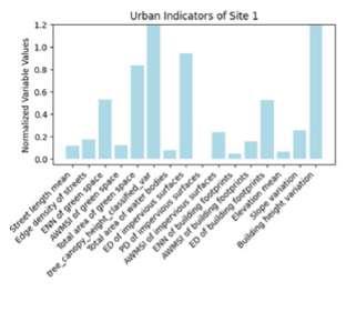
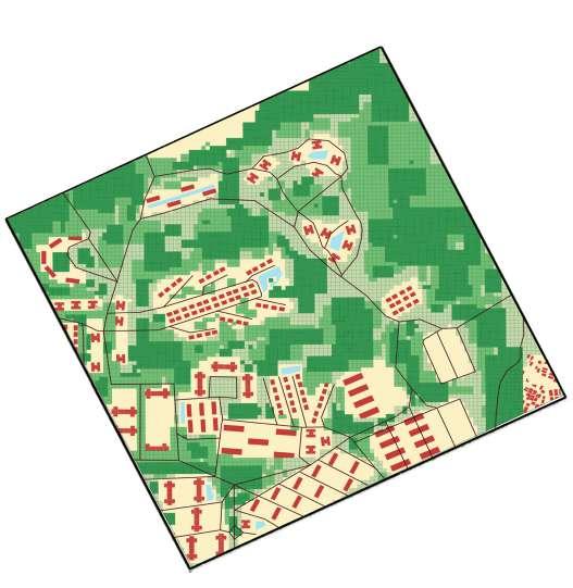
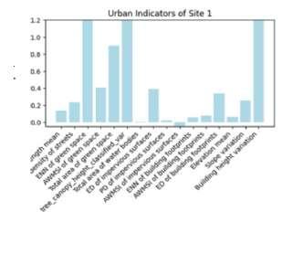
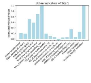
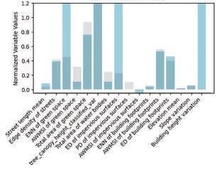
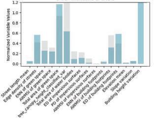
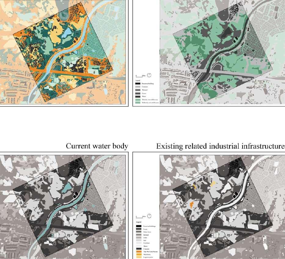
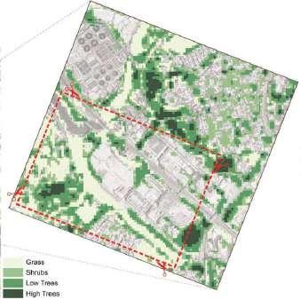
Over the second four weeks, students developed an understanding of landscape patterns and analysed site characteristics using landscape metrics within a 1 square kilometre area, considering both current and baseline conditions. The landscape pattern analysis of the site included area of green space, building footprint and height, canopy height variances, edge density, complexity of buildings, street network, area of water bodies, and permeability of surface.
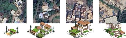
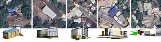
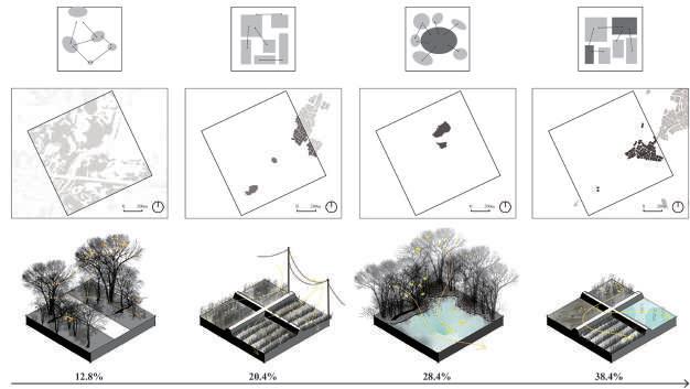
Project 3: Designing landscape typologies
In the third part of the semester, students envisioned the future of neighbourhoods and used design to actively shape ecological, economic and socio-cultural processes over the next 30 years. Through these creative narratives, multifunctional landscapes were seen as active tools for shaping new realities by reorganizing infrastructure, systems, operations, and governance. Students explored how landscape interventions can transform the sample sites through critical landscape representation.
6. Studio Format and collaborators
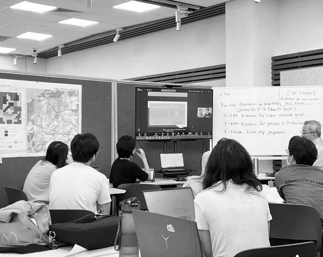
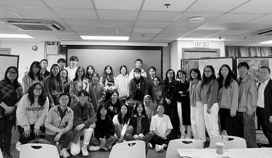
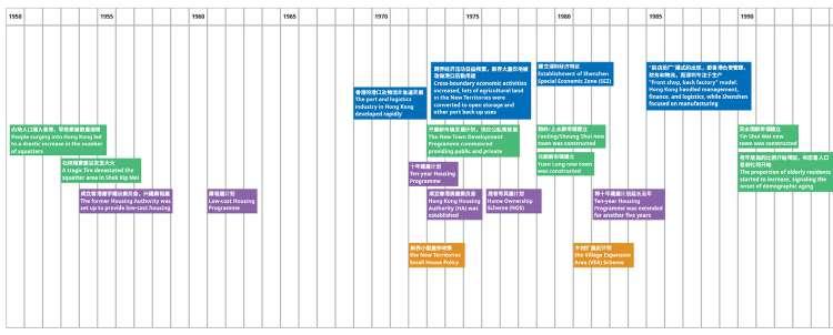
The 14-week of the studio period consisted of 7 weeks of research to understand site context, with in-depth input sessions from professionals and an overseas field trips to the site to identify problems and challenges. The latter 7 weeks focused on design application, which culminated in design solutions for the issues identified by the individual students.
This program is in collaboration with Tsinghua University Masters in Architecture programme. Students had the opportunity to share and learn from their peers’ work at the partner institution through joint review sessions and collaboration during the field trip.
Research and iterative planning proposals were conducted in collaboration with the Future Cities Lab Global (FCLG) research team at the Singapore-ETH Centre. Students were expected to utilize design tools and guidelines provided by the research team to conduct pattern analysis and design decisions which helped further their proposals, and to contribute to research findings through design development.
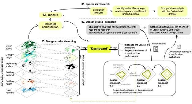
The overall design studio format is represented in the diagram below.
References
1. Development Bureau (November 18, 2016). “The New Development Areas: Introduction/ Background”. www.ktnfln-ndas.gov.hk.
2. Bolchover, J. and Hasdell, P. (2016). Border Ecologies: Hong Kong’s Mainland Frontier. Birkhäuser.
3. He, S.Y., Tao, S., Ng, M.K. and Tieben, H. (2020). Evaluating Hong Kong’s spatial planning in new towns from the perspectives of job accessibility, travel mobility, and work–life balance. Journal of the American Planning Association, 86(3), pp.324-338.
4. Shi, S. (2024). Effectiveness of Evidence-Based Design Approaches for Built Environment Professional Education: A Case Study on an Urban Design Studio. Buildings, 14(3), p.836.
5. Palermo, P.C. (2014). What ever is happening to urban planning and urban design? Musings on the current gap between theory and practice. City, Territory and Architecture, 1, pp.1-9.
6. Pickett, S. T. A., et al. (2013). “Ecological science and transformation to the sustainable city.” Cities 32: S10-S20.
7. Tan, P. Y., Liao, K. H., Hwang, Y. H., Chua, V. (2018). Nature, Place & People: Forging Connections through Neighbourhood Landscape Design, World Scientific, Singapore
8. Nassauer, J.I. and Opdam, P. (2008). Design in science: extending the landscape ecology paradigm. Landscape ecology, 23, pp.633-644.
9. Planning Department. (2019). Fanling, Sheung Shui, Kwu Tung North and Fanling North. The Government of Hong Kong Special Administrative Region. https://www. pland.gov.hk/pland_en/outreach/educational/NTpamphlets/2019/pdf/nt_fss_en.pdf
10. Liber Research Community & The Professional Commons. (2021). Rejuvenating the New Territories: Complementary Development Proposal for Future Land and Housing Projects. https://liber-research.com/en/rejuvenating-the-new-territoriescomplementary-development-proposal-for-future-land-and-housing-projects/
CHRONOLOGY
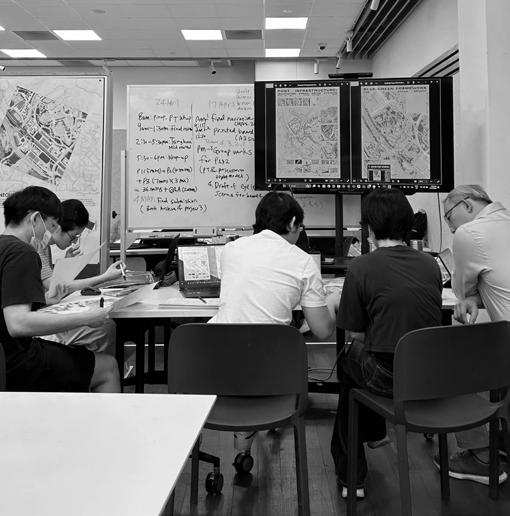
16 January - 24 April
The course objectives were introduced, and the first project launched. The research team held a workshop session to explain how to use the Dashboard to generate and project data for site analysis and decision-making.
16 January
Introductory seminar
23 January
Pin-up I and research workshop I
The research team provided a demo session on using the Dashboard with Rhino models. Then, each group presented their progress on site analysis and our goals for project 1.
01 February Pin-up II
An online consult session was held to review each group’s findings.
After weeks of research and iterative mapping, the two groups presented hypotheses and proposals for project 1.
06 February
Project 1 Presentation
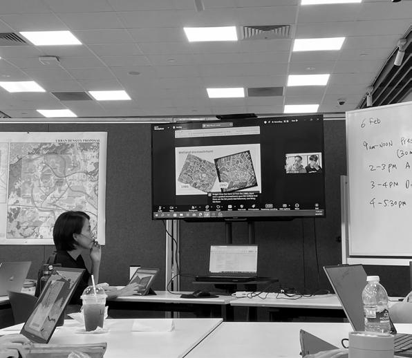
06 February Seminar and field-trip preparation
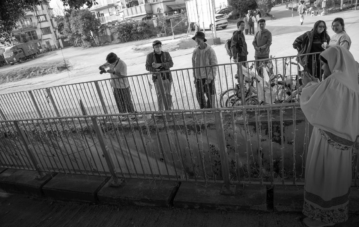
Liber Research Group presented their research on brownfields in Hong Kong. Then, students were given a final briefing before the field trip.
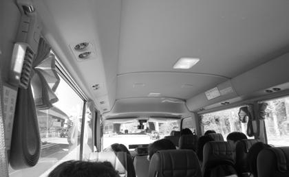
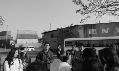
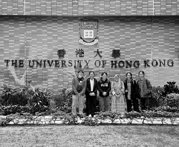
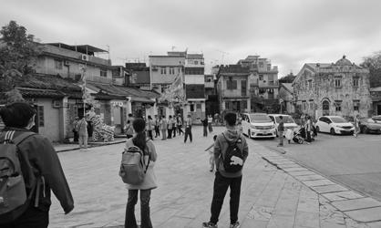
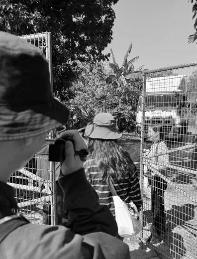
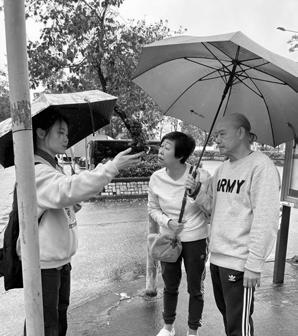
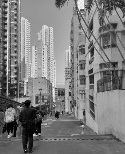
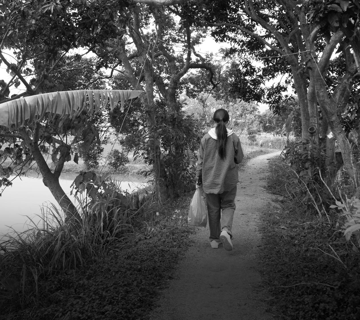
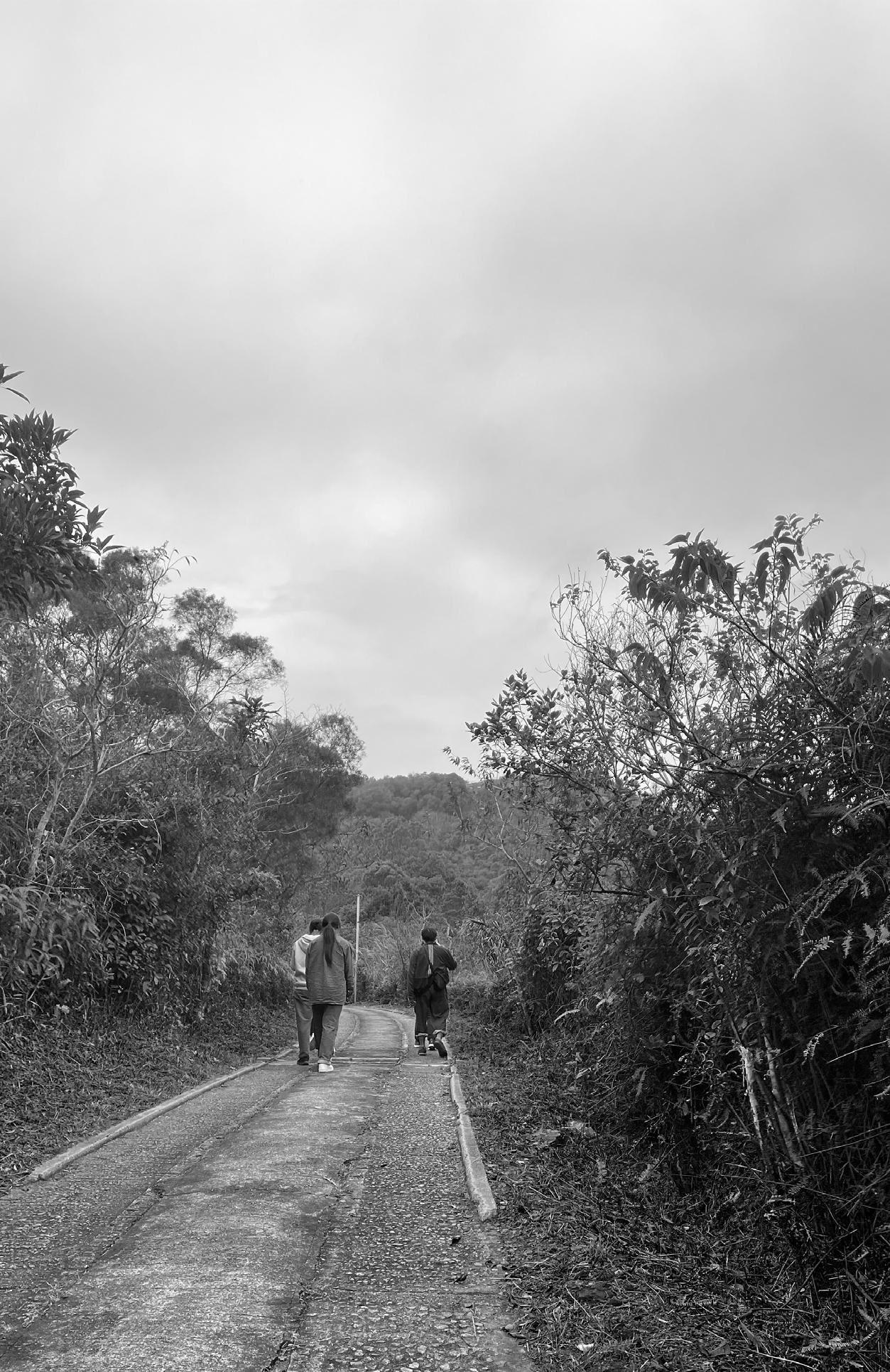
On the first day, students from NUS met at the Hong Kong University (HKU) Planning Department with students from HKU and Tsinghua University. A site visit was conducted in the afternoon to tour key areas of the site.
10
February
Introductions at HKU and site walk
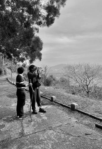
11 February
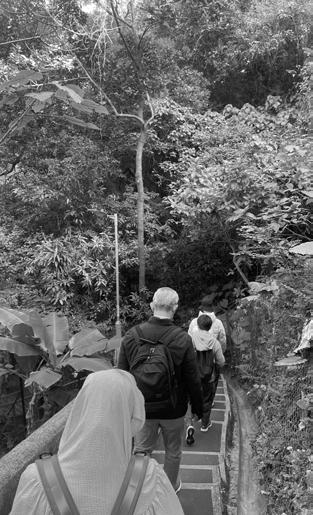
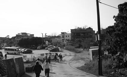
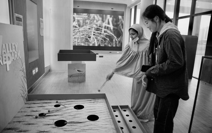
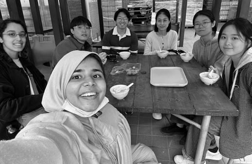
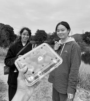
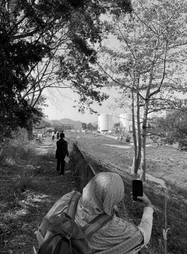
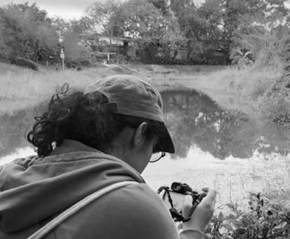
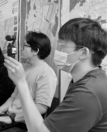
Fieldwork day 1
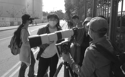
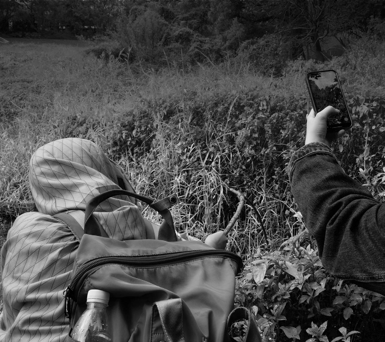
Each of the four groups explored their own sites through various ways, accompanied by students from Tsinghua University.
Students conducted interviews, identified species, collected water samples, visited markets, and more.
12 February
Fieldwork day 2
13 February
Fieldwork day 3
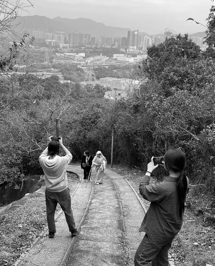
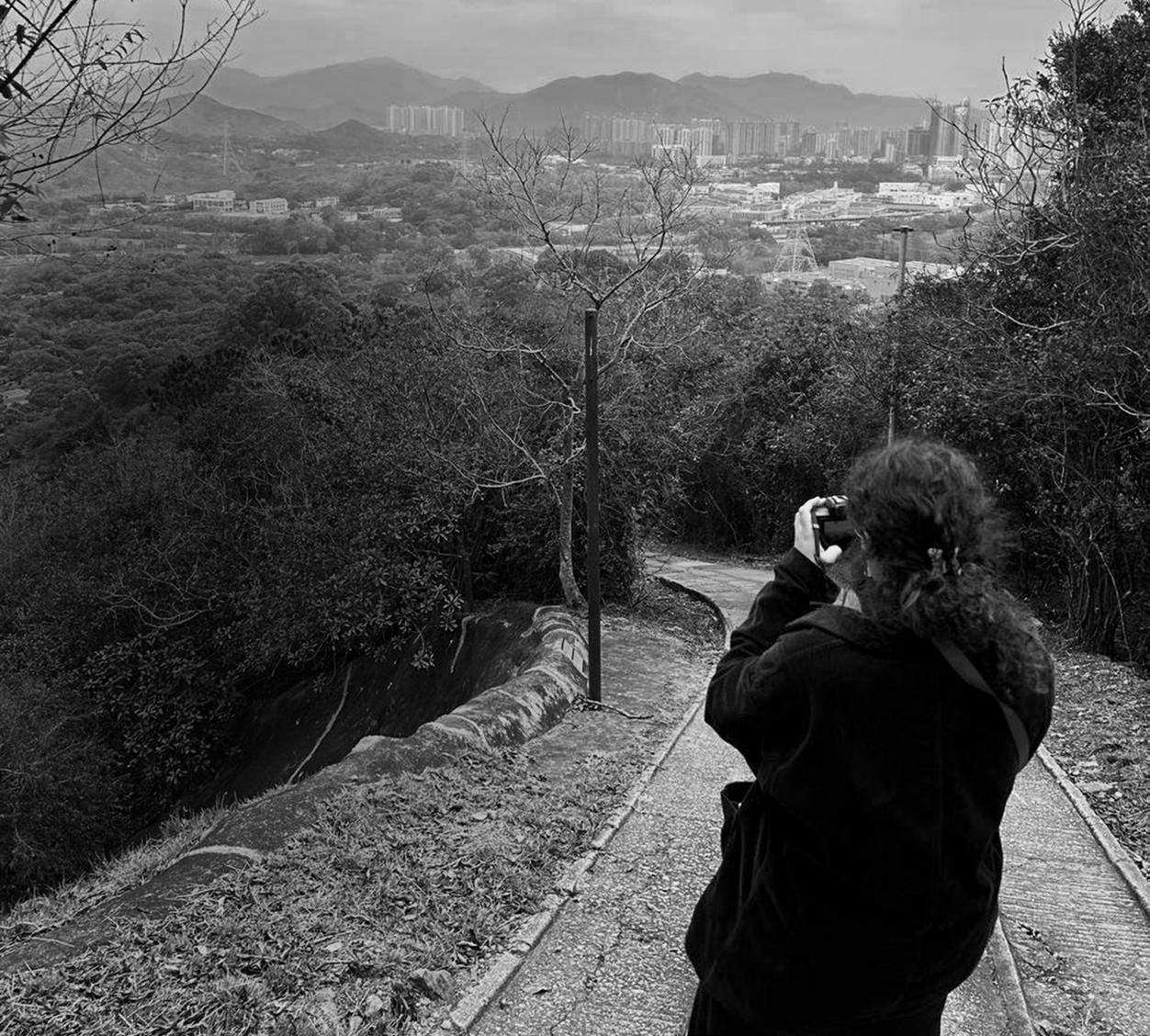
Groups 3 and 4 chose to explore nearby sites on the final day of fieldwork, gaining more insights on the wider site context.
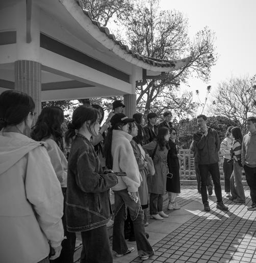
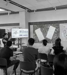
The students presented their site findings and observations at HKU, with feedback from villagers and social workers from the site, researchers, and peers.
14 February
Pecha-Kucha presentation
15 February
End of site visit
The students took this final day in Hong Kong as an opportunity to explore other sites to learn more about planning and design practices.
The studio held a reflection session on the field trip, and additional data and documentation on the sites were shared.
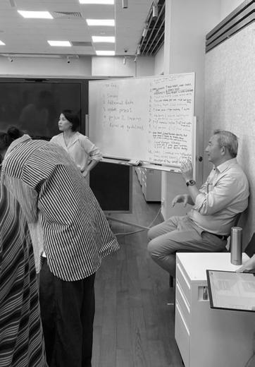
The research team held a brief dashboard workshop to refresh students’ understanding of how to utilize it for iterative pattern analysis.
20 February
Field trip reflection and research workshop II
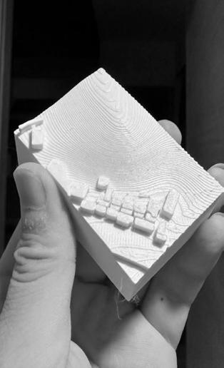
27 February Model-making
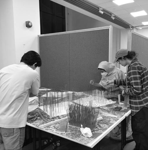
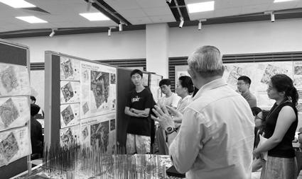
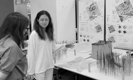
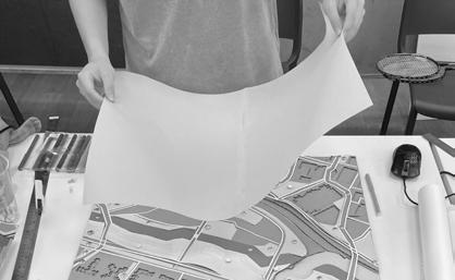
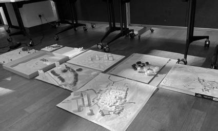
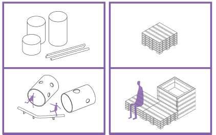
Students from each team prepared a site model for 3D printing.
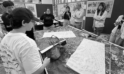
06 March Model-making workshop I
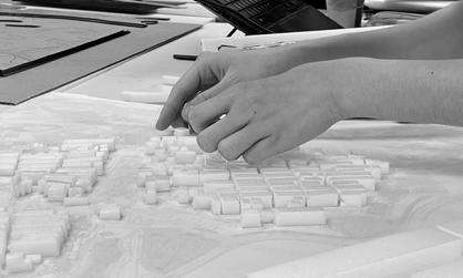
Using the 3D-printed model, the four groups used analogue methods to visualize site proposals.
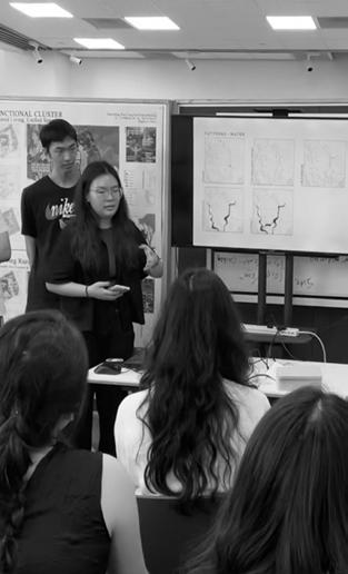
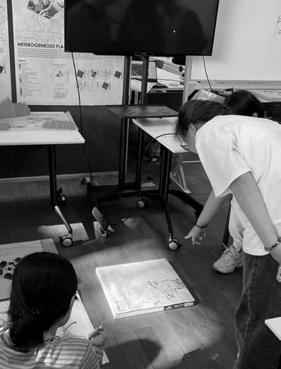
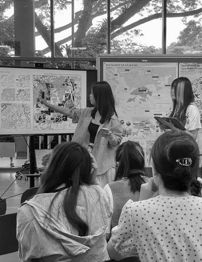
Students presented each of the four sites’ pattern analysis, iterative processes, and masterplan proposals.
13 March
Project 2 Presentation
20 March
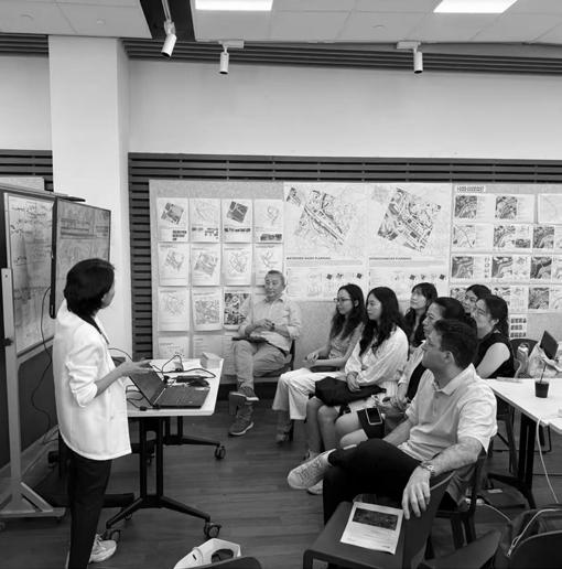
Project 2 feedback and focus group session
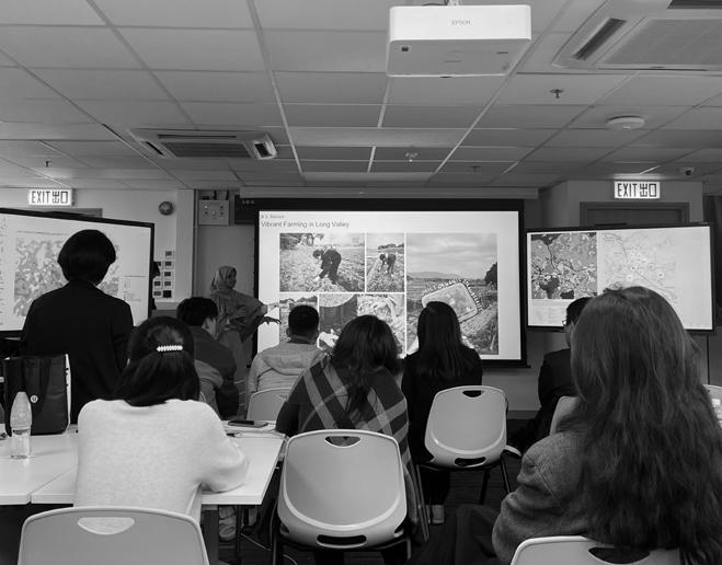
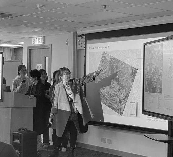
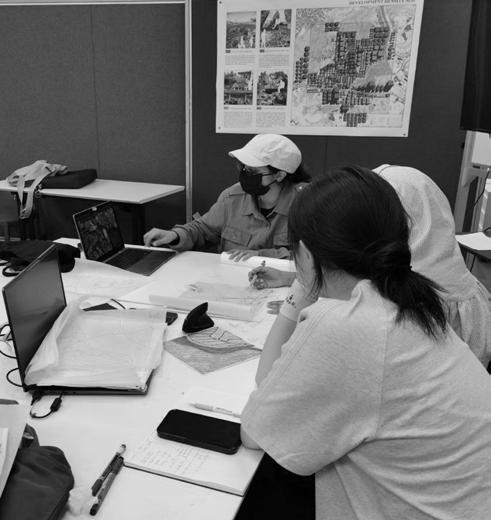
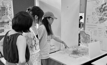
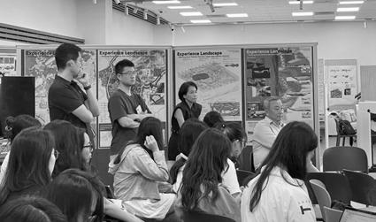
Students presented the updated project 2 proposals to Prof. Ho from HKU. The research team held a focus-group session with students to understand their use of the tools and guidelines provided. Then, project 3 was launched.
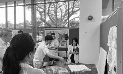
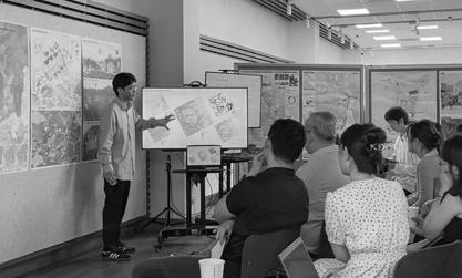
During the morning session, desk critiques were conducted to gain feedback and ideas on project 3 designs.
In the afternoon, a second model making workshop was held to create conceptual models representing key design strategies.
27 March
Model-making workshop II
03 April Consultation
Individual consultation sessions were held to finalize each student’s design scope.
10 April Consultation
Assoc. Prof. Liauw joined a few consultation sessions to provide feedback and suggestions on individual designs.
A final consultation session was held to finalize design proposals and narratives. Students worked in their respective teams to improve on the project 2 masterplans.
17 April
Final consultation
24 April
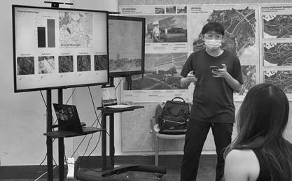
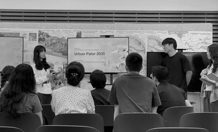
Project 3 Presentation, final review
Students presented their hard work, from site analysis to masterplanning and design conceptualization. Following NUS presentations, students from Tsinghua University presented their midterm work.
PROJECT 1: REGIONAL ANALYSIS
Nature and Culture
Team A P.36
Interconnected Densities Team B P.54
“Cities can be regarded as an urban metabolism of complex systems, in which the metabolic processes, or flows and fluxes of energy, matter, water, organisms, transportation and human movement as well as social and economic activities, determine the physical forms and spatial configurations of cities (Baccini and Brunner, 2012). Once we connect properties of urban form and their ecological processes, we would better know how a city should be designed to contain flows in sustainable and resilient ways.”
– Perry Yang, Serve-Learn-Sustain, Georgia Institute of Technology
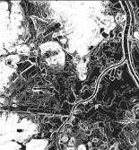
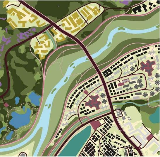
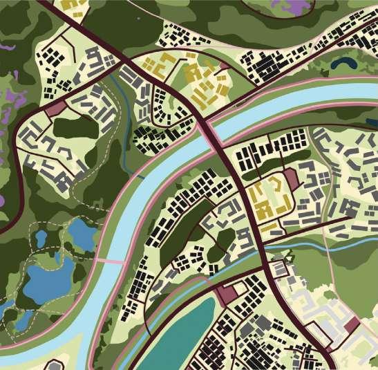
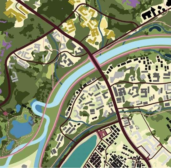
Satellite image of site at regional scale
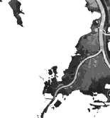
Satellite image of sites at district-scale
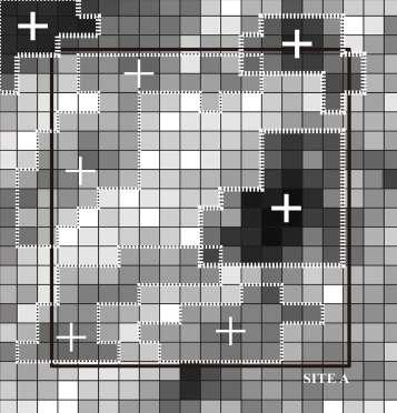
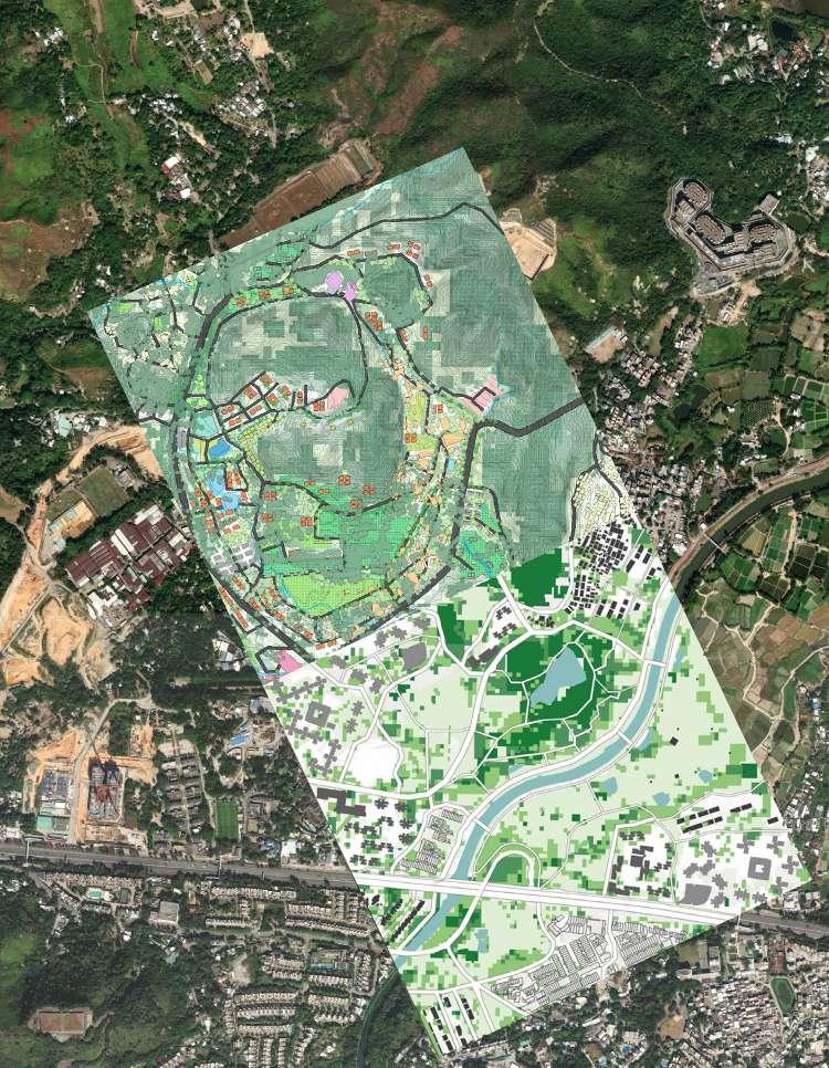
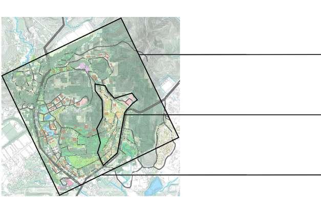
SITE A
Celebrating natural and cultural heritage, unlocking economic potentials, and enriching quality of life
Li Xiyuan | Sun Peiqiang | Lee Wen Qi Sherly Zhou Qinying | Zhou Yao | Qi Kexin | Ho Qian Yu
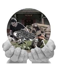
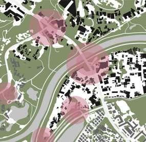
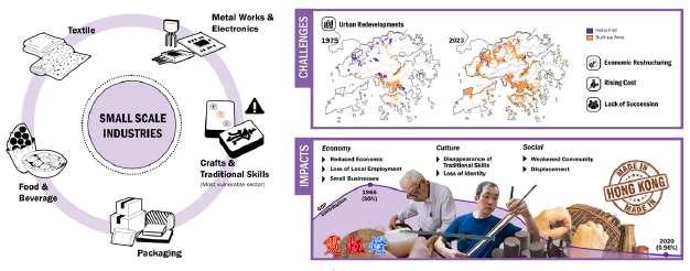
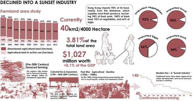
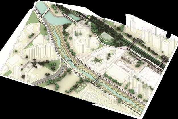
In response to rising housing demands, new development areas—large-scale expansions of existing new towns—have been introduced to manage urban growth and meet housing needs1, especially in the New Territories and northern regions, where the Hong Kong-Shenzhen border is becoming increasingly permeable. However, this new town development in Hong Kong primarily focuses on increasing housing and boosting the economy, seemingly overlooking the importance of “green and blue” spaces and threatening the local historical and cultural heritage. The culture of disappearance2 has long been a significant issue in Hong Kong, driven by socio-cultural and political shifts, sparking concerns about cultural preservation as a way to strengthen local identity3,4. Therefore, this project aims to transform the new town into a community that thrives amidst rich natural, historical, and cultural heritage while also fostering connections, growth, and innovation.
Proposed population density: 10,000/ km2
Cultural preservation and growth
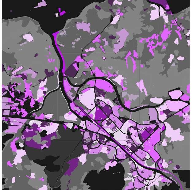
This map explores the potentials of cultural resources in site A, and assigns preservation value to each identified space or activity.2,3,4 The team suggests that preserving key resources can drive socio-cultural and economic growth.
500m
Culturally significant areas with preservation value
Declared monuments
Traditional practices
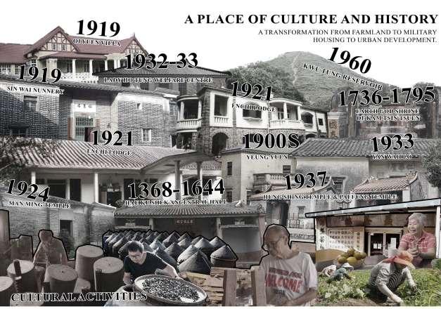
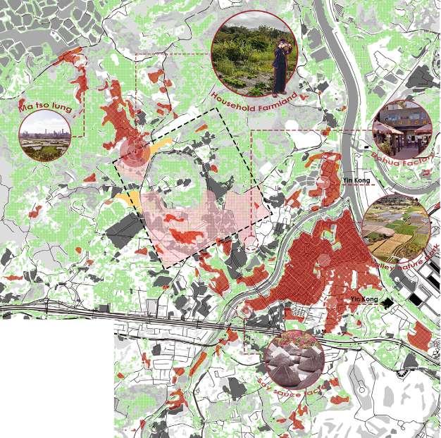
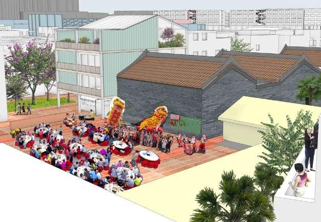
Celebrating Natural & Cultural Heritage
Key historical cultural activities and spaces within site A5 –18 reflecting the transformation from farmland to military housing, and most recently urban development.
Clan distributions within Hong Kong.5,10
Tang Man Lin Hau Pang
Natural resurces to preserve culture
This map explores the nature spaces of site A, highlighting areas of significance to be preserved11. The team hypothesizes that preserving nature spaces will, in turn, promote a stronger cultural identity within the region.
Soil
Grassland
Shrubby grassland
Woodly shrubland
Shrubland Forest Woodland
Wetland Natural water
Urban park
Other urban green
Agriculture
Drainage pipes
Building Highway
Administrative boundary
Preserved area
Potential catchment area
Historical maps of the site.1
Hydrological potential assessment within and around the site.19,20
Soil Grassland Wetland
Farmland
Building
Lake Pond Reservoir River
Hydrological distribution19,20, 21
catchment distribution19,20, 21
Key layers and species of flora and fauna within the site.24,26,27
Ecological importance assessment within site A.22–30
500m
Species distribution22–30 Amphibians, birds, fishes, mammals
Mollusks, arachnids, insects
Endangered species distribution22–30
NDVI map22–30
Endangered species
Economic potential
This map explores the macro-scale economic activities, and identifies areas for fostering economic activities within and beyond the site.1,31,32,33
8-10 min Accessibility
0-1 min
1-2 min
2-4 min
4-6 min
6-8 min
Grassland Shrubland
Woodland
Wetland
Natural water
Brownfield
Building
Unclassified road
Residential road Service road
Surrounding socio-economic zones indicate advantages of the site.31,32,33
Industrial distribution surrounding site A, revealing a homogeneous pattern likely contributing to lower income levels among residents.1
Enriching the quality of life
This map explores the macro-scale economic activities, and identifies areas for fostering economic activities within and beyond the site.
500m
Low pollution risk area (preservation priority)
Moderate pollution risk area (mitigation & adaptive growth)
High pollution risk area (intervention & remediation)
Critical zone (severe pollution)
Pollution risk area assessment corresponding to hypothesis map 4.34–42
Low Pollution Risk Areas (Preservation Priority)
Objective: Maintain and enhance cultural resources while ensuring environmental sustainability.
Strategies:
Implement heritage conservation policies for cultural sites.
Promote eco-tourism and sustainable agriculture. Encourage low-impact urban growth, ensuring new developments align with conservation goals. Enforce green building standards for any new infrastructure.
Moderate Pollution Risk Areas (Mitigation & Adaptive Growth)
Objective: Balance growth with pollution control and cultural preservation.
Strategies:
Introduce buffer zones between cultural sites and higherrisk areas.
Implement green infrastructure solutions like urban forests and wetlands to absorb pollutants. Mixed-use developments to integrate cultural spaces
High Pollution Risk Areas (Intervention & Remediation)
Objective: Reduce pollution impact and rehabilitate cultural and environmental assets.
Strategies:
Implement strict pollution control regulations. Develop waste treatment facilities and enforce waste management policies.
Establish land reclamation projects to restore degraded cultural sites.
Critical Zones (Severe Pollution)
Objective: Restrict harmful activities and prioritize environmental recovery.
Strategies:
Designate no-development zones to allow ecological restoration.
Deploy soil and water remediation technologies (e.g., phytoremediation).
Convert affected areas into green buffers Shift economic activities towards clean industries and
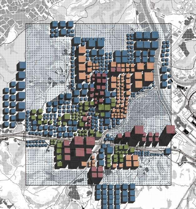
Macro-scale density map
This map proposes residential densities at the macro-scale, comparing the focus site densities to those of neighboring districts.
Macro-scale population density proposal
Site-scale spatial programming proposal
A Celebrating Natural & Cultural Heritage
Site A density map
This map proposes densities of different spatial concepts to site A; living with nature, economic and residential activities, cultural zones, and community living spaces.
Grassland
Shrubland
Woodland
Wetland
Natural water
Brownfield
Building
Unclassified road
Residential road
Service road
Secondary road Motorway
Preserved area (No development)
Nature focus (Very low human density)
Industry focus (Low human density)
Culture focus (Medium human density)
Residents focus (High human density)
Site
References
General data collection
1. HK Maps. “New HK Maps.” https://www.hkmaps.hk/viewer.html.
Culture and village lifestyle
2. Abbas, A. (1997). Hong Kong: Culture and the politics of disappearance. Hong Kong University Press.
3. Sadowski, M. M. (2017). “Urban Cultural Heritage: Managing and Preserving a Local Global Common in the Twenty-First Century.” Journal of Heritage Management, 2(2), 125-151.
4. Cartier, C. (2008). “Culture and the City: Hong Kong, 1997–2007.” The China Review, 8(2) pp. 61-84. JSTOR, https://www.jstor.org/stable/23462261.
5. Antiquities and Monuments Office. (n.d.). “Declared Monuments in Hong Kong - New Territories.” https://www. amo.gov.hk/en/historic-buildings/monuments/new-territories/monuments_123/index.html.
6. Antiquities and Monuments Office. (n.d.). “Hau Ku Shek Ancestral Hall.” https://www.amo.gov.hk/filemanager/ amo/common/download-area/pamphlet/hau_ku_shek.pdf.
7. Antiquities and Monuments Office. (n.d.). “Heritage Appraisal of Hau Mei Fung Ancestral Hall, Kam Tsin, Sheung Shui.” https://www.amo.gov.hk/filemanager/amo/common/form/dminfo/DM123_Related_Informatio n_Eng.pdf.
10. Localiiz. (2020). “Exploring Hong Kong’s Old Lineages and the Five Great Clans of the New Territories.” https:// www.localiiz.com/post/culture-local-history-old-lineages-five-great-clans-new-territories-hong-kong.
Fung Shui woodlands
11. Environmental Protection Department. (2000). “Appendix F: Description of Habitats Occurring Within 500 m of the Spur Line Alignment.” https://www.epd.gov.hk/eia/register/report/eiareport/eia_0442000/Append/Ap-F.htm.
12. Hong Kong Herbarium. (2021). “An Overview of Fung Shui Woods in Hong Kong.” https://www.herbarium.gov. hk/en/special-topics/fung-shui-woods/an-overview-of-fung-shui-woods-in-hong-kong/index.html.
Activities
13. South China Morning Post. (2014). “Living Dictionary Keeps Family History, Culture and Language Alive.”https://www.scmp.com/news/hong-kong/article/1586060/living-dictionary-keeps-family-history-culture-andlanguage-alive.
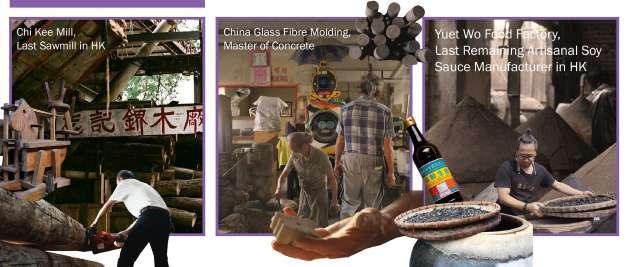
14. South China Morning Post. (2015). “The Woodworkers Keeping a Traditional Art Alive in Hong Kong.” https:// www.scmp.com/lifestyle/article/1864278/woodworkers-keeping-traditional-art-alive-hong-kong.
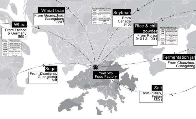
15. Zolima CityMag. (n.d.). Cha Guo Stories: Artisanal, Experimental Yuet Wo Soy Sauce in Hong Kong. https:// zolimacitymag.com/cha-guo-stories-artisanal-experimental-yuet-wo-soy-sauce-hong-kong/
16. Zolima CityMag. (n.d.). Cha Guo Stories: Community Spirit in Kwun Tong. https://zolimacitymag.com/cha-guostories-community-spirit-kwun-tung/
17. Zolima CityMag. (n.d.). Cha Guo Stories: Dragon Fruit Farm in Hong Kong. https://zolimacitymag.com/cha-guostories-dragon-fruit-farm-hong-kong/
18. Zolima CityMag. (n.d.). Cha Guo Stories: Saw Chi Kee, the Wood Mill That Built Hong Kong. https:// zolimacitymag.com/cha-guo-stories-saw-chi-kee-wood-mill-that-built-hong-kong/
Nature and biodiversity
19. Agriculture, Fisheries and Conservation Department (AFCD). (n.d.).. Introduction to Nature Conservation in Hong Kong. https://www.afcd.gov.hk/tc_chi/conservation/con_nat/con_nat_intro/con_nat_intro.html.
20. Environmental Protection Department. (2024). River Water Quality in Hong Kong in 2023. Hong Kong SAR: Environmental Protection Department.
21. Esri China (HK). Hong Kong Open Data Map Platform. (n.d.). https://opendata.esrichina.hk/ maps/9152461b7e7b4076a64594c9cb7dc2
22. Government of the Hong Kong Special Administrative Region. (n.d.). Kwu Tung North and Fanling North New Development Areas: Gazette Schemes and Plans. https://www.ktnfln-ndas.gov.hk/sc/8-1-2-Gazette-Schemesand-Plans.php.
23. Green Power. (n.d.). Hong Kong Ecological Blog: Secondary and Lowland Tropical Forests.https://www. greenpower.org.hk/chi-blog/slt.
24. Hong Kong Wetland Park (n.d.). Biodiversity and Habitat Index. https://www.wetlandpark.gov.hk/tc/biodiversity/ hab-index.
25. Hong Kong Wetland Park (n.d.). Location Map. https://www.wetlandpark.gov.hk/tc/information/location-map.
26. iNaturalist. Tree Observations in Hong Kong (2022-2025). https://www.inaturalist.org/ observations?captive=false&created_d1=2 022-01-01&created_d2=2025-01-29&d1=2022-01-01&d2=2025-01-29&iconic_ taxa=Plantae&nelat=22.522646106791452&nelng=11 4.1391716726363&q=tree&subview=map&swlat=22.426361566822262&swlng=113.95927054958942.
27. iNaturalist. Threatened Species Observations in Hong Kong (2020-2025). https://www.inaturalist.org/ observations?captive=false&creat ed_d1=2020-01-01&created_d2=2025-01-29&d1=2020-01-01&d2=2025-01-01&iconictaxa=Ave s,Amphibia,Reptilia,Mammalia,Actinopterygii,Mollusca,Arachnida,Insecta&nelat=22.52851301507613&nelng=114.12466628628376&subview=map&swlat=22.491404591 112005&swlng=114.08767325955036&threatened.
28. JC Wise. JC Wise: Jockey Club Water Initiative on Sustainability and Engagement (n.d.). https://www.jcwise. hk/.
29. Kwu Tung North and Fanling North New Development Areas, First Phase (n.d.). Water Resources Management. https://www.ktnfln-ndas-firstphase.hk/cn/Water.
31. China Development Institute. (2023). Shenzhen and Hong Kong Twin-City Cooperation to Jointly Build an International Technology Innovation Center. https://en.cdi.org.cn/component/k2/item/550-shenzhen-and-hongkong-twin-city-cooperation-to-jointly-build-an-international-technology-innovation-center
32. Government of the Hong Kong Special Administrative Region. Northern Metropolis Development Strategy Report. https://www.policyaddress.gov.hk/2021/chi/pdf/publications/Northern/Northern-Metropolis-DevelopmentStrategy-Report.pdf.
33. Hong Kong Special Administrative Region Planning Department. (2021). Northern Metropolis Development Strategy. Hong Kong Special Administrative Region Government.
Pollution/Quality of life
34. Bibri, S.E., Krogstie, J. and Kärrholm, M. (2020). Compact city planning and development: Emerging practices and strategies for achieving the goals of sustainability. Developments in the built environment, 4, p.100021.
35. Cooper, C. and Sarkissian, W. (1986). Housing as if People Mattered: Site Design Guidelines for the Planning of Medium-Density Family Housing.
36. Debbage, N. and Marshall-Shepherd, J. (2015). “The Urban Heat Island Effect and City Contiguity.” Computers, Environment and Urban Systems, vol. 54, 2015, pp. 181-194.https://doi.org/10.1016/j.compenvurbsys.
37. Environmental Protection Department Statistics Team. (2024). Hong Kong Solid Waste Monitoring Report: 2023 Waste Statistics. Hong Kong SAR: Environmental Protection Department Statistics Team.
38. European Commission, Joint Research Centre (JRC). (2023). GHS-POP R2023A - GHS population grid multitemporal 1975-2030. http://data.europa.eu/89h/2ff68a52-5b5b-4a22-8f40-c41da8332cfe, DOI: 10.2905/2FF68A52-5B5B-4A22-8F40-C41DA8332CF.
39. Kolokotsa, D., Aikaterini, A. L., Maria, A. L., Nikolaos, P. N. (2020). On the impact of nature-based solutions on citizens’ health & well-being. Energy and Buildings, 229, 110527.
40. Planning Department. (2019). Agreement No. CE40/2016 (TP): Study on Existing Profile and Operation of Brownfield Sites in the New Territories – Feasibility Study: Final Report. Hong Kong SAR: Planning Department. https://www.pland.gov.hk/pland_en/info_serv/open_data/landu/
41. Sarkar, C., Lai, K. Y., Kumari, S., Leung, G. M., Webster, C., & Ni, M. Y. (2021). Characteristics of the residential environment and their association with depression in Hong Kong. JAMA Network Open, 4(10), e2130777. https:// doi.org/10.1001/jamanetworkopen.2021.30777
42. Wong, S., Moore, M., and Chin, J.K. (2008). Hong Kong: Demographic Change and International Labor Mobility. PECC-ABAC Conference on International Labor Mobility. Seoul, Korea. Pacific Economic Cooperation Council. Site A
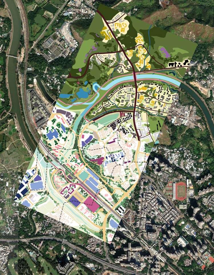
Interconnected Densities
Our proposal aims to focus on densification of both human development as well as ecologies. We anticipate growth of the human population, spatially represented through vertical layering of multifunctional urbanized spaces1- through this approach of land-sparing,2 we are able to allocate more land to fulfill natural and ecological functions. This allows us to use nature as a guiding tool for land use planning and connectivity.3,4 First by preserving, improving, and expanding the conditions of large patches of nature. This, in turn, can help patches of nature infiltrate the urban canvas through the growth of smaller patches of nature within the site.5 Eventually leading to form complex networks of high ecological value, simultaneously benefitting human use through improved health, economy, and resources.5 Our proposal strives to define a novel model for compact cities by emphasizing the significance of nature as critical building blocks for cities.
Proposed population density: 13,500/ km2
Lina Altoaimi | Mariam Yusuf Rajkotwala | Pan Yuwen
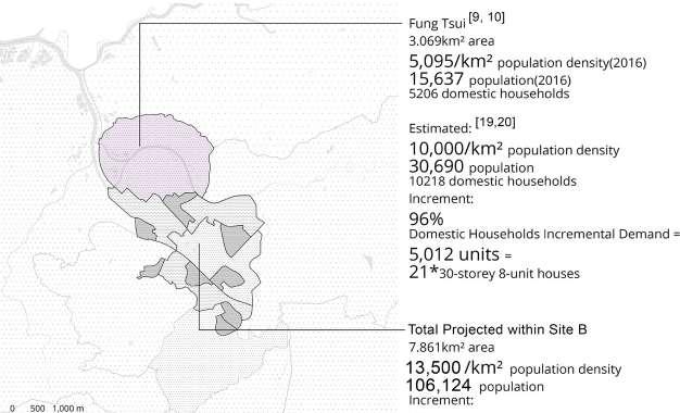
This map explores the current situation of integrated land use on Fanling’s site through understanding its historic conditions.6 The map aims to find potential land for intensive development to meet the multiple needs of new towns.7,8,9,10 Mapping the population growth helps us to determine areas with a need for densification. Furthermore, understanding the existing land-use planning system and population distributions allows us to propose zones for different types of densification.11 – 16
Existing and projected population densities around site B.11,12, 17 – 21
Interconnected Densities 1km
Population / km2
<1,000 1,000 - 5,000 5,000 - 10,000
10,000 - 20,000
20,000 - 50,000
>50,000
The different configurations of residential blocks affect open space and connectivity.
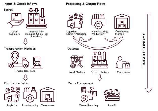
Economy
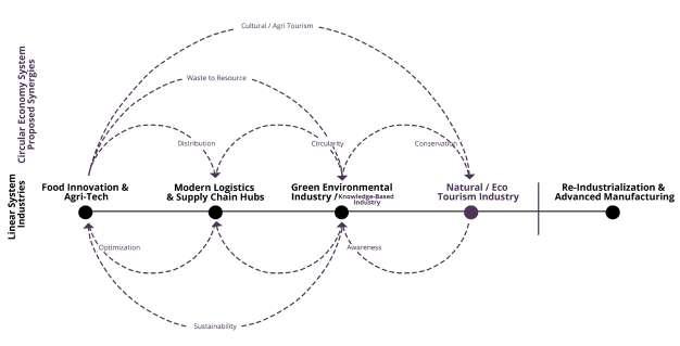
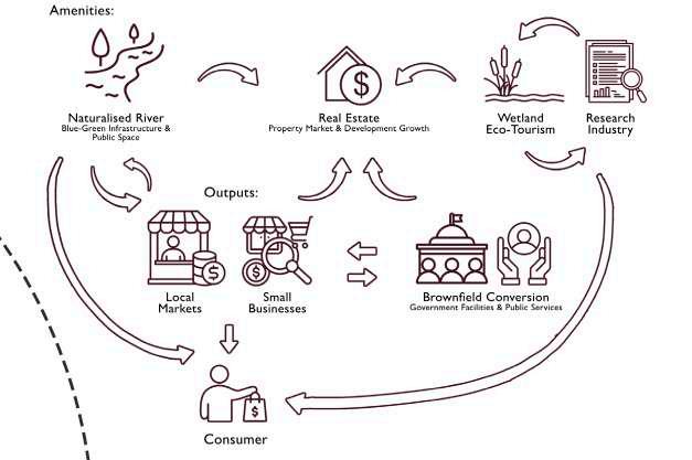
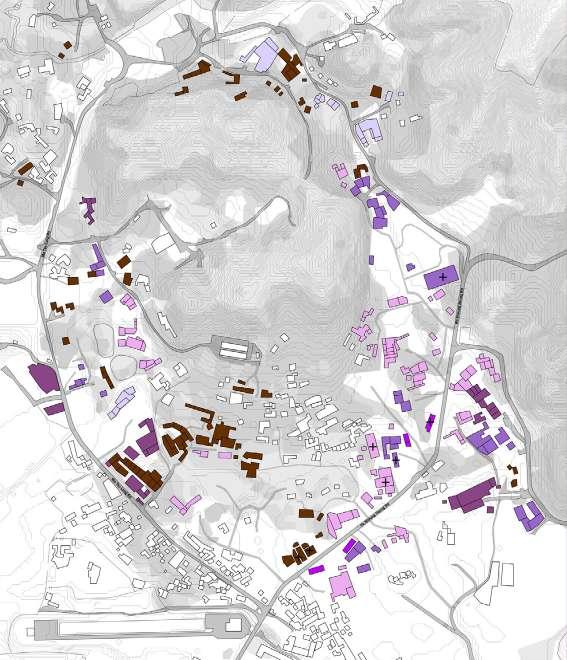
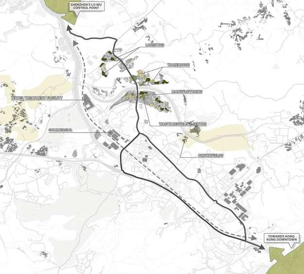
This map explores Fanling’s economic landscape by identifying industries,20 transportation networks,15,16 and their spatial relationships using four criteria: economic impact, land use and real estate impact22, employment and workforce,23,24 and resource dependencies.25,26 This understanding may inform strategic planning, guiding future economic growth through various proposed industries while balancing urban densification with ecological preservation through possible circular economies.27,28
Commercial
Warehouse/ container
Logistics
Manufacturing / repair
Technology
Other industries
Brownfield
Water treatment Highway Main
Secondary
Bus/ truck route
Train
Economic impact
Land use & real estate impact
Employment rate
Resource dependency
Proposed circular economy industry boundary
*Each ring represents the intensity of industrial impact across key factors 500m
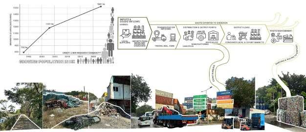
Brownfield, often consisting of warehouses, logistics, and other low-intensity industries, have grown significantly in the past 25 years.
These industries contribute to a very linear economy.13
Brownfield in 2025 Brownfield in 2000
500m
Drawing inspiration from existing conditions, we propose to introduce industries that can contribute to a more circular economy.
Environment and wellbeing
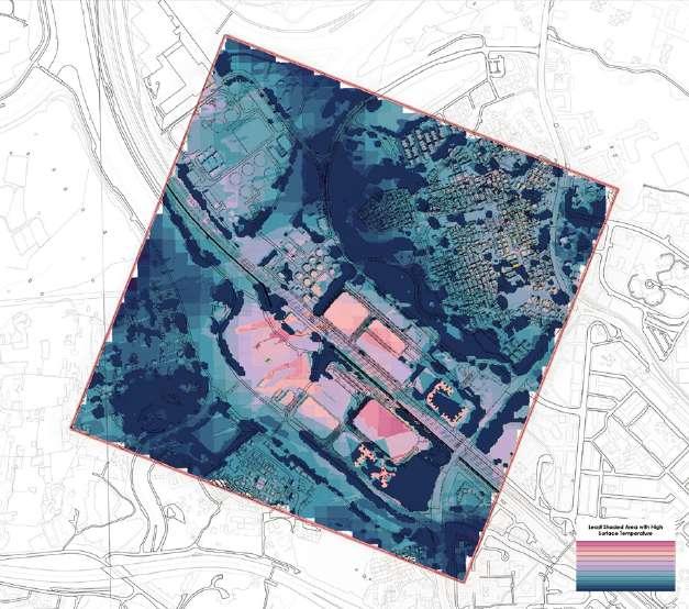
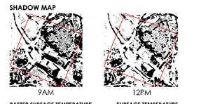
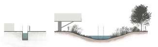
This map explores various landscape elements which may affect the health of residents of Fanling town, and the wellbeing (such as biodiversity) of ecological systems on site. A correlation between brownfield sites and higher surface temperature is indicated on the map, suggesting these spaces for design interventions to alleviate poor urban conditions.29,30,31 This map hypothesizes that reintroducing the natural river form may benefit the health of humans and improve ecological conditions on site.32
Shrub & grassland
Agriculture
Urban green
Current (post-2000s) waterway
Historic (pre-1900s) waterway Road
Highway & main road
Tall buildings (>10m)
Brownfield
Other impervious surface
Areas with higher relative heat (>21Cº)
Woodland
500m
Interconnected Densities
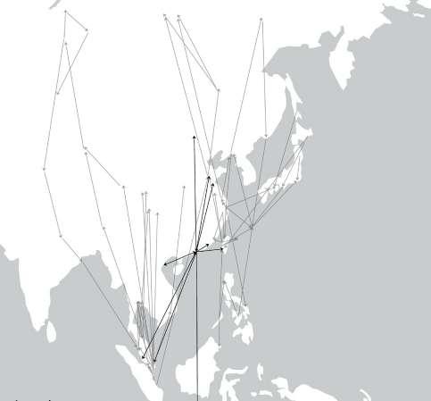
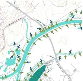
Avian flight patterns to and from site on the global scale.33,34,35
Bird species within site B.36 – 40
Flight patterns to and from site
Other regional flight patterns
2021 Survey 2023 Survey (limited to south of site) 2025 ebird.org data
500m
Site B
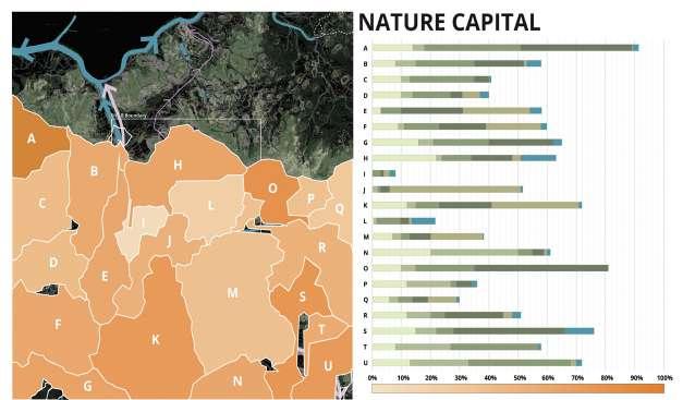
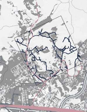
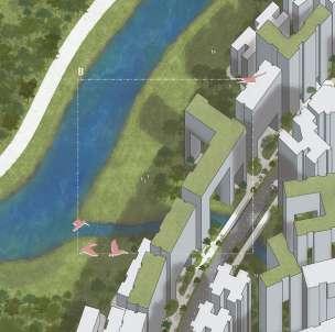
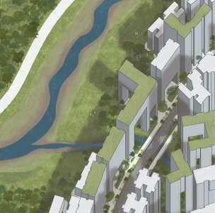
Watershed and flows
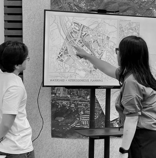
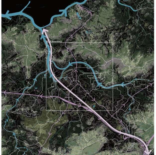
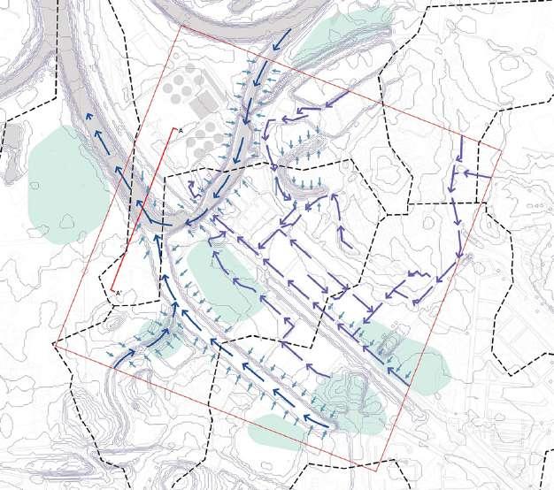
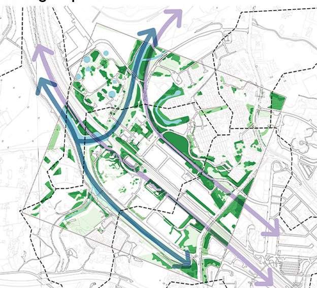
This map explores how watersheds and urban planning interact by comparing natural water catchments with existing roads, buildings, and topography.7,8,9 It aims to show how water flow influences city development and where mismatches may occur.41,42 This approach helps identify nature capital for each watershed and potential conservation areas, providing insights into where green spaces can be densified. It guides how our proposal can develop while working with natural water boundaries for a more sustainable environment.
1m contour lines
Interconnected Densities
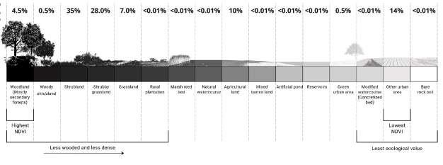
Percentages of habitats and types of spaces found in site B, classified as highest ecological values to lowest.35,38
Catchment areas surrounding the site, with various percentages of nature capital. The colours on the chart correspond to the different habitats shown on the hypothesis 4 map.41,42
Site B
Final combined map
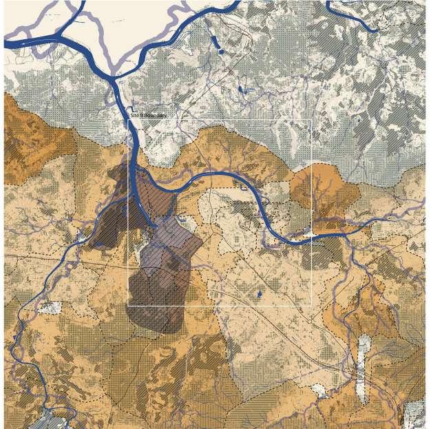
This map visualizes different interactions to assess the balance between ecological preservation and urban development. By layering old river flow, catchment boundaries, habitat types, natural resource distribution, and planned industry zones, it highlights key areas where natural landscapes and human activities intersect. This approach helps recognize nature capital within each watershed, guiding strategies for conservation and sustainable land use.
Woodland Shrubland Grassland Agricultural land
Proposed industrial area
Interconnected Densities
Proposal map: Interconnected Densities
Human population growth is spatially represented through vertical layering of multifunctional urbanized spaces1. Using the approach of land-sparing,2 we allocate more land to fulfill ecological functions to use nature as a planning tool.3,4 Thus, patches of nature spread through the urban site via placement of smaller patches.5 Eventually leading to form complex networks of high ecological value, simultaneously benefitting human use.5
Human and nature densities
Increase of 1000 people / cube 2% increase of natural resources / cube
Site B
References
Referenced proposal strategies
1. Shelton, B., Karakiewicz, J. and Kvan, T., 2013. The making of Hong Kong: from vertical to volumetric. Routledge. pp. 155-164.
2. Tan, P. Y., Rinaldi, B. M. (2019). Landscapes for compact cities. Journal of Landscape Architecture, 14. 1. pp. 4-7.
3. Tan, P.Y., Liao, K.-H., Hwang, Y.H., Chua, V., Guizzo, A.O., and Chan, J. (2018). ‘Designing neighbour-hood landscapes with landscape services’, in P.Y. Tan, K.H. Liao, Y.H. Hwang, and V. Chua (eds.), Nature, Place and People: Forging Connections through Neighbourhood Landscape Design, New Jersey: World Scientific. pp. 95210.
4. McHarg, I. L. (1969). Design with Nature.
5. Dramstad, W.E., Olson, J.D. and Forman, R.T. (1996). Landscape ecology principles in landscape architecture and land-use planning. Cambridge: Harvard University Graduate School of Design.
History and policy
6. Hong Kong Historic Maps. (n.d.). HK Maps. https://www.hkmaps.hk/viewer.html
7. Hong Kong Map Service. (n.d.). HK Map Service.https://www.hkmapservice.gov.hk/OneStopSystem/mapsearch?product=OSSCatB
8. Lands Department– Hong Kong Special Administrative Region. (2025). GeoInfo Map 2.86.2. GeoInfo. https:// www.map.gov.hk/gm/map/
9. Lands Department– Hong Kong Special Administrative Region. (n.d.). Town Planning Board Statutory Planning Portal 3. SPP3. https://www.ozp.tpb.gov.hk
10. Civil Engineering and Development Department– The Government of Hong Kong Special Administrative Region. (2016). North East New Territories New Development Areas. CEDD Information Corner. https://www.cedd. gov.hk/eng/media-corner/press-releases/north-east-nt/index.html
Human demographics and circulation
11. Census and Statistics Department. (2016). 2016 Population By-census. The Government of Hong Kong Special Administrative Region. https://www.censtatd.gov.hk/en/scode459.html
12. Census and Statistics Department. (2021). 2016 Population By-census (Statistics and Boundaries of District Council Constituency Areas). The Government of Hong Kong Special Administrative Region. https://portal.csdi. gov.hk/geoportal/?lang=en&datasetId=censtatd_rcd_1629267205219_53611
13. LIBER Research Community. (2022). LIBER Research Community Geographical Information System Database. ArcGIS Experience.https://experience.arcgis.com/experience/b65d76e01b2f4316a7d171a2d7275b30
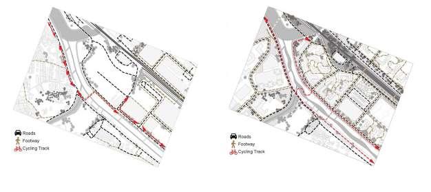
14. Transport Department– The Government of Hong Kong Special Administrative Region. (2024, April). Major Cycle Tracks and Parking Sites Sheung Shui / Fanling. Cycling Information Centre. https://www.td.gov.hk/mini_ site/cic/en/cycling-infrastructure/cycle-tracks-and-parkings/sheung-shui-fanling.html
15. Immigration Department. (2025). Statistics on Daily Passenger Traffic. https://data.gov.hk/en-data/dataset/hkimmd-set5-statistics-daily-passenger-traffic
16. The MTR Corporation. (2025). HISTORIC PATRONAGE FIGURES. https://www.mtr.com.hk/en/corporate/ investor/patronage.php
Land use and government masterplan
17. Hong Kong 2030+. (2021). Hong Kong Development Bureau and Planning Department. https://www.pland.gov. hk/file/planning_studies/comp_s/hk2030plus/index.htm
18. Planning Department. (2022). Hong Kong Planning Standards and Guidelines Summary. Planning Department - The Government of the Hong Kong Special Administrative Region. https://www.pland.gov.hk/file/tech_doc/hkpsg/ sum/pdf/sum_en.pdf
19. Planning Department. (2024). Hong Kong Planning Standards and Guidelines -Chapter 11 Urban Design. Planning Department - The Government of the Hong Kong Special Administrative Region. https://www.pland.gov. hk/file/tech_doc/hkpsg/full/pdf/ch11.pdf
20. Planning Department. (2024, December). 2023 Raster Grids on Land Utilization. Common Spatial Data Infrastructure (CSDI) Portal. https://portal.csdi.gov.hk/geoportal/?lang=en&datasetId=pland_rcd_1696577406166_85973
21. Lands Department. (2025, January). Building. Common Spatial Data Infrastructure (CSDI) Portal. https://portal. csdi.gov.hk/geoportal/?lang=en&datasetId=landsd_rcd_1637211194312_35158
Interconnected Densities
Economy
22. Au, V. (2024, December 3). Hong Kong urged to rethink plan for Fanling golf course flats after court ruling. South China Morning Post.
23. ECONOMIC GROWTH AND ECONOMIC DEVELOPMENT. (n.d.). In Economics. National Institute of Open Schooling. https://nios.ac.in/media/documents/SrSec318NEW/318_Economics_Eng/318_Economics_Eng_ Lesson3.pdf
24. Hong Kong Development Bureau. (2022). THE NEW DEVELOPMENT AREAS \\ OBJECTIVES AND BENEFITS. Kwu Tung North/ Fanling North New Development Area. https://www.ktnfln-ndas.gov.hk/en/textversion/2-1-1-about_project.php
26. Planning for Livable New Towns Fanling/ Sheung Shui, Kwu Tung North and Fanling North. (2022). In Planning Department. https://www.pland.gov.hk/pland_en/outreach/educational/NTpamphlets/pdf/nt_fss_en.pdf
27. Silvério, A. C., Ferreira, J., Fernandes, P. O., & Dabić, M. (2023). How does circular economy work in industry? Strategies, opportunities, and trends in scholarly literature. Journal of Cleaner Production, 412. https://doi. org/10.1016/j.jclepro.2023.137312
28. Civil Engineering and Development Department and Planning Department. (2025). New Territories North New Town Index. New Territories North New Gateway Economy. https://nm-ntnorth.hk/en/index.html
Climate and comfort
29. Goggins W. B., Chan E. Y. Y., Ng E., Ren C., & Chen L. (2012). Effect Modification of the Association between Short-term Meteorological Factors and Mortality by Urban Heat Islands in Hong Kong. PLoS ONE 7(6). https://doi. org/10.1371/journal.pone.0038551
30. Simulated historical climate & weather data for New Territories. (n.d.) Meteoblue. https://www.meteoblue.com/ en/weather/historyclimate/climatemodelled/new-territories_hong-kong_12747063
31. Morgan, B., & Guénard, B. (2018). Hong Kong Climate, Vegetation, and Topography Rasters (Version 2). Figshare. https://doi.org/10.6084/m9.figshare.6791276.v2
32. Cheung, C., Lai, K. Y. Y., Zhang, R., Schuldenfrei, E., Qiao, Q. Webster, C., & Sarkar, C. (2024). Map Showing NDVI Greenness of Hong Kong. In Associations of residential greenness with behavioural, physical, and mental health: a Hong Kong study during the fifth wave of COVID-19 pandemic. Cities & Health. http://dx.doi.org/10.108 0/23748834.2024.2381960
Biodiversity and ecology
33. Li, D., Davison, G., Lisovski, S., et al. (2020). Shorebirds wintering in Southeast Asia demonstrate transHimalayan flights. Scientific Reports 10. https://doi.org/10.1038/s41598-020-77897-z
34. Lisovski, S. (2019). Migration routes of Whimbrels based on satellite transmitters deployed in Singapore in 2018 and 2019. Partnership for the East Asian-Australian Flyway. https://eaaflyway.net/research-on-shorebirdswintering-in-southeast-asia/
35. Agriculture, Fisheries and Conservation Department. (2022). Habitats. Hong Kong Biodiversity Information Hub. https://bih.gov.hk/en/habitats/index-id-1.html
36. eBirding in Long Valley. (2025). eBird. Cornell Lab of Ornithology. https://ebird.org/hotspot/L1772531
37. eBirding in North District Park. (2025). eBird. Cornell Lab of Ornithology. https://ebird.org/hotspot/L17258336
38. Biodiversity Geographic Information System. (n.d.). Hong Kong Biodiversity Information Hub. https://bih.gov. hk/en/bgis/index.html
39. Globally threatened and near threatened bird species. (2024). Agriculture, Fisheries, and Conservation Department. https://www.afcd.gov.hk/english/conservation/con_fau/con_fau_bird/con_fau_bird_bwhk/con_fau_ bird_bwhk.html
40. WSP. (2023). Bird Species Recorded within the Assessment Area. In Environmental Protection Department of Hong Kong. Civil Engineering and Development Department. https://www.epd.gov.hk/eia/register/report/eiareport/ eia_2992023/Appendixes/Appendix8.2.pdf
Hydrology
41. Ng Tung River. (2022). Fu Tei Au Tsuen Cultural Revitalisation Project. https://www.ftaculturalproject.org.hk/ index.php/en/en-ng-tung-river
42. Ng Tung River Location and Catchment. (n.d.). Rivers@HK Database. https://www.jcwise.hk/gis/ng_tung_river. php?lang=en
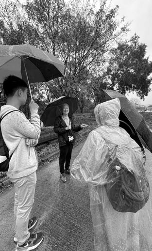
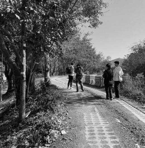
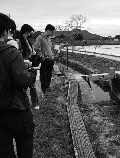
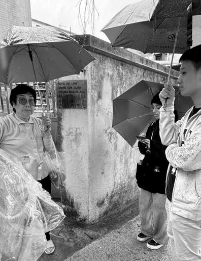
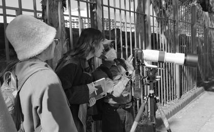
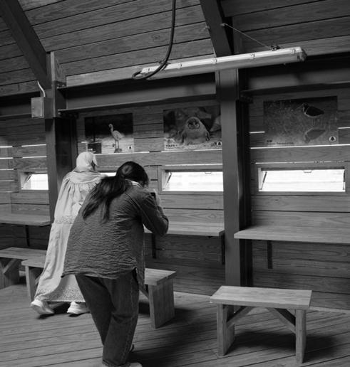
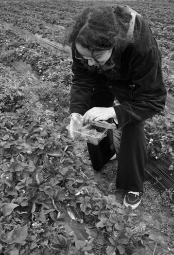
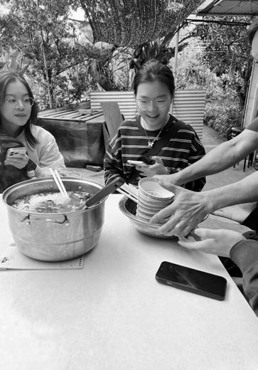
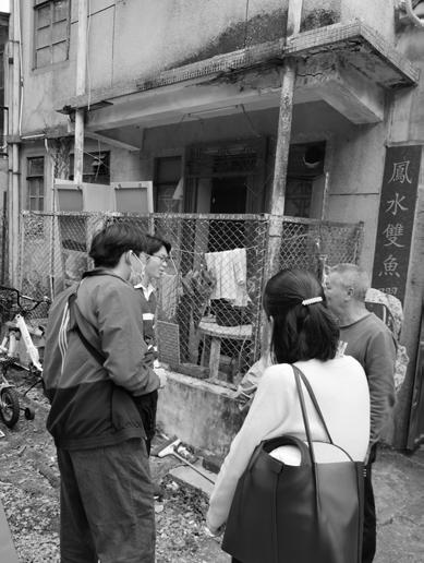
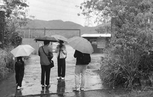
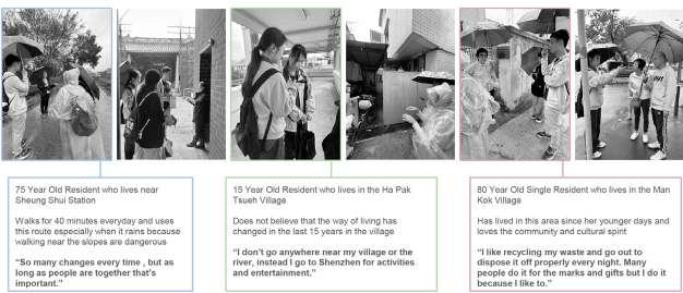
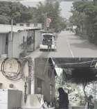
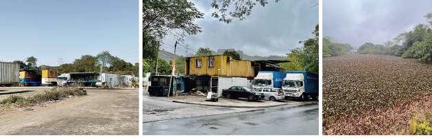
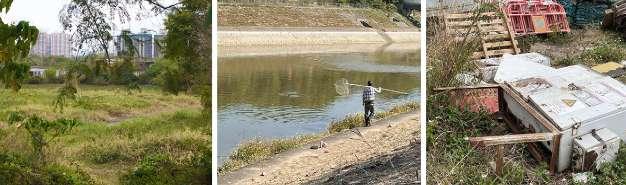
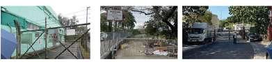
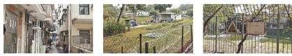
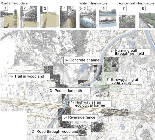
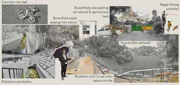
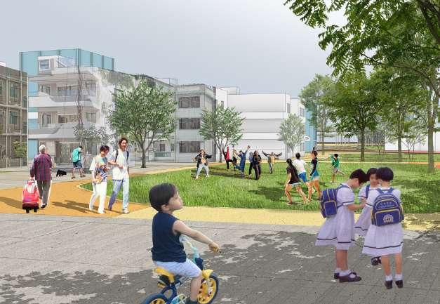
FIELDWORK FINDINGS
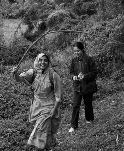
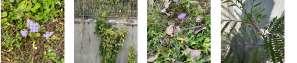
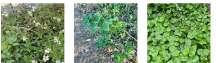
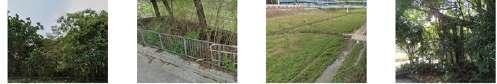
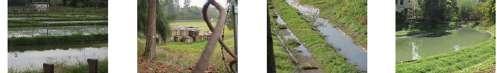
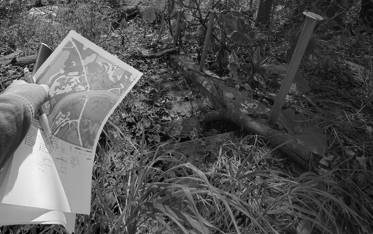
10 – 15 February
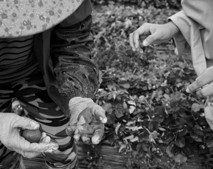
Students conducted interviews with various residents, students, and visitors on site.
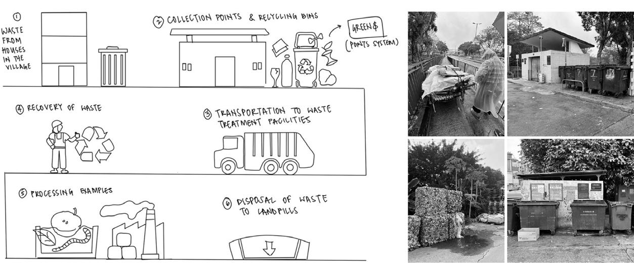
Students investigated residents’ waste reycling habits.
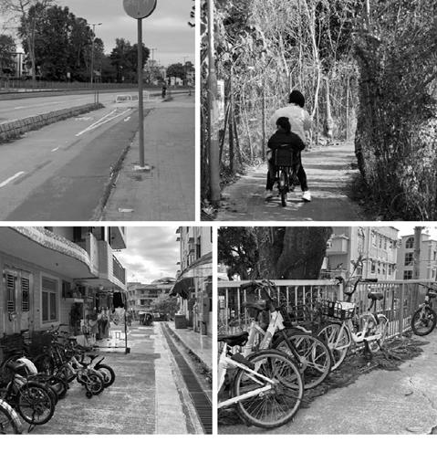
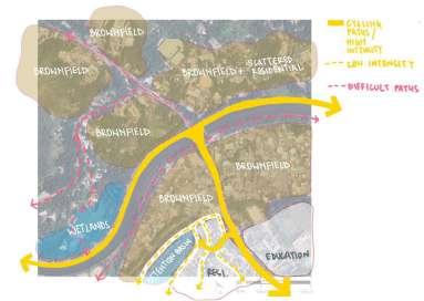
Students observed the village’s cycling spirit.
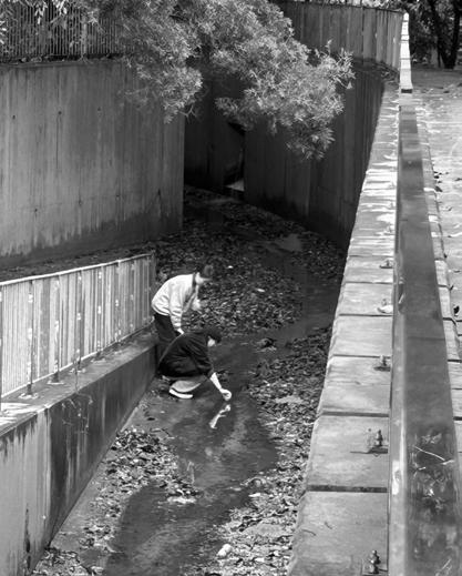
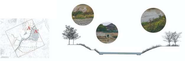
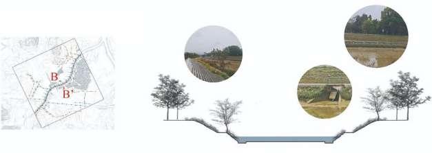
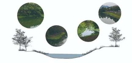
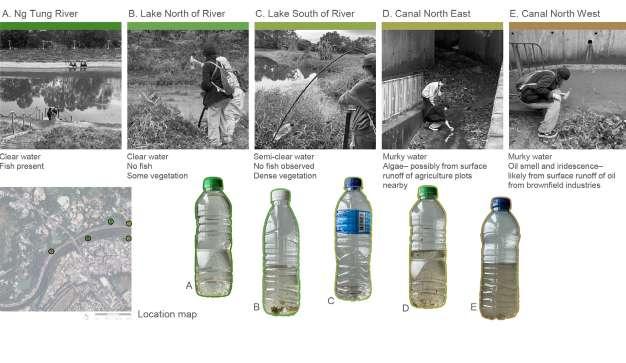
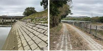
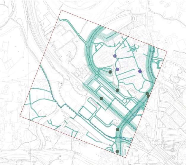
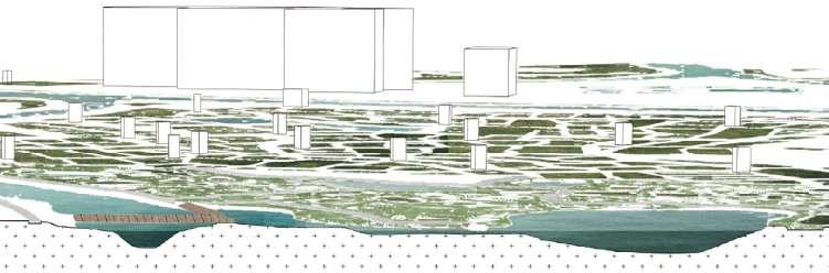
On site, students measured and illustrated sections of canals and waterways.
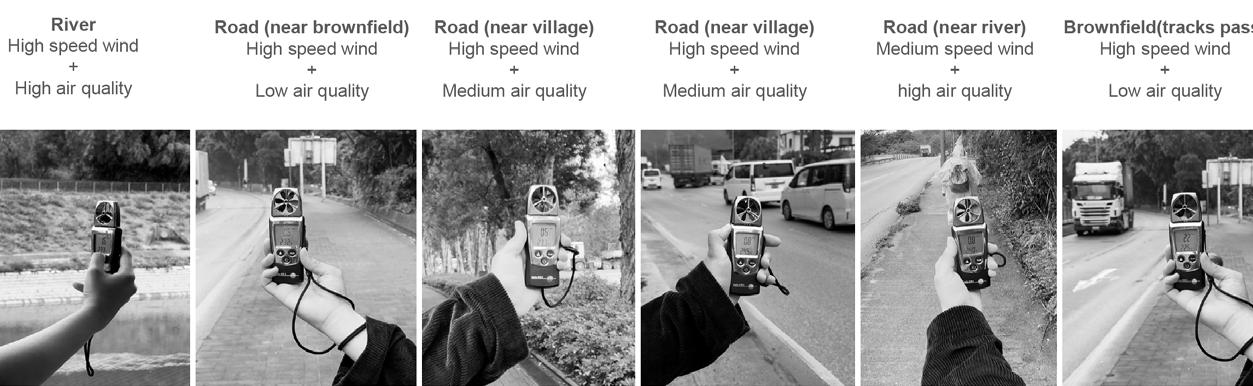
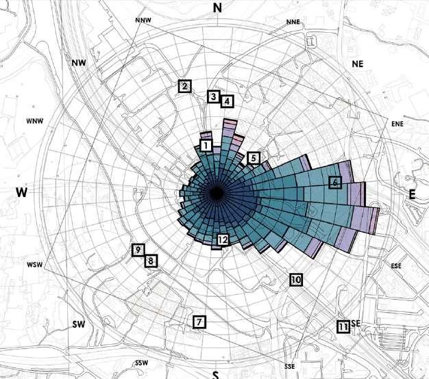
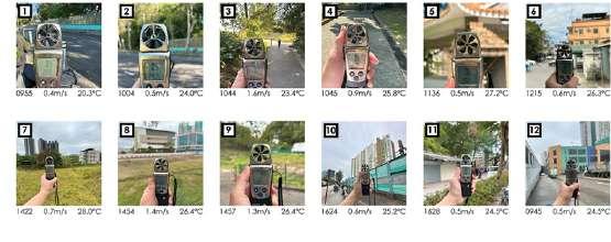
Wind speed, flow, and air quality were measured at key areas within the site.
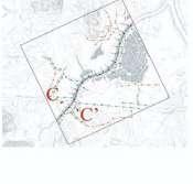
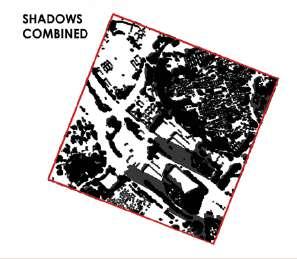
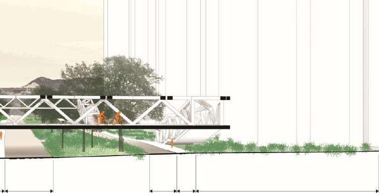
Site 2– canal section A-A’
Site 2– canal section B-B’
Site 2– canal section C-C’ C
C’
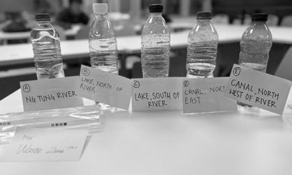
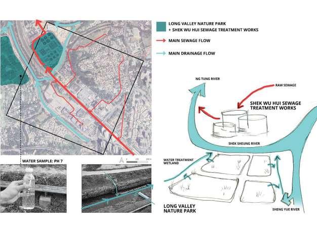
As the students explored the site, they mapped out water and sewage flows, then collected water samples to assess the quality.
PROJECT 2: PATTERN-BASED PLANNING
Quantitative planning tools
P.73
Harmonizing Rural Charm with Urban Comforts Team A1
P.76
Co-Living System of Bird Habitat, Agriculture & Culture Team A2
P.104
Land Sharing or Land Sparing? Team B3
P.142
Dense + Ecological Team B4
P.168
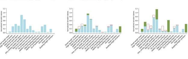
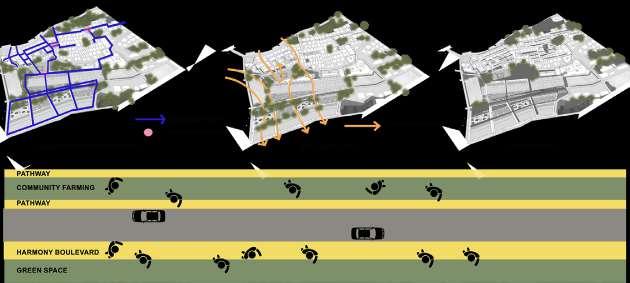
Introduction to the quantitative planning tools
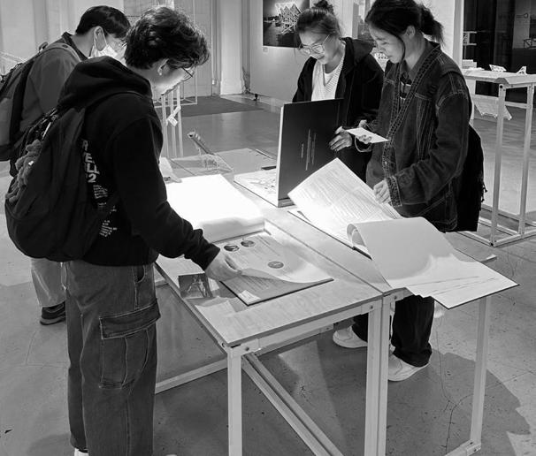
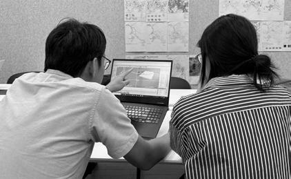
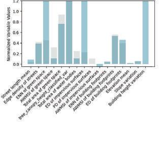
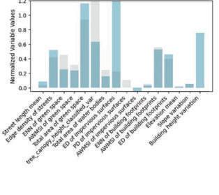
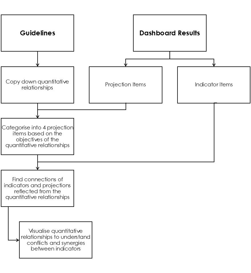
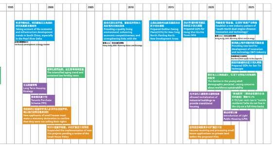
This design studio was conducted as part of research on the Comparative Ecology of Cities exploring the urban pattern-function relationships across cities at the Future Cities Lab Global, Singapore-ETH Centre. Students were introduced to two planning tools: a set of evidence-based planning and design guidelines, and a Dashboard algorithm to predict urban functions.
Through the collaboration with this design studio, the research team aimed to conduct qualitative analysis of how design students responded to the planning tools, and to conduct statistical analysis of the changes in urban patterns and functions at each of the groups’ design iterations.
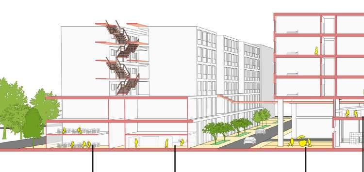
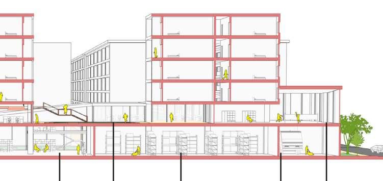
Both the guidelines and Dashboard translate the generalizeable data into quantitative values that allow students to set specific objectives for each design iteration, thus creating more convincing design proposals. The students were encouraged to use the provided tools alongside other data collection and studies, as shown in the studio structure diagram below.
The Planning and Design Guidelines
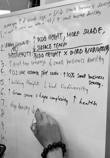
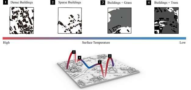
A set of design guidelines is tailored for this design studio and draws from the research findings of the Comparative Ecology of Cities project, which quantitatively analyses the relationships between various urban patterns (i.e., green spaces, built-up areas, and transportation networks) and diverse urban functions, including public health, urban flooding, climate regulation, avian biodiversity, and local economic vibrancy.
The concept of urban pattern-process-function relationships refers to how patterns of human settlement (urban patterns) shape social and ecological processes (urban processes), which in turn influence key aspects of urban living (urban functions), such as social interactions, urban climate, public health, and ecological conditions. These interdependencies provide the foundation for designing sustainable, liveable and resilient neighbourhood landscapes.
Based on these insights, the guideline offers practical design strategies to foster synergies between multiple urban functions through well-planned neighbourhood landscape patterns.
Relationship between pattern indicators and target functions for planning and design.
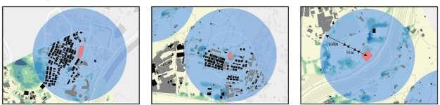
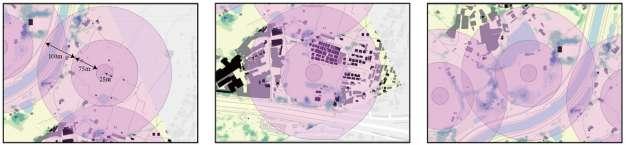
The Dashboard
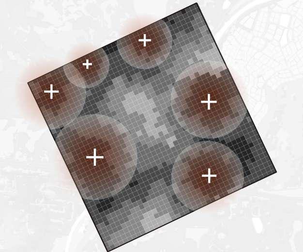
The Gradient Boosting Regressor (GBR), referred to as the “dashboard”, is a machine learning algorithm designed for regression tasks. It builds an ensemble of decision trees sequentially, where each tree corrects the errors of the previous one. By optimizing a loss function in each iteration, GBR delivers highly accurate predictions. It is particularly effective for handling complex data with both linear and non-linear patterns.
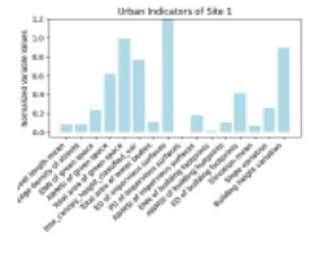
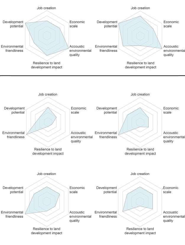
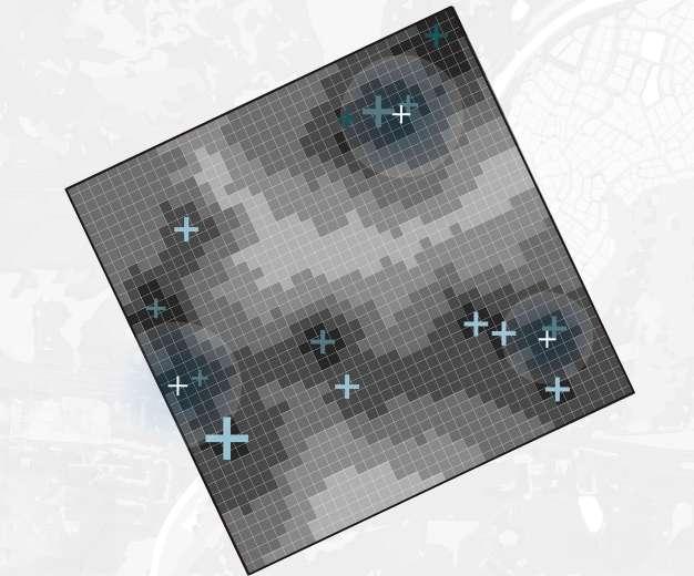
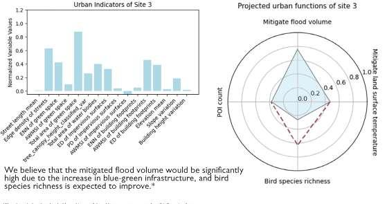
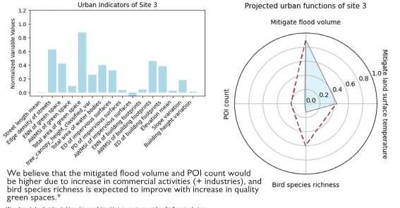
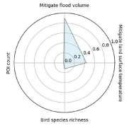
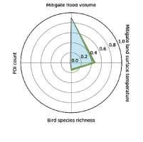
The dashboard uses inputs of the urban patterns to process into urban functions, including pluvial flooding, small business POI count, bird species richness, and land surface temperature. The outputs are projected on a map within the students’ 1 km2 sites. The dashboard computes indicator values into a chart, and projects urban function values into a radar chart.
Workflow of the Dashboard and its incorporation in studio work and in research findings.
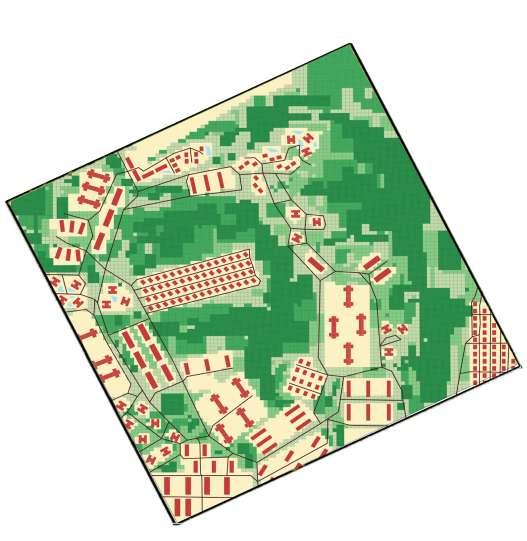
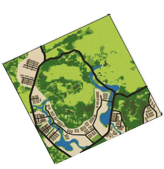
SITE A1
Harmonizing Rural Charm with Urban Comforts
Li Xiyuan | Sun Peiqiang | Lee Wen Qi Sherly
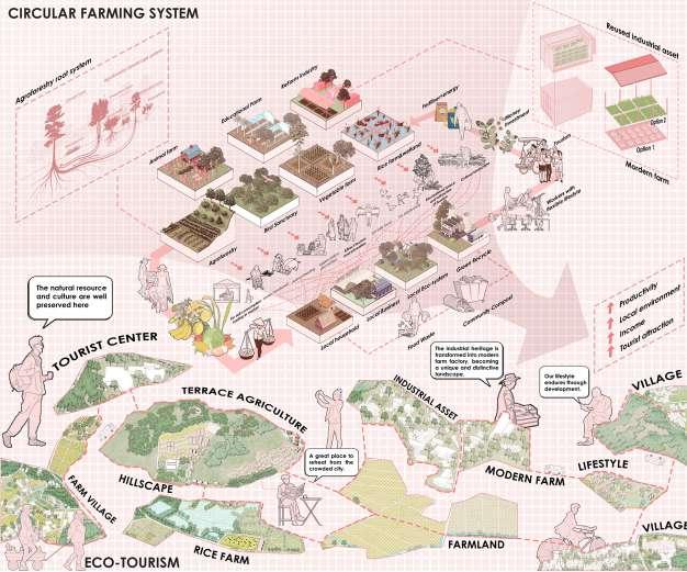
The proposal seamlessly integrates rural landscapes and lifestyle into the new town plann, creating a harmonious blend of modern infrastructure with the charm and tranquility of the countryside. By preserving cultural landscapes such as villages, industrial landscapes, farmlands, the design fosters a deep connection to the heritage while ensuring sustainable growth. This balanced approach not only enhances the quality of life for residents but also promotes economic opportunities by supporting local crafts, agriculture, and eco-tourism, ultimately creating a vibrant and resilient community.
Final proposed population density: 15,300/ km2
The Dialogue Between Two Regions
Without political borders and policy restrictions, should we perceive them as a single landscape divided by a river?
Futian and Luohu are distinct as high-tech, modern regions, and the government’s future plan aims to transform Kwu Tung into a town that economically integrates with these areas. However, given Kwu Tung’s unique identity as a rural landscape, will this development diminish its character and weaken Hong Kong’s overall identity?
Harmonizing Rural Charm with Urban Comforts
Design objectives
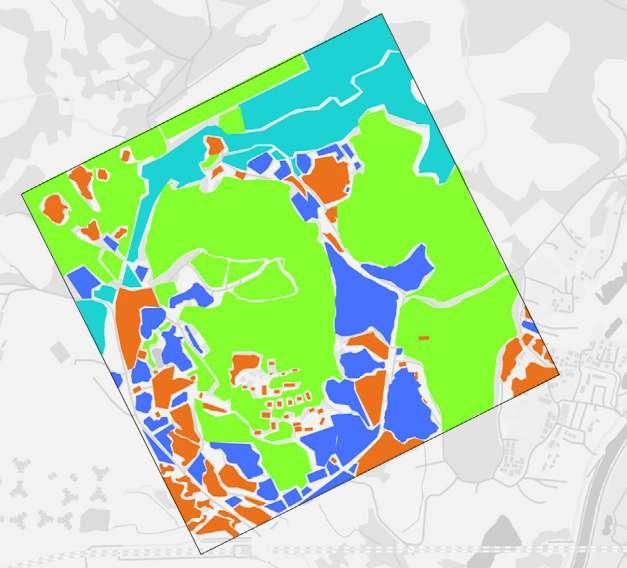
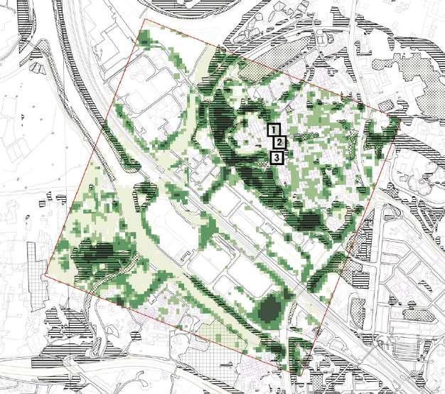
Countryside Landscape Distribution
Expanding settlements into Hong Kong’s countryside may seem like a solution to urban density, but it risks destroying the very benefits these natural spaces provide. With only 25% of the land built up, our countryside is a vital refuge—preserving biodiversity, regulating climate, and improving public health.
Green urban space Forest & mangrove
Shrubland Farm & grassland
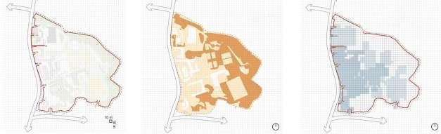
Current site conditions
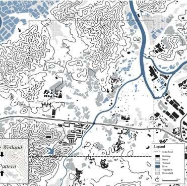
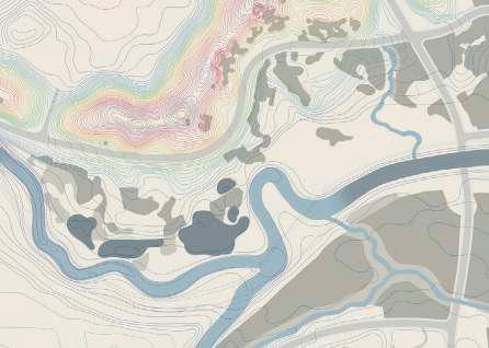
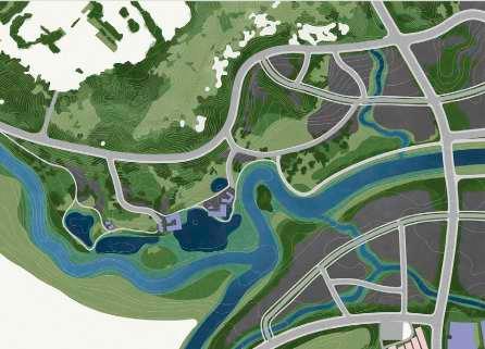
The baseline map identifies key areas that hold significant ecological, cultural, and historical value. The map also aids in identifying potential conflicts between conservation and urbanization, guiding planners in making strategic decisions that harmonize growth with heritage and environmental preservation.
Existing water
Future reservoir
Woodland
Shrubby
woodland
Shrubland
Grassland
Village shacks
Village houses
Industrial
Containers
Farmland
Brownfield
Main road Trees Harmonizing Rural Charm with Urban Comforts
Concept diagram to enhance green connectivity
Conserve large patches
Green cover
Introduce small patches
Create connector corridors
Add green pockets
Grass
Shrubs
Short trees
Tall trees
200m
100m
Harmonizing Rural Charm with Urban Comforts
Pollution sources
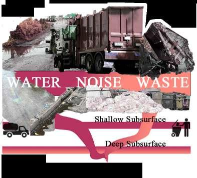
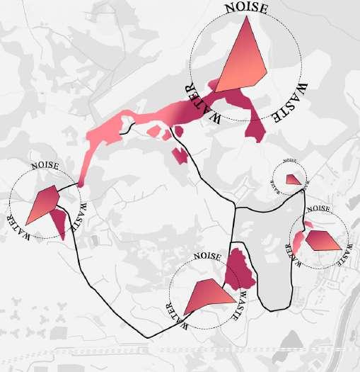
The primary forms of pollution in this area are noise, sewage, and solid waste.
Pollution is predominantly caused by the reservoir construction zone and the waste treatment plant, as well as a small portion of improperly managed domestic waste from some residential areas.
Pollution severity map
Concept diagram for enhancing drainage and conveyance properties
Preserving ponds Naturalizing drains
Water flow
Narrow drain Roadside drain Streams Ponds
Flow direction
Potential water-responsive area
Increase surface for evaporative cooling Connect waterways 100m 200m
Harmonizing Rural Charm with Urban Comforts Site A1
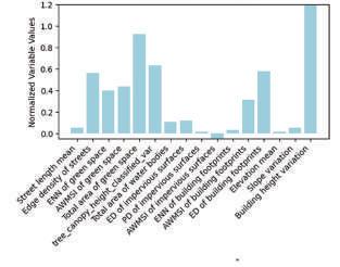
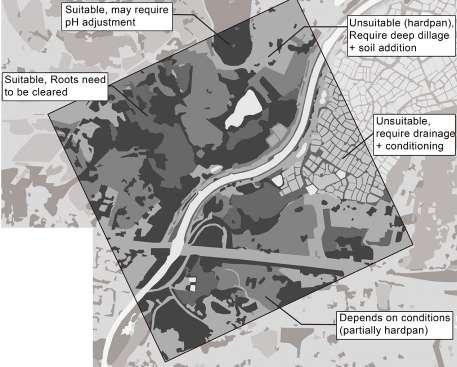
Permeability assessment
Most of the site is dominated by greenery, indicating that its permeability is in good condition.
However, the ongoing construction may lead to a decline in permeability as it increases the built-up area. To preserve its role in flood mitigation and ecological functions associated with permeability, permeable layers should be preserved and enhanced.
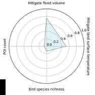
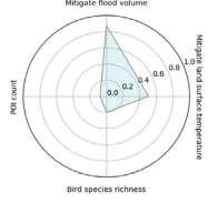
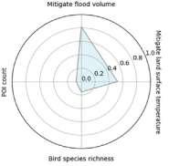
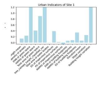
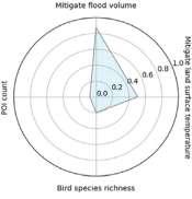
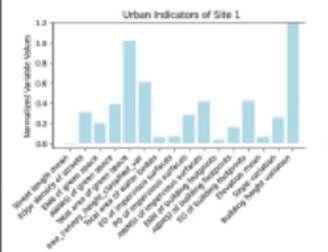
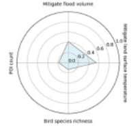
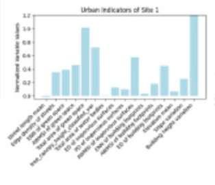
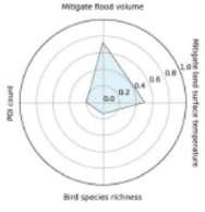
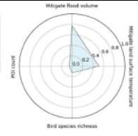
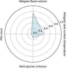
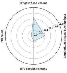
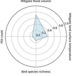
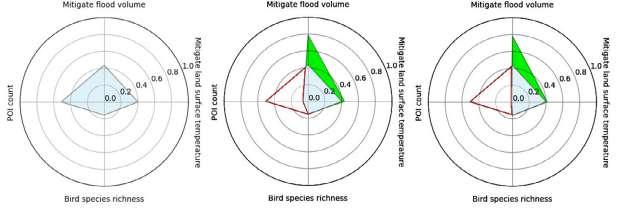
Dashboard analysis:
Mitigated land temperature: 3.1
Mitigated flood volume: 16288.0
POI Count: 62.6
Bird species richness: 3.8
Site permeability
Building Concrete Soil Grass Forest Water body
Macro-scale biodiversity
Although the site has limited recorded biodiversity, the presence of Feng Shui woodlands plays a crucial role as an ecological linkway, allowing biodiversity to move across the wider landscape.
Farmlands have been observed as other key areas of high biodiversity, providing habitats for various species and contributing to the site’s ecological richness.
Site biodiversity
Butterflies Birds Amphibians Fishes
Harmonizing Rural Charm with Urban Comforts
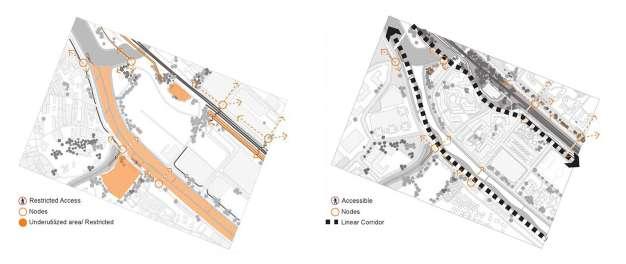
Walkability and accessibility
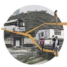
The area is highly dependent on minibuses as there is no metered parking available.Walkability remains a significant challenge due to the car-centric design of the site. With minimal pedestrian infrastructure, individuals are often forced to navigate alongside vehicular traffic, raising serious safety concerns and limiting accessibility.
Human flow
Land use assessment
Most of the utilized land surrounds the central mountain range, with industrial zones and residential areas intermixed, even including some farmland. In the north, there is a reservoir under construction, which, according to the villagers, has been in the works for about 8-9 years.
Land use
Harmonizing Rural Charm with Urban Comforts
Public-private land
63% of the land is privately owned, while 37% is government-owned
Public-private land distribution
Road typologies
Single-lane roads wind through residential areas and serve local residents for daily commuting. Two-way single-lane roads with basic guardrails on both sides and surrounded by greenery offer a harmonious blend of functionality and natural beauty. A wider road under construction reflects the area’s growth and the need for improved infrastructure.
Road network
Harmonizing Rural Charm with Urban Comforts
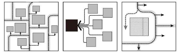
Road network iterations
Dendritic road distribution
Temp: 3.1
Flood: 12265.8
POI: 107.2
Birds: 15.0
Fishbone patterns around transit stations
Temp: 3.5
Flood: 15101.4
POI: 111.3
Birds: 15.2
Simple road distribution
Temp: 3.4
Flood: 12627.8
POI: 108.8
Birds: 17.7
Tree-like distribution
Temp: 3.4
Flood: 12518.3
POI: 109.0
Birds: 15.9
Radial trunk roads
Temp: 3.5
Flood: 12044.4
POI: 109.1
Birds: 15.0
Elevation-based road distribution
Temp: 3.4
Flood: 12488.8
POI: 108.9
Birds: 15.5
Road density varying with existing population density
Temp: 3.4
Flood: 12557.0
POI: 108.8
Birds: 16.9
Checker-board distribution
Temp: 3.1
Flood: 12265.8
POI: 107.2
Birds: 15.0
Building study
There are various village-type buildings and industrial buildings on site. The majority of buildings are low-rise and sparse. A few industrial developments were observed to have residential spaces mixed between them.
Harmonizing Rural Charm with Urban Comforts
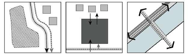
Housing layout iterations
Ecological layout distribution
Temp: 3.4
Flood: 12725.4
POI: 111.3
Birds: 15.6
Fishbone patterns around transit stations
Temp: 3.6
Flood: 14449.5
POI: 548.8
Birds: 13.6
Age-group distribution to meet resident needs
Temp: 3.1
Flood: 12265.8
POI: 107.2
Birds: 15.0
Tree-like distribution
Temp: 3.5
Flood: 15101.4
POI: 111.3
Birds: 15.2
Elevation-based distribution
Temp: 3.4
Flood: 14476.4
POI: 109.0
Birds: 15.8
Vertical alignment around transit stations
Temp: 3.5
Flood: 15365.7
POI: 111.4
Birds: 14.9
Multi-family clustered dwellings
Temp: 3.4
Flood: 12676.3
POI: 110.4
Birds: 15.7
Checker-board distribution
Temp: 3.4
Flood: 12488.8
POI: 108.9
Birds: 15.5
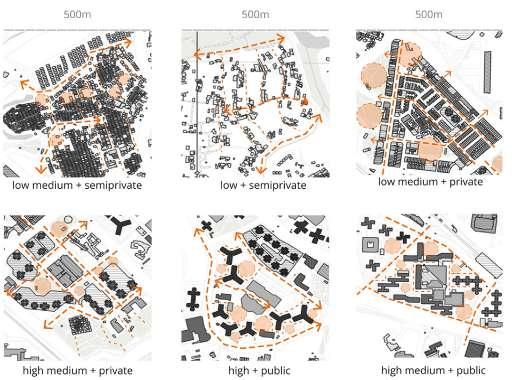
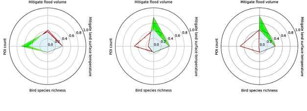
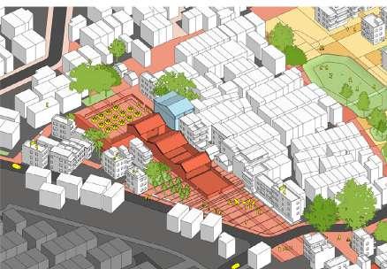
Design scenario 1: Mixed-generation
Different types of communities are interwoven to encourage intergenerational interaction, with shared activity spaces designed for all age groups and comprehensive age-inclusive service facilities provided.
Grass Shrubs
Short trees
Tall trees
Waterbodies
Buildings Paved area Road
Mitigated land temperature: 3.6ºC
Mitigated flood volume: 13409.8 m3
POI Count: 446.6
Bird species richness: 11.9
Harmonizing Rural Charm with Urban Comforts
Design scenario 2: Terrain-adaptive
Homes are arranged by elevation, with townhouses at the foothills and detached houses on the slopes. Terrain differences enhance ventilation and views, while stepped roads and elevators ensure connectivity within a 10-minute walk to transit.
Waterbodies
Buildings
Paved area
Road
Mitigated land temperature: 3.5ºC
Mitigated flood volume: 14429.8 m3
POI Count: 539.5
Bird species richness: 16.6
Grass Shrubs
Short trees
Tall trees
Design scenario 3: Functional clusters
The area is divided into 3-5 clusters, each with 200-300 units and essential amenities. Clusters are 500-800 meters apart, connected by greenways, with a unified architectural style and different functions (e.g., family, youth, or senior communities).
Grass Shrubs
Short trees
Tall trees
Waterbodies
Buildings
Mitigated land temperature: 3.6ºC
Mitigated flood volume: 14545.4 m3
POI Count: 554.2
Bird species richness: 13.5
Harmonizing Rural Charm with Urban Comforts
Design scenario 4: Transit-oriented
Vertical communities align along light rail/ BRT lines, with residential towers arranged in a fishbone pattern around transit stations. The ground level maintains a continuous commercial frontage, creating a three-dimensional TOD model.
Grass Shrubs
Short trees
Tall trees
Waterbodies
Buildings
Mitigated land temperature: 3.5ºC
Mitigated flood volume: 15542.5 m3
POI Count: 566.3
Bird species richness: 16.8
Design scenario 5: Walkable-nature
This idea focuses on preserving the site’s natural resources while also improving the network system to improve walkability. It also integrates various housing types to create a balance between maintaining the countryside lifestyle and accommodating a larger population.
Grass Shrubs
Short trees
Tall trees
Waterbodies
Buildings
Mitigated land temperature: 3.7ºC
Mitigated flood volume: 7427.0 m3
POI Count: 1356.6
Bird species richness: 11.8
Harmonizing Rural Charm with Urban Comforts
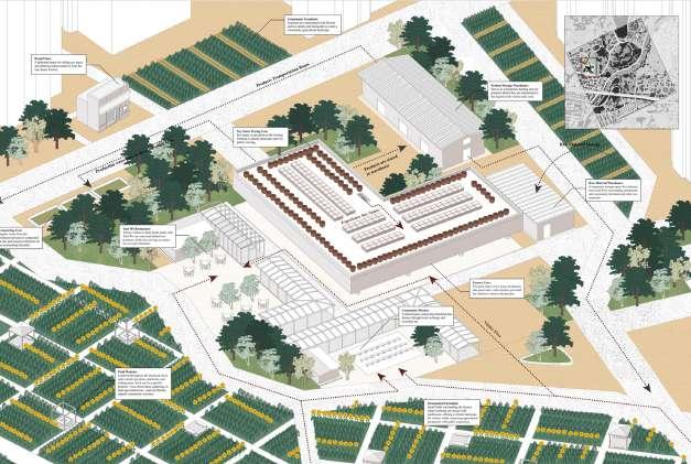
Design scenario 6: Small-business
The concept seeks to improve the existing circulation while honoring the local culture. It aims to revive traditional elements such as farming and small family businesses, which are integral to the countryside way of life.
Short trees
Tall trees
Waterbodies
Buildings Paved area Road
Mitigated land temperature: 3.4ºC
Mitigated flood volume: 12948.8 m3
POI Count: 1478.1
Bird species richness: 12.2
Grass Shrubs
Design scenario 7: Urban green corridors
This urban scenario fosters harmony between green spaces and development through seamless green corridors, supporting biodiversity. Interconnected waterways and pathways enhance ecology, air quality, temperature regulation, and walkability.
Grass Shrubs
Short trees
Tall trees
Waterbodies
Buildings Paved area Road
Mitigated land temperature: 3.5ºC
Mitigated flood volume: 13771.6 m3
POI Count: 387.3
Bird species richness: 11.4
Harmonizing Rural Charm with Urban Comforts
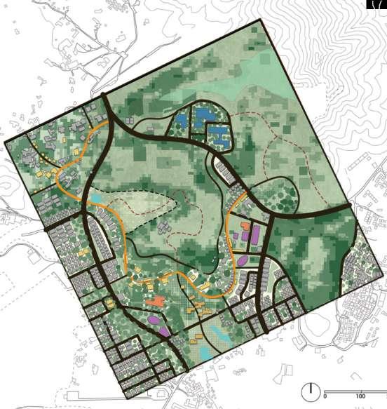
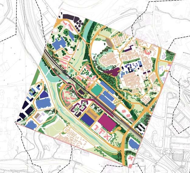
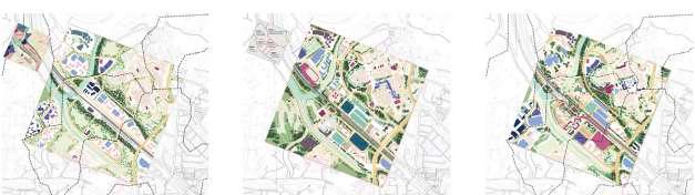
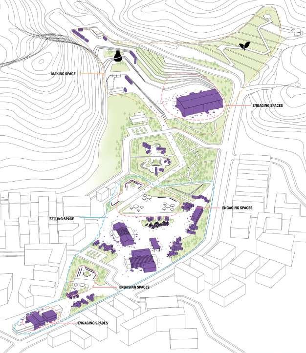
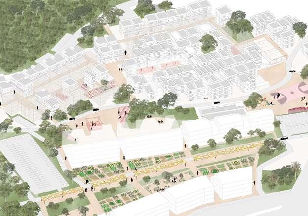
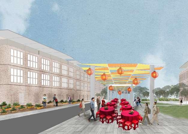
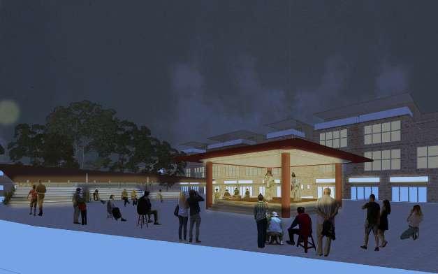
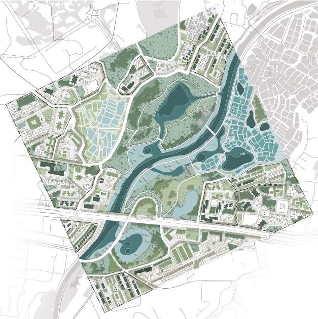
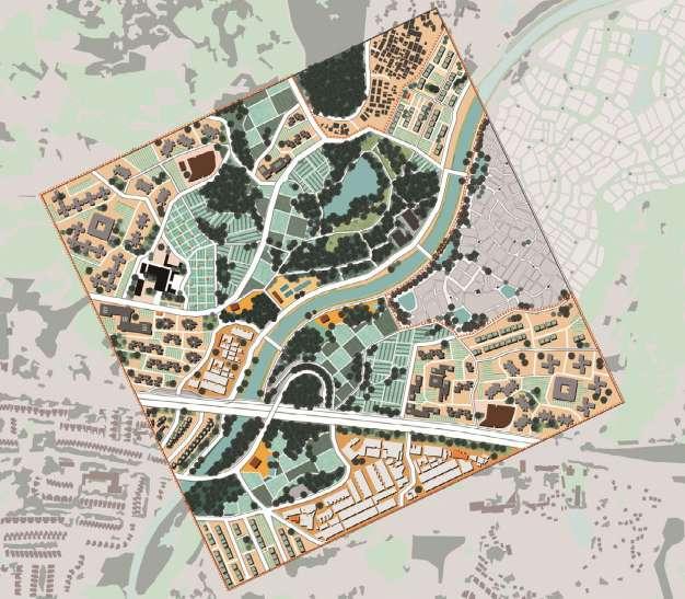
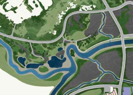
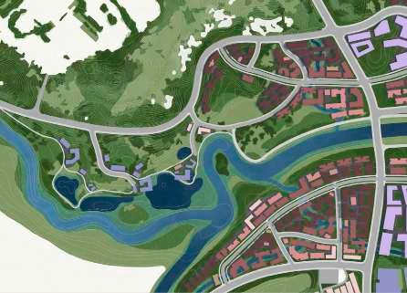
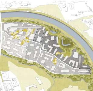
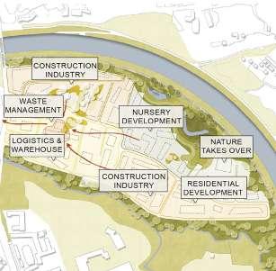
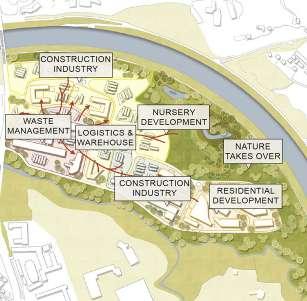
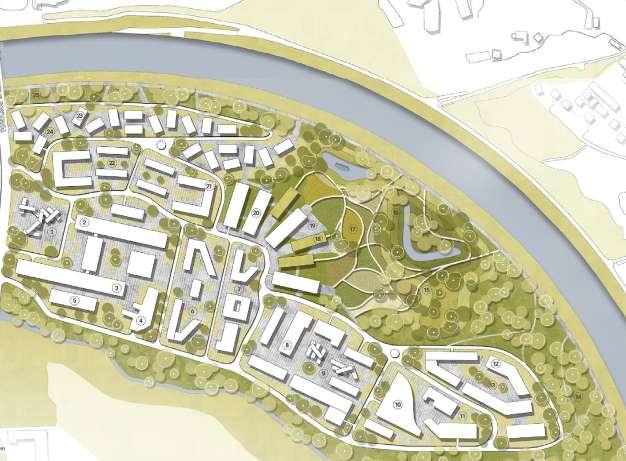
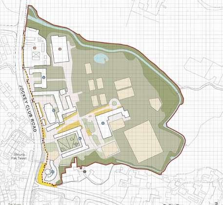
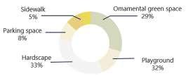
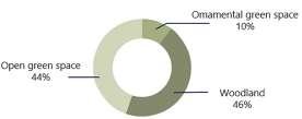
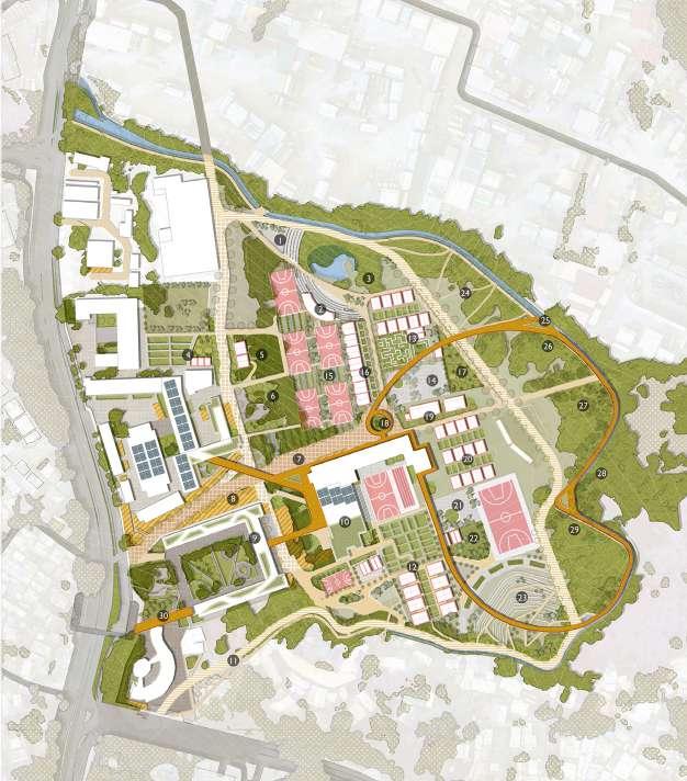
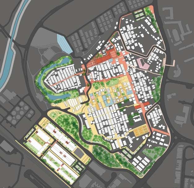
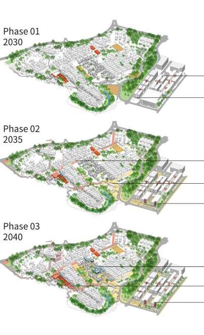
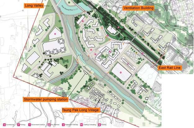
Final master plan
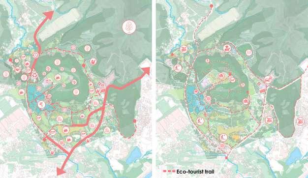
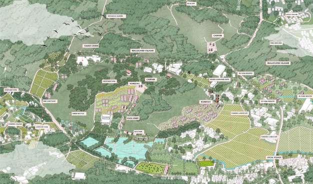
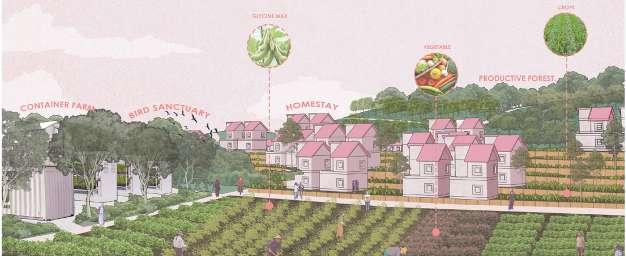
The final proposal integrates existing rural landscapes into the new planned developments. Villages, industrial landscapes, farmlands, and other cultural landscapes are preserved. Furthermore, local crafts, agriculture, ecotourism, and other economic opportunities are promoted throughout the site design.
Trails
Reservoir
Tall trees
Short trees
Shrubs Grass
Health
Business
Education
Community
Museum
Water park
Cultural corridor
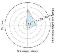
Mitigated land temperature: 3.3ºC
Mitigated flood volume: 13237.5 m3
POI Count: 202.7
Bird species richness: 13.0
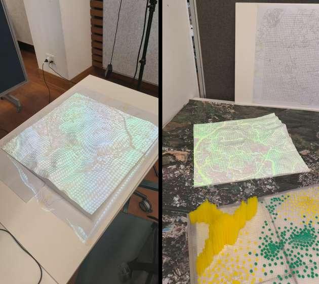
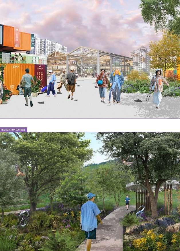
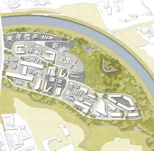
3D model + projection of proposal
Using the 3D-printed model of the existing site conditions, the proposal was projected onto it to show the changes and improvement of site conditions.
Harmonizing Rural Charm with Urban Comforts
Reflecting on the use of pattern-function analysis for town planning
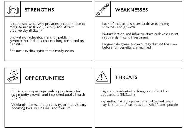
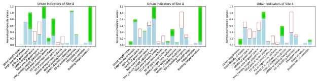
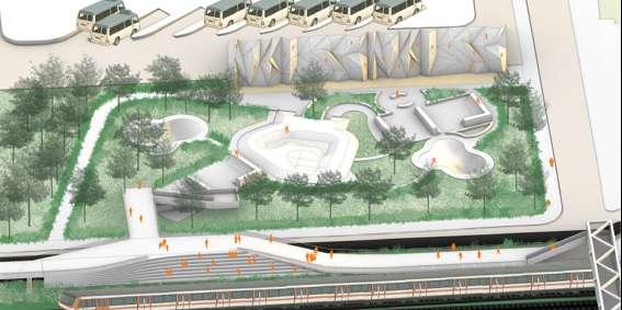
Analyzing the patterns in an urban settlement with a focus on their functions allows for a quick understanding of site conditions before a site visit. This analysis helps identify opportunities for future improvements by addressing issues such as the fragmentation of green spaces. With the advancement of the Dashboard, various functional aspects—such as flood mitigation, bird species distribution, and heat mitigation—can be visualized through data-driven insights. By integrating scientific analysis, we can refine and repattern the site after our assessment to enhance its overall condition.
Through this process, we have realized that a pattern-based design approach can begin with scientific analysis. However, during the concept and design phase, the focus should shift toward a more traditional design approach that emphasizes patterns. This transition allows designers the creative freedom to envision the site without being constrained by numerical data, which often involves conflicting factors. For example, changes in impervious surfaces can impact green spaces and flood mitigation capabilities, yet a well-connected impervious surface network can also support local businesses. Nonetheless, we must carefully weigh the pros and cons to achieve a balanced and well-informed design outcome.
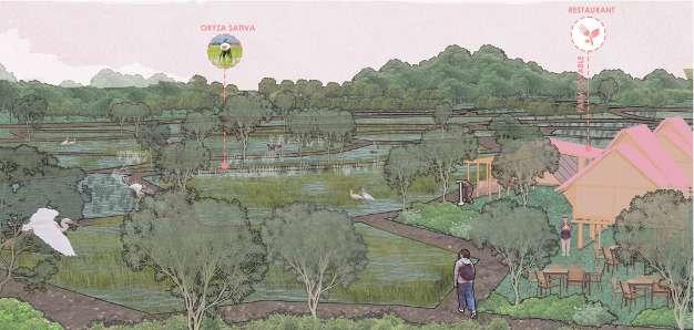
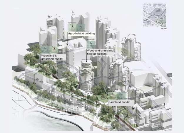
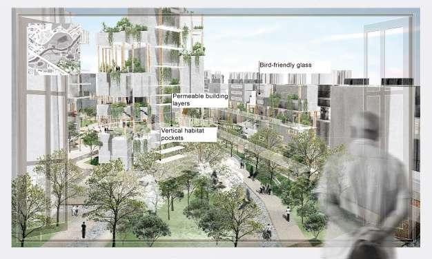
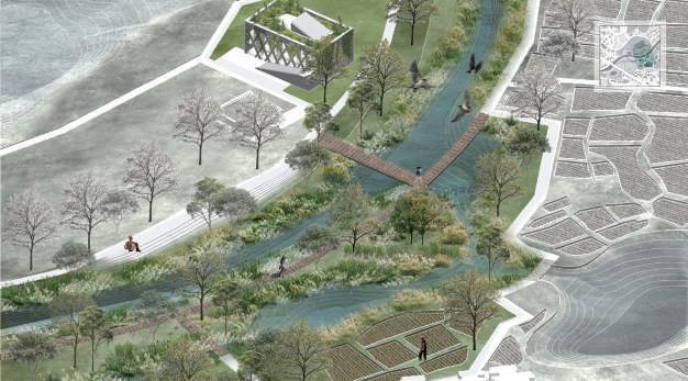
SITE A2
Co-Living System of Bird Habitat, Agriculture & Culture
Qinying | Zhou Yao | Qi Kexin | Ho Qian Yu
The final proposal strategically combines ideas of biodiversity enhancement and agricultural economies to strengthen the existing ecological networks of the site and stimulate further growth and advancements. The proposal meets the government population targets, and envisions high socio-economic impacts on the site.
The evidence-based proposal approaches the site conditions through a shared landscape, where humans and wildlife not only co-exist, but ecological networks are strengthened within the site through green space connectivity and waterbody expansion. By maintaining existing farmland, the cultural essence of the site is conserved.
Final proposed population density: 24,300/ km2
Zhou
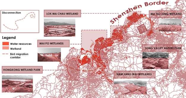
Signficance of site A as part of an ecological migration corridor
Co-Living System of Bird Habitat, Agriculture & Culture
Soil Grassland
Shrubland
Density map (based on project 1)
Co-Living System of Bird Habitat, Agriculture & Culture
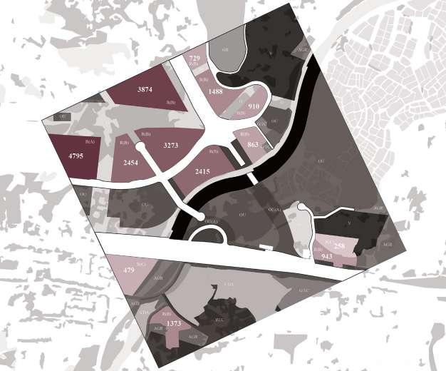
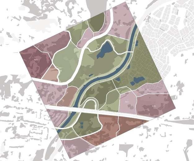
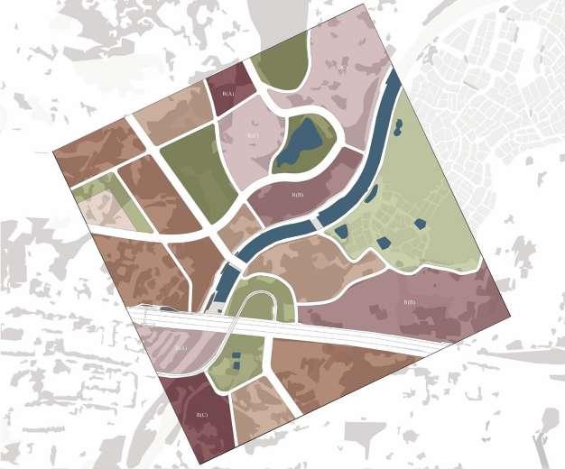
Government masterplan 258
O– Open space
CDA– Comprehensive development area
GB– Green belt
G/ IC– Government, institution, or community
AGR– Agriculture
OU– Other specified use (amenity area)
REC– Recreation
V– Village-type development
Canal
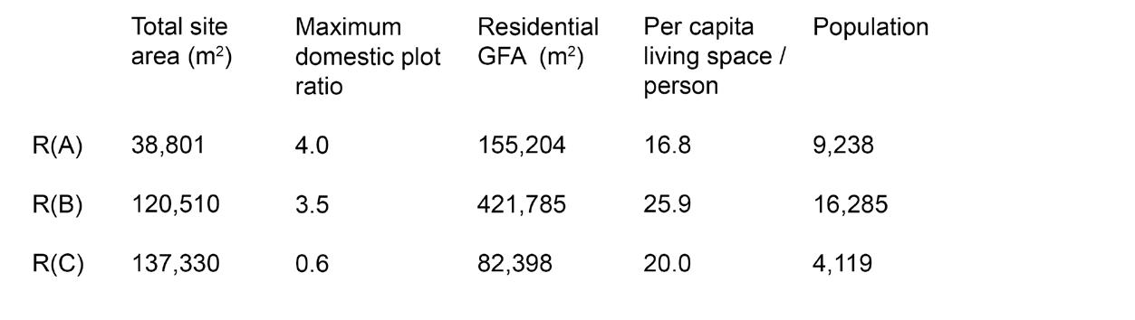
R(A) Residential type A
R(B) Residential type B
R(C) Residential type C
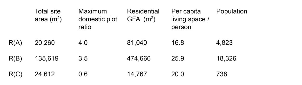
Total planned population: 23,887 people / km2
Agriculture
Food production
Logistics industry
Engineering
Automotive services
Other industries
Brownfields
Co-Living System of Bird Habitat, Agriculture & Culture
Assessment of current industries
Based on the site visit, existing industries were identified, and through further analysis, agriculture and food production appear to have the greatest potential for development.
Building heights
1 storey
1-2 stories
2-2.5 stories
2.5-3 stories
3-3.5 stories
100m
Co-Living System of Bird Habitat, Agriculture & Culture
Building density value mapping
Building height
Building density
Key inputs:
Building heights
Building area
Building densities
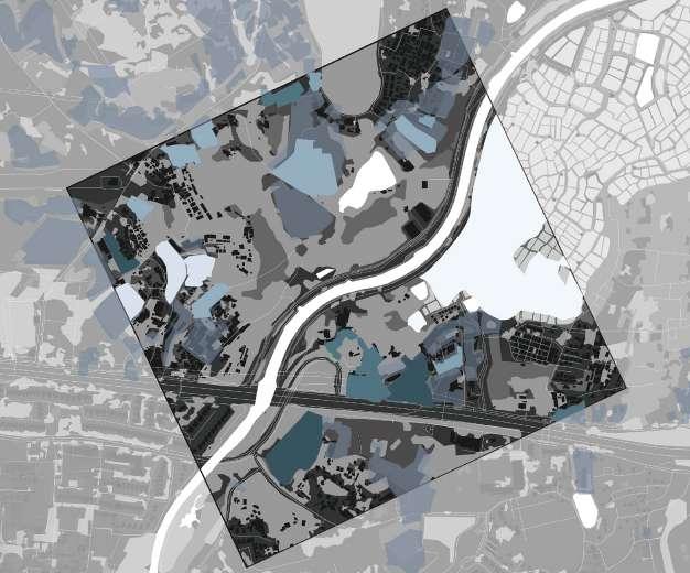
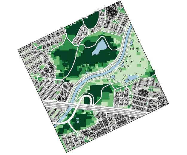
Existing habitats
Soil Grassland
Urban green
Agriculture
Shrublad Woodland Wetland Water
100m
Co-Living System of Bird Habitat, Agriculture & Culture
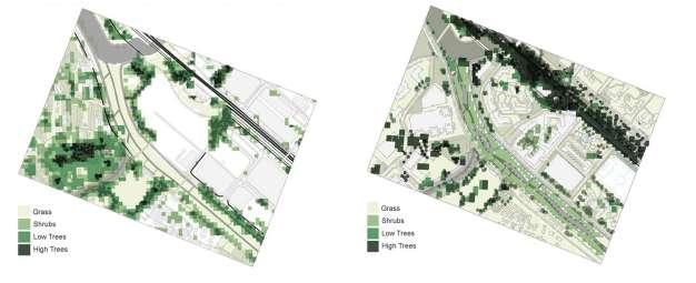
Current canopy heights
Soil Grass Shrub Short tree Tall tree
100m
Existing bird habitats
Boundary woodland & villlage area
Channelised watercourse
Migration plantation
Dry agricultural land
Pond
Dry agricultural land 100m
Co-Living System of Bird Habitat, Agriculture & Culture
Public health
Green cover Amenities Buildings Path network
100m
Current permeability
Level 1– Building
Level2– Concrete
Level 3– Soil
Level 4– Grass
Level 5– Forest
Level 6– Wetland
Level 7– Water 100m
Co-Living System of Bird Habitat, Agriculture & Culture
Existing waterflow and drainage map
Surface flow
Drainage flow
Main canal flow
Elevation (dashboard)
Slope (dashboard)
100m
Co-Living System of Bird Habitat, Agriculture & Culture
Cultural value mapping
5– Very high cultural significance
4– High cultural significance
3– Moderate cultural significance
2– Low cultural significance
1– No cultural significance
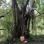
Feng Shui heritage tree
Feng Shui heritage tree Shrine and temple Ancestral hall Cultural activity
Temple Shrine Kwun Yum Festival Stage Setup 100m
Nature value mapping for current conditions
Key inputs:
Habitat map
Canopy height map
Bird habitat map
Building heights map
Co-Living System of Bird Habitat, Agriculture & Culture
Economic value mapping
Key inputs:
Human
Building densities Existing industries
Road network pattern analysis
Co-Living System of Bird Habitat, Agriculture & Culture
Spatial connectivity patterns
Complexity of roads and green cohesion patterns as more favorable for bird habitats
Building density is directly linked to economic growth
Taller building heights may affect bird flight paths and reduce accessible green spaces
Building height & density may affect nature habitats
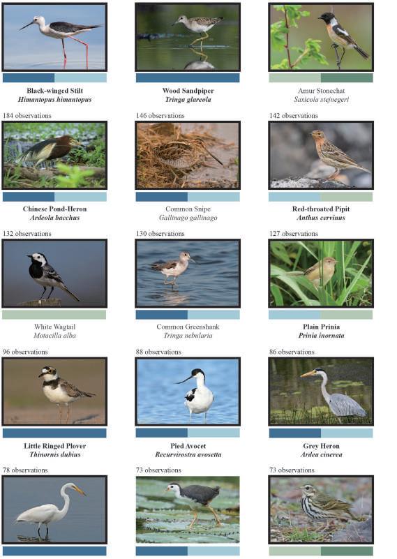
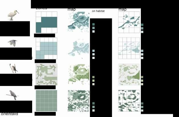
Black-winged Stilt Himantopus himantopus
Wood Sandpiper Tringa glareola
Amur Stonechat Saxicola stejnegeri
Chinese Pond Heron Ardeola bacchus
Common Snipe Gallinago gallinago
Red-throated Pipit Anthus cervinus
White Wagtail Motacilla alba
Common Greenshank Tringa nebularia
Plain Prinia Prinia inornata
Little Ringed Plover Thinornis dubius
Pied Avocet Recurvirostra avosetta
Grey Heron Ardea cinerea
Great Egret Ardea alba
White-breasted Waterhen Amaurornis phoenicurus
Olive-backed Pipit Anthus hodgsoni
Co-Living System of Bird Habitat, Agriculture & Culture
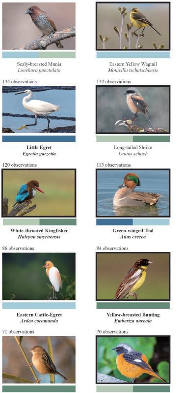
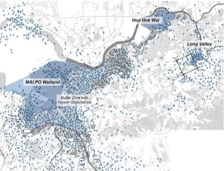
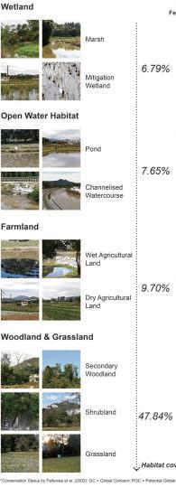
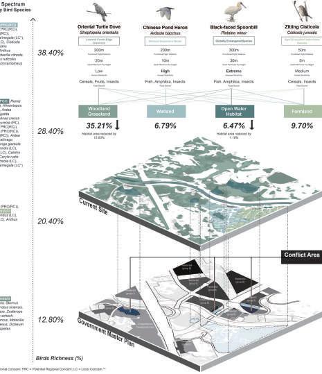
To refine the base map for Proposal A, bird habitat patterns were analysed based on species that were observed more than 70 times per year. The analysis shows that wet farmlands have the highest bird density, followed by ponds. 20 of the 25 most common bird species in the site are migratory birds, showing the ecological importance of this area.
Secondary forest & village
Dry agricultural land Pond
Wet agricultural land Migratory birds
Scaly-breasted Munia Lonchura punctulata
Eastern Yellow Wagtail Motacilla tschutschensis
Little Egret Egretta garzetta
Long-tailed Shrike Lanius Schach
White-throated Kingfisher Halcyon smyrnensis
Green-winged Teal Anas crecca
Eastern Cattle Egret Ardea coromanda
Yellow-breasted Bunting Emberiza aureola
Zitting Cisticola Cisticola juncidis
Daurian Redstart Phoenicurus auroreus
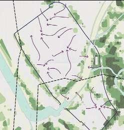
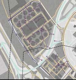
Bird habitat patterns and typologies Human flow patterns
Brownfield Agriculture
Co-Living System of Bird Habitat, Agriculture & Culture
Accessibility to amenities
Easy within 100m distance
Accessibility to green spaces
Moderate within 200m distance
Difficult more than 200m distance
Easy within 100m distance from path
Moderate Green spaces surrounded by trees and shrubs
Difficult Green spaces are blocked by trees and waterbodies
Urban
Proposal A landuse: bird habitat preservation
R(A) Residential group A
R(B) Residential group B
R(C) Residential group C
nature value
Total planned population: 24,323 people / km2 (1.825% increase of existing density)
Co-Living System of Bird Habitat, Agriculture & Culture
Proposal B landuse: economic development
R(A) Residential group A
R(B) Residential group B
R(C) Residential group C High nature value Medium nature value Low nature value
Total planned population: 29,642 people / km2 (2.409% increase of existing density) 100m
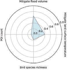
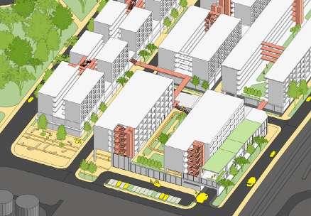
Proposal A scenario 1: Green expansion and elevation for bird habitat
network
Mitigated land temperature: 2.3ºC
Mitigated flood vol: 13535.5 m3
Bird species richness: 17.1
Tall trees Short trees Shrubs Grass Water Building Road
POI Count: 679.7
100m
Co-Living System of Bird Habitat, Agriculture & Culture
Proposal A scenario 2: Wetland and pond expansion for bird habitat
Mitigated land temperature: 2.6ºC
Mitigated flood vol: 12640.7 m3 POI Count: 408.7
species richness: 12.3
Proposal A scenario 3: Adaptive floodplain for bird habitat
Mitigated land temperature: 2.6ºC
Mitigated flood vol: 13308.6 m3
Bird species richness: 12.0
POI Count: 441.4
Tall trees
Short trees
Shrubs Grass Water Building Road network
100m
Co-Living System of Bird Habitat, Agriculture & Culture
Proposal A integrated scenario: Wetland and pond expansion for bird habitat
Mitigated land temperature: 2.8ºC
Mitigated flood vol: 13535.5 m3
POI Count: 679.7 Bird species richness: 17.1
Tall trees Short trees Shrubs Grass Water Building Road network
Proposal B scenario 1: Food industry development for economic growth
Mitigated land temperature: 2.6ºC
Mitigated flood vol: 11076.4 m3
Bird species richness: 10.0
POI Count: 941.9
Tall trees
Short trees
Shrubs Grass Water Building Road network
100m
Co-Living System of Bird Habitat, Agriculture & Culture
Proposal B scenario 2: Food production as drivers for economic growth
Mitigated land temperature: 2.6ºC
Mitigated flood vol: 12665.1 m3
POI Count: 918.5
Bird species richness: 12.0
Tall trees Short trees Shrubs Grass Water Building Road network
Final integrated proposal: Co-living system of bird habitat, agriculture & culture
Mitigated land temperature: 2.8ºC
Mitigated flood vol: 13024.5 m3
Bird species richness: 16.3
POI Count: 680.9
Tall trees Short trees Shrubs Grass Water Building Road network
100m
Co-Living System of Bird Habitat, Agriculture & Culture
Proposed ecological corridors
Proposed food production areas
Residential A
Residential B
Residential C
Farmland
Forest
Low economic value
High economic value
Food production zones of farmland
Farmland
Forest 100m 100m
Physical model
Using the 3D-printed model of the existing site conditions, materials were overlaid to represent different population densities and biodiversity densities. Model making was integral to the iterative process leading up to the final proposal.
Reflecting on the use of pattern-function analysis for town planning
In our project, the pattern-process-function relationship has been key to understanding how various site elements interact. We began by identifying patterns of green patches, which directly affect biodiversity, particularly bird species richness. Using a dashboard application, we analyzed bird species richness and discovered that the closer the green patches are, the better the connectivity of the green network, which in turn boosts bird species richness.
Similarly, we identified that the industrial area plays a vital role in the site’s economic growth. During our site visit, we found that the industrial zone, particularly food production and agriculture, impacts the area’s economic value. Additionally, the road network affects the number of points of interest (POI), influencing population density. This influx of people fosters economic growth through more job opportunities, longer business hours, and higher food demand.
By applying the pattern-process-function relationship, we gained insights into how the patterns of green patches, industrial zones, and road networks shape both ecological and economic processes. This understanding has enabled us to design a site that promotes environmental sustainability while supporting economic growth.
SITE B3
Land Sharing or Land Sparing?
Lina Altoaimi | Mariam Yusuf Rajkotwala | Pan Yuwen
Our land sharing proposal for Sheung Shui reimagines Hong Kong’s fragmented brownfields as inclusive, ecologically resilient, and economically adaptive urban landscapes. Rooted in the idea of equitable cohabitation, the plan supports both current users such as logistics and construction industries, along with the existing villages and future residents by layering programs that enable shared access rather than exclusive use. It avoids displacement by integrating existing informal uses into a broader vision of community-oriented development.
The proposal introduces public spaces within and between industrial zones, offering improved and new amenities, such as increasing accessibility and walkability, pocket parks, green corridors, and multi-use civic platforms. Furthermore, protecting and nurturing the natural environment is a key strategy approached through the reintroduction of hydrological systems and nature-based design.
Economically, the proposal takes a phased and adaptive land-sharing approach that balances immediate functionality with long-term transformation. Existing industrial operations are not abruptly removed, but gradually upgraded and repositioned for gradual densification and circular upgrades.
Final proposed population density: 22,000/ km2
Urban heat due to brownfield pavement Linear economies Invasive species
Inaccessible wetlands Illegal fishing activities
Wastescapes due to brownfield leftover items
Potential
Potential to improve path from neighborhood to park
Potential to improve connectivity to key biodiversity zones
Concrete river bed
to improve connectivity between parks
Initial concept for iterations
Following project 1, the regional land sparing proposal was split into two contrasting versions of proposal iterations for site 3: land sparing and land sharing.
Land sparing
Typical land sparing Proposed land sparing Strategies
Monofunctionality
Uniform patch shapes
Vertical and horizontal sprawl
1. Mixed height, mixed use
Multifunctionality
Varying patch shapes
Potential ‘volumetric’ clustering
Land sharing Strategies
Typical land sharing Proposed land sharing
Monofunctionality
Uniform patch shapes
Uncontrolled sprawl
2. Rejuvenating brownfield for government use
3. Naturalizing river for biodiversity
4. Large public green spaces
Multifunctionality
Varying patch shapes & organic grid
Clustering spaces
Distinct low & high rise zones
Rejuvenating brownfield for circularity
Wetlands to promote ecotourism
Fragmented public green spaces
1.
2.
3.
4.
Land Sharing or Land Sparing?
Population estimates & targets
The initial population targets for both land sparing and land sharing design proposals aim to exceed the existing population density on site while prioritizing functional aspects of the design.
Later iterations recalculate the population targets to aim for higher densities than the estimated one by the Government’s plan.
Base map: current conditions and initial proposals
Existing conditions
This map provides a foundational analysis of the conditions on site 3, comparing it to the envisioned proposal conditions.
Land Sparing iteration 1.0
4-Lane main road (asphalt)
2-Lane secondary road (asphalt)
Maintenance road (perforated)
Car park (asphalt)
River park walkway (concrete)
Naturalised river path
Wetland trail path (timber)
Designated bike path (concrete)
Ng Tung River
Shek Sheung River Wetlands
Ponds and lakes
Water storage field Large drains
Brownfield containers
Village houses
Village shacks
Religious temple
Institution
Other
Woodland + shrubby woodland
Shrubland + shrubby grassland
Grassland Agriculture
Urban green
Bare soil rocks
Paved surfaces Graves
Land Sharing or Land Sparing?
Nature & human flows: current conditions and initial proposals
Existing conditions
This map represents the movement and interactions of people and nature on site.
Hydrology: current conditions and initial proposals
Existing conditions
Drainage map (base conditions): Inlet Outlet
Water
Stormwater storage field 5m contours
Water chanel
Stormwater pipe
Sewage pipe
Permeability levels:
Impermeable (concrete / asphalt)
Low (compacted soil)
Moderate (perforated concrete)
Very
High (soil / planters)
(marshy soil / ponds)
Climate: current conditions and initial proposals
Wind rose
Existing conditions
20-30 km/hr
10-20 km/hr
5-10 km/hr
<5 km/hr
Existing conditions
3-6m tall buildings
9-12m tall buildings
15-18m tall buildings
Road network 23ºC 18ºC
Land Sharing or Land Sparing?
Public / private: current conditions and initial proposals
Existing conditions
This map translate the site findings on private and semi-private spaces, and envisions more publically-accessible areas in each proposal.
Economy: current conditions and initial proposals
Existing conditions
This map represents the current lowdensity economic landscape on site. The proposals suggest opportunities to foster circularity and connectivity between industries.
Commercial
Green environmental industry
Logistics & supply chain hub
Government facilities
Wetland eco-tourism
Naturalized river
Others
Research-based industry
Transportation network
Human network
Land Sharing or Land Sparing?
Economy: current economic relationships on site
Economy: potential for circularity
Walkability: current conditions and initial proposals
Existing conditions
This map explores walkability and accessibility on site as a part of health indicators.
Residential building School
Residential area
Water Green space
Walking and cycling tracks
Public transport path
Landscape discontinuities
Bus stop
Land Sharing or Land Sparing?
Walkability and potential to densify nature across urban spaces
Potentials to enhance nature connectivity
Concept for more organic sequencing of green landscapes across pathways
Analysis of iteration A: Land Sparing via guidelines
Iteration A dashboard results
The dotted lines suggest that future iterations should aim for higher bird species richness, through targeting indicators such as tree canopy height variation.
Land Sharing or Land Sparing?
Analysis of iteration B via guidelines
Iteration B dashboard results
The dotted lines suggest that future iterations should aim for higher bird species richness and POI count, through targeting indicators such as tree canopy height variation, increased edge density of building footprints, and increased street lengths.
Refined proposal A: Land Sparing
This revised iteration of proposal A highlights high-value natural zones, potential restoration areas, and intensive development sites, aiming to maximize biodiversity protection while accommodating human activities efficiently.
4-Lane main road (asphalt)
2-Lane secondary road (asphalt)
1-Lane road (asphalt)
Car park (asphalt)
Maintenance path (perforated)
River park walkway (concrete)
Naturalised river path
Wetland trail path (timber)
Designated bike path (concrete)
Proposed bus stop
Naturalized river and streams
Shek Sheung River
Wetlands
Ponds and lakes
Water storage field
Village houses
High rise residential
Mid rise residential
Institution
Government facility
Other
Woodland + shrubby woodland
Shrubland + shrubby grassland
Grassland
Agriculture
Urban green
Paved surfaces
Graves
100m
Land Sharing or Land Sparing?
Refined proposal B: Land Sharing
This revised iteration of proposal B highlights mixed-use areas that balance human activity with ecological preservation, such as green infrastructure, multifunctional landscapes, and shared spaces that support both biodiversity and urban living.
4-Lane main road (asphalt)
2-Lane secondary road (asphalt)
1-Lane road (asphalt)
Car park (asphalt)
Maintenance path (perforated)
River park walkway (concrete)
Naturalised river path
Wetland trail path (timber)
Designated bike path (concrete)
Proposed bus stop
Naturalized river and streams
Shek Sheung River
Wetlands
Ponds and lakes
Water storage field
Village houses
High rise residential
Mid rise residential
Institution
Government facility
Other
Woodland + shrubby woodland
Shrubland + shrubby grassland
Grassland
Agriculture
Urban green
Paved surfaces
Graves
Integrated proposal: Land Sparing + Land Sharing+ aims to densify residential and industrial estates on existing built-up brownfield spaces, while preserving existing nature on site.
4-Lane main road (asphalt)
2-Lane secondary road (asphalt)
1-Lane road (asphalt)
Car park (asphalt)
Maintenance path (perforated)
River park walkway (concrete)
Naturalised river path
Wetland trail path (timber)
Designated bike path (concrete)
Proposed bus stop
Naturalized river and streams
Shek Sheung River
Wetlands
Ponds and lakes
Water storage field
Village houses
High rise residential
Mid rise residential
Institution
Government facility
Other
Woodland + shrubby woodland
Shrubland + shrubby grassland
Grassland
Agriculture
Urban green
Paved surfaces
Graves
Land Sharing or Land Sparing?
Comparison using dashboad and refinement of integrated proposal
Existing conditions
Government plan
Land sharing+ (initial proposal)
Urban indicators
Tree canopy height variation and building height variation of Land Sharing+ are in greater value than the current and government conditions.
Projected urban functions
Mitigated land temp: 3.0ºC
Mitigated flood vol: 16017.8 m3
POI Count: 115.6
Bird species richness: 11.0
Mitigated land temp: 3.3ºC
Mitigated flood vol: 16168.1 m3
POI Count: 119.0
Bird species richness: 13.7
Mitigated land temp: 3.3ºC
Mitigated flood vol: 13110.4 m3
POI Count: 123.0
Bird species richness: 10.1
Finalized axonometric render
This plan illustrates how nature is densified through providing urban green spaces, partially naturalizing existing drainage paths, and creating green corridors throughout the site.
Biochar production Research & development
Educational Incubator hub
Social / networking areas
Offices / co-working
Logistics industry
Timber industry
Concrete industry
Steel industry
Warehouse industry
Landscape / research industry
Commercial / F&B
Land Sharing or Land Sparing? Site B3
Final proposal plan: Land Sharing+
Projected population density: 22,000 / km2
Projected nature density:
>30% large patches of natural habitat / km2
>20% small patches of vegetation / km2
Tall trees Short trees Shrub Grass Water Low rise Mid rise High rise 4-lane road 2-lane road Paths
Paved surface
Physical concept model
A projection of different colored sticks is created over the 3D printed model. The aim for this model is to visualize proposed densities of different variables on site 3, and reflects a combination of both the land sparing and land sharing iterations.
The light brown (uncolored) sticks indicate residential areas, and dark brown indicate industrial zones which are clustered North of the river. Light green indicate urban greenery, while dark green indicate preserved existing greenery.
Land
Sharing or Land Sparing?
Reflecting on the use of pattern-function analysis for town planning
Having created our base map through satellite maps, data provided by the research team, and our own observations on site, we extracted existing patterns and explored how we might use them to maximize the functions of biodiversity, urban flood, climate, health, and economy in detail. Our goal from project 1 was to optimize multi-use spaces for both human and nature, hence we chose to explore land sharing and sparing as two different means of pattern-based planning for high density environments.
Though we realized the Dashboard was somewhat limiting in analysing the key functions in depth, we used it alongside our own research and understanding. However, the Guidelines were useful in understanding quantifiable tradeoffs and opportunities to improve our design.
Ecological spaces on our site are integrated with socio-economic factors to enhance the five key functions, hence creating our final proposal which optimizes land-use and spatial layouts by layering them at various scales within our site. The use of iteration in pattern-process-function relationships has exposed us to a thorough and effective way of decision-making, and has pushed us to consider all variables and possible outcomes in design.
This proposal uses natural watershed boundaries to guide zoning, ensuring development aligns with hydrological flows and environmental conditions. Low-lying areas are identified for water bodies, permeable landscapes, and multifunctional and flexible public spaces that enhance flood resilience and user experience. By using a landscape first approach. blue and green spaces are prioritised to be strategically placed in low-lying zones to increase the current permeability on site. Mixed-use developments are then incorporated alongside temporal and flexible open spaces.
A high population density is achieved by allocating 40% of the site to residential units, incorporating village housing, high-rise buildings, and mixed-use developments. Decentralising the current government proposal through watershedbased planning ensures each zone has sufficient resources, allowing residents to be in closer proximity to amenities.
Final proposed population density: 16,000/ km2
Seah
Site context
Key infrastructure lie within site 4, including transportation and untility infrastructures.
Planning objectives for project 2
Developing dynamic landscapes
Enhancing linear network connectivity
Watershed-based planning
Baseline map
This map compares the Government masterplan with existing site conditions in Sheung Shui to identify potential areas for redevelopment or preservation.
Due for redevelopment
Under construction
Residential (group A)
Commercial
Other specified use
Village-type development
Agriculture
Maximum building storey
Potential transformation zones
Government or community
Industrial Green belt
Open space
Dense + Ecological
Public and private spaces
Commercial and productive spaces, transport and logistics, private property.
Public: governmentowned infrastructure, open nature spaces, public housing.
Accessibility
Land and buildings are categorized according to time-based accesibility and access by specific groups of people.
Public
Semi-public
Semi-private
Private/ inaccessible
Restricted access points
Public: roads, parks, public open spaces
Semi-public: Community centers, car parks
Semi-priate: Schools, factories, farmlands
Private: Riverbanks, stormwater storage ponds
Restricted: stormwater pumping station, river, sewage treatment
Dense + Ecological Site
Biodiversity (Fauna)
Wildlife observations on-site revealed species clustering within their natural habitats, away from urban areas. Despite segregation between human and nature, interactions persist.
Ecologically valuable areas
Birds
Insects, mollusks, arachnids
Mammals
Fish
Amphibians
Biodiversity spotted on site
White wagtail
Spotted dove Grey heron
Red-whiskered bulbul
Chinese pond heron
Red-billed blue magpie
Blackwinged stilt Oriental magpie
Blackcollared starling
Whitebreasted waterhen
Masked laughing thrush
Great egret Oriental magpie-robin Nile tillapia Brown cattle
100m
Habitat types
Despite the site’s predominantly urban classification, several green habitats support wildlife. These ecologically valuable areas present opportunities for preservation.
Woodland
Woody shrubland
Shrubland
Shrubby grassland
Grassland
Urban green
Agriculture
Rural plantation
Mixed barren land
Bare rock soil
Modified waterway
Artificial pond
Woodland Shrubland Grassland Urban green
Agriculture Mixed barren land Modified waterway Artificial pond
Dense + Ecological
Green coverage
The green spaces in Site 4 feature a diverse range of tree species with varying canopy heights, influencing microclimate conditions and ecological functions.
Site boundary
Farmland Park
Woodland Grass Shrubs Short trees Tall trees
Cotton tree
Hairy fig Portia tree
Bishop wood Paperbark tree
100m
Permeability
This map categorizes land surfaces based on their ability to absorb and filter water, influencing flood risk, and stormwater management. It highlights five levels of permeability
Level 1– impermeable
Level 2– low permeability
Level 3– semi-permeable
Level 4– moderately permeable
Level 5– Highly permeable
Level 1: Large rooftops, sealed concrete, stone
Level 2: Asphalt roads, concrete parking lots
Level 3: Compacted lawns, sports fields
Level 4: Parks, landscaped areas, agricultural land
Level 5: Porous soils, wetlands, forests
Dense + Ecological
Water flows
Surface runoff, indicated by blue contour-based flow lines, follows the natural topography and drains into the Sheung Yue River and Shek Sheung River.
Site boundary
Waterbodies
Sewage network
Surface runoff
Watershed boundary
Water flow direction
Potential water-responsive areas
Climate: Sun-shade
The sun shading analysis for the Sheung Shui area in Hong Kong highlights the impact of solar exposure and shading on the urban environment.
Least shaded area / highest surface temperature
Most shaded area / lowest surface temperature
Shadow maps
9 AM 12 PM
shadow maps
Dense + Ecological
Climate: Wind speed
The wind rose diagram shows that winds mainly come from the east and southeast, with recorded speeds ranging between 0.2 m/s and 9.0 m/s.
Human flow
On Site 4, the distributions and directions of paths are influenced by the motorway and the layout of building clusters. There are only a few POI on site.
Small business Bus stop
Pedestrian path Cycle track Bus routes 100m
Dense + Ecological
Vehicular and pedestrian circulation
Car circulation is evenly distributed across the site, including the sewage and construction areas, with intersection nodes clustering at major road crossings.
Pathway intersections
Pathways (links between nodes on site)
Road intersections
Roads (link between nodes on site)
Number
*A higher cyclomatic number improves network resilience but may add inefficiencies, while a lower number simplifies the network but may cause congestion.
Proximity of consumption places
This map illustrates how Site 4 is covered by 5, 10, and 15-minute walking isochromes. It shows that high density urban villages are all located within the 15-minute loop.
Parks are included within a 10-minute walking distance. The majority of the site is included in the school, clinic, and hospital 15-minute walking distances.
Park School Clinic
Park: 10-minute walking distance
School: 15-minute walking distance
Hospital: 15-minute walking distance
Clinic: 15-minute walking distance
Dashboard workflow visualization
Dense + Ecological
Case study of new town populations in Singapore
Residential area ratio = residential area / total area
Residential desnsity = population / residential area
Current population density
8,000 – 10,000 / km2
Government proposed density
14,000 – 15,500 / km2 (based on newly planned residential units)
Proposed density for proposal A: Watershed-based planning
16,000 / km2
40% Residential ratio in site 4
Proposed density for proposal A: Heterogeneous planning
20,000 / km2
50% Residential ratio in site 4
Draft iterations of proposals
Dense + Ecological
Proposal A: Watershed-based planning
This proposal uses natural watershed boundaries to guide zoning, ensuring development aligns with hydrological flows and environmental conditions. Decentralizing the current government proposal through watershed-based planning ensures each zone has sufficient resources, allowing residents to be in closer proximity to amenities.
LAD4010 Design 8 & LA4702 MLA studio AY 2024-25, Semester 2
Authorship Deston, Yingzhao, Winston
Waterbody
Tall trees
Short trees
Shrub / farmland
Grass
Hard surface open space
Residential (village type)
Residential
Residential + commercial
Commercial
Business
Industry
Education
Health & medical care
Recreation
Civic & community institutions
Place of worship
Infrastructures
Transport facilities
Roads
Watershed boundary
Proposal B: Heterogeneous Planning
This proposal transforms an aging industrial corridor into a vibrant, high-density community. A naturalized canal serves as a seasonal public space, and former industrial buildings are repurposed into commercial hubs. 50% of the site dedicated to housing, ensuring a dynamic, walkable neighborhood integrating nature, heritage, and community-driven innovation.
LAD4010 Design 8 & LA4702 MLA studio
AY 2024-25, Semester 2
Waterbody
Tall trees
Short trees
Shrub / farmland
Grass
Hard surface open space
Residential (village type)
Residential
Residential + commercial
Commercial
Business
Industry
Education
Health & medical care
Recreation
Civic & community institutions
Place of worship
Infrastructures
Transport facilities
Roads 100m
Authorship Deston, Yingzhao, Winston
Integrated proposal development
Land parcel allocation:
Instead of haphazard zoning, zones are demarcated alongside natural watershed boundaries
Blue-green distribution:
By using a landscape-first approach, blue and green spaces are prioritised to be strategically placed in low-lying zones to increase the current permeability on site.
Human network:
Critical networks such as the main roads and MTR tracks are retained. The allocation of roads will be categorized based on 4, 2, and 1-lane roads alongside pedestrian pathsways and cyclist tracks.
Land use planning
To increase the already heterogeneous site by incorporating more mixed-use developents alongslide temporal and flexible open spaces.
Integrated proposal: Dense + Ecological
This proposal integrates watershed-based planning with urban renewal to create a resilient, high-density community. Developments are dencentralized, ensuring each space has access to amenities while supporting a population density of 16,000/ km2. This approach blends nature, heritage, and innovation, promoting a walkable, adaptive urban environment.
This proposal uses natural watershed boundaries to guide zoning, ensuring development aligns with hydrological flows and environmental conditions. Low-lying areas are identified for water bodies, permeable landscapes, and multifunctional and flexible public spaces that enhance flood resilience and user experience.
Ecological spine (green corridor) Blue network
100m
Waterbody Tall trees Short trees
Shrub / farmland Grass
Comparison between current conditions, government plans, and proposal
Existing conditions
Government plan
Integrated proposal
Urban indicators
Projected urban functions
Mitigated land temp: 2.7ºC
Mitigated flood vol: 7759.3 m3
POI Count: 3793.7
Bird species richness: 13.5
Mitigated land temp: 2.9ºC
Mitigated flood vol: 14117.3 m3
POI Count: 431.7
Bird species richness: 12.8
Mitigated land temp: 2.8ºC
Mitigated flood vol: 13987.4 m3
POI Count: 95.6
Bird species richness: 14.0
Dense + Ecological Site
Comparison between proposals using Dashboard metrics
Proposal A
Proposal B
Integrated proposal
Urban indicators
Projected urban functions
Mitigated land temp: 2.7ºC
Mitigated flood vol: 6795.4 m3
POI Count: 5093.5
Bird species richness: 13.6
Mitigated land temp: 2.8ºC
Mitigated flood vol: 13443.9 m3
POI Count: 1016.8
Bird species richness: 14.5
Mitigated land temp: 2.8ºC
Mitigated flood vol: 13987.4 m3
POI Count: 95.6
Bird species richness: 14.0
Finalized axonometric render
This proposal uses natural watershed boundaries to guide zoning, ensuring development aligns with hydrological flows and environmental conditions. Low-lying areas are identified for water bodies, permeable landscapes, and mulfifuntional and flexible public spaces that enhance flood resilience and user experience.
A population density of 16,000 people/km 2 is achieved by allocating 40% of the site to residential units, incorporating village housing, high-rise buildings, and mixed-use developments.
Waterbody
Tall trees
Short trees
Shrub / farmland
Grass
Hard surface open space
Residential (village type)
Residential
Residential + commercial
Commercial
Business
Industry
Education
Health & medical care
Recreation
Civic & community institutions
Place of worship
Infrastructures
Transport facilities
Roads
Watershed boundary
Dense + Ecological
Final proposal plan: Dense + Ecological
Decentralising the current government proposal through watershed-based planning ensures each zone has sufficient resources, allowing residents to be in closer proximity to amenities.
100m
Physical model
Using an acrylic sheet to lay over the site model, coloured sticks are added as an indicator of human and nature densities within the 20m2 grid. The varying heights represent an estimate of 1cm for every 10 humans. For nature, 4 different heights were used to represent grass, shrubs, low trees, and tall trees. The watershed boundary is marked using string.
Reflecting on the use of pattern-function analysis for town planning
Applying the pattern-process-function relationship in design allows for a more ecologically integrated urban environment.
By analyzing spatial patterns, such as watershed boundaries, ecological networks, and urban densities, we can propose ideas that align with natural processes like water flow, biodiversity movement, and climate adaptation. Eventually, we are using this approach to pursue a balance between human densification and nature’s prosperity, promoting layered land use, mixed-density zoning, and decentralized planning. A key feature is it enables flexible land use, where spaces can shift functions over time, such as floodable parks, seasonal markets, or multi-use public areas. These programs can take place in the various open spaces within the master plan.
Furthermore, we found various synergies and trade-offs that could influence our proposal by analysing different patterns. It led us to focus on solutions mitigating urban heat, improving stormwater absorption, and supporting biodiversity restoration. By integrating green corridors, permeable surfaces, and adaptive infrastructure, the area can become more climate-resilient.
Finally, this approach strengthens connectivity and accessibility. When we analyse patterns such as proximity using isochromes, we are then able to improve pedestrian movement, transportation, and accessibility. Through pattern-driven design, the final proposal allows our site to become multifunctional and adaptive, supporting both human and ecological well-being.
PROJECT
3: ENVISIONING LANDSCAPES FOR FUTURE NEW TOWNS
Experience Landscape Li Xiyuan
Agri-Cultural Landscapes
Sun Peiqiang
Made in HK
Lee Wen Qi Sherly
TEAM A1 PROPOSALS
Experience Landscape: Weaving Rural Memory into Kwu Tong’s Mobility Network Li Xiyuan P.206
Made in HK Lee Wen Qi Sherly P.214
Agri-Cultural Landscapes: Integrating Nature, Culture, and Community into Kwu Tung’s Farmlands Sun Peiqiang P.222
EXPERIENCE LANDSCAPE
– WEAVING RURAL MEMORY INTO KWU TONG’S MOBILITY NETWORK
Li Xiyuan
The existing transportation network in Kwu Tong is marked by disconnection and inaccessibility, and lacks sufficient capacity to accommodate anticipated population growth. These constraints not only hinder future development but also limit how residents and visitors interact with the area’s cultural and spatial character. Without a coherent and comfortable mobility framework, users often experience fragmented routes, inconsistent access, and a lack of visual or spatial continuity. As a result, the daily journey across Kwu Tong becomes inconvenient, difficult to navigate, and visually underwhelming, reducing the potential for meaningful place attachment. At the same time, the region’s evolving role as a rural-urban interface presents a unique opportunity to rethink mobility as a way of storytelling and spatial experience. This project addresses these challenges by proposing an experiential mobility network rooted in local identity and embedded in the terrain. Strategy 1 involves locating key anchors—such as cultural landmarks, ridgelines, and thresholds—to enhance spatial connectivity and circulation efficiency. These points are integrated into a layered network that respects rural memory while guiding users through distinctive environmental sequences.
Strategy 2 focuses on leveraging existing conditions, including topographical variation, informal footpaths, and vegetation corridors, to minimize disruption and maximize ecological value. Rather than imposing a new structure,the design amplifies what already exists, allowing the network to grow organically from the landscape.
Strategy 3 enhances users’ experiences by providing shaded routes, rest points, framed views, and moments of interaction with both nature and cultural memory. Ultimately, the proposal illustrates how mobility infrastructure can be both functional and place-sensitive. By balancing accessibility, ecological performance, and cultural continuity, the project offers a replicable model for other urbanizing peripheral areas of Hong Kong facing similar pressures of growth and preservation.
Experience Landscape Li Xiyuan
Current traffic conditions
NDA transport network
Government plan conditions
Main traffic flow Road network on site NDA
NDA framework
Road network pattern transformation case study
Strength: Current network can facilitate estimated population
Weaknesses: Broken road lines, scattered destinations, and limited space for road developement
Opportunities: Potential for improvement using flat terrain, potential to meet the needs of tourists
Threats: Excessive pathways may affect environment, may promote higher population
Tsuen Wan
Sha Tin
Kowloon Peninsula
SWOT analysis
Experience Landscape Li Xiyuan
Existing materials and uses
The conventional road network paradigm exhibits critical limitations in multimodal integration and spatial, consequently degrading holistic user experience.
Topographic adjustments
Before After
Road network reconfiguration
Before After
Modified contour lines are shown in red.
Based on a 1.3x denser layout:
66.1% of roads are easy to walk on, compared to a previous 52.98%
4.13% of roads are difficult to walk on, compared to a previous 10.04%
100m
Proposed design plan
Network details
Primary distributor road (4-lane)
District distributor road (2-lane)
Local distributor road (1-lane)
Cycle track
Pedestrian overpass
Footpath
Entry to site
Bus station
100m
Experience Landscape Li Xiyuan
Key locations on site
Daily light interval (18mol/m2/day)
88% of the designed paths lie on DLI zones under 18mol/m2/day.
The average slope along the route is ≤10º
Experience Landscape Li Xiyuan
Cyclist hub 1 unit
800m radius
First aid kiosk 1 unit at Loop Junction
Bike repair pods
2 units
400m spacing
Landuse typologies
Vista Cafe 1 unit at Key Vista Spot
Adaptive Pavillion 2 units
350m radius
Info-SOS Totem 4 units
250m spacing
MADE IN HK
Lee Wen Qi Sherly
Hong Kong’s small-scale industries once formed the core of its economy and cultural identity, proudly bearing the “Made in HK” label. However, urban expansion and shifting economic priorities have led to their decline, endangering local craftsmanship and small businesses. Kwu Tung, one of the last remaining industrial clusters, now faces redevelopment pressures that threaten its unique legacy of innovation and community. Environmental degradation from decades of industrial activity adds further complexity. While some post-industrial efforts in Hong Kong have transformed buildings into creative spaces, they often miss the deeper cultural and historical context.
This project sees Kwu Tung as a chance to rethink post-industrial renewal through three interlinked strategies. First, it emphasizes leveraging existing resources to serve new, sustainable functions, fostering continuity and reducing waste. Second, it aims to build green entrepreneurship by supporting small businesses engaged in repair, recycling, and eco-product development, contributing to a circular economy while creating jobs and restoring the environment. Finally, the project places strong emphasis on community involvement. By creating platforms for local craftspeople, residents, and youth to contribute ideas and share their stories, it ensures that redevelopment remains deeply rooted in lived experience.
This project envisions a future where the area becomes a model for post-industrial renewal, rooted in cultural heritage, sustainability, and innovation.
Made in HK
Investigating small-scale industries in Hong Kong
Lee Wen Qi Sherly
Key artisanal activities remaining on site need to be preserved
Prevalence of industrial spaces on site pose opportunities to revitalize cultural identities
Mapping analysis of existing conditions
Made in HK:
Revitalizing heritage, sustainability, and community through post-industrial transformation
Logistic storage & warehouse
Manufacturing workshops
Waste recycling
Construction storage & warehouse
Automotive services
Abandoned industrial buildings
Residential buildings
Woodland
Shrubland
Grasslands
Roads
Potential buildings to be reused 100m
212 buildings on site are active, while 92 are abandoned
Site design
Key plan
Repurposed
Repurposed
Reused
Reused
Design strategy 1: Preserve
Landforms
Warehouses, shipping containers, and structural elements
Industrial materials
Design strategy 2: Regenerate
Industrial waste
Materials and spaces on site are preserved and adaptively reused in design.
Lee Wen Qi Sherly
Design strategy 3: Connect
Spaces are designed for mixed-use, with both seasonal and year-long events being hosted. This envisions a rejuvention of culture and identity on site.
Made
Proposed design conditions
Made in HK: Revitalizing heritage, sustainability, and community through post-industrial transformation
MADE IN HK
Made in HK
Revitalizing heritage, sustainability, and community through post-industrial transformation
Perspective 1: Engaging plaza MADE IN HK
Revitalizing heritage, sustainability, and community through post-industrial transformation
Perspective 2: Remediation garden
Lee Wen Qi Sherly
AGRI-CULTURAL LANDSCAPES: INTEGRATING NATURE, CULTURE, AND COMMUNITY IN KWU TUNG’S FARMLANDS
Sun Peiqiang
The proposed densification of Kwu Tung presents a significant threat to its rural landscape, which is rich in natural resources and holds deep cultural value as productive agricultural land. Although farming once played a central role in Hong Kong’s identity, it has since declined into a sunset industry, leaving these landscapes increasingly vulnerable to neglect and redevelopment. Nevertheless, this land possesses great potential as a future retreat, particularly for communities seeking flexible, nature-connected lifestyles. Currently, farming settlements across the site are fragmented and disconnected from local businesses and surrounding ecosystems. In addition, agricultural activities have become increasingly monotonous and economically unviable, weakening biodiversity and diminishing farmers’ connection to the land.
This project envisions the revitalization of Kwu Tung’s agricultural heritage through the creation of a productive, biodiverse landscape that harmonizes development with ecological and cultural resilience. By reimagining the site as a place for farming, education, and ecotourism, it aims to promote sustainable livelihoods and empower local communities.
STRATEGIES:
Resource Integration: Harness the site’s natural features (e.g., fertile soil, topography), industrial heritage assets, and local human resource (e.g., resident farmers) to support and enhance sustainable farming practices. Circular Systems: Develop closed-loop systems that support environmentally sustainable and economically viable farming practices. Biodiversity and Cultural Functions: Introduce ecological buffers—such as wetlands and bird sanctuaries—to restore soil health, enhance biodiversity, and integrate social and cultural programming into the productive landscape.
Agri-Cultural Landscapes Sun Peiqiang
Urban pressure on rural heritage: densifying Kwu Tung
Largest active agricultural landscape in Hong Kong: Exploring connecitions with neighboring wetlands
Studying existing farmland conditions
Interviews on site & Farmland plants
Agri-Cultural Landscapes
Mapping site conditions
Sun Peiqiang
Grassland
Shrubland
Woodland
Wetland
Natural waste
Brownfield
Disappearing farm
Farmland
Cultural landscapes
Disconnectivity within the agri-food industry poses an opportunity
1km
Design proposal
Proposed road
Existing road
Existing building
Existing pond
Removed building
Woodland
Shrubland
Productive greening
Residential
Homestay hotel
Tourism center
Farm waste recycling
Proposed rice farm
Food houses
Library
Market
ReFarm factory
Existing farm
Proposed farm
Livestock farm
Botanical garden
Bird sanctuary
Hill decks
Existing trees
Proposed trees
Carpark
200m
Agri-Cultural Landscapes Sun Peiqiang
Remove & repurpose
Enhanced network & living
New farming systems
Eco-tourism along preserved nature spaces
Proposed farming systems and eco-tourism
Agri-Cultural Landscapes Sun Peiqiang
Perspective 1: Framing Farm Life– a Homestay in the Terraces
Perspective 2: Feeding Life– Where Wetlands Meet the Table
Perspective 3: Growing Together– a Landscape with Farmers and Fields
Bridging Traditions
Ho Qian Yu
Reweaving the Urban Fabric
Zhou Yao | Zhou Qinying
Rooted in Soy Qi Kexin
TEAM A2 PROPOSALS
Bridging Traditions: Integrating Heritage and Modernity in the Evolving Urban Landscape
Ho Qian Yu P.232
Reweaving the Urban Fabric: Integrating Bird Migration Corridors into Cityscapes
Zhou Yao | Zhou Qinying P.236
Rooted in Soy: Enhancing Industrial Sustainability through Agriculture and Culture
Qi Kexin P.246
BRIDGING TRADITIONS: INTEGRATING HERITAGE AND MODERNITY IN THE EVOLVING URBAN LANDSCAPE
Ho Qian Yu
The rapid urbanization of the Northern District is leading to the fragmentation and decline of traditional villages, displacing local communities and threatening the loss of rich cultural and historical heritage. These areas, often characterized by dense, unregulated growth, suffer from poor ventilation, trapped heat and pollutants, and a lack of open public spaces, all of which negatively affect residents’ health, comfort, and social well-being. The project aims to address these challenges by integrating cultural heritage into urban planning, enhancing environmental quality through improved ventilation and infrastructure, expanding accessible public spaces, and fostering social cohesion. Ultimately, creating a sustainable and inclusive urban environment where traditional village life and modern development can coexist harmoniously.
By strategically positioning open spaces within existing village structures, this approach enhances environmental quality, preserves cultural identity, and fosters inclusive, multifunctional communities. Interconnected green corridors will link old and new areas, improving air circulation, reducing urban heat island effects, and providing walking and cycling routes that enhance connectivity and promote healthier lifestyles. Culturally rooted activities, such as festivals, workshops, and storytelling, will be integrated with climate-sensitive design elements like shaded seating and green buffers to create vibrant, inclusive public spaces that celebrate local heritage while ensuring comfort for all residents. This approach blends cultural heritage preservation with sustainable urban growth, using green infrastructure, community spaces, and cultural programming to transform urban districts into vibrant, ecologically sustainable, and socially inclusive environments.
Bridging Traditions
Site design: strategic open space planning in villages
Ho Qian Yu
A– Existing cultural landscape spaces
A– Proposed cultural landscape spaces
B– Existing recreational spaces
B– Proposed recreational spaces
Road connecting to car parks
New residential areas
Woodland
Shrubland
Grassland
A– Culture
A1 Ancestral Hall
A2 Village office
A3 Temple
A4 Altar
A5 Outdoor theatre
A6 Community farm
A7 Multipurpose festive space
A8 Village courtyard
B– Recreation
B1 Playground & court
B2 Exercise amenities
B3 Sports amenities
B4 Traditional play area
B5 Alfresco dining area
Green Corridor Integration for Health and Connectivity :
Create green corridors linking old and new areas to improve airflow , reduce heat , and promote walking and cycling.
Green Corridor Integration for Health and Connectivity :
Green corridor integration for health and connectivity
Create green corridors linking old and new areas to improve airflow , reduce heat , and promote walking and cycling.
Interconnected green corridors will integrate both existing and newly developed areas, enhancing air circulation, mitigating urban heat island effects, and offering dedicated walking and cycling routes. These corridors will not only improve spatial connectivity but also encourage active mobility and support healthier, more sustainable lifestyles for the community.
Interconnected green corridors will integrate both existing and newly developed areas, enhancing air circulation, mitigating urban heat island effects, and offering dedicated walking and cycling routes. These corridors will not only improve spatial connectivity but also encourage active mobility and support healthier, more sustainable lifestyles for the community.
Pedestrian network systems
Cultural Programming with Climate Sensitive Design:
Cultural Programming with Climate Sensitive Design:
Blend cultural activities with climate friendly design to create inclusive ,comfortable public spaces that celebrate heritage.
Bridging Traditions Ho Qian Yu
Blend cultural activities with climate friendly design to create inclusive ,comfortable public spaces that celebrate heritage.
Perspective 1: Cultural programming with climate-sensitive design
Perspective 2: Envisioned cultural activities on site
REWEAVING THE URBAN FABRIC: INTEGRATING BIRD MIGRATION CORRIDORS INTO CITYSCAPES
Zhou Yao | Zhou Qinying
Our site lies along a key bird migration corridor, but this ecological route is under dual pressure from north-south urban expansion, and the site itself is at risk of being isolated by surrounding urban structures. Meanwhile, although Mai Po Wetland remains a protected area, its buffer zone allows human access, revealing a broader insufficiency of undisturbed habitat. Within the site, existing habitats are limited and fragmented, failing to support long-term biodiversity and seasonal migration needs. Moreover, current urban structures and infrastructure not only block bird movement but also isolate ecologically valuable zones from human access-weakening opportunities for positive human-nature interactions.
This project envisions an urban ecological system that reinforces the site’s role as a key node along the bird migration corridor, while embedding bird life into the everyday urban landscape. Through a spatial strategy based on species-specific habitat preferences, new ecological patches are introduced to strengthen continuity and resilience. Building forms are adapted in type, height, and permeability, allowing birds to pass through or inhabit structures without collision or disturbance. Infrastructure such as roads, canals, and agricultural fields is redesigned to enable low-impact human access while creating functional habitats and safe transitions for birds. Together, these strategies seek to rebuild ecological flows, expand multispecies territory, and establish a dynamic urban landscape where ecological and social systems are mutually supportive. The project offers a replicable vision for future development in Kwu Tung North, where biodiversity and urbanization are not seen as opposites, but as co-evolving systems.
Reweaving the Urban Fabric
Interrupted bird migration: macro scale urban pressure on corridors
Core habitat
Water source
Site Boundary
Yao | Zhou Qinying
Bird observation spots
Site-scale habitat isolation in Long Valley (modelled map)
Endangered species
Migration species
Local species
Site boundary
Zhou
Habitat and species at risk under development pressure
Pattern analysis: bird biodiversity and human health
Reweaving the Urban Fabric Zhou Yao | Zhou Qinying
Infrastructure and failed interaction between spaces
Road network relationships
Between
Road network pattens on site
Building structure and habitat fragmentation map
Villa area
Village area
Temporary factories
Small businesses
Large businesses
High-rise residences 500m
Design strategies derived from species’ needs and core activity zones
Reweaving the Urban Fabric
Design map
Zhou Yao | Zhou Qinying
Current habitat:
Residential
Commercial
Protected village / other building
Current canopy
Added canopy
Wetland
Open water
Habitat-building:
Farmland
Woodland + Grassland
Proposed population count: 24,323 people / km2 1.825% increase 100m
Additional habitat:
Wetland
Open water
Farmland
Woodland + Grassland
Overall site axonometric
Perspective 1: Residential view
Reweaving the Urban Fabric
Bird’s eye view 1: Typological strategies to accomodate avian movement and co-living
Bird’s eye view 2: Habitat creation
Zhou Yao | Zhou Qinying
Bird’s eye view 3: Bird habitat and spatial typologies
Sectional perspective
Infrastructure:
Habitat: Open water habitat
Waterfront promenade Bird ecology centre
Waterfront
Reweaving the Urban Fabric Zhou Yao | Zhou Qinying
Bird’s eye view 4: Ecological interfaces
Path typologies
Boardwalk
Waterfront steps
Farmland walk
Waterfront steps Wooden bridge
Boardwalk
ROOTED IN SOY: ENHANCING INDUSTRIAL SUSTAINABILITY THROUGH AGRICULTURE AND CULTURE
Qi Kexin
Due to new development in the Kwu Tung area, most existing industries on the site are facing relocation, including Yuet Wo Soy Sauce Factory. As a low-impact food industry that carries the cultural memory of Kwu Tung, the factory holds strong development potential and is thus retained in the initial planning phase. Because the factory relies on imported raw materials, its sustainability is at risk. While its traditional production method lacks the efficiency and scale of large corporations, its strength lies in the rich flavor and the cultural value it carries. Meanwhile, the region’s conditions are well-suited for soybean cultivation, making non-wetland areas appropriate for raw material production. As such, the project aims to shift the factory toward a more sustainable model by growing soybeans on-site and combining production with tourism and education to enhance its cultural and social value.
The project identifies farmable areas and existing infrastructure, integrating them into a circular system. By cultivating soybeans on-site, raw material self-sufficiency is promoted through a system of different kinds of farmland, while infrastructure such as logistics, irrigation, and harvesting is incorporated to support a complete production cycle. Diversified forms of soybean planting are introduced, primarily through productive farmland, and supplemented by small-scale insertions into remnant natural and urban fabrics.
Meanwhile, the entire site is redefined through the integration of the factory and surrounding farmland, becoming a hub for public engagement. Community residents grow soybeans in community or productive farmland and engage in hands-on agricultural education as part of the production process. Visitors are invited to join factory-organized tours to observe key production steps, including fermentation and rooftop sun-drying. Also, visitors can enjoy dishes such as tofu pudding and soy milk, highlighting the richness of soy in everyday cuisine. This project demonstrates how a well-curated business model can enhance the environmental, economic, and sociocultural value of Hong Kong’s peri-urban regions.
Identifying farmable areas and existing infrastructure, integrating them into a circular system.
Rooted in Soy
Site design
Design area
Forest
Rooftop farmland
Green squares
Open-field soybean cultivation
Community soybean plots
Wetlands
Water
Commercial building
Residential building (group A)
Residential building (group B)
Residential building (group C)
Field ridge
Road network
Yuet Wo Food Factory
Commercial area
Residential area
Industrial area
Water treatment zone
Soybean collection & pressing area
Logistics point
Preserving station
Yuet Wo retail store & investment
Impoundments
Purification pond
Qi Kexin
Agriculture and Industry: Soybean farming, processing, and the integration of production flow with public movement routes.
Agriculture and Industry: Soybean farming, processing, and the integration of production flow with public movement routes.
Production process flow and public movement routes
Soybean farming and processing
Public Engagement:
Community farming and agricultural education, interactive factory tours, and soy-based culinary experiences.
Public Engagement:
Public Engagement: Community farming and agricultural education, interactive factory tours, and soy-based culinary experiences.
Public Engagement:
Rooted in Soy Qi Kexin
Community farming and agricultural education, interactive factory tours, and soy-based culinary experiences.
Community farming and agricultural education, interactive factory tours, and soy-based culinary experiences.
Perspective 1: Community farming & agricultural education
Interactive factory tours
Soy-based cuisine
Aggregating Landscape Lina Altoaimi Land Re/Coded Mariam Yusuf Rajkotwala
Adaptive Commoning Pan Yuwen
TEAM B3 PROPOSALS
Aggregating Landscape: Water as an Agent of Urban Growth and Natural Regeneration Lina Altoaimi P.256
Land Re/Coded: Reconfiguring Sheung Shui’s Brownfields Towards a Circular Neighborhood Mariam Yusuf Rajkotwala P.264
Adaptive Commoning: Programming Residual Spaces for Multifunctional Everyday Use Pan Yuwen P.272
AGGREGATING LANDSCAPE: WATER AS AN AGENT OF URBAN GROWTH AND NATURAL REGENERATION
Lina Altoaimi
The transformation of the Ng Tung River into a concrete canal in the 20th century has resulted in various ponds and wetland ecosystems forming only at its fringes. Yet canals and drains are now of low ecological value because of the lack of river bed. Today, these wetland spaces are inaccessible due to private brownfield site expansion and risk redevelopment by the government. Furthermore, existing river revitalization projects in Hong Kong have been limited to small-scale interventions of greening canal surfaces and only assess the performance of micro-habitats. The aim of this project is to densify both nature and human spaces through a multi-axis landsharing and revitalization approach of the focus area, with proposed intersection and multi-functionality of the high rise residential zone, the proposed government facilities, and intensifying the function of water-based habitats found on site; hence, this project aims to explore the interactions between dense residential spaces and restoration of nature spaces at a larger and more rigorous, aggregated scale.
Three key strategies are undertaken to achieve this goal: First, to retrofit and reroute the Ng Tung River over time to include a riparian zone which intends to provide new habitats and improve water quality. Next, to circulate water, such that runoff from residential and commercial zones can be reused after running through the natural filtration systems. Third, to maximize land-use in residential areas (which lie on previous brownfield sites) and connecting them to nature zones as educational and recreational spaces.
Through re-routing the river with a multi-axis land-sharing approach, water and natural systems can promote and meet the needs of urban health and land use, while benefitting natural regeneration processes.
Aggregating Landscape Lina Altoaimi
Current site conditions
Grassland
Shrubland
Woodland
Agricultural land
Urban green (short and tall trees)
Brownfield structure
Low-rise residential
Mid-rise mixed use
High-rise mixed use
Other low and mid-rise
2025 waterways
1982 waterways
Vehicular roads
Paved surfaces
Paved brownfield surfaces
1m topographic lines
200m
Key
Partial waterway naturalization to follow historic meanders
Current conditions
Proposed conditions
Minimally 1:6 edge slope for safety
Additionally, smaller drains are naturalized to improve purification and sediment removal
Research institute to study natural rehabilitation and succession
Phase 3: Stacked residential development
+1 km river length
45% increase in drainage capacity
0.6m depth of streams for accessibility
Open public spaces & perforated buildings allow for micro-habitats to spontaneously grow in between urban spaces
LAND
RE/CODED: RECONFIGURING
SHEUNG SHUI’S BROWNFIELDS TOWARDS A CIRCULAR NEIGHBORHOOD
Mariam Yusuf Rajkotwala
Hong Kong’s land scarcity and growing population have driven expansion and greenfield development, yet vast brownfields remain overlooked. Sheung Shui’s brownfields, positioned along the logistics and economic spine between Hong Kong and Shenzhen, are essential to regional supply chains. However, their fragmented, mono-functional nature and reliance on a linear output model have led to inefficiencies, urban sprawl, and environmental strain. As part of a critical economic zone, Sheung Shui holds unique potential for transformation. While the brownfield is set to evolve into a high density district, supporting 5,000 residents, it urgently needs to rethink waste practices. Many industries still rely on Shenzhen for processing, creating inefficiencies and missed opportunities for resource loops.
This project sees waste landscapes as a catalyst, closing localized loops and supporting new development where architecture and landscape harness waste to meet the growing demands of urban expansion, anchoring a new circular economy. It envisions Sheung Shui as a productive, adaptive, flexible, and ecologically integrated neighborhood where industry, housing, and public spaces support one another through three key strategies. First, reconfiguring land use to support denser, mixed developments. Logistics, construction, nature-based systems, and recycling are phased in to maintain economic continuity and future transitions. Next, integrating circular systems into hard and green infrastructure, transforming waste into ecological and material value. Finally, blurring boundaries between industrial and non-industrial zones to encourage cohabitation. Public spaces accommodate both production and participation, making waste visible, interactive, and part of daily life.
By sharing and sparing land strategically, Sheung Shui’s brownfields can evolve into a resilient model of urban-industrial ecology where waste is not discarded, but re-coded into resource.
Land Re/Coded
Mapping site conditions
Mariam Yusuf Rajkotwala
Warehouse Logistics
Manufacturing / repair
Other industries
Brownfields
Government-proposed new development
Ng Tung River Road network
Economic and logistircs spine East Rail Line
Brownfield expansion in Hong Kong
Mono-functional nature and linear output model
Phase 01: Re/trace – Zoning & waste movement
Mapping, identifying, preserving, and recycling existing networks and resources while introducing relevant industries.
Phase 02: Re/configure – Zoning and waste movement
Configuring mixed land use, initiating on-site waste-to-resource systems, and beginning ecological repair.
Asphalt – retain in place
Asphalt – crush & reuse on site
Asphalt – remove & repurpose on site
Recycle natural assets on site
New softscape with recycled base
Remove specific roads
Preserve existing road networks
Existing brownfield footprints
Land Re/Coded
Phase 03: Re/code
Mariam Yusuf Rajkotwala
Establishing a fully circular, producting landscape, where waste, industry, and everyday life are integrated 1 Container plaza 2 Construction waste management facility
Landscape waste management facility
Mixed-use district axonometric
Mixed-use district
Residential
Car park
Construction waste facility
Landscape waste facility
Biochar production
Research & development
Educational
Incubator hub
Social / networking areas
Offices / co-working
Logistics industry
Timber industry
Concrete industry
Steel industry
Warehouse industry
Landscape / research industry
Commercial / F&B
System loops illustrated
Construction material waste reuse
Container steel waste reuse
Timber waste reuse
Compost waste reuse
Landscape / biochar waste reuse
Ecology and water reuse
Economy loop
Land Re/Coded
Detail axonometric: Waste flow & circular loops
Mariam Yusuf Rajkotwala
Project 3: Envision Landscapes for Future New Towns
LAND RE/CODED: Reconfiguring Sheng Shui's Brownfields Towards a Circular Neighbourhood
System loops illustrated
Waste input
Waste as a resource input
Waste as a resource output
Resource output
Road network
Detail axonometric: Loops in concrete & steel industries
Perspective: Making waste visible, public, and participatory
Sectional perspective: Waste to productive and ecological value
Land Re/Coded
Mariam Yusuf Rajkotwala
Envisioned R&D loops
System loops illustrated
Construction material waste reuse
Container steel waste reuse
Timber waste reuse
Compost waste reuse
Landscape / biochar waste reuse
Ecology and water reuse
Economy loop
ADAPTIVE COMMONING: PROGRAMMING RESIDUAL SPACES FOR MULTIFUNCTIONAL EVERYDAY USE
Pan Yuwen
In a school-centered area in Sheung Shui, North New Territories, large open spaces— including campuses, woodlands, and recreational grounds-remain underutilized. Many of these areas are residual spaces left behind by mismatched zoning, infrastructural gaps, or fenced boundaries. Today, they are often isolated, inactive, or accessible only to limited user groups. This situation reflects not only missed opportunities for multifunctional use, but also growing pressure from rising urban population demands. This project aims to transform these overlooked edge spaces into adaptive, time-responsive, and multifunctional commons, with a core focus on ecological learning and community co-creation.
Three strategies support this transformation. The first is Spatial Transformation, which converts previously enclosed or inefficient spaces into shared grounds for education, recreation, and community activities. Forest learning zones and nature-based educational spaces serve as key anchors. The second is Temporal Programming for Shared Use, which enables flexible use across time, functions, and users. By responding to hourly, daily, and seasonal rhythms, these spaces serve multigenerational needs without requiring permanent construction. The third is Fostering Stewardship and Place-Based Identity, which enhances the spatial and sensory quality of landscapes to encourage community participation, environmental awareness, and a sense of belonging. As Hong Kong currently lacks a formal Forest School model, this project serves as a strategic pilot for high-density communities.
Inserted micro-infrastructure-such as walkways, modular structures, and permeable boundaries-improves accessibility and diversity, encouraging intergenerational stewardship. Framed within an adaptive commoning approach, the project weaves hydrology, education, and daily life into a walkable, inclusive, and replicable public landscape that quietly re-stitches the rhythms of everyday life into a more resilient urban fabric.
Adaptive Commoning
Existing conditions: Inefficient use of public space
Woodland
Pan Yuwen
Open green space
Ornamental green space
Playground
Hardscape
Car park
Street
Sidewalk
Fence
Natural boundary / fence
Government building
Temporary building
Educational building
Spatial distribution on site Softscape distribution on site
Spatial analysis: identification of potential intervention areas on 10x10m grid
Site mobility
Access to spaces
Existing densities
Adaptive Commoning Pan Yuwen
Water flow
Circulation
Function
Overflow / drainage channel
Rain garden / infiltration zone
Water collection square
Multifunctional programming
The main pedestrian spine connects the main school buildings to the forest school classes through shaded wayfinding and porous transitions.
Rooftop link elevated walkway
Primary pedestrian spine
Secondary pathways
Slow lane
Circuit walkway
Key connectors
Connected rooftops
Spaces shift from school use to public use on a timed basis, facilitating weekend markets, family spaces, and intergenerational activity zones.
Rain-responsive spaces, such as the playground, act as seasonal floodbasins–dry during the summer, and playful during monsoon season. 200m
Nature spaces
Educational spaces
Nature + educational spaces
Intergenerational activity zone
Planting area
Spatial typologies
A) Parking node– flexible time-based use
B) Shared lawn
D) Main pedestrian network
Axonometric view of site design
C) Woodland area planting palette
E) Quiet edge with rain-responsive features
Adaptive Commoning Pan Yuwen
Perspective 1: Mixed-use space
Perspective 2: Woodland area
Post Infratructure
Seah Yun Zhang Deston
Temporal Hybridity Chen Yingzhao
The Everyday Corridor Choi Yung Zhen Winston
TEAM B4 PROPOSALS
Post Infratructure: (Re)Routing Urban Water Systems Seah Yun Zhang Deston P.280
Temporal Hybridity: Revitalization Strategies for Sheung Shui Wai Village and Industrial Cluster Chen Yingzhao P.288
The Everyday Corridor: Reclaiming Linear Landscape Infrastucture for Inclusive Communities Choi Yung Zhen Winston P.296
POST INFRASTRUCTURE: (RE)ROUTING URBAN WATER SYSTEMS
Seah Yun Zhang Deston
Through watershed and heterogenous planning, this project proposes the transformation of the site into a high-density, mixed-use community that accommodates a projected population density of 16,000 people/ km2, balancing urban expansion with environmental restoration. Originally built in the 1980s, the Shek Wu Hui, Sewage Treatment Works has undergone multiple expansions, including a 2015 plan to upgrade it into the Shek Wu Hui Effluent Polishing Plant, serving 300,000 residents in Sheung Shui and Fanling. Alongside government plans, the site has potential to be redeveloped.
Currently, the site is is one of several zones that contributes to ecological fragmentation, disrupting habitat connectivity between surrounding green spaces and limiting biodiversity movement. Additionally, its existing highly impermeable industrial infrastructure has no spatial correlation with and disrupts natural water flows, weakening the watershed’s ability to regulate stormwater and support ecological processes. To address the aforementioned issues, this project aims to develop hydrological networks as the backbone for this high-density neighborhood development.
Key strategies include strategically positioning blue and green spaces to promote sustainable stormwater management, water recycling, and habitat enhancement. Also, to repurpose existing infrastructures to fit current development demands as well as to provide multifunctional open spaces for both human and nature. Finally, the design will accommodate the growth of nature and increasing population density over time through an incremental development plan. By prioritizing a landscapefirst approach, this project envisions a post-industrial, water-integrated community in Sheung Shui-one that restores ecological connectivity, enhances watershed resilience, and harmonizes urban living with the natural environment.
Green connectivity – macro site Proposed residential buildings
Impermeable
Low permeability
Semi-permeable
Moderate permeability
Highly permeable
Main water flow
Human flow
Surface runoff Grass
Post Infrastructure
Design plan
Seah Yun Zhang Deston
Axonometric of phased development
Current condition: Shek Wu Hui Sewage Treatment Works
Road network
Phase 1: Landscape-first enhancements
Phase 2: Human development
Connective green residential model
Development type 14 residential blocks 9 mixed-use residential blocks
Total site area 0.15 km2
Number of residential units 1,067 units
Population 3,200 people
Post Infrastructure
Seah Yun Zhang Deston
Perspective 1: Greywater reuse through aquaponics for ecological filtration and local food production
Living machine treatment system
Community aquaponics
Perspective 2: Blackwater circulation through a living machine system
Annual water usage / person 141 L
Total annual water usage 451,200 L
Annual water reuse estimate 88% | 351,500 L
Sectional perspective A: Proposed mixed-use development model
Residential
Commercial
Greywater systems for toilet flushing Natural gravel,
Sectional perspective B: Naturalized Shek Sheung river and recreational route
0.7km semi-elevated recreational route
MTR track + water pipeline
filtration via soil, & wetland plants
Stored & treated water reused in recreational pools
Cycling network
Seah Yun Zhang Deston
TEMPORAL HYBRIDITY: REVITALIZATION STRATEGIES FOR SHEUNG SHUI
WAI VILLAGE AND INDUSTRIAL CLUSTER
Chen Yingzhao
Hong Kong’s emerging North Metropolis is bringing intense change to Kwu Tung North, Fanling North and the older districts that surround them. While the new development areas are still construction sites, labour will pour in-from highend innovators to construction crews and service workers-seeking inexpensive accommodation that village houses and disused factories might supply. At the same time, logistics operations that once filled Sheung Shui’s warehouses are migrating east, leaving behind under-used industrial land. Long-standing villages such as Sheung Shui Wai therefore sit at the centre of converging pressures: densification, shifting land use and the search for a distinctive identity within the North Metropolis. This project takes Sheung Shui Wai and its neighbouring factory cluster as a case study, asking how public-space provision and heritage character can be safeguarded even as residential capacity rises.
The proposal advances three linked moves. First, it redistributes circulation and carves out new plazas, courtyards and service points, chosen for their ties to the village’s historic street grid and today’s vacant lots, so that both the village and industrial quarter share a continuous public-space network. Second, it stages development over time: early phases retrofit factories into low-rent flats and microbusiness units, then layer in neighbourhood parks and, later, mixed commercialresidential “warehouse-store” blocks. Third, it invests in placemaking-restoring the moat and gateways of the walled village, upgrading the environs of Liao Man-Shek Tong Ancestral Hall, and re-equipping the village-centre park—to attract creative firms and middle-income residents who value character settings. Taken together, these steps outline a flexible framework for steady, inclusive growth; they can be revised as demographic and economic forecasts shift, yet they keep public space, affordable housing and cultural memory at the forefront of North District revitalisation.
Temporal Hybridity
The Context of the North Metropolis
Chen Yingzhao
Connectivity across the North Metropolis
New Development areas near site
Existing new towns near site Control points
Existing railway Planned railway
Existing road Planned road
Objective: This project, based on Sheung Shui Wai Village and the nearby industrial building group, explores how to maintain public space per capita and conserve the unique historical identity, while increasing residential density.
Chronology: what affects the north of Hong Kong
100m
Temporal Hybridity
Strategy 01: Distributing public space
1 Ancestral Hall Plaza
2 Banyan Tree Park
3 Market & Semiunderground car park
4 Revitalized industrial cluster
5 Village central park
6 Connecting Square
7 Village south entrance
8 Village north entrance 100m
Chen Yingzhao
Strategy 02: Progressive development
Convert 3-6 floors of industrial clusters into affordable housing
Retain 1-2 floors of industrial cluster for material storage & small business space
Begin integrating historic spaces
Integrate functional space & organize vehicular flow
Convert 1-2 floors of industrial clusters into public space & warehouse stores
Introduce commercial & office functions within village centre
Enhanced placemaking of historic spaces
Warehouse stores mix with offices and housing
Chen Yingzhao
Strategy 3: Retrofit & revitalize
The plaza in front of the ancestral hall is enhanced, and event space at the rear square is renovated.
Green infrastructure is retrofit into industrial zones. Accessible connectivity to the village is enabled.
Mixed use and historic spaces are connected through hardscape design. Additions to existing buildings are made for office use.
Perspective 1: Revitalized neighbourhood spirit
Sectional perspective of retrofitted built spaces
Small businesses
Small businesses
Outdoor market stalls
Workspace
Temporal Hybridity Chen Yingzhao
Perspective 2: Cultural activities on site
THE EVERYDAY CORRIDOR: RECLAIMING LINEAR LANDSCAPE INFRASTRUCTURE FOR INCLUSIVE COMMUNITIES
Choi Yung Zhen Winston
As of 2021, Sheung Shui is home to 247,900 residents—a number set to grow rapidly under the government’s residential development plans. This surge in population will escalate urban density from 10,000 to 14,000 people per square kilometer, placing immense pressure on green spaces and community health. Densification has led to fragmented greenery and disrupted the continuity of linear green spaces along the Shek Sheung Canal and East Rail corridor. Once vital for walkability and well-being, these spaces are now severed by infrastructure-disjointed pedestrian paths, broken cycling networks, and obstructed access due to intrusive water pipes and railway barriers. This loss of connectivity discourages residents from engaging with nature in their daily lives.Despite their historic and spatial significance, the canal and railway are often dismissed as purely utilitarian relics. This project seeks to reclaim and reimagine them as multifunctional, inclusive public spines that support community life in a densifying urban landscape.
Strategy is to improve connectivity establish direct linkages between residential neighborhoods, the MTR station, and green infrastructure by transforming the canal corridor into a continuous pedestrian and cycling route that also integrates nature and transit. Create safe, seamless access points across barriers, ensuring all residents— including seniors and those with mobility challenges-can easily reach and enjoy the canal and railway-adjacent spaces. Repurpose existing infrastructuresuch as the pipe corridor-into elevated walkways and observation decks, offering scenic views and encouraging greater public interaction.
By integrating mobility, ecology, and community needs, the Everyday Corridor will transform undervalued infrastructure into a resilient landscape framework-one that sustains quality of life amidst rising urban density. In the broader context of Hong Kong’s new town planning, this project offers a replicable model for how linear infrastructure can be reimagined as inclusive, multifunctional public space-bridging urban growth with environmental and social resilience.
The Everyday Corridor Choi Yung Zhen Winston
Existing conditions on site
Sheung Shui Ventilation Building
Cycling track bridge
Stormwater pumping station
Naturalized canal
East Rail & Dong Jiang Pipes
Sheung Shui Ambulance Depot
Underappreciated infrastructure on site
Shek Sheung River
Footbridge
Tsung Pak Long village
Greenspace fragmentation
Moderate Euclidean Nearest Neighbour (ENN) value of green spaces insite 4
Low ENN
High ENN
Competing for space: expected population surge in the near-future competes with green space provision
Site B
Grass Shrubs
Low trees
Tall trees
The Everyday Corridor
Proposed changes to site conditions
Current conditions
Connectivity
Choi Yung Zhen Winston
Proposed conditions
Accessibility
Accessible Nodes Linear corridor Roads Pathway Cycling track
Restricted Nodes Underutilized/ restricted area
Green spaces
Grass Shrubs
Low trees
Tall trees
Design plan
Water
Crop cultivation Roads
Pedestrian/ cyclist path
Railway Building Access points
200m
Site axonometric
The Everyday Corridor Choi Yung Zhen Winston
Bird’s eye
1: Play and skate area and parking space
view
Bird’s eye view 2: Naturalized canal
Bird’s eye view 3: Elevated walkway above the water pipes and railway
Spatial typologies
Skate & play plaza
Perspective 1: Skate park
Naturalized canal corridor
Elevated walkway
Section A–A’
Path Road
Water pipes
Railway Path
The Everyday Corridor Choi Yung Zhen Winston
Perspective 2: Naturalized canal
Perspective 3: Elevated walkway Road
REFLECTIONS & FINAL REMARKS
CONCLUDING REMARKS
TAN PUAY YOK Professor, Landscape Architecture, Department of Architecture, College of Design and Engineering, National University of Singapore
Landscape design has been described as the creation of spatially explicit landscape patterns to promote environmental sustainability and community goals. Advancing the broad goals entails addressing two key goals: understanding the relationship between landscape patterns and sustainability, and effective translation of knowledge of such relationships into landscape design.
These two goals are part of a Future Cities Laboratory Global Project called “Comparative Ecology of Cities: Exploring the urban pattern-function relationships across cities”. The research undertook this assessment in five domains: avian biodiversity, public health, socioeconomic vibrancy, urban climate, and urban hydrology. The approach was: (1) broad based, looking into both landscape and urban patterns, (2) comparative, with the aim of studying patterns across multiple cities to develop generalizations, and (3) integrative, in synthesizing these relationships across domains and understanding optimization, synergies and trade-offs in landscape planning decisions. The study also incorporated a component to understand how knowledge in the form of landscape and urban planning guidelines developed from the study can be tested in landscape planning and design projects on an actual site.
The BLA4/MLA1 studio provided an excellent platform for us to work with budding designers in a learning environment, without the constraints and time demand of professional practice. We wanted to learn from the students— to understand if there are gaps in our understanding, the practical challenges of applying the guidelines produced from the research, and most importantly, whether the students found that this additional knowledge benefitted them in their design appreciation, process and the final product.
From the works of the students, it is obvious that they have understood the objective of our attempt, and have tried their best to use pattern-process knowledge to guide the landscape planning. Their participation in the regular feedback sessions provided important information for the research team. It was also clear that not all the knowledge can be used at the planning and design stage, and their sharing also provide valuable insights for us to consider in the research project. This is the value of classroom learning-to stretch students and our own thinking in a safe environment. From the research team, the participation of students are highly appreciated, and we hope that the knowledge they have gained is an additional tool that they can apply in their future works!
Working on a site outside of Singapore was a new experience. It made me think more carefully about who we were designing for and how their needs and environment might be different.
–Mariam Yusuf Rajkotwala
We must not just focus on architecture, and always consider the spaces that will be strung together by landscapes. We need to question deeper on decisions that will drive the masterplan.
–Li Xiyuan
Throughout this studio, we grew as designers and as people by understanding how landscape architecture encompasses research, planning, and design processes. This studio taught me the significance of using both qualitative and quantitative methods to analyze a site.
–Lina Altoaimi
This studio taught me to look deeper into site context and question each design choice. I learned the value of iteration and collaboration in creating spaces that are meaningful and adaptable. It reminded me that good landscape design goes beyond form, it must respond to people, place, and changing needs.
–Ho Qian Yu
Landscape design requires thinking not only in space, but also in time. Designing around uncertainty can create more resilient and inclusive spaces. Iteration is not just refinement— it’s a way of thinking through drawing.
–Pan Yuwen
In this studio, I learned how to understand a site through a more structured and scientific process. We used pattern analysis combined with fieldwork to study how different elements, like landscape, infrastructure, and ecological systems, are connected. This method helped me build a clear understanding of the site before jumping into design.
–Zhou Qinying
Through this studio, I developed a deeper understanding of industrial synergy. I learned that it’s not just about focusing on a single industry, but about exploring how it interacts with the surrounding environment, community, and other sectors. For example, combining agriculture, food production, tourism, and education can create a complementary, circular system that enhances economic benefits while generating social and cultural value. This experience helped me realize that integrating industrial synergy into design is a key approach to achieving sustainable development.
–Qi Kexin
This semester reshaped my approach to design by emphasizing logic over intuition. Through feedback, I learned that good design requires clarity, intention, and reasoning— constantly asking “why” and “how” decisions connect to broader systems. I now critically question assumptions in briefs, sites, or even design “rules,” refining ideas through analysis rather than passive acceptance. This shift strengthened my process and communication, allowing me to articulate ideas with greater confidence. Beyond design, the ability to reflect, challenge, and structure thinking will remain invaluable.
–Zhou Yao
I have learnt that landscape analysis can be quantified, that different contexts provide different design lenses and that the development process in design requires much thought and consideration.
–Seah Yun Zhang Deston
This studio taught me the importance of constantly questioning design decisions such as asking “why this?” and “why design it that way?” It encouraged a mindset of reflection and purpose, pushing beyond surface-level solutions.
–Lee Wen Qi Sherly
The collaboration with the design studio on implementing a machine learning-based ‘Dashboard model’ provided a valuable opportunity to bridge data-driven research with design practice. By predicting how urban patterns affect key urban functions, the model served as a practical tool to support evidence-based design decisions. It was very encouraging and rewarding for us to observe how the integration of research insights into studio work deepened students’ understanding and raised their awareness of the importance of balancing socio-economic development with ecological sustainability in landscape planning and design. I tend to believe this experience brings valuable feedback to facilitate further development of the “Dashboard model ” in aiding design practice, as well as lays a foundation for continued dialogue between research and design in the future.
–Dr. Yue Zhu (collaborating researcher from CEC FCLG)
I’m very happy to have been part of this design studio, which made a ground-breaking attempt to apply research outcomes directly to the design process. While ideas like “AI in design” or “digital transformation in urban planning” are often discussed, it’s rare to see them implemented so concretely. This collaboration was a great opportunity to witness how technical research can support and inspire design. The students did an impressive job integrating digital tools into traditional workflows. We’re also glad this process helped us reflect on making scientific outputs more accessible and user-friendly for designers.
–Chen Xinyu (collaborating researcher from CEC FCLG)
ACKNOWLEDGEMENTS
Studio Tutors
Prof. Yun Hye Hwang – Associate Professor of Landscape Architecture, NUS
Prof. Puay Yok Tan – Professor of Landscape Architecture, NUS
Collaborating professors and reviewers
Dr. Ye Zhang – Associate Professor of Architecture, Tsinghua University
Dr. Jianxing Huang – Associate Professor of Urban Planning, Hong Kong University
Dr. Zhu Tao – Associate Professor of Architecture, Hong Kong University
Dr. Han Hsi Ho – Urban Design Lecturer, Hong Kong University
Dr. Lawrence Liauw – Associate Professor of Urban Planning, Hong Kong University
Dr. Jinda Qi – Assistant Professor of Landscape Architecture, NUS
Dr. Maxime Decaudin – Senior Lecturer of Landscape Architecture, NUS
Prof. Janice Tung – Associate Professor of Landscape Architecture, NUS