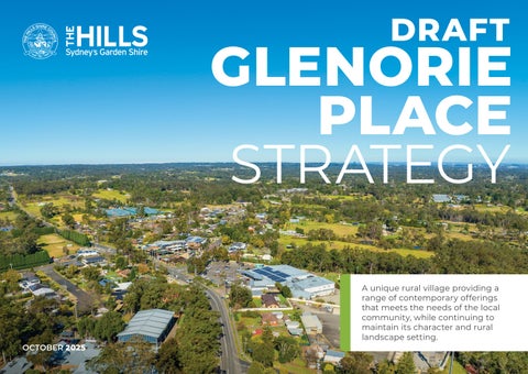
A unique rural village providing a range of contemporary offerings that meets the needs of the local community, while continuing to maintain its character and rural landscape setting.
October 2025
The Draft Glenorie Place Strategy was endorsed by Council on xxx, Minute No. xx for public exhibition and consultation.
Disclaimer
Every reasonable effort has been made to ensure that this document is correct at the time of printing. The Hills Shire Council disclaims all liability in respect of the consequences of anything done or omitted.
Copyright Notice
This document represents the collation of information from a number of sources, including Government plans and policies, Council plans and policies and on-site and desktop investigations. This document may be reproduced for personal, in-house or non-commercial use. Reproduction of this document for any other purpose shall only be permitted with the written permission of The Hills Shire Council.
What is the purpose of the place strategy?
The Glenorie Place Strategy is a place-based plan which examines the Glenorie Rural Village in its entirety – its character, role and function and how it relates to the surrounding landscape and rural activities. It highlights what is important and valued about Glenorie and, in consultation with the community and stakeholders, creates a shared vision for the future of the village and its surrounds.
The Place Strategy builds on the strategic work and policies of Council and the NSW Government, as well as detailed investigations into Glenorie’s unique features, role and function, environmental constraints and capacity to service new development. It provides an evidence base and framework to guide decisions relating to the planning framework and provision of infrastructure.
The Place Strategy is supported by analysis and technical investigations that identify Glenorie as a successful service-based rural village, with opportunity for some residential and commercial expansion, improved connectivity and public domain and protection of biodiversity.
Above all, the Place Strategy recognises the village’s role as an important hub for the local community with a rich history and a beautiful rural landscape. The Place Strategy first and foremost prioritises protection and enhancement of Glenorie’s well-established rural character. It is intended to promote revitalisation of the village, rural enterprises and strengthened viability of retail and amenities, for the benefit of the broader rural catchment which the village services.
The Place Strategy should be read in conjunction with the supporting Background Investigations Paper and technical studies.
Specifically, the Place Strategy serves the following purposes:
y Responds to priorities for rural villages identified within State and local planning policies
y Facilitates engagement with the community and stakeholders with respect to the future of the village
y Acknowledges the existing role of the village as a locally oriented and community-focused rural village
y Documents the key opportunities and constraints impacting the future of the village
y Establishes a vision and blueprint for modest growth and revitalisation of the village, including potential changes to planning controls, infrastructure improvements and objectives for the public domain and enhancement of local character
A NOTE ON GOVERNMENT HOUSING SUPPLY TARGETS:
The NSW Government set a 5-year housing completion target of 23,300 homes for The Hills Shire Council by 2029. Whilst the Place Strategy does envisage modest residential growth in the Glenorie Village, the aim of this growth is to support the revitalisation of the village and viability of retail and commercial expansion, rather than contribute to State Government housing targets which are focused on opportunities for high density infill housing in welllocated areas within the walkable catchment of transport hubs or well-serviced centres. New residential development in Glenorie will respond to the place-based opportunities, constraints and investigations, will be limited in scale and will strengthen the suburb’s rural character.
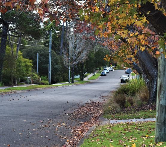
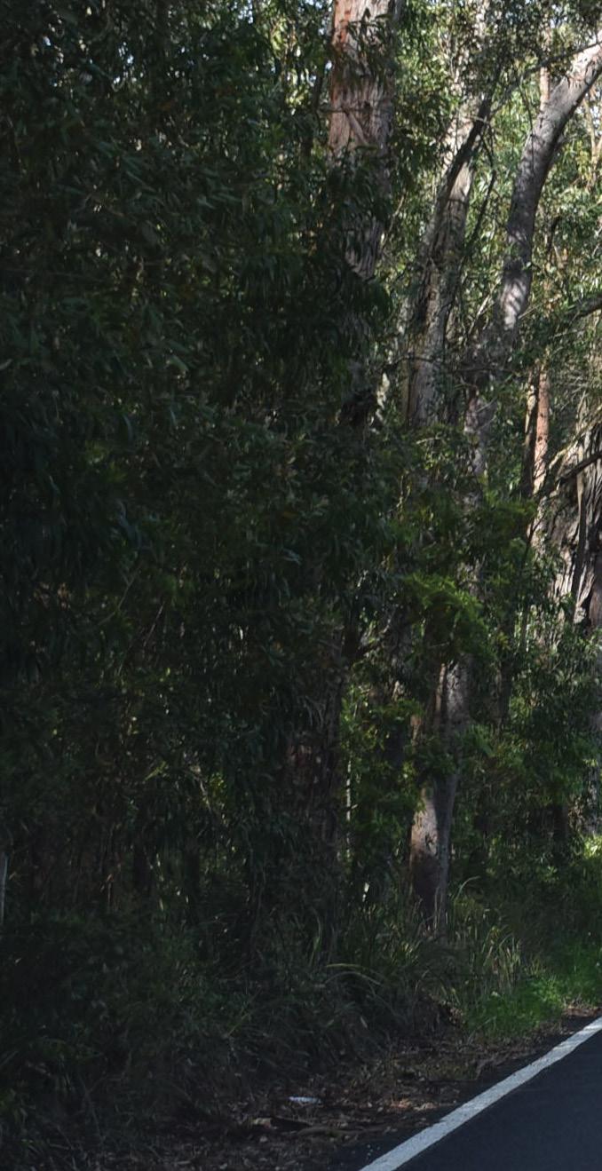
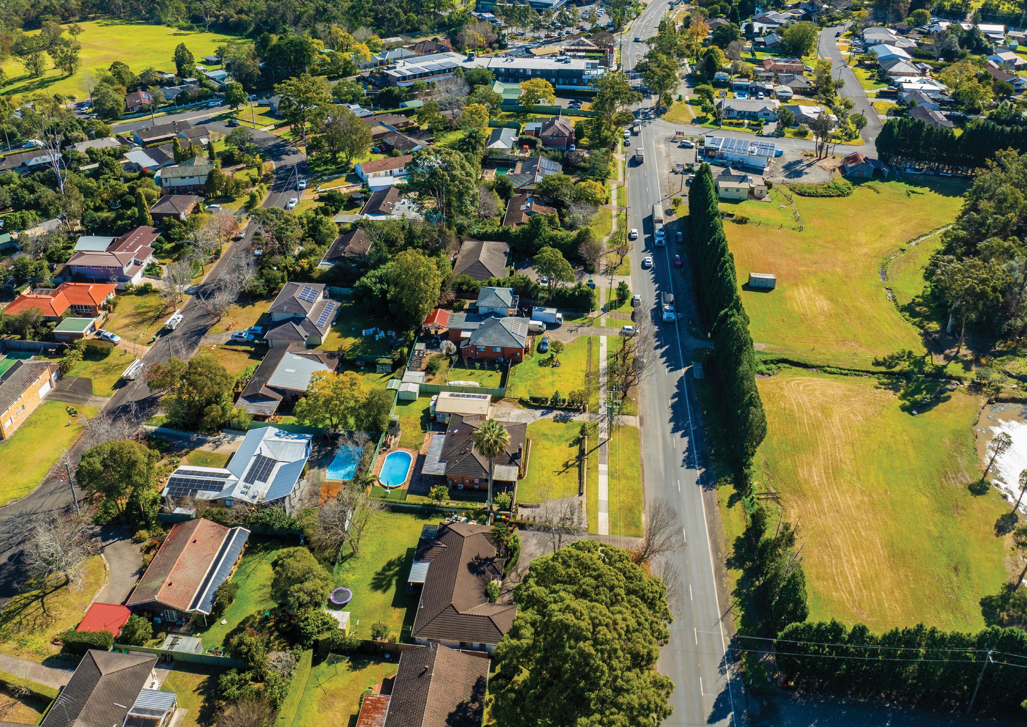
Pertaringa Way, Glenorie
Study Area
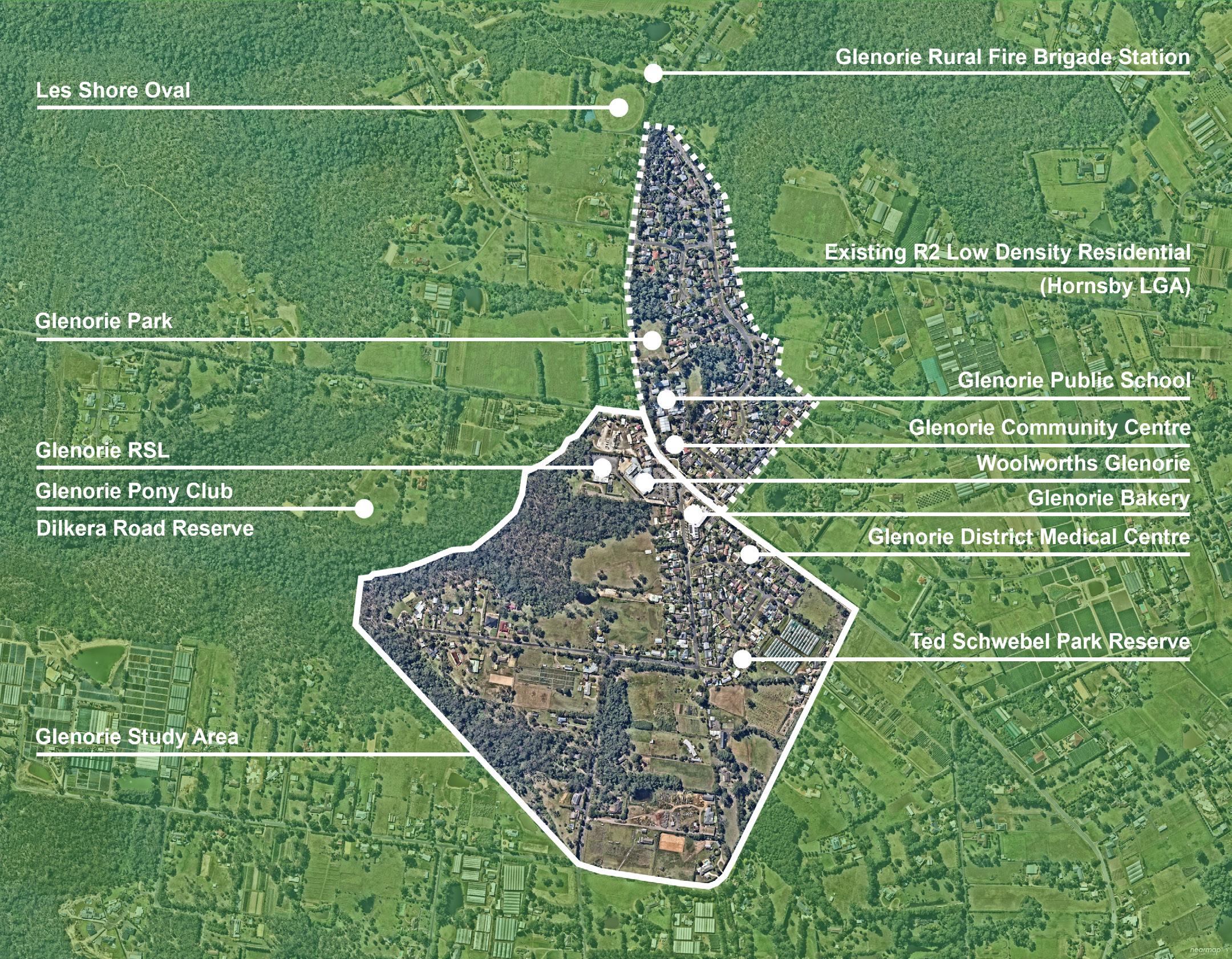
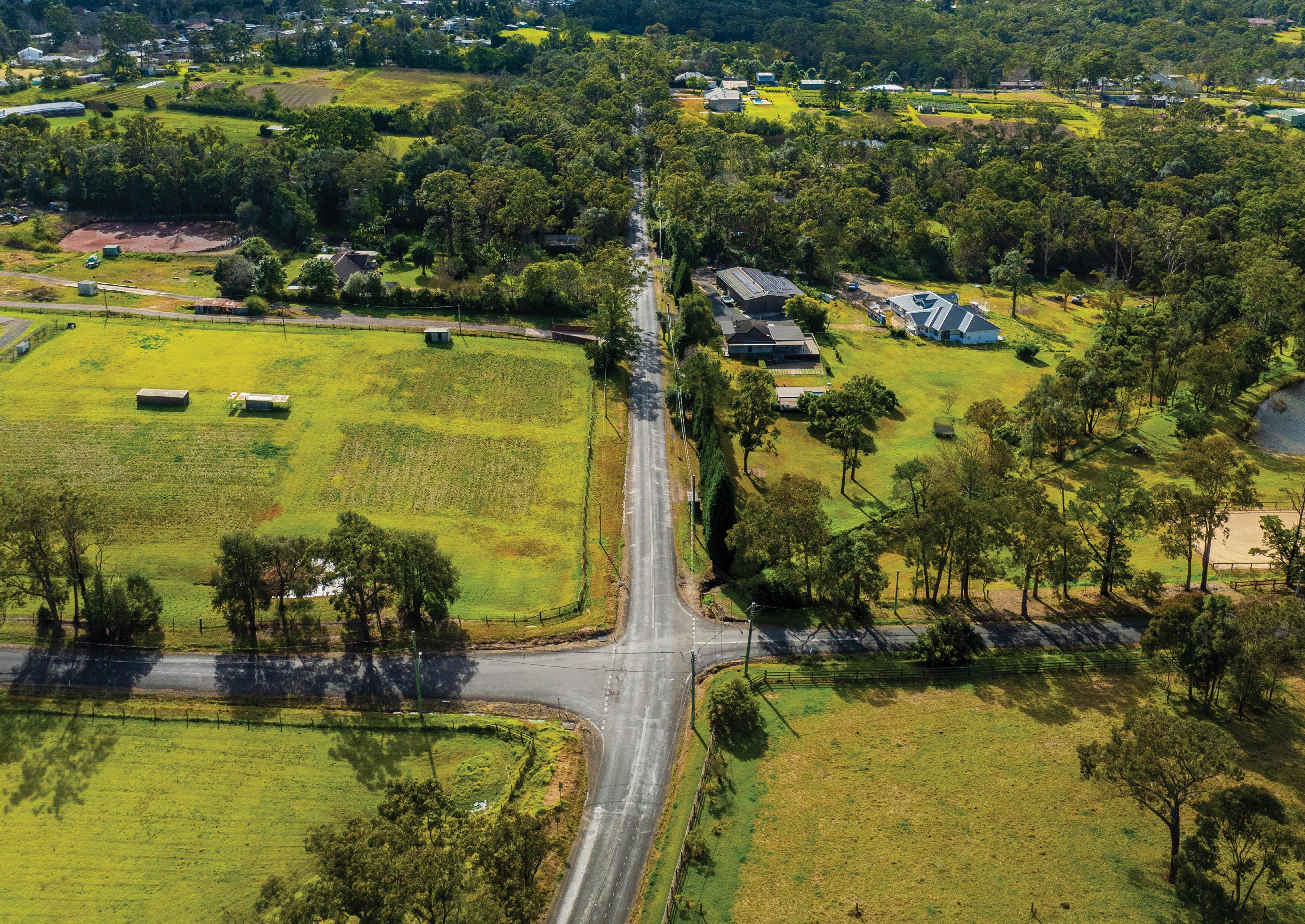
The Glenorie Rural Village is located along Old Northern Road and is split between The Hills Shire and Hornsby Shire Local Government Areas (LGAs).
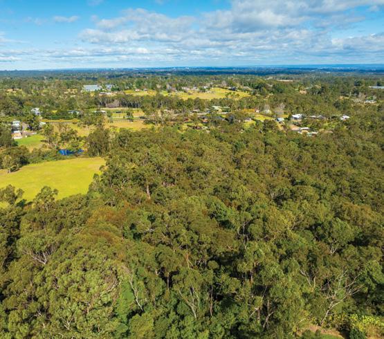
The area of the village within The Hills Shire LGA is generally bound by Old Northern Road to the east, Whites Road to the south, Schwebel Lane and a tributary of Kellys Creek to the north and environmental areas to the west. The Study Area for the Place Strategy is around 86 hectares in size.
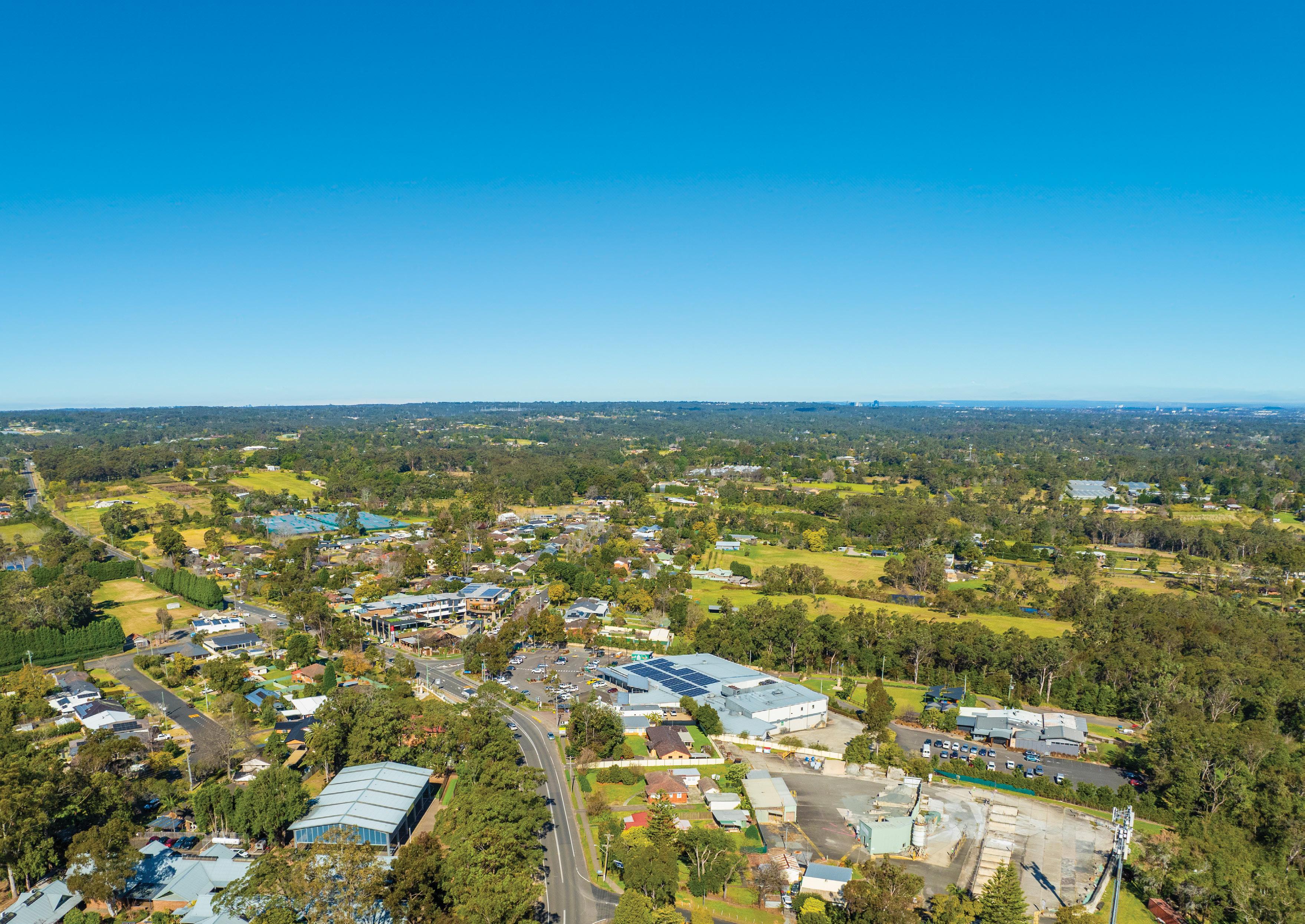
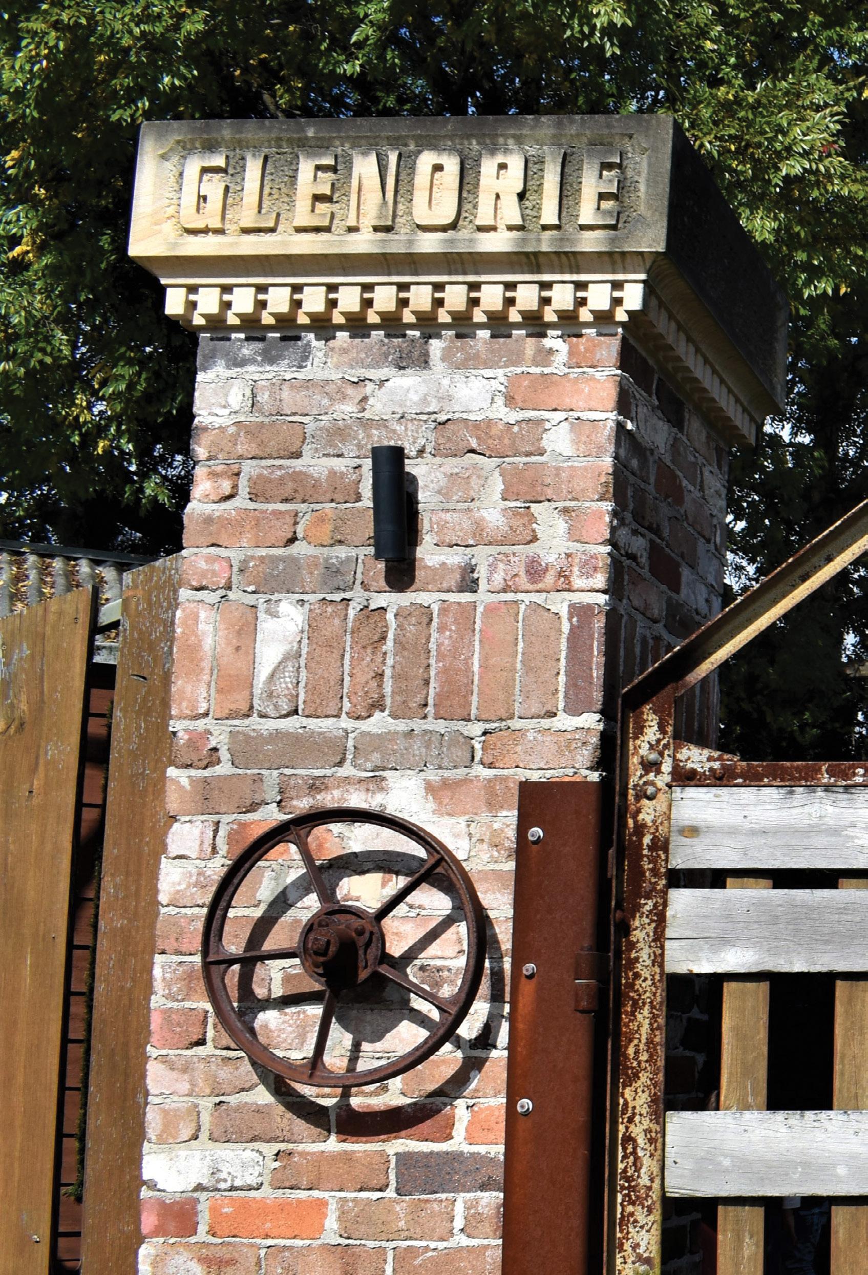
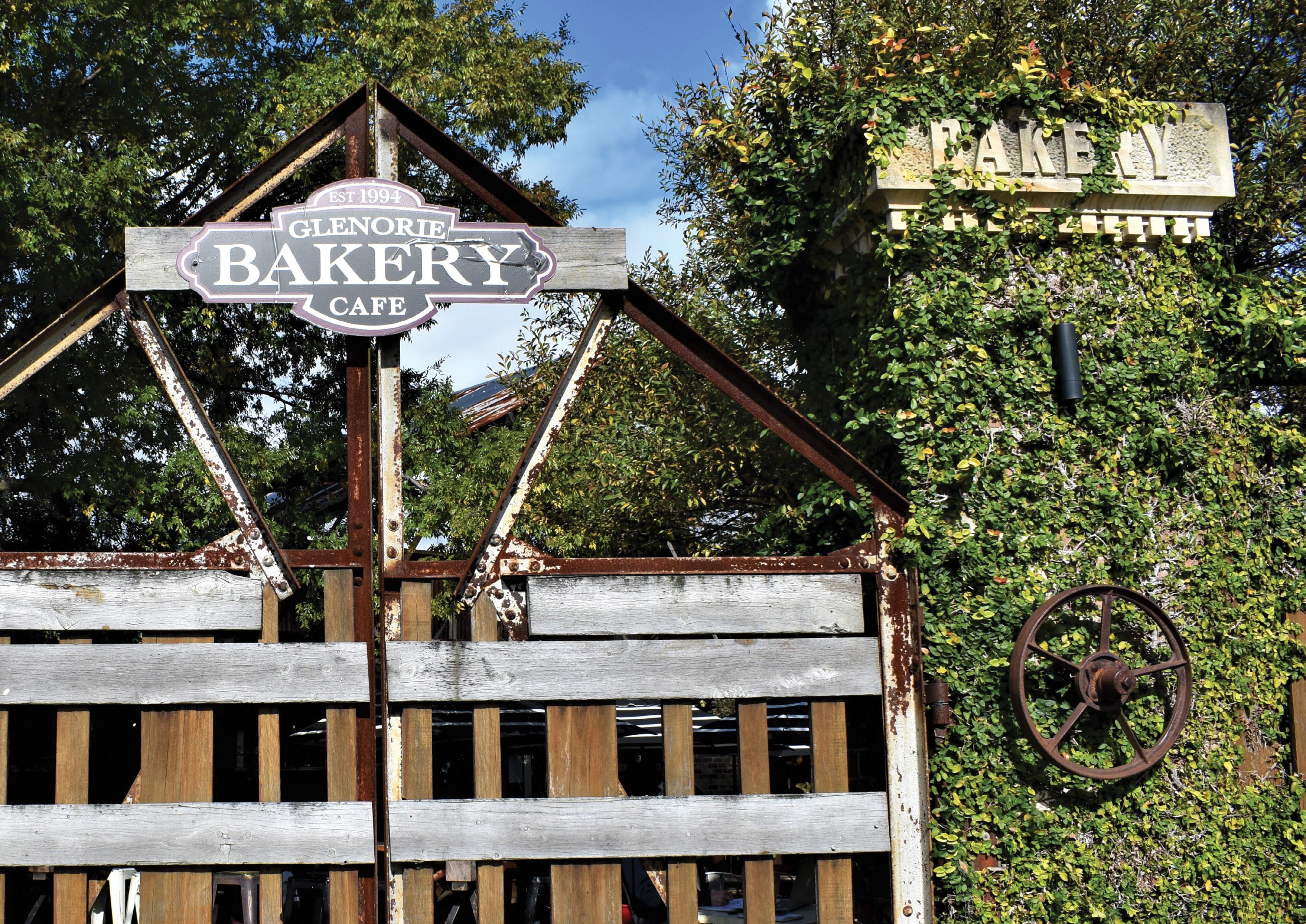
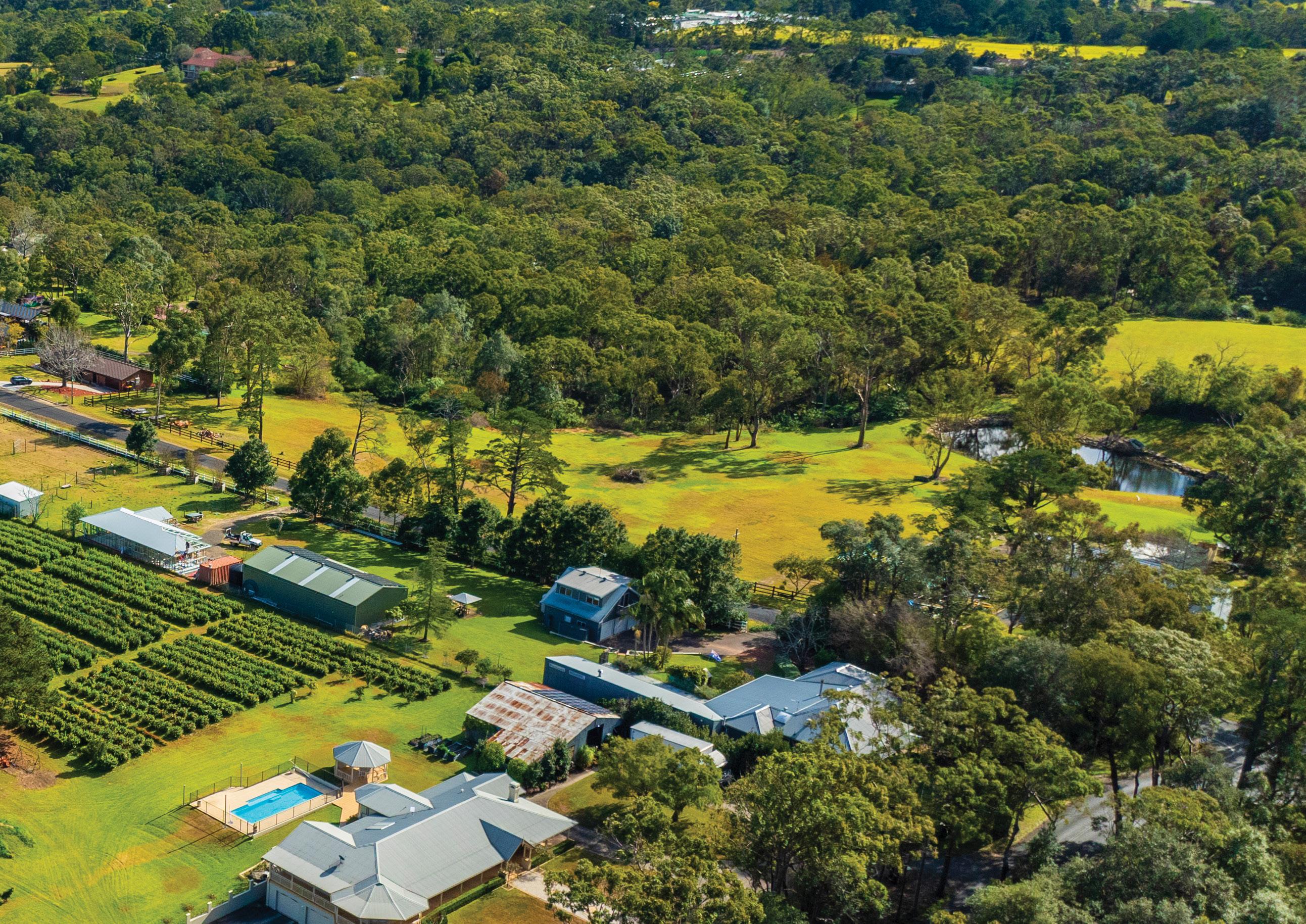
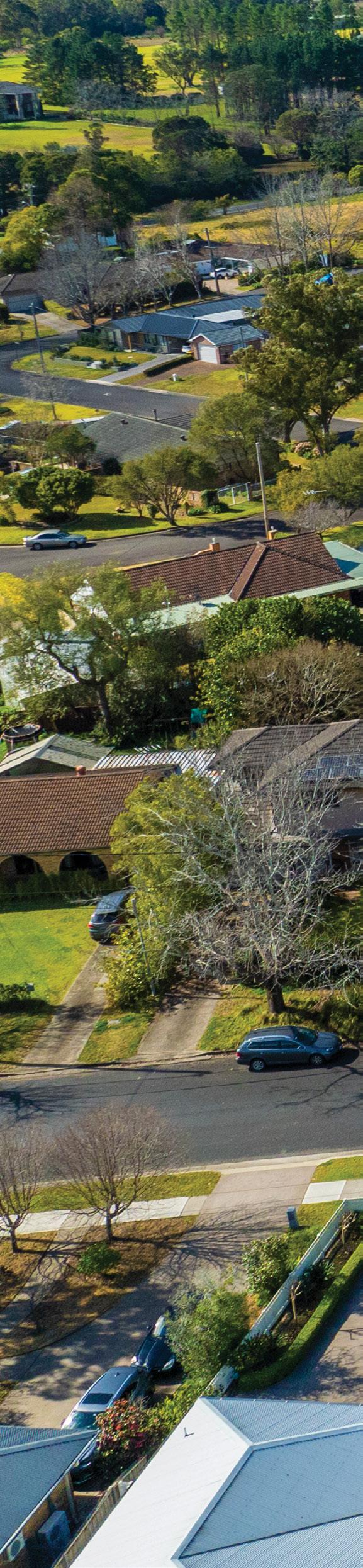
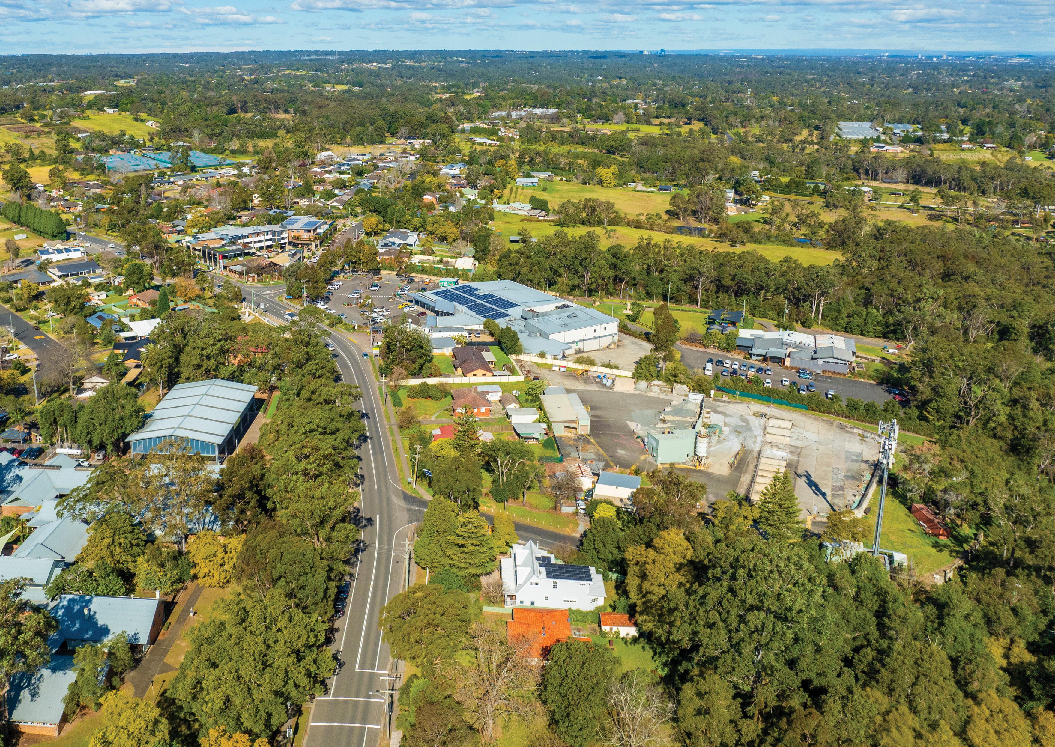
Glenorie offers a quiet open setting and is anchored by the village centre that serves as a focal point for the surrounding rural area. The village centre provides residents with basic services that meet their daily needs, including a full-line supermarket and other specialty retailers, a medical centre, pharmacy, post office and RSL Club. Glenorie Bakery is a popular and thriving destination in the heart of the centre which serves the local community, as well as visitors to the region.
Further out from the village centre is low density housing, larger rural properties and public open space. Other complementary service offerings on the eastern side of Old Northern Road within the Hornsby Shire include Glenorie Public School, and Glenorie Community Centre.
Figure 1: Glenorie Study Area
Glenorie Study Area
Glenorie Today
The population of Glenorie has been slowly increasing in recent decades, being home to around 3,792 people in 2021 (+11.4% from 2011). The demographic profile reflects Glenorie’s aging population, with an average age of 42 years, an increase in the proportion of people aged 70-85+ and a decrease in the proportion of people aged 0-9 and 30-39. The majority of households in Glenorie are family households, similar to the remainder of The Hills Shire, however these are increasingly households with older children. These trends are driven by a combination of low turn-over of housing stock, rising housing market prices and a desire for rural lifestyle and character during retirement.
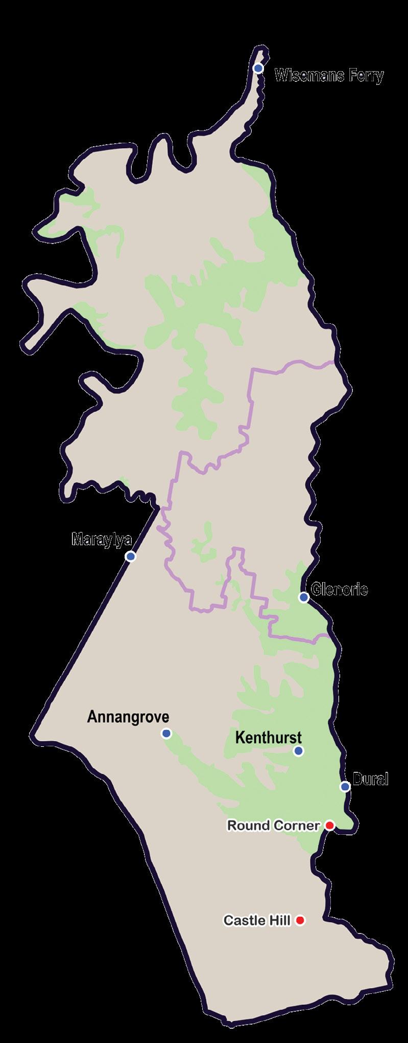
There were a total of 1,234 private dwellings in Glenorie as of 2021 with household sizes higher than average for The Hills, reflecting the predominant dwelling stock of larger detached dwellings, with the average family comprising two children. As would be expected for a semi-rural area there is a heavy reliance on private motor vehicles for transport. Glenorie forms part of the Shire’s primary agricultural cluster which stretches from Dural in the south to Maroota in the north. The agricultural sector is a major economic contributor both locally and more widely, serving as the ‘nursery capital’ of Greater Sydney.
DWELLINGS AND HOUSEHOLDS
INDUSTRY VALUE ADDED (IVA)
Top industry - Construction $26.0m
Agriculture Forestry and Fishing
$13.5m (13.6% of the Shire IVA)
1,041
Source: Profile.id for Glenorie suburb
Agriculture Forestry and Fishing 114 (19.8% of the Shire jobs in this industry)
BUSINESSES
560
Top industry - Retail 169 jobs Top industry - Construction 172 businesses
Agriculture Forestry and Fishing 45 (13.2% of the Shire business in this industry)
Source: Economic and Business Profile for Glenorie-Forest Glen, Atlas Economics, 2025
LEGEND
The Hills Shire Rural Villages Competitor Centres
Glenorie-Forest Glen
Agricultural Clusters
The Hills Shire LGA
Figure 2: Agricultural Clusters, The Hills Shire LGA
Source: Atlas Economics 2025
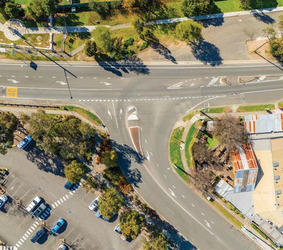
Post Office Road and surrounds, Glenorie
Strategic Context
GREATER SYDNEY REGION PLAN & CENTRAL CITY DISTRICT PLAN
The Greater Sydney Region Plan and Central City District Plan emphasise the importance of protecting and maintaining the character of rural villages and agricultural productivity, with rural villages not intended to satisfy residential demand.
COMMUNITY STRATEGIC PLAN
The Community Strategic Plan identifies objectives for Council to value local heritage, support the visitor economy and ensure quality strategic land use and urban planning.
LOCAL STRATEGIC PLANNING STATEMENT
The Hills LSPS states that Council will protect the role and function of rural villages and provide opportunities for limited residential and commercial expansion to support the surrounding rural areas.
RURAL STRATEGY
The Hills Shire Rural Strategy identifies Glenorie as a rural village that would benefit from a holistic plan for revitalisation and a modest amount of residential and commercial growth whilst maintaining its character.
ECONOMIC GROWTH PLAN
The Economic Growth Plan flags the importance of the Glenorie Village in supporting the productivity of the agriculture and tourism sectors of The Hills.
PUBLIC DOMAIN STRATEGY
The Public Domain Strategy identifies design strategies to improve the public domain of rural villages, enhancing their walkability, safety and aesthetics.
ECONOMIC AND BUSINESS DRIVERS TECHNICAL INVESTIGATION
Prepared by Atlas Economic, the Economic and Business Drivers Technical Investigation provided insights into the current and future economic role and function of Glenorie, relevant economic drivers and opportunities to support and leverage economic growth.
BIODIVERSITY AND BUSHFIRE TECHNICAL INVESTIGATION
Prepared by Water Technology, the Biodiversity and Bushfire Technical Investigation examined environmental affectations within the Study Area, including biodiversity and bushfire risk.
Community Engagement
Council is dedicated to delivering place-based outcomes that reflect the values and priorities of the tight-knit local community. The Glenorie Place Strategy will be driven by engagement with the local community to understand their vision for the future of the Village.
For the purposes of public exhibition, the preparation of the draft Place Strategy has drawn on the consultation with, and feedback received from, key stakeholders over recent years in relation to this and other related strategic planning projects.
Consultation with the community and stakeholders with respect to this draft Place Strategy is an important next step in the process. This section (and the Place Strategy more broadly) will be updated as necessary after hearing and considering the feedback received from the community and stakeholders.
CHALLENGES
y Recognising and managing environmental characteristics.
y Protecting scenic values.
y Providing housing choice at different price points with many leaving the area.
y Supporting the mix of rural uses - agriculture, home business and tourism.
y Responding to pressure for increased residential densities.
y Protecting character and consolidating the urban area.
y Managing potential land use conflicts with rural activities.
y Managing pressure on infrastructure such as roads and open space.
y Ensuring safe evacuation routes – flood and bushfire.
POSSIBILITIES
y Providing for future growth sympathetic to the character of the village.
y Respecting and enhancing landscape and biodiversity values.
y Providing more housing diversity to appeal to a wider variety of residents.
y Collaboration between Hornsby and Hills Councils to coordinate outcomes.
y Collaboration with the State Government around infrastructure provision.
y Enhancing public domain and landscaping to complement the rural setting.
y Maintaining the village’s role and function whilst better supporting local business and embracing commercial, retail and industrial opportunities.
y Better supporting primary production and the rural tourism economy.
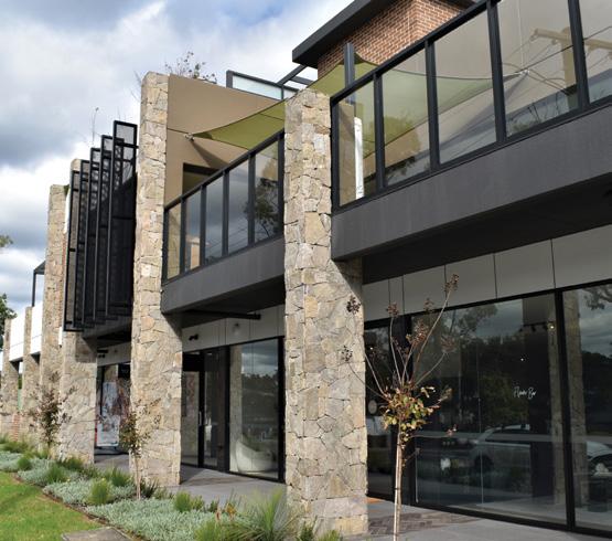
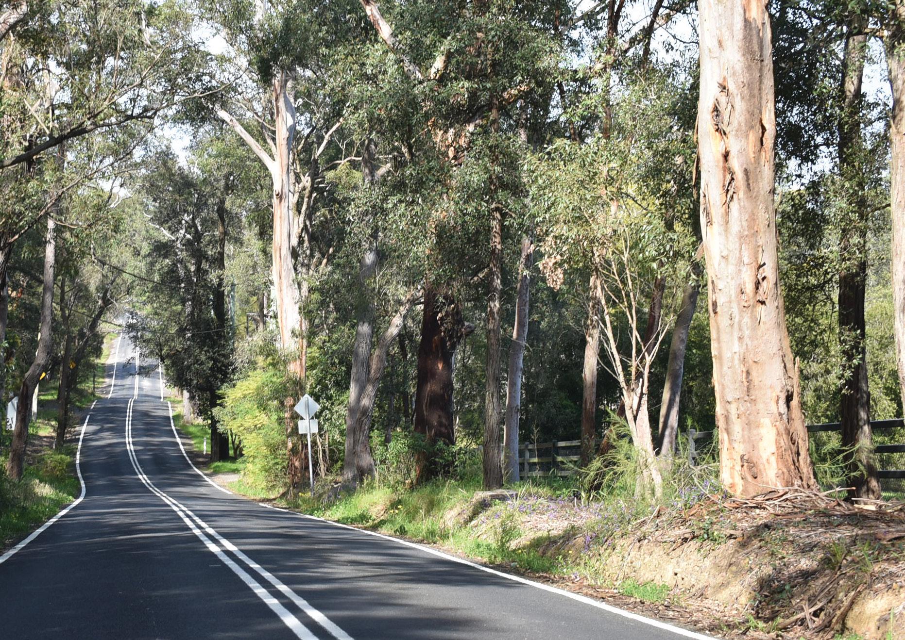
Old Northern Road, Glenorie
Guiding Principles
The Place Strategy is underpinned by 6 guiding principles which provide a framework for Glenorie Village to reach its potential as a thriving village centre. These guiding principles are derived from the guidance and objectives within the strategic planning policies along with the planning investigations completed for the Study Area in 2025.
PLACEMAKING AND LIVEABILITY
Establish a strong sense of identity, community and place that builds on the existing local character and enhances the public domain, informed by the thoughts and values of the tight-knit community that call Glenorie home. Public domain upgrades will prioritise enhancing Glenorie’s rural suburban charm, enabling it to establish a strong sense of place and identifiable local character.
MOVEMENT AND CONNECTIVITY
Improve connections and pedestrian safety by enabling people to move easily and conveniently. A focus on new local roads, pedestrian and cycle links, additional pedestrian crossings and open space areas will create more attractive opportunities for physical activity and active transport.
BUILDING ON ECONOMIC STRENGTHS
Build on the success of the existing village and provide a more diverse and contemporary retail offering for residents, while also strengthening Glenorie’s agriculture and tourism sectors, recognising the value that these sectors bring to local employment and Sydney’s rural economy.
HOUSING DIVERSITY
Offer a range of low-scale housing opportunities, providing greater choice for a variety of budgets and lifestyles. Limited residential expansion must maintain and enhance the character and values of the surrounding landscape and is intended to support the revitalisation and growth of the village to better serve the surrounding rural community, rather than responding to Government housing targets.
ENVIRONMENT AND SUSTAINABILITY
Protect and enhance the natural environment to ensure that current and future generations can enjoy these assets for years to come and that potential hazards such as bushfire risk are carefully managed. Increasing the tree canopy along streets, in parks and other public spaces as well as in private developments will be key to managing and mitigating urban heat.
SERVICED BY INFRASTRUCTURE
Provision of public utility, state and local infrastructure is essential for the successful delivery of place outcomes. Any growth needs to consider and be guided by the capacity of playing fields, parks, roads, stormwater and community facilities at the local level, and utilities, schools, emergency services, public transport and state roads at a regional level.
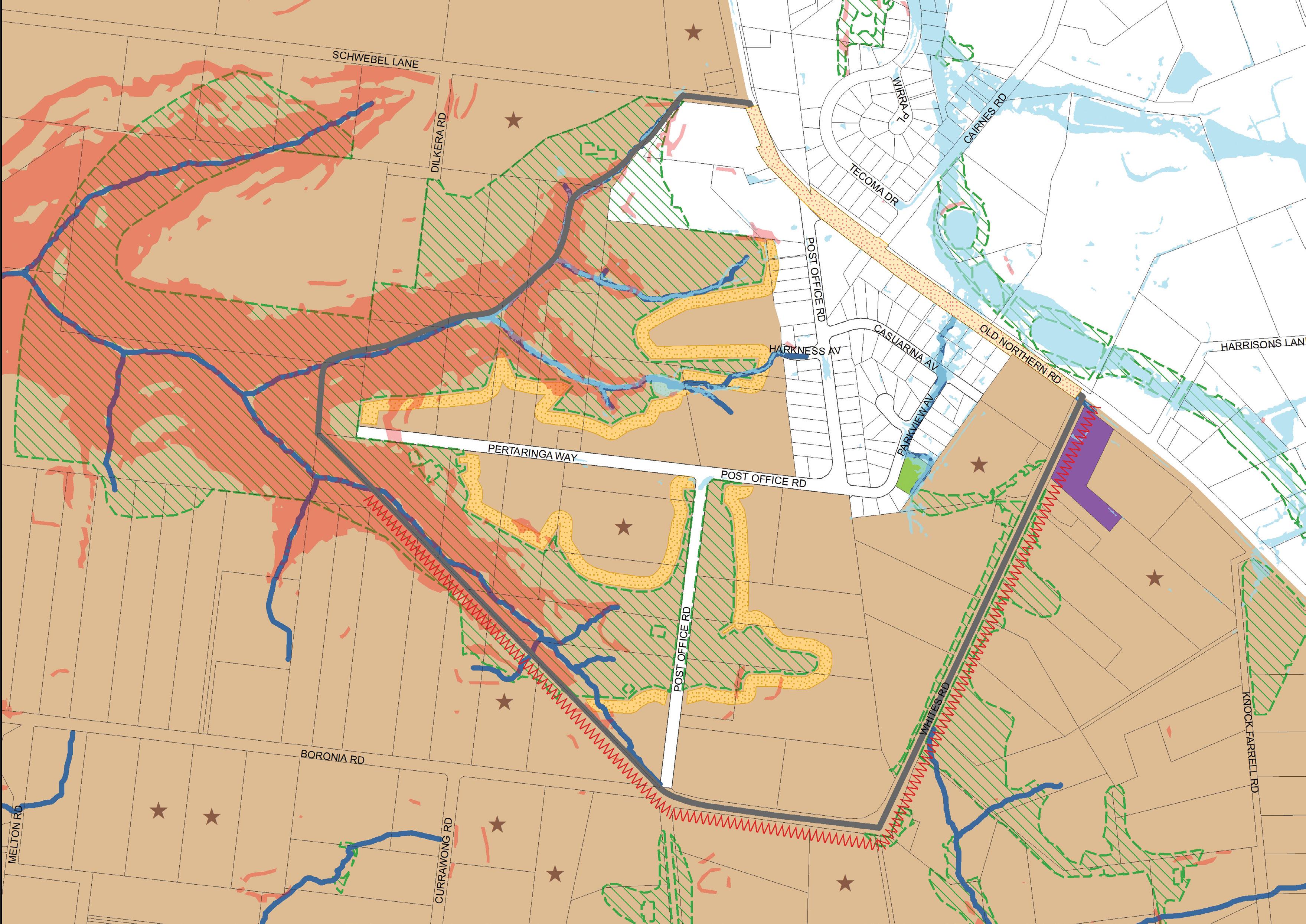
Constraints
ENVIRONMENTAL CONSTRAINTS
Some land contains high biodiversity values, steep topography and watercourses and is unsuitable for development.
BUSHFIRE HAZARD
Given the topography and extensive vegetation, large parts of the Study Area are subject to bushfire risk. Asset Protection Zones will be a necessary buffer between vegetation and future development.
ESSENTIAL INFRASTRUCTURE
Advice received from Sydney Water indicates there is no capacity in the existing sewer system and there are no plans or funding to extend the wastewater servicing area at this time. Water servicing and telecommunications are available whilst electricity and gas networks have some/limited capacity.
TRAFFIC AND TRANSPORT
Buses are the only mode of public transportation available with a limited bus service connecting Glenorie to Dural and Castle Hill. Future growth may exacerbate road congestion and may require significant Government investment for regional road upgrades.
PEDESTRIAN CONNECTIVITY AND MOVEMENT
Limited pedestrian links across Old Northern Road, which is an arterial road, coupled with large undeveloped lots in the peripheral areas restricts pedestrian movement. This is further compounded by an inconsistent footpath along Post Office Road to the village.
SENSITIVE INTERFACES AND RURAL PRODUCTIVE CAPACITY
Sensitive interfaces include the industrial pocket to the south, the concrete facility to the north and environmental land west of the Study Area. There is also land within the Study Area with productive agricultural land uses which will require measures to be implemented to minimise land use conflicts as part of any future development.
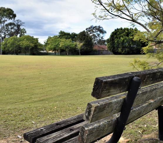
PUBLIC OPEN SPACE
While there are some active open space areas within and surrounding the Study Area, all recreation facilities across the Shire are in high demand. The existing network in the locality is only able to service modest growth without the need to find new active open space solutions.
LEGEND
Glenorie Study Area
Public Open Space Support Services
Slope 20% and Over
1% AEP Flood Extent
Rural
Old Northern Road
Bushfire Buffer Zone
High Biodiversity
Creek Centreline and Overland Flowpaths
Sensitive Interface
Agricultural Activities
A NOTE ON WASTEWATER SERVICING:
In addition to character outcomes, environmental constraints and infrastructure capacity limitations, the lack of wastewater servicing capacity, as advised by Sydney Water, is a key factor in determining the potential density and lot size for residential development, as any new development would require onsite sewage management systems. Several criteria apply to onsite waste management on land within rural areas, including minimum area for effluent disposal (1,000m2) and locational criteria such as slope and buffer distances to creeks, dams, property boundaries, dwellings, pools, driveways and buildings. Reserve areas (usually equal to the primary effluent disposal area of 1,000m2) must also be accommodated. The Environmental Protection Agency’s Onsite Wastewater Management Guidelines (2025) note that subdivisions for residential development involving onsite sewage management require minimum lot sizes of more than 4,000m2 .
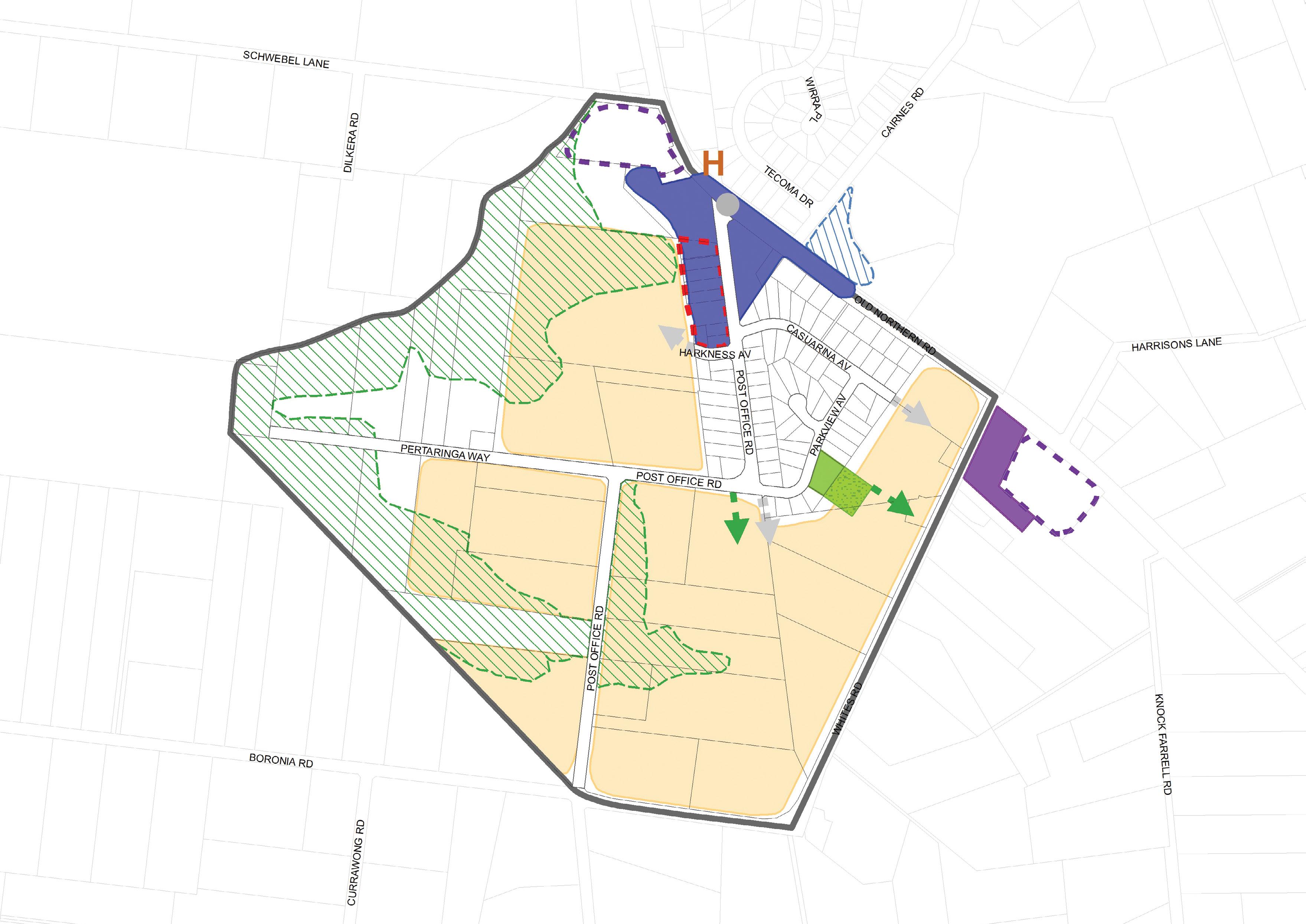
Opportunities
LOCAL CHARACTER
Glenorie’s distinctive rural character and village feel is attractive and inviting for locals and visitors. This should be protected and enhanced. Better integrations between commercial and community activities will provide a more cohesive and pedestrian friendly “high street” that enhances amenity within the village.
RETAIL GROWTH
Growing retail employment in Glenorie will leverage off the success of the existing village centre and provide additional services for the surrounding rural area. Additional ‘centre’ floorspace (minimum 1,000m2) can be accommodated within the Study Area, or more likely at the corner of Cairnes Road and Old Northern Road in Hornsby LGA.
EXPANDED SUPPORT SERVICES
By promoting complementary activities within and around the village centre, the agritourism, nursery and floriculture sectors can be supported, strengthening local agricultural and production uses. There is longer-term opportunity to investigate expansion of industrial activities to help deliver local services, however demand for these types of uses will need to be demonstrated, along with wastewater servicing capacity.
MEDIUM DENSITY HOUSING
A limited amount of medium density housing (villas or townhouses) on Post Office Road directly adjoining the existing retail area would provide increased housing diversity and meet some of the demands of a changing population. However, this needs to be carefully balanced with other factors such as desired character outcomes and infrastructure capacity. This is a longer-term opportunity. In the short to medium term, this outcome is unlikely to occur, as a result of the servicing constraints and feasibility of redevelopment.
ENVIRONMENTAL LIVING
Less constrained lots have potential for low-impact development, recognising and protecting the environmental and scenic values of the locality. Larger lot sizes together with appropriate environmental and bushfire protection measures will provide a transition in density from existing residential development to the interface with more open rural zoned land.
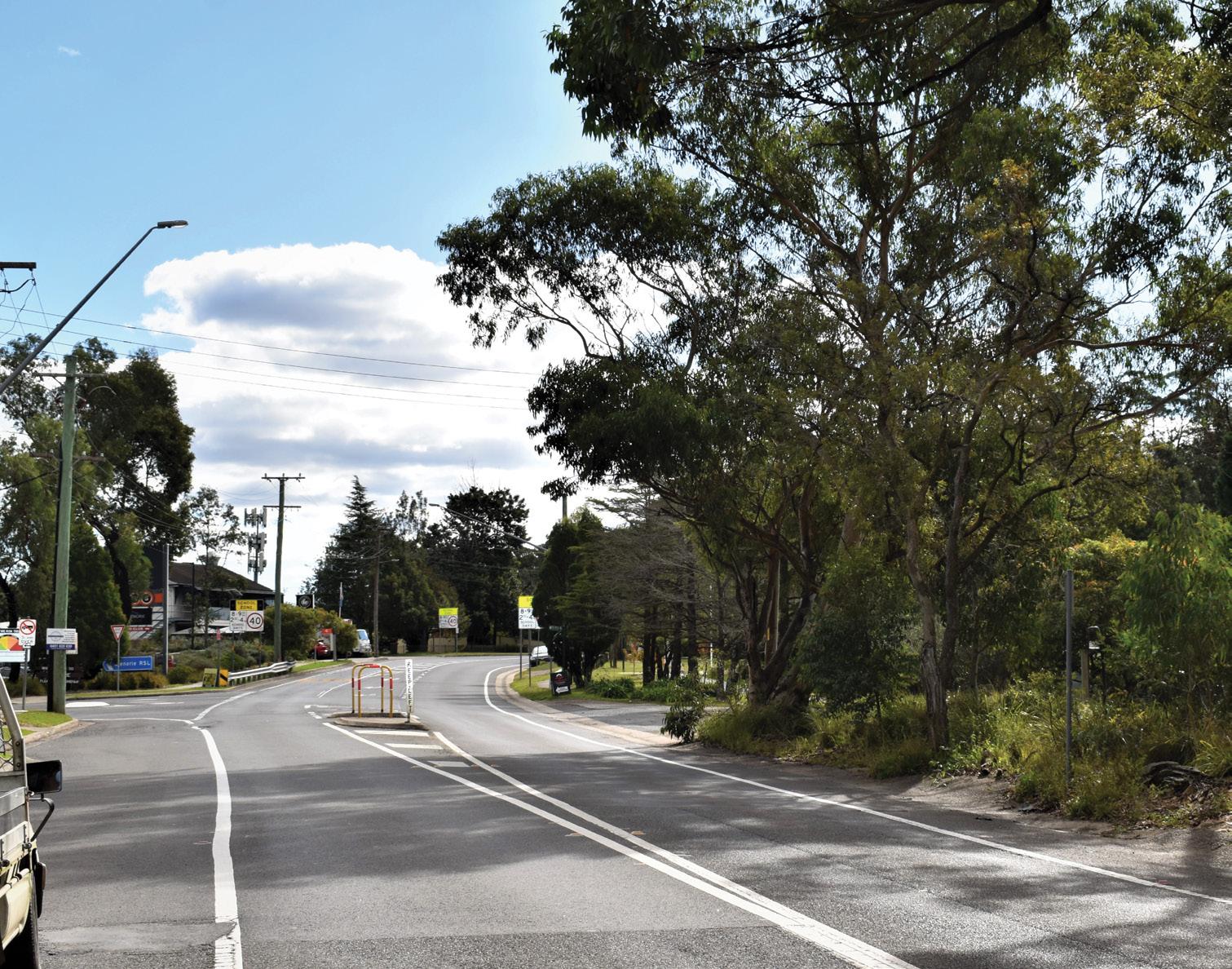
NEW VEHICULAR CONNECTIONS AND ROAD UPGRADES
New pedestrian crossings and a roundabout at the intersection of Old Northern Road and Post Office Road will improve the safety of the village and can serve as an appropriate traffic calming solution.
ENHANCED PEDESTRIAN AND CYCLING LINKS
To improve safety, upgrades will be required to crossings and footpath treatments. Providing shared path opportunities between key destinations within the village will encourage walking and cycling.
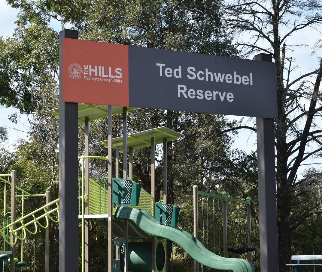
OPEN SPACE EXPANSION
There is scope to expand the passive open space offered by Ted Schwebel Reserve by around 3,000m2 increasing its capacity and providing informal open space areas that can be enjoyed by workers and residents.
PUBLIC DOMAIN IMPROVEMENTS
This will build upon the success of the existing village centre, to establish a clear identity and create places that residents, workers and visitors will enjoy using.
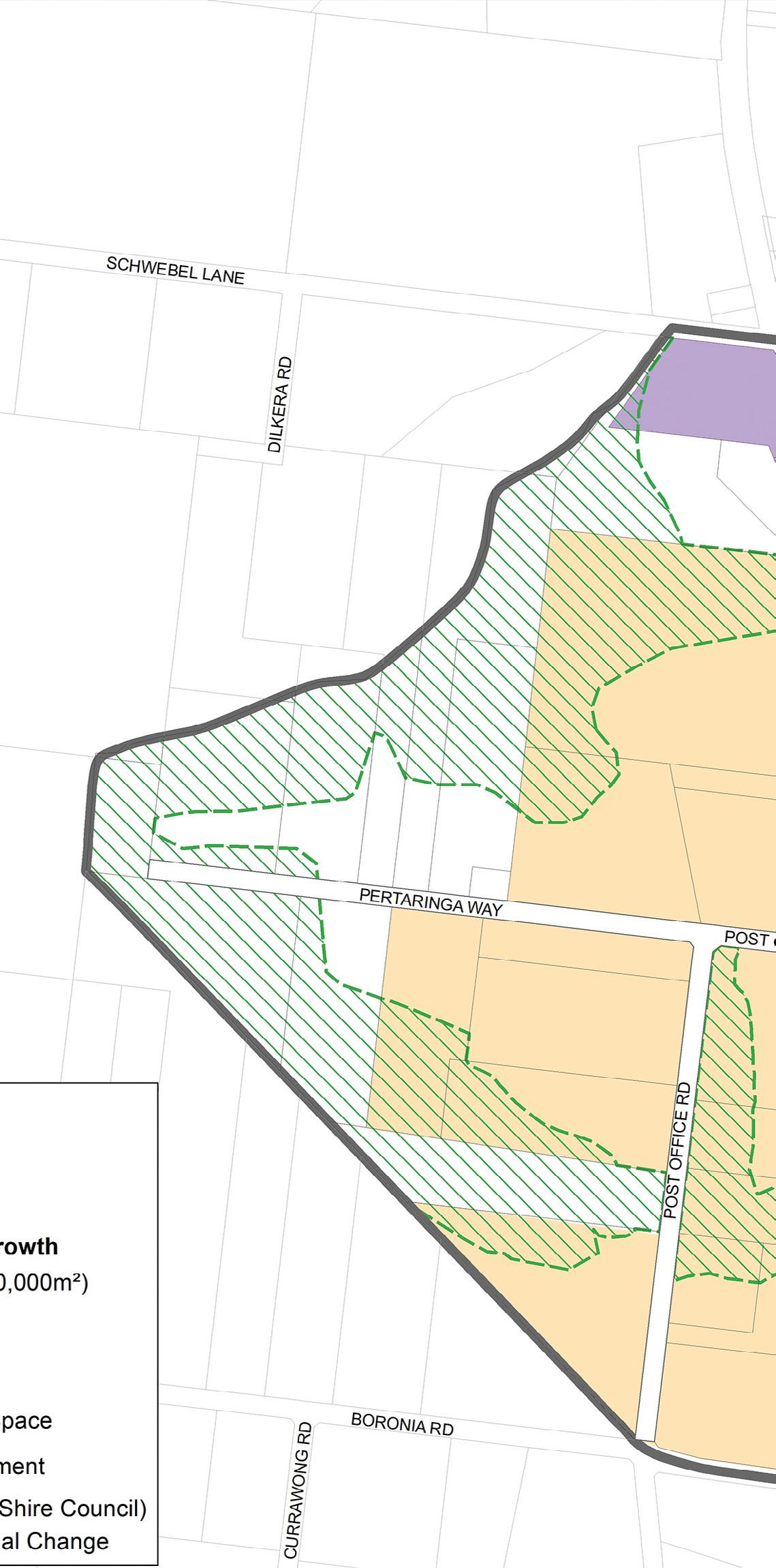
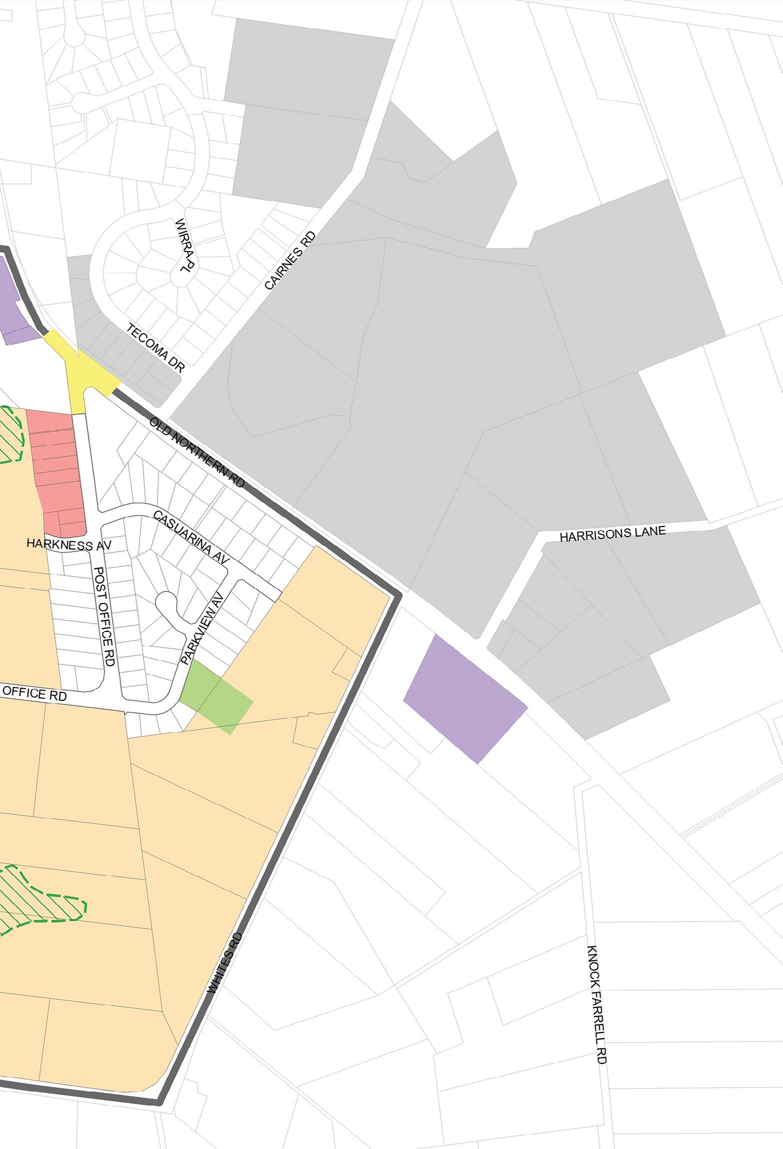
LEGEND
Glenorie Study Area
Enhanced Public Domain
Environmental Living
Support Services
Public Open Space
Potential Expansion of Open Space
High Biodiversity
Additional Centre Floorspace
Potential Medium Density
Potential Support Services
Roundabout
Proposed Road
Proposed Pedestrian Linkage
Heritage
*Note: Development areas to be located clear of environmental constraints.
Vision for Glenorie
Glenorie Village is a thriving village centre that is a focal point for the people who live in, work in and visit Glenorie and the surrounding rural areas. As well as serving local residents, the centre can support and promote the thriving economy of the rural area including local nursery, floriculture and agritourism activities.
There is opportunity for more housing choice, primarily in the form of semirural and environmental living lots, with some longer-term potential for a limited amount of medium density housing (such as villas and townhouses) in the immediate proximity to the heart of the centre, subject to wastewater servicing constraints being addressed.
This small increase in residential population within the Glenorie Village will enhance the viability of a broader range of retail, amenities, hospitality, services and business activities that meet the day-to-day needs of residents and create an appealing place to visit, shop, dine and socialise.
Open space and connectivity can be enhanced with a larger local park and green links along new roads and improved walkability and integration of the centre across Old Northern Road.
Areas of high environmental value can be protected and managed, continuing to provide a scenic landscaped backdrop to the village.
y 70-80 semi-rural and environmental living lots (4,000m2 to 10,000m2)
y 30-35 medium density dwellings (longer-term opportunity)
y 1,000m2 retail floorspace (most likely within Hornsby LGA)
y 7,500m2 support services floorspace (longer-term opportunity)
y 3,000m2 additional passive open space
POTENTIAL FOR ADDITIONAL DEVELOPMENT AND GROWTH
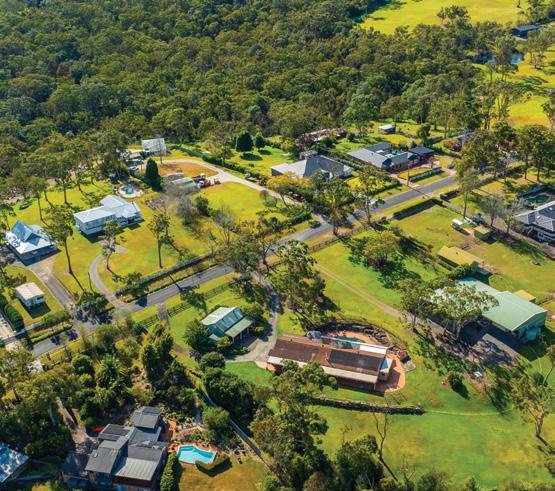
Post Office Road, Glenorie
Areas for Change and Growth
POTENTIAL SUPPORT SERVICES (LONGER TERM OPPORTUNITY)
y 2 potential sites at either entry point into the Village (averaging 1.5 ha each)
y Support services help deliver local services for residents (e.g. vehicle repairs) or may be activities that support the agricultural and floricultural sectors
y Realising these opportunities will largely depend on servicing availability and economic need and demand for these types of services in this area
POTENTIAL MEDIUM DENSITY (LONGER TERM OPPORTUNITY)
y Some additional housing supply (villas and townhouses) would provide an opportunity to better meet the needs of a changing population and workforce
y This needs to be carefully balanced with other factors such as desired character and infrastructure capacity
y This is a longer term opportunity and the feasibility of this redevelopment opportunity will ultimately be contingent on the availability of servicing capacity, particularly wastewater, which is currently unavailable
y Until such time as this constraint is overcome, the currently applicable R2 Low Density Residential zone and low density residential outcome is appropriate to remain
ENVIRONMENTAL LIVING (4,000-10,000M 2)
y Potential to capitalise on the lesser constrained lands
y Opportunities for smaller lot and low-impact living, recognising and protecting the environmental and scenic values of the locality
y Larger lot sizes together with environmental and bushfire protection measures provide a more appropriate transition in density surrounding the Village to the interface with more open rural zoned land
HORNSBY LGA POTENTIAL COMMERCIAL/RESIDENTIAL
y Potential to permit a mix of business and residential uses to help meet the community’s desire for more shops, pending wastewater availability
HORNSBY LGA POTENTIAL SMALL RURAL LOTS
y Hornsby Council have also been progressing their investigations
y The key actions of Hornsby’s draft Place Plan are compatible with the outcomes and directions outlined for The Hills
y Areas suitable for larger lot housing aligns with the pattern of growth envisaged by The Hills – being concentrated close to the Village centre
POTENTIAL INTERSECTION IMPROVEMENT
y Potential for public domain upgrades and road improvements, including a new roundabout and pedestrian crossings
POTENTIAL EXPANSION OF OPEN SPACE
y With some modest redevelopment outcomes along Whites Road, there is opportunity for future development to facilitate the expansion of the existing Ted Schwebel Reserve and improved pedestrian access between Whites Road and Parkview Avenue
A NOTE ON POTENTIAL ENVIRONMENTAL LIVING LOT SIZES:
The land areas with minimal environmental and bushfire constraints would be appropriate for the smaller lot size of 4,000m2 , whereas land which is more heavily constrained would be appropriate for the larger size of 10,000m2 to allow for appropriate management of these constraints.
HORNSBY SHIRE PLACE PLAN
Hornsby Shire Council considered a report on their Glenorie Village Investigations and Draft Glenorie Village Place Plan on 9 July 2025. These documents were exhibited from 14 July to 31 August 2025.
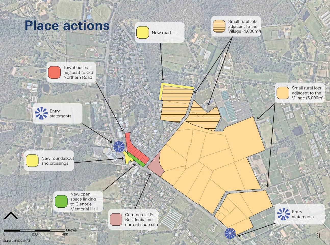
Hornsby’s Place Actions are generally in alignment with the outcomes and directions envisaged for The Hills. This is largely a reflection of the constraints to growth which affect both LGAs, such as wastewater servicing, biodiversity and bushfire hazard.
The area they have identified for some potential retail expansion as well as the areas suitable for larger lot housing aligns with the pattern of growth envisaged by this strategy – being concentrated close to the Village Centre.
Figure 5 : “Place Actions” in Hornsby Council Draft Glenorie Village Place Plan – Hornsby Council
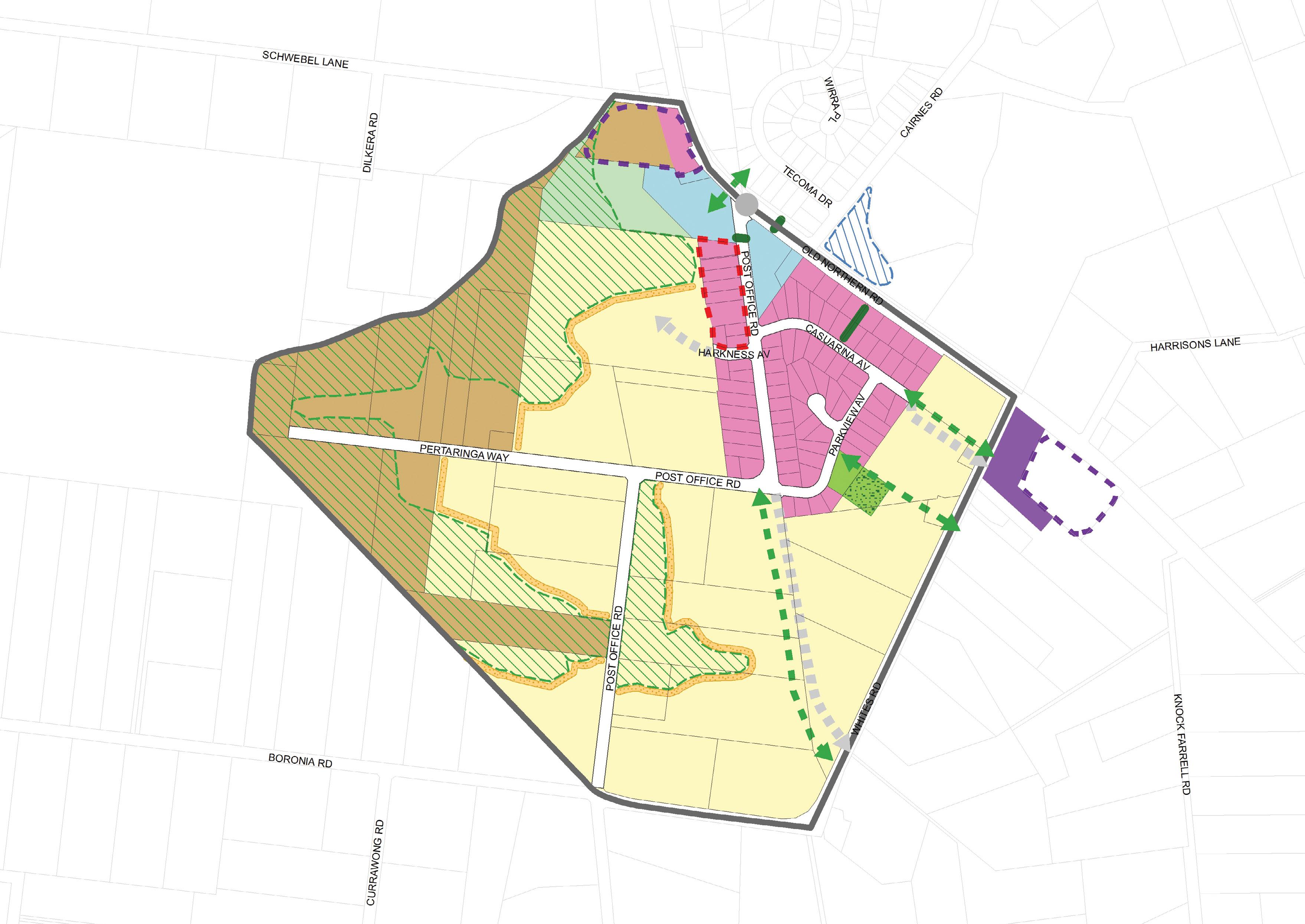
Structure Plan
SERVING THE COMMUNITY
y Additional centre floorspace of 1,000m2 (in Hornsby LGA) to deliver more specialty shops, hospitality and lifestyle offerings.
y Expansion of industrial land to deliver local services and activities that support the agricultural and floricultural sector.
LEGEND
Glenorie Study Area
Environmental Living (4,000-10,000m2)*
Support Services
PROVIDING HOUSING CHOICE
ENHANCING THE CHARACTER
y Semi-rural lots of 4,000m2 to 10,000m2 south & west of the village to provide lifestyle options.
y Medium density housing options such as villas and townhouses close to centre (subject to infrastructure and servicing capacity).
y Public domain upgrades such as pathways, wayfinding, landscaping, tree planting and seating.
y Transitioning from smaller lot housing at the heart of the village, to larger rural lots and agricultural activities.
y Containing low scale growth to the south and west, reinforcing the heart of the centre around Post Office Road.
ENHANCING OPEN SPACE AND CONNECTIVITY
y Expanding Ted Schwebel Reserve by approximately 3,000m2 to a total area of 5,300m2 .
y New green links for pedestrians/cyclists from the park to Whites Road and along new roads.
y Improved integration across Old Northern Road in collaboration with Hornsby Council.
SUPPORTING RURAL PRODUCTIVITY
PROTECTING THE ENVIRONMENT
ENSURING ESSENTIAL INFRASTRUCTURE
y Containing low scale growth to a tightly defined area to the south and west of the village.
y Continuing to support and promote local nursery, floriculture and agritourism activities.
y Identifying highly constrained land due to topography, watercourses, flooding and ecology.
y Identifying bushfire risk and the need for Asset Protection Zones and perimeter roads.
y Collaborating with providers for water, electricity, gas and telecommunications networks.
y Ensuring new semi-rural lots have the capacity for onsite sewage management.
y New local roads extending from Harkness Avenue, Post Office Road and Casuarina Avenue.
y Advocate for improved regional transport to enhance connectivity and open up new markets.
Low Density Residential
Private Recreation
Public Open Space
Rural Land
Village Centre
Bushfire Buffer Zone
Potential Medium Density
Potential Support Services
Additional Centre Floorspace
Potential Expansion of Open Space
High Biodiversity
Roundabout
Pedestrian Linkage
Proposed Road
Proposed Pedestrian Linkage
*Note: Larger subdivision lot sizes will be required where land is subject to environmental constraints.
Infrastructure
REGIONAL
SERVICES AND UTILITIES
Preliminary advice has been obtained from relevant utility providers:
UTILITY PROVIDER PRELIMINARY ADVICE
POTABLE WATER The water servicing trunk system currently has capacity to service some proposed growth.
WASTEWATER SERVICING The area is located outside of the current Glenorie Priority Sewer Program wastewater system boundary. The system has reached its growth servicing capacity and there are no plans or funding to investigate extending the wastewater servicing area.
GAS Dependent on the volume of growth, type of housing and small retail businesses, there is some opportunity to extend the gas main along Old Northern Road, subject to economic viability.
ELECTRICITY The Glenorie Zone Substation should have some spare capacity sufficient to facilitate opportunities for limited residential expansion.
TELECOMMUNICATIONS There is existing fibre infrastructure available to service new development.
TRAFFIC AND TRANSPORT
Old Northern Road experiences heavy traffic congestion further south around Dural. Any significant growth in Glenorie will exacerbate these existing regional transport issues. Any future work will require collaboration with Hornsby Shire Council and consultation with Transport for NSW.
HEALTH AND EDUCATION
Consideration of the capacity of schools and access to hospitals is essential when planning for the growing community.
Readily available health facilities ensure residents are well looked after. Understanding the capacity of nearby schools assists in identifying whether any improvements are required to accommodate additional population. Engagement with School Infrastructure NSW will assist with understanding the capacity of Glenorie Primary School and Galston High School to support additional student enrolments and identifying any upgrades or improvements required to accommodate the anticipated future population.
EMERGENCY SERVICES
Suitable access for emergency services is necessary when planning for future development in rural areas. Further investigations and engagement with State agencies will be required to inform future safe evacuation planning for the communities in the area, particularly in relation to flooding and bushfire risk.
LOCAL
STORMWATER AND DRAINAGE
Adequate stormwater infrastructure as part of any new development must ensure that there is no increase in flood levels on neighbouring properties. It is expected that potential impacts can be suitably addressed as part of individual developments given the rural setting, the generous size of potential future lots and the modest development yield.
LOCAL ROAD NETWORK
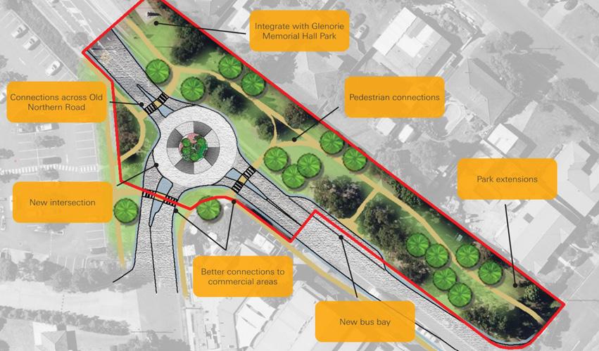
Some local roads may need to be upgraded, or their profiles revised, to meet additional vehicular and pedestrian/cyclist demands. Council will work with Hornsby Shire Council to investigate the upgrade of the Old Northern Road and Post Office Road intersection. This could involve the implementation of a roundabout and new pedestrian crossings to improve safety for vehicles turning in and out of Post Office Road (refer to Figure 7).
Some new local roads may extend from existing roads to facilitate future rural/residential subdivision and improved connectivity for vehicles and pedestrians. These would be provided as part of any development in the respective portions of the Study Area.
PUBLIC OPEN SPACES
Glenorie contains a variety of open space and recreational facilities. There is potential for expansion of Ted Schwebel Reserve, providing an enhanced informal open space area for the enjoyment of the community.
PUBLIC DOMAIN AND PEDESTRIAN CONNECTIVITY
Upgrades to the public domain are required to improve safety and pedestrian connectivity, whilst reinforcing Glenorie’s distinct rural character. This will include a new pedestrian link connecting Ted Schwebel Reserve to Whites Road. In addition, improvements to the public domain and streetscape such as additional tree planting, seating and pathways will be facilitated as development occurs.
COMMUNITY FACILITIES
Various spaces are located within and around Glenorie with a range of offerings. Given the incremental and modest population growth, the existing community facilities are expected to be sufficient.
1 Upgrade of Old Northern Road and Post Office Road intersection – new roundabout, pedestrian crossings and traffic calming measures
Implementation
To turn the Place Strategy vision into a reality, amendments to The Hills Local Environmental Plan and Development Control Plan will be required, alongside consideration of the most appropriate mechanisms to secure the funding and delivery of the necessary infrastructure items.
The timeline for realisation of the Place Strategy outcomes will ultimately depend on a variety of factors including servicing constraints, the role of relevant stakeholders (including private landowners, developers and State Government agencies and utility providers) and fragmented ownership patterns in some parts of the Study Area which may take time to overcome and resolve.
Any amendments to the planning framework will be considered by Council as part of a future Planning Proposal to give effect to the Place Strategy. There is also potential for landowners to progress with individual Planning Proposals within their own timeframe. Council’s assessment of strategic and site-specific merit will be based on, and seek to give effect to the parameters, outcomes and vision set out in the Place Strategy.
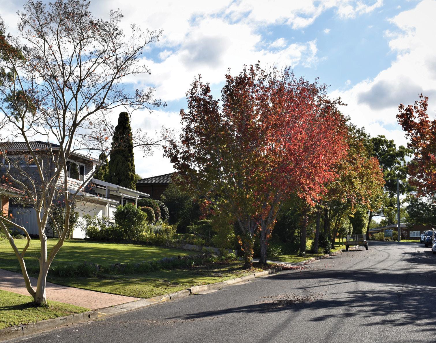
Old Northern Road, Glenorie’
Casuarina Avenue, Glenorie
THE HILLS LOCAL ENVIRONMENTAL PLAN
THE HILLS DEVELOPMENT CONTROL PLAN
y PLANNING FRAMEWORK
Land Zoning
The C4 Environmental Living zone would facilitate the residential development outcomes envisaged.
Minimum Lot Size
4,000m2-10,000m2 depending on the site’s environmental and bushfire hazard characteristics. The land areas with minimal environmental and bushfire constraints would be appropriate for the smaller lot size of 4,000m2, whereas land which is more heavily constrained would be appropriate for the larger size of 10,000m2 to allow for appropriate management of these constraints.
Local Provisions
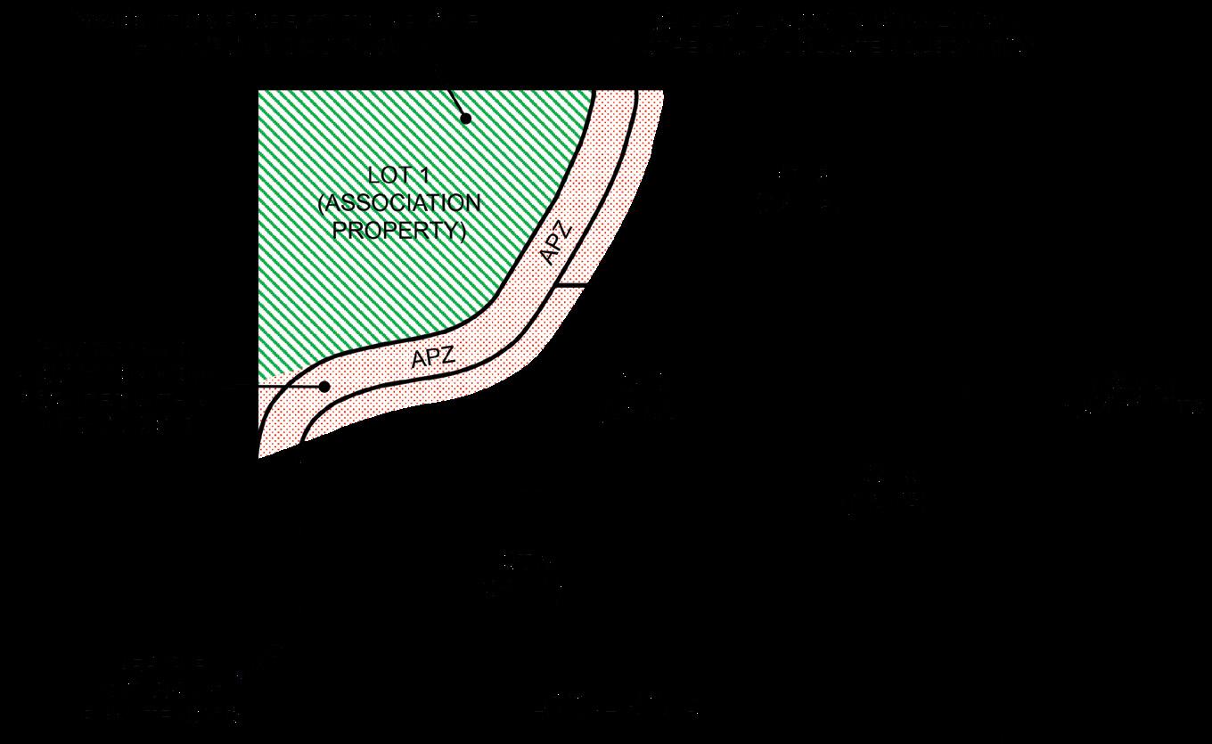
Potential to apply a refined ‘rural cluster subdivision’ approach to facilitate environmentally integrated outcomes with shared responsibility for biodiversity protection and some hazard management under a community title arrangement.
Terrestrial Biodiversity
Opportunity to amend mapping to reflect areas identified with high biodiversity values.
Introduce a site-specific section for Glenorie Village that covers matters such as:
y Lot width and depth
y Site coverage
y Setbacks and landscaping
y Movement network and design
y Public domain
y Wastewater management
y Subdivision and earthworks
y Ecology and riparian corridors
y Bushfire management and asset protection zones
Future development will be guided by plans to facilitate improvements to the public domain and streetscape.
Figure 8: Option for refined ‘rural cluster subdivision’ local provision and approach to facilitate environmentally integrated outcomes under a community title arrangement
INFRASTRUCTURE FRAMEWORK
New public infrastructure will be planned to support the growing Glenorie population and revitalisation of the Village. Further consideration of the most appropriate mechanisms to secure the funding and delivery of the necessary infrastructure items will be undertaken, potentially including contributions plans, voluntary planning agreements and requirements for developers to complete works as conditions of development consent.